How to get to Makaalex by bus?
Click on the bus route to see step by step directions with maps, line arrival times and updated time schedules.
From Nissan Mexicana A1, Aguascalientes
53 minFrom Fraccionamiento Asturias, Aguascalientes
73 minFrom Avenida Paseo de las Maravillas, Aguascalientes
37 minFrom Universidad Tecnologica De Aguascalientes, Aguascalientes
49 minFrom Universidad Tecnológica De Aguascalientes, Aguascalientes
49 minFrom Costco, Aguascalientes
38 minFrom La Cantera, Aguascalientes
62 minFrom EATON, Aguascalientes
40 minFrom Lohu Construcciones, Aguascalientes
45 minFrom Villas de San Antonio, Aguascalientes
42 min
Bus stops near Makaalex in Aguascalientes
- Obrero Mundial, 108c, 4 min walk,VIEW
- Aparatos Ejercicio (No Oficial), 5 min walk,VIEW
- Aries, 625a, 5 min walk,VIEW
- Aguascalientes - San Francisco De Los Romo, 117, 5 min walk,VIEW
- Avenida De La Convención De 1914 Oriente, 602, 5 min walk,VIEW
- Manuel Gómez Morin, Lb, 7 min walk,VIEW
- Avenida Gabriela Mistral, 101a, 7 min walk,VIEW
- Avenida Ferrocarril, 191, 8 min walk,VIEW
Bus lines to Makaalex in Aguascalientes
- RUTA 16, Bellavista,VIEW
- RUTA 08, Utma,VIEW
- RUTA 09, Mahatma Gandhi,VIEW
- RUTA 20N, Terminal Oriente - Terminal Oriente (N),VIEW
- RUTA 35, Uaa,VIEW
- RUTA 45, Valle De Los Cactus - Uaa,VIEW
- RUTA 20S, Terminal Oriente - Terminal Oriente (S),VIEW
- RUTA 43, Utma,VIEW
- RUTA 51, Casa Blanca,VIEW
- RUTA 37, Hacienda San Marcos,VIEW
- RUTA 43, San Antonio Via Lomas De New York,VIEW
What are the closest stations to Makaalex?
The closest stations to Makaalex are:
- Obrero Mundial, 108c is 278 meters away, 4 min walk.
- Aparatos Ejercicio (No Oficial) is 312 meters away, 5 min walk.
- Aries, 625a is 312 meters away, 5 min walk.
- Aguascalientes - San Francisco De Los Romo, 117 is 354 meters away, 5 min walk.
- Avenida De La Convención De 1914 Oriente, 602 is 386 meters away, 5 min walk.
- Manuel Gómez Morin, Lb is 490 meters away, 7 min walk.
- Avenida Gabriela Mistral, 101a is 515 meters away, 7 min walk.
- Avenida Ferrocarril, 191 is 618 meters away, 8 min walk.
Which bus lines stop near Makaalex?
These bus lines stop near Makaalex: RUTA 08, RUTA 09, RUTA 16, RUTA 20S, RUTA 35.
What’s the nearest bus station to Makaalex in Aguascalientes?
The nearest bus station to Makaalex in Aguascalientes is Obrero Mundial, 108c. It’s a 4 min walk away.
What time is the first bus to Makaalex in Aguascalientes?
The RUTA 20N is the first bus that goes to Makaalex in Aguascalientes. It stops nearby at 5:45 AM.
What time is the last bus to Makaalex in Aguascalientes?
The RUTA 43 is the last bus that goes to Makaalex in Aguascalientes. It stops nearby at 10:29 PM.
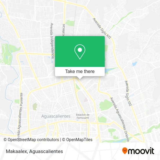
See Makaalex, Aguascalientes, on the map
Public Transit to Makaalex in Aguascalientes
Wondering how to get to Makaalex in Aguascalientes? Moovit helps you find the best way to get to Makaalex with step-by-step directions from the nearest public transit station.
Moovit provides free maps and live directions to help you navigate through your city. View schedules, routes, timetables, and find out how long does it take to get to Makaalex in real time.
Looking for the nearest stop or station to Makaalex? Check out this list of stops closest to your destination: Obrero Mundial; Aparatos Ejercicio (No Oficial); Aries; Aguascalientes - San Francisco De Los Romo; Avenida De La Convención De 1914 Oriente; Manuel Gómez Morin; Avenida Gabriela Mistral; Avenida Ferrocarril.
Bus: RUTA 08, RUTA 09, RUTA 16, RUTA 20S, RUTA 35, RUTA 20N, RUTA 45, RUTA 43, RUTA 51.
Want to see if there’s another route that gets you there at an earlier time? Moovit helps you find alternative routes or times. Get directions from and directions to Makaalex easily from the Moovit App or Website.
We make riding to Makaalex easy, which is why over 1.5 million users, including users in Aguascalientes, trust Moovit as the best app for public transit. You don’t need to download an individual bus app or train app, Moovit is your all-in-one transit app that helps you find the best bus time or train time available.
For information on prices of bus, costs and ride fares to Makaalex, please check the Moovit app.
Use the app to navigate to popular places including to the airport, hospital, stadium, grocery store, mall, coffee shop, school, college, and university.
Makaalex Address: Calle Obrero Mundial 204, Fraccionamiento Ctm, 20150 Aguascalientes, Aguascalientes street in Aguascalientes
- Inepja Plaza Comunitaria Estrella,
- Carniceria Chávez Hermanos,
- Gorditas Nery,
- Venta de Accesorios para Perros,
- Tacos de Tripas Doña Pera,
- Integra Odontología,
- Tienda de Accesorios Telefonicos,
- Puesto de Tacos de Bistec,
- El Pechugón,
- Botanas Lupita,
- Cerrajería El Puente,
- Pañales Vainilla,
- Presto Cash,
- Bigotes,
- Elegant Boutique,
- Semillas y Cereales,
- Bazar Multi Bazar,
- Cremeria La Unica,
- Super Tianguis,
- Novedades Tere
Places Near Makaalex (Aguascalientes)
- ESPACIOS, Aguascalientes,
- Centro, Aguascalientes,
- Isla San Marcos, Aguascalientes,
- Imss Clinica 1, Aguascalientes,
- clinica 3 uaa, Aguascalientes,
- Hospital Imss No. 3, Aguascalientes,
- Blvd. Luis Donaldo Colosio, Aguascalientes,
- Nuevo Hospital Hidalgo, Aguascalientes,
- Ciudad industrial, Aguascalientes,
- Parque Las Tres Centurias, Aguascalientes,
- Terminal De Combis, Aguascalientes,
- Agropecuario, Aguascalientes,
- Villasuncion, Aguascalientes,
- Aeropuerto de Aguascalientes S.A. de C.V., Aguascalientes,
- La Isla San Marcos, Aguascalientes,
- Centro Comercial Altaria, Aguascalientes,
- Jesús María, Aguascalientes,
- Universidad Autónoma de Aguascalientes, Aguascalientes,
- Villas de Nuestra Señora de la Asunción, Aguascalientes,
- Central De Autobuses, Aguascalientes
How to get to popular places in Aguascalientes with public transit
Get around Aguascalientes by public transit!
Traveling around Aguascalientes has never been so easy. See step by step directions as you travel to any attraction, street or major public transit station. View bus and train schedules, arrival times, service alerts and detailed routes on a map, so you know exactly how to get to anywhere in Aguascalientes.
When traveling to any destination around Aguascalientes use Moovit's Live Directions with Get Off Notifications to know exactly where and how far to walk, how long to wait for your line, and how many stops are left. Moovit will alert you when it's time to get off — no need to constantly re-check whether yours is the next stop.
Wondering how to use public transit in Aguascalientes or how to pay for public transit in Aguascalientes? Moovit public transit app can help you navigate your way with public transit easily, and at minimum cost. It includes public transit fees, ticket prices, and costs. Looking for a map of Aguascalientes public transit lines? Moovit public transit app shows all public transit maps in Aguascalientes with all bus routes and stops on an interactive map.
Aguascalientes has 1 transit type(s), including: bus, operated by several transit agencies, including Coordinación General de Movilidad