How to get to Malcolm Local Locksmih by bus?
Click on the bus route to see step by step directions with maps, line arrival times and updated time schedules.
From 72nd Ave. & 25th St. @ Miami, North Westside
77 minFrom Hialeah Park Casino, Hialeah
64 minFrom Ada M Barreto P A, North Westside
80 minFrom Conchitas Transit Express, Hialeah
74 minFrom Tri Rail Metrorail Transfer Station, Miami
87 minFrom St Thomas University, Miami
94 minFrom Le Jeune Rd / E 49th St, Hialeah
66 minFrom Doral Academy Prep Middle /High School, North Westside
133 minFrom Spin Group, North Westside
137 minFrom NW 37th Ave, Miami
92 min
Bus stops near Malcolm Local Locksmih in Hialeah
Bus lines to Malcolm Local Locksmih in Hialeah
What are the closest stations to Malcolm Local Locksmih?
The closest stations to Malcolm Local Locksmih are:
- W 68 St@w 32 Av is 218 yards away, 3 min walk.
- W 76 St@w 32 Av is 868 yards away, 11 min walk.
- W 28 Av@w 69 Ter is 1165 yards away, 14 min walk.
Which bus line stops near Malcolm Local Locksmih?
HIAMAR (City Of Hialeah Transit (Marlin))
What’s the nearest bus station to Malcolm Local Locksmih in Hialeah?
The nearest bus station to Malcolm Local Locksmih in Hialeah is W 68 St@w 32 Av. It’s a 3 min walk away.
What time is the first bus to Malcolm Local Locksmih in Hialeah?
The 54 is the first bus that goes to Malcolm Local Locksmih in Hialeah. It stops nearby at 5:43 AM.
What time is the last bus to Malcolm Local Locksmih in Hialeah?
The HIAMAR is the last bus that goes to Malcolm Local Locksmih in Hialeah. It stops nearby at 8:36 PM.
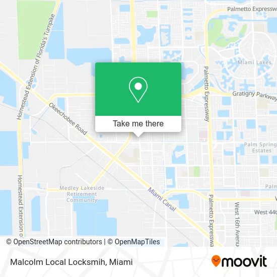
See Malcolm Local Locksmih, Hialeah, on the map
Public Transit to Malcolm Local Locksmih in Hialeah
Wondering how to get to Malcolm Local Locksmih in Hialeah? Moovit helps you find the best way to get to Malcolm Local Locksmih with step-by-step directions from the nearest public transit station.
Moovit provides free maps and live directions to help you navigate through your city. View schedules, routes, timetables, and find out how long does it take to get to Malcolm Local Locksmih in real time.
Looking for the nearest stop or station to Malcolm Local Locksmih? Check out this list of stops closest to your destination: W 68 St@w 32 Av; W 76 St@w 32 Av; W 28 Av@w 69 Ter.
Bus: HIAMAR, HIAFLA, 54.
Want to see if there’s another route that gets you there at an earlier time? Moovit helps you find alternative routes or times. Get directions from and directions to Malcolm Local Locksmih easily from the Moovit App or Website.
We make riding to Malcolm Local Locksmih easy, which is why over 1.5 million users, including users in Hialeah, trust Moovit as the best app for public transit. You don’t need to download an individual bus app or train app, Moovit is your all-in-one transit app that helps you find the best bus time or train time available.
For information on prices of bus and train, costs and ride fares to Malcolm Local Locksmih, please check the Moovit app.
Use the app to navigate to popular places including to the airport, hospital, stadium, grocery store, mall, coffee shop, school, college, and university.
Malcolm Local Locksmih Address: 6900 W 32nd Ave Hialeah, FL 33018 street in Hialeah
- Meli Medical Center Unit 12,
- Seniors Garden Adult Day Care,
- Alcober Hair Studio,
- Locksmith Alarm Locks Hialeah,
- Myrna Party Design,
- Miami Dade Emergency Locksmith,
- Miami and Hialeah Guitar Lessons,
- MoneyGram,
- Hello Cuba Travel,
- Sabor de Cuba,
- Prolux Beauty Supply,
- Key Food,
- West Hialeah Gardens Elementary School,
- Villa Vicenza Apartments Rentals,
- Los Palacios Apartments,
- Doctora Cachifa Cleaning Services,
- Goodwill,
- P Blooming Nails & Tattoo,
- Experimax Hialeah Gardens,
- Tax Leaf Hialeah
Places Near Malcolm Local Locksmih (Hialeah)
- Sawgrass mall ( FL ), Miami Beach,
- Miami Freedom Park, Miami,
- Sawgrass Mall, Miami,
- Keiser University Flagship Campus, West Palm Beach,
- Dolphin Mall Bus, Miami,
- Aventura Mall, Miami,
- Wynwood, Miami,
- Brickell City Centre, Miami,
- Miami-Dade County Courthouse, Miami,
- Hard Rock Stadium, Miami Gardens,
- Zoo Miami, Miami,
- Little Havana, Miami,
- Miami VA Hospital, Miami,
- Aventura Mall, Miami Beach,
- Port of Miami Cruise Terminal, Miami,
- Dolphin Mall, Miami,
- Marlins Park, Miami,
- Bayside Marketplace, Miami,
- Richard E. Gerstein Justice Building, Miami,
- Miami Design District, Miami
How to get to popular places in Miami with public transit
Get around Hialeah by public transit!
Traveling around Hialeah has never been so easy. See step by step directions as you travel to any attraction, street or major public transit station. View bus and train schedules, arrival times, service alerts and detailed routes on a map, so you know exactly how to get to anywhere in Hialeah.
When traveling to any destination around Hialeah use Moovit's Live Directions with Get Off Notifications to know exactly where and how far to walk, how long to wait for your line, and how many stops are left. Moovit will alert you when it's time to get off — no need to constantly re-check whether yours is the next stop.
Wondering how to use public transit in Hialeah or how to pay for public transit in Hialeah? Moovit public transit app can help you navigate your way with public transit easily, and at minimum cost. It includes public transit fees, ticket prices, and costs. Looking for a map of Hialeah public transit lines? Moovit public transit app shows all public transit maps in Hialeah with all Bus, Train, Light Rail and Ferry routes and stops on an interactive map.
Miami has 4 transit type(s), including: Bus, Train, Light Rail and Ferry, operated by several transit agencies, including Broward County Transit, Miami-Dade Transit, Metrorail, Palm Tran, Tri-Rail, Brightline, MARTY, City of Homestead Trolley, Key West Transit, Treasure Coast Connector, GoLine IRT, Amtrak, Greyhound-us, FlixBus-us and Aventura Express Shuttle Bus