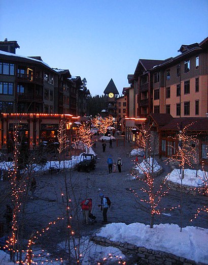
See Mammoth Lakes on the map
Directions to Mammoth Lakes with public transportation
The following transit lines have routes that pass near Mammoth Lakes
 Bus:
Bus: - Cable Car:
How to get to Mammoth Lakes by bus?
Click on the bus route to see step by step directions with maps, line arrival times and updated time schedules.
Cable Car stations near Mammoth Lakes
- Stop 11 - Old Mammoth Rd / Main St,2 min walk,
Bus stations near Mammoth Lakes
- Stop 26 - Sierra Park Rd / Meridian Blvd,5 min walk,
- Mammoth Lakes Park & Ride,6 min walk,
- Stop 108 - Tavern Rd / Old Mammoth Rd (Park & Ride),7 min walk,
Bus lines to Mammoth Lakes
- PURPLE LINE,The Village,
- TEAL LINE,Old Mammoth / Woodman St,
- GREEN,Mammoth,
- MAMMOTH EXPRESS,Bishop,
- 395 ROUTE NORTH,Reno,
- 395 ROUTE SOUTH,Mammoth,
What are the closest stations to Mammoth Lakes?
The closest stations to Mammoth Lakes are:
- Stop 11 - Old Mammoth Rd / Main St is 148 yards away, 2 min walk.
- Stop 26 - Sierra Park Rd / Meridian Blvd is 428 yards away, 5 min walk.
- Mammoth Lakes Park & Ride is 475 yards away, 6 min walk.
- Stop 108 - Tavern Rd / Old Mammoth Rd (Park & Ride) is 519 yards away, 7 min walk.
Which bus lines stop near Mammoth Lakes?
These bus lines stop near Mammoth Lakes: 395 ROUTE NORTH, GREEN.
What’s the nearest bus stop to Mammoth Lakes?
The nearest bus stop to Mammoth Lakes is Stop 26 - Sierra Park Rd / Meridian Blvd. It’s a 5 min walk away.
What’s the nearest cable car station to Mammoth Lakes?
The nearest cable car station to Mammoth Lakes is Stop 11 - Old Mammoth Rd / Main St. It’s a 2 min walk away.
What time is the first bus to Mammoth Lakes?
The PURPLE LINE is the first bus that goes to Mammoth Lakes. It stops nearby at 7:04 AM.
What time is the last bus to Mammoth Lakes?
The GREEN is the last bus that goes to Mammoth Lakes. It stops nearby at 8:27 PM.
What time is the first cable car to Mammoth Lakes?
The TOWN TROLLEY is the first cable car that goes to Mammoth Lakes. It stops nearby at 7:17 AM.
What time is the last cable car to Mammoth Lakes?
The LATE NIGHT TROLLEY is the last cable car that goes to Mammoth Lakes. It stops nearby at 1:56 AM.
See Mammoth Lakes on the map
Public Transportation to Mammoth Lakes
Wondering how to get to Mammoth Lakes, United States? Moovit helps you find the best way to get to Mammoth Lakes with step-by-step directions from the nearest public transit station.
Moovit provides free maps and live directions to help you navigate through your city. View schedules, routes, timetables, and find out how long does it take to get to Mammoth Lakes in real time.
Looking for the nearest stop or station to Mammoth Lakes? Check out this list of stops closest to your destination: Stop 11 - Old Mammoth Rd / Main St; Stop 26 - Sierra Park Rd / Meridian Blvd; Mammoth Lakes Park & Ride; Stop 108 - Tavern Rd / Old Mammoth Rd (Park & Ride).
Bus:Cable Car:
Want to see if there’s another route that gets you there at an earlier time? Moovit helps you find alternative routes or times. Get directions from and directions to Mammoth Lakes easily from the Moovit App or Website.
We make riding to Mammoth Lakes easy, which is why over 1.5 million users, including users in Fresno, trust Moovit as the best app for public transit. You don’t need to download an individual bus app or train app, Moovit is your all-in-one transit app that helps you find the best bus time or train time available.
For information on prices of bus, costs and ride fares to Mammoth Lakes, please check the Moovit app.
Use the app to navigate to popular places including to the airport, hospital, stadium, grocery store, mall, coffee shop, school, college, and university.
Location: Fresno
Popular routes from Mammoth Lakes
Attractions near Mammoth Lakes
Shilo Inn,Fluidix,Orvis,The Troutfitter,Grocery Outlet Bargain Market,Covid-19 Testing Site: Mammoth Hospital,Sierra Park Family Dental Clinic,Carson Tahoe Cardiology,Citibank,Mammoth Remodeling,Jennifer Leialoha Lane, L.Ac.,A D T,Nails by Jill,Jocelyn Lee Beauty,Century 21,Mammoth Lakes CA,Spiritual Connection,Mammoth Lakes Park & Ride,McGee Creek RV Park,Natural Retreats Mammoth LakesHow to get to popular attractions in Fresno with public transit
2 Amigos Taco truck, Fresno,Chevron On Cedar And Kings Canyon, Fresno,99 Freeway South Clinton, Fresno,Body Fusion Thai Massage, Lemoore,Marshalls, Atwate,Una Bella Salon & Salon, Los Banos,Naval Air Station Lemoore, Lemoore Station,Yosemite National Park, Yosemite Valley,City of Mendota, Mendota,Hugo - Ali's Cab Taxi Service, Los Banos,Sierra Housecalls Medical Group, Sonora,Hanford Family Dental Center, Hanford,GSK Consumer WC RDC, Fresno,UC Merced - Lakireddy Hall, University Of California-Merced,Benjamin Fig, Sonora,GRASP Gold Rush Airport Shuttle Provider, Sonora,Advantage Legal Document Assistance & Notary Services, Sonora,KFTV Univision 21, Fresno,Picayune Rancheria Tribal Gaming Commission,Edward Samourjian, MD, VisaliaGet around Fresno by public transit!
Traveling around Fresno has never been so easy. See step by step directions as you travel to any attraction, street or major public transit station. View bus and train schedules, arrival times, service alerts and detailed routes on a map, so you know exactly how to get to anywhere in Fresno.
When traveling to any destination around Fresno use Moovit's Live Directions with Get Off Notifications to know exactly where and how far to walk, how long to wait for your line, and how many stops are left. Moovit will alert you when it's time to get off — no need to constantly re-check whether yours is the next stop.
Wondering how to use public transit in Fresno or how to pay for public transit in Fresno? Moovit public transit app can help you navigate your way with public transit easily, and at minimum cost. It includes public transit fees, ticket prices, and costs. Looking for a map of Fresno public transit lines? Moovit public transit app shows all public transit maps in Fresno with all bus routes and stops on an interactive map.
Fresno has 1 transit type(s), including: bus, operated by several transit agencies, including FAX, FCRTA, The Bus, Madera County Connection, Yosemite Area Regional Transportation System, Madera Metro, VISALIA TRANSIT, Kings Area Rural Transit, Tulare County Regional Transit Agency, Tulare County Area Transit (TCAT), Porterville Transit, Dinuba Area Regional Transit, Clovis Transit, Eastern Sierra Transit Authority and Amtrak