How to get to Manderson Orthopedics by bus?
Click on the bus route to see step by step directions with maps, line arrival times and updated time schedules.
From Warner Theatre, Washington
50 minFrom Coast Guard HQ & Bus Bay D, Washington
100 minFrom George Washington University Hospital, Washington
66 minFrom The John F. Kennedy Center for the Performing Arts, Washington
79 minFrom Hyatt Place-Arlington Courthouse Plaza (Hyatt Place Arlington/Courthouse Plaza), Arlington County
93 minFrom Headquarters - U.S. Coast Guard, Washington
110 minFrom The Pentagon, Hall Of Heroes, Arlington County
74 minFrom Nationals Park, Washington
68 minFrom Sibley Memorial Hospital, Washington
70 minFrom AC Hotel by Marriott Washington DC Downtown (AC Hotel Washington DC Downtown), Washington
62 min
How to get to Manderson Orthopedics by metro?
Click on the metro route to see step by step directions with maps, line arrival times and updated time schedules.
From Warner Theatre, Washington
34 minFrom Coast Guard HQ & Bus Bay D, Washington
65 minFrom George Washington University Hospital, Washington
39 minFrom The John F. Kennedy Center for the Performing Arts, Washington
52 minFrom Hyatt Place-Arlington Courthouse Plaza (Hyatt Place Arlington/Courthouse Plaza), Arlington County
52 minFrom The Pentagon, Hall Of Heroes, Arlington County
49 minFrom Nationals Park, Washington
49 minFrom AC Hotel by Marriott Washington DC Downtown (AC Hotel Washington DC Downtown), Washington
38 min
Bus stops near Manderson Orthopedics in Washington
Metro stations near Manderson Orthopedics in Washington
Bus lines to Manderson Orthopedics in Washington
What are the closest stations to Manderson Orthopedics?
The closest stations to Manderson Orthopedics are:
- 12 St Ne+Allison St NE is 258 yards away, 4 min walk.
- Taylor St Ne+9 St NE is 377 yards away, 5 min walk.
- Brookland-Cua is 386 yards away, 5 min walk.
- South Dakota Av Ne+Allison St NE is 525 yards away, 7 min walk.
- Michigan Av Ne+Sargent Rd NE is 813 yards away, 10 min walk.
- Fort Totten is 3080 yards away, 36 min walk.
Which bus lines stop near Manderson Orthopedics?
These bus lines stop near Manderson Orthopedics: C71, D30, D74.
Which metro line stops near Manderson Orthopedics?
RED (Glenmont)
What’s the nearest metro station to Manderson Orthopedics in Washington?
The nearest metro station to Manderson Orthopedics in Washington is Brookland-Cua. It’s a 5 min walk away.
What’s the nearest bus station to Manderson Orthopedics in Washington?
The nearest bus station to Manderson Orthopedics in Washington is 12 St Ne+Allison St NE. It’s a 4 min walk away.
What time is the first metro to Manderson Orthopedics in Washington?
The GREEN is the first metro that goes to Manderson Orthopedics in Washington. It stops nearby at 5:08 AM.
What time is the last metro to Manderson Orthopedics in Washington?
The GREEN is the last metro that goes to Manderson Orthopedics in Washington. It stops nearby at 12:33 AM.
What time is the first bus to Manderson Orthopedics in Washington?
The D30 is the first bus that goes to Manderson Orthopedics in Washington. It stops nearby at 3:01 AM.
What time is the last bus to Manderson Orthopedics in Washington?
The D30 is the last bus that goes to Manderson Orthopedics in Washington. It stops nearby at 3:22 AM.
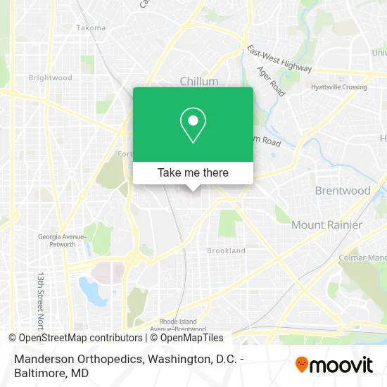
See Manderson Orthopedics, Washington, on the map
Public Transit to Manderson Orthopedics in Washington
Wondering how to get to Manderson Orthopedics in Washington? Moovit helps you find the best way to get to Manderson Orthopedics with step-by-step directions from the nearest public transit station.
Moovit provides free maps and live directions to help you navigate through your city. View schedules, routes, timetables, and find out how long does it take to get to Manderson Orthopedics in real time.
Looking for the nearest stop or station to Manderson Orthopedics? Check out this list of stops closest to your destination: 12 St Ne+Allison St NE; Taylor St Ne+9 St NE; Brookland-Cua; South Dakota Av Ne+Allison St NE; Michigan Av Ne+Sargent Rd NE; Fort Totten.
Bus: C71, D30, D74, P33.Metro: RED, GREEN, YELLOW.
Want to see if there’s another route that gets you there at an earlier time? Moovit helps you find alternative routes or times. Get directions from and directions to Manderson Orthopedics easily from the Moovit App or Website.
We make riding to Manderson Orthopedics easy, which is why over 1.7 million users, including users in Washington, trust Moovit as the best app for public transit. You don’t need to download an individual bus app or train app, Moovit is your all-in-one transit app that helps you find the best bus time or train time available.
For information on prices of bus and metro, costs and ride fares to Manderson Orthopedics, please check the Moovit app.
Use the app to navigate to popular places including to the airport, hospital, stadium, grocery store, mall, coffee shop, school, college, and university.
Manderson Orthopedics Address: 1140 Varnum St NE street in Washington
- Providence Hospital,
- Providence Urgent Care Center,
- Providence Hospital - Emergency Department,
- Providence Hospital - DePaul Building,
- Carroll Manor,
- Raymond A. Dufour (Athletic) Center,
- Catholic University Athletics,
- Turkey Thicket Recreation Center,
- Raymond A. Dufour (Athletic) Center,
- Today's Pizza (Todays Pizza),
- Turkey Thicket,
- Brightstar Medical Supplies,
- Capital Area Food Bank,
- Carlini Field,
- Franciscan Monastery of the Holy Land in America,
- Ft. Totten Solid Waste Transfer Station , Washington D.C.,
- Children's National Hospital,
- Princess Mhoon Dance Institute,
- 10th St NE & Bunker Hill Rd NE,
- Washington Yu Ying Public Charter School
Places Near Manderson Orthopedics (Washington)
- Westfield Montgomery Mall, Montgomery County,
- Basilica of the National Shrine, Washington,
- Capital One Arena, Washington,
- Sibley Memorial Hospital, Washington,
- Pennsylvania Ave NW (3rd st and pennsylvania), Washington,
- Amazon Hq2, Arlington County,
- Rock Creek Tennis Center, Washington,
- Georgetown, Washington,
- Washington DC VA Medical Center, Washington,
- National Zoo, Washington,
- Warner Theatre, Washington,
- M&T Bank Stadium, Baltimore,
- Museum Of The Bible, Washington,
- Camden Yards, Baltimore,
- Washington National Cathedral, Washington,
- The Anthem, Washington,
- National Theatre, Washington,
- PG Mall, Prince George's County,
- National Museum of African American History and Culture, Washington,
- Marriott Marquis Washington, DC, Washington
How to get to popular places in Washington, D.C. - Baltimore, MD with public transit
Get around Washington by public transit!
Traveling around Washington has never been so easy. See step by step directions as you travel to any attraction, street or major public transit station. View bus and train schedules, arrival times, service alerts and detailed routes on a map, so you know exactly how to get to anywhere in Washington.
When traveling to any destination around Washington use Moovit's Live Directions with Get Off Notifications to know exactly where and how far to walk, how long to wait for your line, and how many stops are left. Moovit will alert you when it's time to get off — no need to constantly re-check whether yours is the next stop.
Wondering how to use public transit in Washington or how to pay for public transit in Washington? Moovit public transit app can help you navigate your way with public transit easily, and at minimum cost. It includes public transit fees, ticket prices, and costs. Looking for a map of Washington public transit lines? Moovit public transit app shows all public transit maps in Washington with all Bus, Train, Metro, Light Rail and Ferry routes and stops on an interactive map.
Washington, D.C. - Baltimore, MD has 5 transit type(s), including: Bus, Train, Metro, Light Rail and Ferry, operated by several transit agencies, including WMATA, Montgomery County Ride On, Fairfax Connector, TheBus, PRTC, DASH - Alexandria, Arlington Transit (ART), RTA of Central Maryland, MDOT MTA, MDOT MTA Light RailLink, MDOT MTA Commuter Bus, MDOT MTA Local Bus, FXBGO!, Virginia Railway Express (VRE) and MARC