How to get to Manoel Raimundo Lopes dos Reis by bus?
Click on the bus route to see step by step directions with maps, line arrival times and updated time schedules.
From Conjunto Mestre Oscar Santos, Macapá
42 minFrom Acqua Park Club, Macapá
55 minFrom Igarape do lago, Macapá
53 minFrom Ramal Do Micro Mundo, Fazendinha
70 minFrom Estrada do Goiabal, Macapá
51 minFrom Frente do IFAP, Macapá
45 minFrom Conjunto São José - Km 9, Macapá
58 minFrom Avenida Mário Fortunato Barriga, Macapá
61 minFrom Rua Redenção, Macapá
42 minFrom Igreja de São Jorge, Macapá
56 min
Bus stops near Manoel Raimundo Lopes dos Reis in Macapá
Bus lines to Manoel Raimundo Lopes dos Reis in Macapá
- 117, Ilha Redonda - São Camilo,VIEW
- 118, Amazonas - São Camilo,VIEW
- 124, Amazonas - Zerão,VIEW
- 131, Universidade - Jardim,VIEW
- 137, Curiau - Centro,VIEW
- 214, Congós - Jardim,VIEW
- 300, Macapá - Santana (Via Km-9),VIEW
- 431, Macapaba - Garden Shopping,VIEW
- 432, Macapaba - São Camilo,VIEW
- 441, Brasil Novo - Universidade,VIEW
- 442, Brasil Novo - São Camilo,VIEW
- 443, Brasil Novo - Marabaixo,VIEW
- 452, Infraero II - São Camilo,VIEW
- 453, Infraero II - Centro - Zerão,VIEW
- 461, Infraero I - São Camilo,VIEW
- 511, Jardim - Centro - Zerão,VIEW
- 521, Jardim I,VIEW
- 531, Ipê - Novo Horizonte - Centro,VIEW
- 532, Ipê - São Camilo,VIEW
- 116, Renascer - Unifap (Via Cidade Nova),VIEW
What are the closest stations to Manoel Raimundo Lopes dos Reis?
The closest stations to Manoel Raimundo Lopes dos Reis are:
- Gen. Rondon Com Pedro Américo is 166 meters away, 3 min walk.
- Pará Com São Paulo is 189 meters away, 3 min walk.
Which bus lines stop near Manoel Raimundo Lopes dos Reis?
These bus lines stop near Manoel Raimundo Lopes dos Reis: 116, 612.
What’s the nearest bus station to Manoel Raimundo Lopes dos Reis in Macapá?
The nearest bus stations to Manoel Raimundo Lopes dos Reis in Macapá are Gen. Rondon Com Pedro Américo and Pará Com São Paulo. The closest one is a 3 min walk away.
What time is the first bus to Manoel Raimundo Lopes dos Reis in Macapá?
The 116 is the first bus that goes to Manoel Raimundo Lopes dos Reis in Macapá. It stops nearby at 5:46 AM.
What time is the last bus to Manoel Raimundo Lopes dos Reis in Macapá?
The 443 is the last bus that goes to Manoel Raimundo Lopes dos Reis in Macapá. It stops nearby at 1:49 AM.
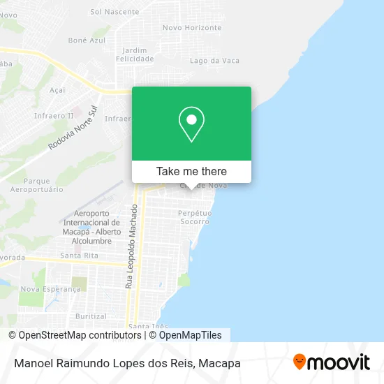
See Manoel Raimundo Lopes dos Reis, Macapá, on the map
Public Transit to Manoel Raimundo Lopes dos Reis in Macapá
Wondering how to get to Manoel Raimundo Lopes dos Reis in Macapá? Moovit helps you find the best way to get to Manoel Raimundo Lopes dos Reis with step-by-step directions from the nearest public transit station.
Moovit provides free maps and live directions to help you navigate through your city. View schedules, routes, timetables, and find out how long does it take to get to Manoel Raimundo Lopes dos Reis in real time.
Looking for the nearest stop or station to Manoel Raimundo Lopes dos Reis? Check out this list of stops closest to your destination: Gen. Rondon Com Pedro Américo; Pará Com São Paulo.
Bus: 116, 612, 117, 118, 124, 131, 137, 512.
Want to see if there’s another route that gets you there at an earlier time? Moovit helps you find alternative routes or times. Get directions from and directions to Manoel Raimundo Lopes dos Reis easily from the Moovit App or Website.
We make riding to Manoel Raimundo Lopes dos Reis easy, which is why over 1.5 million users, including users in Macapá, trust Moovit as the best app for public transit. You don’t need to download an individual bus app or train app, Moovit is your all-in-one transit app that helps you find the best bus time or train time available.
For information on prices of bus, costs and ride fares to Manoel Raimundo Lopes dos Reis, please check the Moovit app.
Use the app to navigate to popular places including to the airport, hospital, stadium, grocery store, mall, coffee shop, school, college, and university.
Manoel Raimundo Lopes dos Reis Address: Avenida José do Espírito Santo Araújo, 342 Cidade Nova Macapá-AP 68905-120 street in Macapá
- Norte Construcoes,
- Construnorte,
- Importadora Macapa Rural Casa e Construcao,
- Erik Motos,
- Jl Multimarcas,
- Afra,
- Comunidade Evangélica Peniel Amapá,
- Farmacia Mas Popular,
- Lumina Sun,
- Construtora Pronorte,
- Cakes da Lucia,
- Clinica Consulta Ja,
- Frutaria Pedro Americo,
- Andre Doces e Salgados,
- Comercial São Tiago,
- Lemos Negócios Imobiliários,
- Caroline Fashion,
- Ministerio Pentecostal Casa de Oracao Alianca Com Deus,
- Shop do Pé,
- Batalhão Forte
Places Near Manoel Raimundo Lopes dos Reis (Macapá)
- Avenida Professora Cora de Carvalho, Macapá,
- Ai! Que Fome, Macapá,
- Bairro Parque dos Buritis, Macapá,
- km 9 - linha E, Macapá,
- Macapá Shopping, Macapá,
- Bairro Amazonas, Macapá,
- Av. Presidente vargas - Centro ( Macapá - Ap ), Macapá,
- 7° Av do Congós, Macapá,
- Puteiro Do Titio, Macapá,
- Porto De Navegação Souza Mar, Santana,
- Avenida Coaracy Nunes, Macapá,
- Vhj, Macapá,
- Ferreira Gomes, Macapá,
- shopping Garden, Macapá,
- Universidade Federal do Amapá (UNIFAP), Macapá,
- IFAP, Macapá,
- Casa do Caralho!, Macapá,
- SAMF - Superitendência de Administração, Macapá,
- Puteiro, Santana,
- Mazagão, Macapá
How to get to popular places in Macapa with public transit
Get around Macapá by public transit!
Traveling around Macapá has never been so easy. See step by step directions as you travel to any attraction, street or major public transit station. View bus and train schedules, arrival times, service alerts and detailed routes on a map, so you know exactly how to get to anywhere in Macapá.
When traveling to any destination around Macapá use Moovit's Live Directions with Get Off Notifications to know exactly where and how far to walk, how long to wait for your line, and how many stops are left. Moovit will alert you when it's time to get off — no need to constantly re-check whether yours is the next stop.
Wondering how to use public transit in Macapá or how to pay for public transit in Macapá? Moovit public transit app can help you navigate your way with public transit easily, and at minimum cost. It includes public transit fees, ticket prices, and costs. Looking for a map of Macapá public transit lines? Moovit public transit app shows all public transit maps in Macapá with all bus routes and stops on an interactive map.
Macapa has 1 transit type(s), including: bus, operated by several transit agencies, including Sião Thur, Expresso União, Expresso Marco Zero, Amazontur and Capital Morena