How to get to Manyar Rejo II / 24 by bus?
Click on the bus route to see step by step directions with maps, line arrival times and updated time schedules.
From Uuz Collection, Ujung
49 minFrom International Container Terminal (ICT) Port Of Tanjung Perak Surabaya, Surabaya
75 minFrom Coban Rondo, Surabaya
39 minFrom Purimas Regency, Gunung Anyar
29 minFrom Grapari Telkomsel Perak Timur, Surabaya
55 minFrom Rumah Sakit PHC Surabaya, Perak Utara
48 minFrom Badan Pengembangan Sumber Daya Manusia Provinsi Jawa Timur, Surabaya
49 minFrom Pakuwon Trade Center, Lontar
54 minFrom RSUD Dr. Soedono Madiun, Babatan
50 minFrom bis damri perak lewat TP, Sidoarjo
36 min
How to get to Manyar Rejo II / 24 by train?
Click on the train route to see step by step directions with maps, line arrival times and updated time schedules.
Bus stops near Manyar Rejo II / 24 in Menur Pumpungan
Train station near Manyar Rejo II / 24 in Menur Pumpungan
- Stasiun Wonokromo, 43 min walk,VIEW
Bus lines to Manyar Rejo II / 24 in Menur Pumpungan
- RBK, Rungkut Barata,VIEW
- S, Kenjeran,VIEW
- WB, Bratang,VIEW
- FD11, Terminal Bratang,VIEW
- FD3, Terminal Intermoda Joyoboyo - Gunung Anyar,VIEW
- FD7, Terminal Bratang - Stasiun Pasar Turi,VIEW
- GS, Gunung Anyar - Sidorame,VIEW
- JBM, Joyoboyo - Gunung Anyar,VIEW
- Q, Kalimas Barat - Bratang,VIEW
- R4, Terminal Purabaya - ITS,VIEW
- RT, Rungkut - Pasar Turi,VIEW
- BUS D, Terminal Bratang,VIEW
What are the closest stations to Manyar Rejo II / 24?
The closest stations to Manyar Rejo II / 24 are:
- Jalan Raya Manyar 71 is 83 meters away, 2 min walk.
- Manyar 2 A is 120 meters away, 2 min walk.
- Ubaya Ngagel is 150 meters away, 3 min walk.
- Jalan Bratang Jaya 98 is 718 meters away, 10 min walk.
- Stasiun Wonokromo is 3307 meters away, 43 min walk.
Which bus lines stop near Manyar Rejo II / 24?
These bus lines stop near Manyar Rejo II / 24: FD3, FD7, GS, JBM, Q, WB.
Which train line stops near Manyar Rejo II / 24?
A (Bojonegoro)
What’s the nearest bus station to Manyar Rejo II / 24 in Menur Pumpungan?
The nearest bus stations to Manyar Rejo II / 24 in Menur Pumpungan are Jalan Raya Manyar 71 and Manyar 2 A. The closest one is a 2 min walk away.
What time is the first train to Manyar Rejo II / 24 in Menur Pumpungan?
The S is the first train that goes to Manyar Rejo II / 24 in Menur Pumpungan. It stops nearby at 3:13 AM.
What time is the last train to Manyar Rejo II / 24 in Menur Pumpungan?
The SP is the last train that goes to Manyar Rejo II / 24 in Menur Pumpungan. It stops nearby at 1:54 AM.
What time is the first bus to Manyar Rejo II / 24 in Menur Pumpungan?
The WB is the first bus that goes to Manyar Rejo II / 24 in Menur Pumpungan. It stops nearby at 5:00 AM.
What time is the last bus to Manyar Rejo II / 24 in Menur Pumpungan?
The FD7 is the last bus that goes to Manyar Rejo II / 24 in Menur Pumpungan. It stops nearby at 9:24 PM.
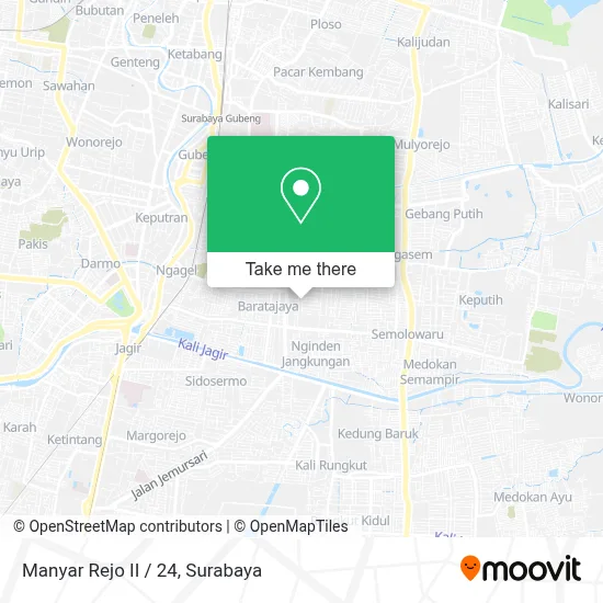
See Manyar Rejo II / 24, Menur Pumpungan, on the map
Public Transit to Manyar Rejo II / 24 in Menur Pumpungan
Wondering how to get to Manyar Rejo II / 24 in Menur Pumpungan? Moovit helps you find the best way to get to Manyar Rejo II / 24 with step-by-step directions from the nearest public transit station.
Moovit provides free maps and live directions to help you navigate through your city. View schedules, routes, timetables, and find out how long does it take to get to Manyar Rejo II / 24 in real time.
Looking for the nearest stop or station to Manyar Rejo II / 24? Check out this list of stops closest to your destination: Jalan Raya Manyar 71; Manyar 2 A; Ubaya Ngagel; Jalan Bratang Jaya 98; Stasiun Wonokromo.
Bus: FD3, FD7, GS, JBM, Q, WB, RBK, S, FD11, BUS D.Train: A, D, J, P, S.
Want to see if there’s another route that gets you there at an earlier time? Moovit helps you find alternative routes or times. Get directions from and directions to Manyar Rejo II / 24 easily from the Moovit App or Website.
We make riding to Manyar Rejo II / 24 easy, which is why over 1.5 million users, including users in Menur Pumpungan, trust Moovit as the best app for public transit. You don’t need to download an individual bus app or train app, Moovit is your all-in-one transit app that helps you find the best bus time or train time available.
For information on prices of bus and train, costs and ride fares to Manyar Rejo II / 24, please check the Moovit app.
Use the app to navigate to popular places including to the airport, hospital, stadium, grocery store, mall, coffee shop, school, college, and university.
Location: Menur Pumpungan, Surabaya
- Stephen Wongso House,
- M91 Reload,
- PT Puspa Lestari Indah,
- ALFAMART,
- Yakin Hidup Sukses,
- Grace & Glory Toko Buku Rohani,
- Tatoo-Skin City,
- Pujasera Gereja Bethany Manyar,
- Toko Benang Rajut (Pecinta Benang),
- Toko Dimas,
- Toko Ponorogo,
- Gereja Bethany Manyar,
- Sekolah Tinggi Teologi Bethany Sttb,
- Dental Care Clinic Hidayati Wardhani, Drg,
- Rindukopi Warung Seduh Kopi,
- Rindu Kopi X Jumaran,
- Gereja Yhs Manyar,
- Catering Shobrina,
- Toko Triple D,
- Balai Rw 5 Manyar Rejo
Places Near Manyar Rejo II / 24 (Menur Pumpungan)
- Smoking Room Terminal Domestik Juanda International Airport, Sidoarjo,
- PTC, Surabaya,
- Bg Junction, Bubutan,
- Bis Damri P1 (Perak-Bungurasih PP), Krembangan Selatan,
- Stadion gelora bung tomo(surabaya,jawa timur), Surabaya,
- Kantor Regional II BKN Surabaya, Sidoarjo,
- Pelabuhan Tanjung Perak,
- GBT (Gelora Bung Tomo) Surabaya, Benowo,
- Halte Bis Royal Plaza, Wonokromo,
- Galaxy Mall Surabaya, Mulyorejo,
- Taman Harmoni, Keputih,
- BG Junction Mall, Bubutan,
- Grand City Mall, Surabaya, Gubeng,
- Pakuwon Mall, Lontar,
- Universitas Negeri Surabaya (UNESA), Lidah Wetan,
- Graha Pena, Ketintang,
- Pakuwon City Mall, Keputih,
- UPN Veteran Jawa Timur, Gunung Anyar,
- Kebun Binatang Surabaya, Darmo,
- Masjid Al-Akbar, Surabaya
How to get to popular places in Surabaya with public transit
Get around Menur Pumpungan by public transit!
Traveling around Menur Pumpungan has never been so easy. See step by step directions as you travel to any attraction, street or major public transit station. View bus and train schedules, arrival times, service alerts and detailed routes on a map, so you know exactly how to get to anywhere in Menur Pumpungan.
When traveling to any destination around Menur Pumpungan use Moovit's Live Directions with Get Off Notifications to know exactly where and how far to walk, how long to wait for your line, and how many stops are left. Moovit will alert you when it's time to get off — no need to constantly re-check whether yours is the next stop.
Wondering how to use public transit in Menur Pumpungan or how to pay for public transit in Menur Pumpungan? Moovit public transit app can help you navigate your way with public transit easily, and at minimum cost. It includes public transit fees, ticket prices, and costs. Looking for a map of Menur Pumpungan public transit lines? Moovit public transit app shows all public transit maps in Menur Pumpungan with all Bus and Train routes and stops on an interactive map.
Surabaya has 2 transit type(s), including: Bus and Train, operated by several transit agencies, including KAI Commuter, Angkutan Surabaya, Trans Semanggi Suroboyo, Suroboyo Bus, Feeder Wira Wiri Suroboyo, Trans Jatim and DAMRI