How to get to Map by bus?
Click on the bus route to see step by step directions with maps, line arrival times and updated time schedules.
From I-695 @ Exit 18 (Liberty Rd/MD 26), Baltimore County
105 minFrom Johns Hopkins Medicine at Green Spring Station, Baltimore County
133 minFrom I-695 @ Exit 17 (Security Blvd/MD 122), Baltimore County
105 minFrom Sinai Hospital, Baltimore
107 minFrom Mva, Baltimore
42 minFrom Pimlico Race Course, Baltimore
92 minFrom Randallstown, MD, Baltimore County
127 minFrom I-83 Exit 16 (Timonium Road), Baltimore County
154 minFrom I-70 at Security Blvd Baltimore City Lot Park & Ride, Baltimore
129 minFrom Reisterstown Road Plaza, Baltimore
37 min
Bus stop near Map in Baltimore County
- 700 Red Brook Blvd Opp, 3 min walk,VIEW
Metro station near Map in Baltimore County
- Owings Mills Metro, 55 min walk,VIEW
Bus lines to Map in Baltimore County
- 89, Redland Court,VIEW
What are the closest stations to Map?
The closest stations to Map are:
- 700 Red Brook Blvd Opp is 154 yards away, 3 min walk.
- Owings Mills Metro is 4715 yards away, 55 min walk.
Which bus lines stop near Map?
These bus lines stop near Map: 87, 89.
What’s the nearest bus station to Map in Baltimore County?
The nearest bus station to Map in Baltimore County is 700 Red Brook Blvd Opp. It’s a 3 min walk away.
What time is the first metro to Map in Baltimore County?
The METRO is the first metro that goes to Map in Baltimore County. It stops nearby at 4:28 AM.
What time is the last metro to Map in Baltimore County?
The METRO is the last metro that goes to Map in Baltimore County. It stops nearby at 12:31 AM.
What time is the first bus to Map in Baltimore County?
The 89 is the first bus that goes to Map in Baltimore County. It stops nearby at 5:28 AM.
What time is the last bus to Map in Baltimore County?
The 89 is the last bus that goes to Map in Baltimore County. It stops nearby at 6:38 PM.
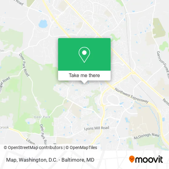
See Map, Baltimore County, on the map
Public Transit to Map in Baltimore County
Wondering how to get to Map in Baltimore County? Moovit helps you find the best way to get to Map with step-by-step directions from the nearest public transit station.
Moovit provides free maps and live directions to help you navigate through your city. View schedules, routes, timetables, and find out how long does it take to get to Map in real time.
Looking for the nearest stop or station to Map? Check out this list of stops closest to your destination: 700 Red Brook Blvd Opp; Owings Mills Metro.
Bus: 87, 89.Metro: METRO.
Want to see if there’s another route that gets you there at an earlier time? Moovit helps you find alternative routes or times. Get directions from and directions to Map easily from the Moovit App or Website.
We make riding to Map easy, which is why over 1.5 million users, including users in Baltimore County, trust Moovit as the best app for public transit. You don’t need to download an individual bus app or train app, Moovit is your all-in-one transit app that helps you find the best bus time or train time available.
For information on prices of bus, metro and light rail, costs and ride fares to Map, please check the Moovit app.
Use the app to navigate to popular places including to the airport, hospital, stadium, grocery store, mall, coffee shop, school, college, and university.
Map Address: 400 Red Brook Blvd Owings Mills, MD 21117 street in Baltimore County
- Vna of Maryland - Owings Mills,
- Locksmith 24 Hours In Owings Mills,
- Employment Background Investigations,
- Navy Federal Credit Union,
- PP*Camille Nyman,
- Peak Custom Remodeling,
- Red Brook Center,
- Resource Title,
- Wright Scott & Assoc,
- Christopher Breen - Associate Financial Advisor, Ameriprise Financial Services,
- Day 6th,
- Thornton Cephas & Associates,
- Paul Davis Restoration of Greater Baltimore,
- Definitive Building, Inc.,
- Healthyminds Wellness LLC: Ayorinde Oyeneyin, DNP,
- First Funds Group,
- American Pool Enterprises,
- Mmha on Line,
- IREM Maryland Chapter,
- CMT Advisory Services
Places Near Map (Baltimore County)
- Westfield Montgomery Mall, Montgomery County,
- Capital One Arena, Washington,
- Amazon Hq2, Arlington County,
- Sibley Memorial Hospital, Washington,
- M&T Bank Stadium, Baltimore,
- Warner Theatre, Washington,
- Rock Creek Tennis Center, Washington,
- Pennsylvania Ave NW (3rd st and pennsylvania), Washington,
- PG Mall, Prince George's County,
- National Theatre, Washington,
- Basilica of the National Shrine, Washington,
- National Zoo, Washington,
- Camden Yards, Baltimore,
- Museum Of The Bible, Washington,
- The Anthem, Washington,
- Marriott Marquis Washington, DC, Washington,
- Washington National Cathedral, Washington,
- Georgetown, Washington,
- Washington DC VA Medical Center, Washington,
- National Museum of African American History and Culture, Washington
How to get to popular places in Washington, D.C. - Baltimore, MD with public transit
Get around Baltimore County by public transit!
Traveling around Baltimore County has never been so easy. See step by step directions as you travel to any attraction, street or major public transit station. View bus and train schedules, arrival times, service alerts and detailed routes on a map, so you know exactly how to get to anywhere in Baltimore County.
When traveling to any destination around Baltimore County use Moovit's Live Directions with Get Off Notifications to know exactly where and how far to walk, how long to wait for your line, and how many stops are left. Moovit will alert you when it's time to get off — no need to constantly re-check whether yours is the next stop.
Wondering how to use public transit in Baltimore County or how to pay for public transit in Baltimore County? Moovit public transit app can help you navigate your way with public transit easily, and at minimum cost. It includes public transit fees, ticket prices, and costs. Looking for a map of Baltimore County public transit lines? Moovit public transit app shows all public transit maps in Baltimore County with all Bus, Train, Metro, Light Rail and Ferry routes and stops on an interactive map.
Washington, D.C. - Baltimore, MD has 5 transit type(s), including: Bus, Train, Metro, Light Rail and Ferry, operated by several transit agencies, including WMATA, Montgomery County Ride On, Fairfax Connector, TheBus, PRTC, DASH - Alexandria, Arlington Transit (ART), RTA of Central Maryland, MDOT MTA, MDOT MTA Light RailLink, MDOT MTA Commuter Bus, MDOT MTA Local Bus, FXBGO!, Virginia Railway Express (VRE) and MARC