Directions to Maple Ave Corner Store (Hartford) with public transportation
The following transit lines have routes that pass near Maple Ave Corner Store
 Bus: 43, 61, 950, FLIXBUS 2610, GREYHOUND US0230.
- Train: AMTRAK HARTFORD LINE, HARTFORD LINE, VERMONTER, NORTHEAST REGIONAL, VALLEY FLYER.
How to get to Maple Ave Corner Store by bus?
Click on the bus route to see step by step directions with maps, line arrival times and updated time schedules.
How to get to Maple Ave Corner Store by train?
Click on the train route to see step by step directions with maps, line arrival times and updated time schedules.
Bus stops near Maple Ave Corner Store in Hartford
Train station near Maple Ave Corner Store in Hartford
- Hartford Union Station, 36 min walk,VIEW
Bus lines to Maple Ave Corner Store in Hartford
What are the closest stations to Maple Ave Corner Store?
The closest stations to Maple Ave Corner Store are:
- Campfield Ave @ Bushnell St is 187 yards away, 3 min walk.
- Broad St @ Clifford St is 340 yards away, 5 min walk.
- Hartford Union Station is 3052 yards away, 36 min walk.
Which bus lines stop near Maple Ave Corner Store?
These bus lines stop near Maple Ave Corner Store: 43, 61, 950, FLIXBUS 2610, GREYHOUND US0230, GREYHOUND US0255S.
Which train lines stop near Maple Ave Corner Store?
These train lines stop near Maple Ave Corner Store: AMTRAK HARTFORD LINE, HARTFORD LINE, VERMONTER.
What’s the nearest bus station to Maple Ave Corner Store in Hartford?
The nearest bus station to Maple Ave Corner Store in Hartford is Campfield Ave @ Bushnell St. It’s a 3 min walk away.
What time is the first train to Maple Ave Corner Store in Hartford?
The NORTHEAST REGIONAL is the first train that goes to Maple Ave Corner Store in Hartford. It stops nearby at 4:51 AM.
What time is the last train to Maple Ave Corner Store in Hartford?
The NORTHEAST REGIONAL is the last train that goes to Maple Ave Corner Store in Hartford. It stops nearby at 11:59 PM.
What time is the first bus to Maple Ave Corner Store in Hartford?
The 61 is the first bus that goes to Maple Ave Corner Store in Hartford. It stops nearby at 5:25 AM.
What time is the last bus to Maple Ave Corner Store in Hartford?
The 61 is the last bus that goes to Maple Ave Corner Store in Hartford. It stops nearby at 1:04 AM.
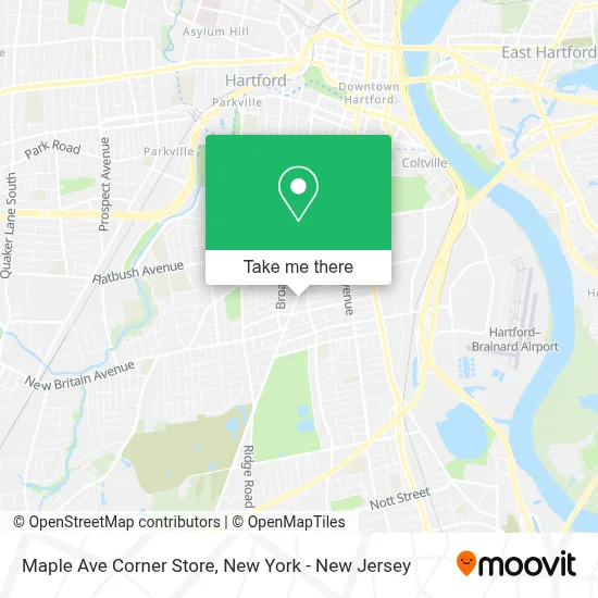
See Maple Ave Corner Store, Hartford, on the map
Public Transit to Maple Ave Corner Store in Hartford
Wondering how to get to Maple Ave Corner Store in Hartford? Moovit helps you find the best way to get to Maple Ave Corner Store with step-by-step directions from the nearest public transit station.
Moovit provides free maps and live directions to help you navigate through your city. View schedules, routes, timetables, and find out how long does it take to get to Maple Ave Corner Store in real time.
Looking for the nearest stop or station to Maple Ave Corner Store? Check out this list of stops closest to your destination: Campfield Ave @ Bushnell St; Broad St @ Clifford St; Hartford Union Station.
Bus: 43, 61, 950, FLIXBUS 2610, GREYHOUND US0230, GREYHOUND US0255S.Train: AMTRAK HARTFORD LINE, HARTFORD LINE, VERMONTER, NORTHEAST REGIONAL, VALLEY FLYER.
Want to see if there’s another route that gets you there at an earlier time? Moovit helps you find alternative routes or times. Get directions from and directions to Maple Ave Corner Store easily from the Moovit App or Website.
We make riding to Maple Ave Corner Store easy, which is why over 1.5 million users, including users in Hartford, trust Moovit as the best app for public transit. You don’t need to download an individual bus app or train app, Moovit is your all-in-one transit app that helps you find the best bus time or train time available.
For information on prices of train and bus, costs and ride fares to Maple Ave Corner Store, please check the Moovit app.
Use the app to navigate to popular places including to the airport, hospital, stadium, grocery store, mall, coffee shop, school, college, and university.
Maple Ave Corner Store Address: 736 Maple Ave street in Hartford
- Green Home Care,
- Juicy & Tasty,
- Alebrijes Mexican Fusion,
- Alebrijes Mexican Kitchen,
- Reliable Auto Tire Co Inc,
- Ct Podcaster Studios,
- Tapeworks Recording Studio,
- Handyman Ct,
- Michael’S Barbershop & Lounge,
- The Hartford Society Of Latin American Firefighters,
- Bcn Limousine Llc,
- Church Of Jesus Christ Of Latter Day Saints,
- Maple Giant Grinder & Wood Oven Pizza,
- Bud360,
- Family Home Care,
- The Light Of the World,
- Maple Giant Grinder & Pizza,
- Victoria Ice Cream,
- Bank Of America Financial Center & Drive-Thru Atm | Maple Avenue,
- Line Services
Places Near Maple Ave Corner Store (Hartford)
- Mountainside Hospital, Glen Ridge,
- Pier 83, Manhattan,
- 111 Centre New York City Supreme Court, Manhattan,
- SoHo, Manhattan,
- 376 Hudson Street, Manhattan,
- Wall Street, Manhattan,
- Chinatown, Manhattan,
- 26 Federal Plaza, Manhattan,
- Times Square, Manhattan,
- 1 Police Plaza, Manhattan,
- Katz's Deli, Manhattan,
- Bellevue Hospital, Manhattan,
- 911 Memorial, Manhattan,
- San Gennaro Feast, Manhattan,
- 3 Stone St, Manhattan,
- Hudson Yards, Manhattan,
- 66 John Street, Manhattan,
- Queens Center Mall, Queens,
- Rockefeller Center, Manhattan,
- qqqq, Manhattan
How to get to popular places in New York - New Jersey with public transit
Get around Hartford by public transit!
Traveling around Hartford has never been so easy. See step by step directions as you travel to any attraction, street or major public transit station. View bus and train schedules, arrival times, service alerts and detailed routes on a map, so you know exactly how to get to anywhere in Hartford.
When traveling to any destination around Hartford use Moovit's Live Directions with Get Off Notifications to know exactly where and how far to walk, how long to wait for your line, and how many stops are left. Moovit will alert you when it's time to get off — no need to constantly re-check whether yours is the next stop.
Wondering how to use public transit in Hartford or how to pay for public transit in Hartford? Moovit public transit app can help you navigate your way with public transit easily, and at minimum cost. It includes public transit fees, ticket prices, and costs. Looking for a map of Hartford public transit lines? Moovit public transit app shows all public transit maps in Hartford with all Bus, Train, Subway, Light Rail, Ferry and Cable Car routes and stops on an interactive map.
New York - New Jersey has 6 transit type(s), including: Bus, Train, Subway, Light Rail, Ferry and Cable Car, operated by several transit agencies, including MTA Subway, Metro-North Railroad, LIRR, PATH, MTA New York City Transit - Express routes, MTA Bus, NJ Transit, NYC Ferry, NICE bus, Bee-Line Bus, NJ Transit Rail, Norwalk Transit District, Hartford Line, River Valley Transit and HART