How to get to Maple St by bus?
Click on the bus route to see step by step directions with maps, line arrival times and updated time schedules.
From Ies Commercial, Reno
48 minFrom Dolan KIA, Reno
32 minFrom Thrive Market, Inc., Sparks
32 minFrom Thomas Cuisine, Reno
56 minFrom STARBUCKS, Reno
39 minFrom Mynd Property Management, Reno
43 minFrom Atlantis Hotel And Casino Conference Center, Reno
24 minFrom Howard Putman Enterprises, Sparks
71 minFrom Prototype Drive at Igt, Reno
56 min
Bus stops near Maple St in Reno
Train station near Maple St in Reno
- Reno, 51 min walk,VIEW
Bus lines to Maple St in Reno
What are the closest stations to Maple St?
The closest stations to Maple St are:
- N Sierra Street And Elm Street is 219 yards away, 4 min walk.
- W 5th Street And N Arlington Avenue is 223 yards away, 4 min walk.
- W 4th Street And N Arlington Avenue is 385 yards away, 6 min walk.
- Lake Street And E 6th Street is 416 yards away, 6 min walk.
- Evans Avenue And E 6th Street is 417 yards away, 6 min walk.
- North Virginia Street And 5th Street is 512 yards away, 7 min walk.
- Reno is 4288 yards away, 51 min walk.
Which bus lines stop near Maple St?
These bus lines stop near Maple St: 2, 7, CRSN, VRGN.
What’s the nearest bus station to Maple St in Reno?
The nearest bus stations to Maple St in Reno are N Sierra Street And Elm Street and W 5th Street And N Arlington Avenue. The closest one is a 4 min walk away.
What time is the first train to Maple St in Reno?
The CALIFORNIA ZEPHYR is the first train that goes to Maple St in Reno. It stops nearby at 3:37 PM.
What time is the last train to Maple St in Reno?
The CALIFORNIA ZEPHYR is the last train that goes to Maple St in Reno. It stops nearby at 9:24 AM.
What time is the first bus to Maple St in Reno?
The 11 is the first bus that goes to Maple St in Reno. It stops nearby at 4:32 AM.
What time is the last bus to Maple St in Reno?
The 11 is the last bus that goes to Maple St in Reno. It stops nearby at 2:35 AM.
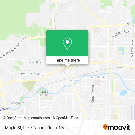
See Maple St, Reno, on the map
Public Transit to Maple St in Reno
Wondering how to get to Maple St in Reno? Moovit helps you find the best way to get to Maple St with step-by-step directions from the nearest public transit station.
Moovit provides free maps and live directions to help you navigate through your city. View schedules, routes, timetables, and find out how long does it take to get to Maple St in real time.
Looking for the nearest stop or station to Maple St? Check out this list of stops closest to your destination: N Sierra Street And Elm Street; W 5th Street And N Arlington Avenue; W 4th Street And N Arlington Avenue; Lake Street And E 6th Street; Evans Avenue And E 6th Street; North Virginia Street And 5th Street; Reno.
Bus: 2, 7, CRSN, VRGN, 4, 11, 5, 5, 15.Train: CALIFORNIA ZEPHYR.
Want to see if there’s another route that gets you there at an earlier time? Moovit helps you find alternative routes or times. Get directions from and directions to Maple St easily from the Moovit App or Website.
We make riding to Maple St easy, which is why over 1.5 million users, including users in Reno, trust Moovit as the best app for public transit. You don’t need to download an individual bus app or train app, Moovit is your all-in-one transit app that helps you find the best bus time or train time available.
For information on prices of bus, costs and ride fares to Maple St, please check the Moovit app.
Use the app to navigate to popular places including to the airport, hospital, stadium, grocery store, mall, coffee shop, school, college, and university.
Maple St Address: Reno, NV 89503 street in Reno
- Jimmy John's,
- Planet Smoothie,
- Sierra Spirit Bus,
- Howard Johnson-Reno,
- Atm Walgreens,
- Super Movers,
- Canyon Flats Apartments,
- Kramer House,
- 235 W 6th St Parking,
- Duborg Tract,
- A & D T-Alarm & Home Security,
- St. Mary's Emergency Room,
- Rink at the Row,
- ACDelco,
- ATM,
- Tram at Circus Circus Reno,
- Nevada Bureau of Mines and Geology,
- Mark McAllister MD,
- Max C Fleischmann Medical Library,
- Manzanita Inn
Places Near Maple St (Reno)
- Tesla, Carson City,
- DMV, Reno,
- Reno, Nevada, Reno,
- Meadowood Mall, Reno,
- Walmart Supercenter, Reno,
- Nugget Casino Resort, Sparks,
- The Nugget Sparks - Tesla Destination, Sparks,
- Peppermill, Reno,
- The Summit (Summit Shopping Center), Reno,
- Tesla, Reno,
- 2777 usa Parkway, Sparks,
- Hidden Beach, Incline Village,
- Social Security Administration, Reno,
- Boomtown Hotel, Reno,
- Emerald Bay, South Lake Tahoe,
- Mount Rose Ski Resort Entrance, Reno,
- Boreal Mountain Resort, Truckee,
- Grand Sierra Resort, Reno,
- Department of Motor Vehicles (DMV), Reno,
- Tesla, Reno
How to get to popular places in Lake Tahoe - Reno, NV with public transit
Get around Reno by public transit!
Traveling around Reno has never been so easy. See step by step directions as you travel to any attraction, street or major public transit station. View bus and train schedules, arrival times, service alerts and detailed routes on a map, so you know exactly how to get to anywhere in Reno.
When traveling to any destination around Reno use Moovit's Live Directions with Get Off Notifications to know exactly where and how far to walk, how long to wait for your line, and how many stops are left. Moovit will alert you when it's time to get off — no need to constantly re-check whether yours is the next stop.
Wondering how to use public transit in Reno or how to pay for public transit in Reno? Moovit public transit app can help you navigate your way with public transit easily, and at minimum cost. It includes public transit fees, ticket prices, and costs. Looking for a map of Reno public transit lines? Moovit public transit app shows all public transit maps in Reno with all Bus and Train routes and stops on an interactive map.
Lake Tahoe - Reno, NV has 2 transit type(s), including: Bus and Train, operated by several transit agencies, including RTC RIDE, Tahoe Truckee Area Regional Transit, North Lake Tahoe Express - 24 hour advance reservations required, Tahoe Transportation District, Amtrak and Greyhound-us