How to get to Mapspace by bus?
Click on the bus route to see step by step directions with maps, line arrival times and updated time schedules.
From Regeneron Pharmaceuticals Inc, Tarrytown
85 minFrom Westchester Mall, White Plains
32 minFrom Ridge Hill Mall, Yonkers
87 minFrom Cross County Mall, Yonkers
84 minFrom Cross County Shopping Center, Yonkers
85 minFrom Mamaroneck NY, Mamaroneck
44 minFrom White Plains, NY, White Plains
31 minFrom New Rochelle, NY, New Rochelle
46 minFrom GFFF, Stamford
75 minFrom NBC Sports Shuttle, Stamford
97 min
How to get to Mapspace by train?
Click on the train route to see step by step directions with maps, line arrival times and updated time schedules.
Bus stops near Mapspace in Port Chester
Train stations near Mapspace in Port Chester
Bus lines to Mapspace in Port Chester
What are the closest stations to Mapspace?
The closest stations to Mapspace are:
- Broad St @ Irving Ave is 136 yards away, 2 min walk.
- Port Chester is 222 yards away, 4 min walk.
- S Main St @ Westchester Ave is 331 yards away, 5 min walk.
- Greenwich is 5052 yards away, 60 min walk.
Which bus lines stop near Mapspace?
These bus lines stop near Mapspace: 13, 311, 61.
Which train line stops near Mapspace?
3 (1339#| Grand Central)
What’s the nearest train station to Mapspace in Port Chester?
The nearest train station to Mapspace in Port Chester is Port Chester. It’s a 4 min walk away.
What’s the nearest bus station to Mapspace in Port Chester?
The nearest bus station to Mapspace in Port Chester is Broad St @ Irving Ave. It’s a 2 min walk away.
What time is the first train to Mapspace in Port Chester?
The 3 is the first train that goes to Mapspace in Port Chester. It stops nearby at 4:49 AM.
What time is the last train to Mapspace in Port Chester?
The 3 is the last train that goes to Mapspace in Port Chester. It stops nearby at 2:46 AM.
What time is the first bus to Mapspace in Port Chester?
The 13 is the first bus that goes to Mapspace in Port Chester. It stops nearby at 5:35 AM.
What time is the last bus to Mapspace in Port Chester?
The 311 is the last bus that goes to Mapspace in Port Chester. It stops nearby at 11:56 PM.
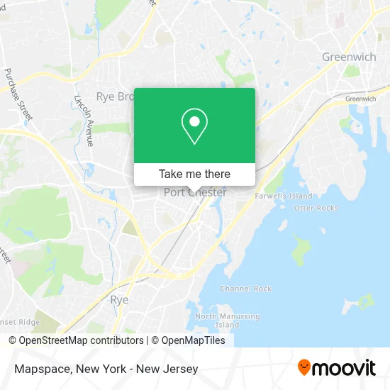
See Mapspace, Port Chester, on the map
Public Transit to Mapspace in Port Chester
Wondering how to get to Mapspace in Port Chester? Moovit helps you find the best way to get to Mapspace with step-by-step directions from the nearest public transit station.
Moovit provides free maps and live directions to help you navigate through your city. View schedules, routes, timetables, and find out how long does it take to get to Mapspace in real time.
Looking for the nearest stop or station to Mapspace? Check out this list of stops closest to your destination: Broad St @ Irving Ave; Port Chester; S Main St @ Westchester Ave; Greenwich.
Bus: 13, 311, 61.Train: 3, 4, 5.
Want to see if there’s another route that gets you there at an earlier time? Moovit helps you find alternative routes or times. Get directions from and directions to Mapspace easily from the Moovit App or Website.
We make riding to Mapspace easy, which is why over 1.5 million users, including users in Port Chester, trust Moovit as the best app for public transit. You don’t need to download an individual bus app or train app, Moovit is your all-in-one transit app that helps you find the best bus time or train time available.
For information on prices of bus and train, costs and ride fares to Mapspace, please check the Moovit app.
Use the app to navigate to popular places including to the airport, hospital, stadium, grocery store, mall, coffee shop, school, college, and university.
Mapspace Address: 6 N Pearl St street in Port Chester
- The New Look,
- Street-Works Studio,
- The Flying Locksmiths,
- Diaz Boxing Club,
- Prestige Martial Arts,
- Walter's Office,
- Interstate Graphics & Signs,
- Di-Paty Jewelry - Multiservicios,
- Ryestationer,
- Constellation Acquisition,
- Iconic Decor Rentals,
- Harry Otto Properties,
- Hubbard’S Cupboard Bistro,
- Upholstery by Fernando,
- Moderna Llc,
- Semaca Auto Repairs Inc,
- Elissa Held Corporation,
- Outside,
- Spectrum Comm,
- Prana Prenatal Yoga
Places Near Mapspace (Port Chester)
- Pier 83, Manhattan,
- qqqq, Manhattan,
- 66 John Street, Manhattan,
- Rockefeller Center, Manhattan,
- Bellevue Hospital, Manhattan,
- Mountainside Hospital, Glen Ridge,
- 911 Memorial, Manhattan,
- 1 Police Plaza, Manhattan,
- 376 Hudson Street, Manhattan,
- 111 Centre New York City Supreme Court, Manhattan,
- Queens Center Mall, Queens,
- Times Square, Manhattan,
- Katz's Deli, Manhattan,
- 3 Stone St, Manhattan,
- 26 Federal Plaza, Manhattan,
- SoHo, Manhattan,
- Hudson Yards, Manhattan,
- San Gennaro Feast, Manhattan,
- Wall Street, Manhattan,
- Chinatown, Manhattan
How to get to popular places in New York - New Jersey with public transit
Get around Port Chester by public transit!
Traveling around Port Chester has never been so easy. See step by step directions as you travel to any attraction, street or major public transit station. View bus and train schedules, arrival times, service alerts and detailed routes on a map, so you know exactly how to get to anywhere in Port Chester.
When traveling to any destination around Port Chester use Moovit's Live Directions with Get Off Notifications to know exactly where and how far to walk, how long to wait for your line, and how many stops are left. Moovit will alert you when it's time to get off — no need to constantly re-check whether yours is the next stop.
Wondering how to use public transit in Port Chester or how to pay for public transit in Port Chester? Moovit public transit app can help you navigate your way with public transit easily, and at minimum cost. It includes public transit fees, ticket prices, and costs. Looking for a map of Port Chester public transit lines? Moovit public transit app shows all public transit maps in Port Chester with all Bus, Train, Subway, Light Rail, Ferry and Cable Car routes and stops on an interactive map.
New York - New Jersey has 6 transit type(s), including: Bus, Train, Subway, Light Rail, Ferry and Cable Car, operated by several transit agencies, including MTA Subway, Metro-North Railroad, LIRR, PATH, MTA New York City Transit - Express routes, MTA Bus, NJ Transit, NYC Ferry, NICE bus, Bee-Line Bus, NJ Transit Rail, Norwalk Transit District, Hartford Line, River Valley Transit and HART