Directions to Marché Bonsecours (Montréal) with public transportation
The following transit lines have routes that pass near Marché Bonsecours
 Bus: 129, 14, 30, 430, 445.
- Train: SJ.
- Metro: LIGNE 2 - ORANGE, LIGNE 1 - VERTE, LIGNE 4 - JAUNE.
How to get to Marché Bonsecours by bus?
Click on the bus route to see step by step directions with maps, line arrival times and updated time schedules.
How to get to Marché Bonsecours by train?
Click on the train route to see step by step directions with maps, line arrival times and updated time schedules.
How to get to Marché Bonsecours by metro?
Click on the metro route to see step by step directions with maps, line arrival times and updated time schedules.
Bus stops near Marché Bonsecours in Montréal
- De La Commune / De Bonsecours, 2 min walk,
- Notre-Dame / De Bonsecours, 4 min walk,
- Place Jacques-Cartier, 4 min walk,
- Saint-Antoine / Gosford, 6 min walk,
- Berri / Viger, 8 min walk,
Metro stations near Marché Bonsecours in Montréal
- Station Place D'Armes, 7 min walk,
- Station Berri-Uqam, 14 min walk,
Bus lines to Marché Bonsecours in Montréal
- 50, Ouest,
- 14, Sud,
- 361, Nord,
- 129, Nord,
- 30, Sud,
What are the closest stations to Marché Bonsecours?
The closest stations to Marché Bonsecours are:
- De La Commune / De Bonsecours is 141 meters away, 2 min walk.
- Notre-Dame / De Bonsecours is 231 meters away, 4 min walk.
- Place Jacques-Cartier is 294 meters away, 4 min walk.
- Saint-Antoine / Gosford is 420 meters away, 6 min walk.
- Station Place D'Armes is 483 meters away, 7 min walk.
- Berri / Viger is 569 meters away, 8 min walk.
- Station Berri-Uqam is 1061 meters away, 14 min walk.
Which bus lines stop near Marché Bonsecours?
These bus lines stop near Marché Bonsecours: 129, 14, 30, 430, 445, 50, 55.
Which train line stops near Marché Bonsecours?
SJ (Lucien-L'Allier)
Which metro line stops near Marché Bonsecours?
LIGNE 2 - ORANGE (Station Montmorency -Zone B)
What’s the nearest metro station to Marché Bonsecours in Montréal?
The nearest metro station to Marché Bonsecours in Montréal is Station Place D'Armes. It’s a 7 min walk away.
What’s the nearest bus station to Marché Bonsecours in Montréal?
The nearest bus station to Marché Bonsecours in Montréal is De La Commune / De Bonsecours. It’s a 2 min walk away.
What time is the first metro to Marché Bonsecours in Montréal?
The LIGNE 4 - JAUNE is the first metro that goes to Marché Bonsecours in Montréal. It stops nearby at 5:30 AM.
What time is the last metro to Marché Bonsecours in Montréal?
The LIGNE 4 - JAUNE is the last metro that goes to Marché Bonsecours in Montréal. It stops nearby at 1:06 AM.
What time is the first bus to Marché Bonsecours in Montréal?
The 361 is the first bus that goes to Marché Bonsecours in Montréal. It stops nearby at 3:02 AM.
What time is the last bus to Marché Bonsecours in Montréal?
The 361 is the last bus that goes to Marché Bonsecours in Montréal. It stops nearby at 2:56 AM.
See Marché Bonsecours, Montréal, on the map
Public Transit to Marché Bonsecours in Montréal
Wondering how to get to Marché Bonsecours in Montréal? Moovit helps you find the best way to get to Marché Bonsecours with step-by-step directions from the nearest public transit station.
Moovit provides free maps and live directions to help you navigate through your city. View schedules, routes, timetables, and find out how long does it take to get to Marché Bonsecours in real time.
Looking for the nearest stop or station to Marché Bonsecours? Check out this list of stops closest to your destination: De La Commune / De Bonsecours; Notre-Dame / De Bonsecours; Place Jacques-Cartier; Saint-Antoine / Gosford; Station Place D'Armes; Berri / Viger; Station Berri-Uqam.
Bus: 129, 14, 30, 430, 445, 50, 55, 361.Train: SJ.Metro: LIGNE 2 - ORANGE, LIGNE 1 - VERTE, LIGNE 4 - JAUNE.
Want to see if there’s another route that gets you there at an earlier time? Moovit helps you find alternative routes or times. Get directions from and directions to Marché Bonsecours easily from the Moovit App or Website.
We make riding to Marché Bonsecours easy, which is why over 1.5 million users, including users in Montréal, trust Moovit as the best app for public transit. You don’t need to download an individual bus app or train app, Moovit is your all-in-one transit app that helps you find the best bus time or train time available.
For information on prices of bus, metro and train, costs and ride fares to Marché Bonsecours, please check the Moovit app.
Use the app to navigate to popular places including to the airport, hospital, stadium, grocery store, mall, coffee shop, school, college, and university.
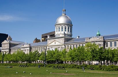
Marché Bonsecours Address: Rue Saint-Paul Est street in Montréal
- Pub Brewskey (Microbrewery),
- Bonsecours Market,
- Montreal Marche Bonsecours,
- Rue de la Commune,
- Nature et Decouverte,
- Observation Wheel Montreal,
- Chapelle Notre-Dame-de-Bon-Secours,
- Musée Marguerite-Bourgeoys,
- L'Usine Spaghetti Parisienne,
- Notre Dame de Bon Secours Chapel,
- Tyrolienne MTL Zipline,
- Château Ramezay,
- hotel pierre du calvet,
- Fairmount Bagels,
- Jardin Nelson,
- SOS Labyrinthe,
- Souvenir Place Jacques Cartier,
- Jm Nettoyage Toute Saison,
- Jacopo,
- Montreal City Hall
Places Near Marché Bonsecours (Montréal)
- Place Versailles, Montréal,
- Casino De Montréal, Montréal,
- Theatre Rialto, Montréal,
- Stade Saputo, Montréal,
- Place Bell, Laval,
- Bell Centre, Montréal,
- Marché Central, Montréal,
- L'Arsenal, Montréal,
- Mtelus, Montréal,
- Place Ville-Marie, Montréal,
- Centre Bell, Montréal,
- Palais Des Congrès De Montréal, Montréal,
- Royalmount, Mont-Royal,
- Vieux-Port, Montréal,
- Le Centre Eaton de Montreal, Montréal,
- Jewish General Hospital, Montréal,
- Galeries d'Anjou, Anjou,
- CHUM - Centre Hospitalier de l'Université de Montréal, Montréal,
- Carrefour Laval, Laval,
- Gare Centrale, Montréal
How to get to popular places in Montreal with public transit
Get around Montréal by public transit!
Traveling around Montréal has never been so easy. See step by step directions as you travel to any attraction, street or major public transit station. View bus and train schedules, arrival times, service alerts and detailed routes on a map, so you know exactly how to get to anywhere in Montréal.
When traveling to any destination around Montréal use Moovit's Live Directions with Get Off Notifications to know exactly where and how far to walk, how long to wait for your line, and how many stops are left. Moovit will alert you when it's time to get off — no need to constantly re-check whether yours is the next stop.
Wondering how to use public transit in Montréal or how to pay for public transit in Montréal? Moovit public transit app can help you navigate your way with public transit easily, and at minimum cost. It includes public transit fees, ticket prices, and costs. Looking for a map of Montréal public transit lines? Moovit public transit app shows all public transit maps in Montréal with all Bus, Train, Metro and Shuttle routes and stops on an interactive map.
Montreal has 4 transit type(s), including: Bus, Train, Metro and Shuttle, operated by several transit agencies, including RTL, STM, exo-Réseau de transport métropolitain, exo-Chambly-Richelieu-Carignan, exo-Haut-Saint-Laurent, exo-Laurentides, exo-La Presqu'île, CRT Lanaudière, exo-Le Richelain / Roussillon, exo-Sorel-Varennes, exo-Sud-Ouest, exo-Vallée du Richelieu, exo-L'Assomption, exo-Terrebonne-Mascouche and exo-Sainte-Julie