How to get to Marchetti Francesca by bus?
Click on the bus route to see step by step directions with maps, line arrival times and updated time schedules.
From Le Panteraie Discotheque Montecatini Lidò, Montecatini-Terme
146 minFrom Quarrata, Quarrata
44 minFrom Montemurlo, Montemurlo
122 minFrom Montecatini Terme, Montecatini Terme
127 minFrom Renzo Bonechi Quagliodromo - Federcaccia, Prato
181 minFrom La Dogaia Prison, Prato
111 minFrom Assembly Hall of Jehovah's Witnesses, Prato
137 minFrom Quetzal Club. The Legendary '90s, Serravalle Pistoiese
39 minFrom Curtatone Montanara Square, Quarrata
42 minFrom Monsummano Terme, Monsummano Terme
107 min
How to get to Marchetti Francesca by train?
Click on the train route to see step by step directions with maps, line arrival times and updated time schedules.
Bus stops near Marchetti Francesca in Pistoia
Train stations near Marchetti Francesca in Pistoia
Bus lines to Marchetti Francesca in Pistoia
- 24, Fiano,VIEW
- 21, Pistoia Station - Gello - Stazzana - Campiglio - Statigliana - Villa Di Cireglio,VIEW
- 22, Pistoia San Francesco Square - Piestro - Saturnana - Le Grazie - Pitornecca,VIEW
- 23, Pistoia Station - Gello - Sarripoli - Grati - Fagno,VIEW
- 25U, Pistoia Piazza San Francesco - Capostrada - San Felice - Piteccio,VIEW
- 56, Pistoia Station - Signorino - Sammommè / Collina - Taviano - Porretta Terme / Treppio,VIEW
- 23, Pistoia Alighieri Square [Railway Station],VIEW
- 5, Pistoia Alighieri Square [Railway Station],VIEW
- 4, A. Mantegna Street,VIEW
- 15, Candeglia Terminal,VIEW
- 25, Montale/Agliana Railway Station,VIEW
- 26, Baggio Terminal,VIEW
- 26, La Rena Terminal,VIEW
- 35, Industrial Zone,VIEW
- 85GER, Piazza San Francesco,VIEW
- 27-28, Lupicciano Terminal,VIEW
- 30, Torbecchia Terminal,VIEW
What are the closest stations to Marchetti Francesca?
The closest stations to Marchetti Francesca are:
- Frog Park is 212 meters away, 3 min walk.
- Porta Al Borgo (Post Office) is 235 meters away, 4 min walk.
- Via Del Villone (Junction Via Dei Macelli) is 364 meters away, 5 min walk.
- G. Fattori Street is 497 meters away, 7 min walk.
- Matteotti Avenue (Health Center) is 501 meters away, 7 min walk.
- Roncalli Institute is 560 meters away, 8 min walk.
- Pistoia West is 1110 meters away, 15 min walk.
- Pistoia is 2507 meters away, 33 min walk.
Which bus lines stop near Marchetti Francesca?
These bus lines stop near Marchetti Francesca: 25, 4, 5, 56, 8.
Which train line stops near Marchetti Francesca?
R (Prato/Firenze)
What’s the nearest train station to Marchetti Francesca in Pistoia?
The nearest train station to Marchetti Francesca in Pistoia is Pistoia West. It’s a 15 min walk away.
What’s the nearest bus station to Marchetti Francesca in Pistoia?
The nearest bus station to Marchetti Francesca in Pistoia is Frog Park. It’s a 3 min walk away.
What time is the first train to Marchetti Francesca in Pistoia?
The R is the first train that goes to Marchetti Francesca in Pistoia. It stops nearby at 5:20 AM.
What time is the last train to Marchetti Francesca in Pistoia?
The R is the last train that goes to Marchetti Francesca in Pistoia. It stops nearby at 1:13 AM.
What time is the first bus to Marchetti Francesca in Pistoia?
The 4 is the first bus that goes to Marchetti Francesca in Pistoia. It stops nearby at 6:17 AM.
What time is the last bus to Marchetti Francesca in Pistoia?
The 56 is the last bus that goes to Marchetti Francesca in Pistoia. It stops nearby at 9:09 PM.
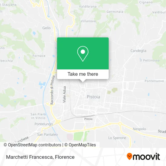
See Marchetti Francesca, Pistoia, on the map
Public Transit to Marchetti Francesca in Pistoia
Wondering how to get to Marchetti Francesca in Pistoia? Moovit helps you find the best way to get to Marchetti Francesca with step-by-step directions from the nearest public transit station.
Moovit provides free maps and live directions to help you navigate through your city. View schedules, routes, timetables, and find out how long does it take to get to Marchetti Francesca in real time.
Looking for the nearest stop or station to Marchetti Francesca? Check out this list of stops closest to your destination: Frog Park; Porta Al Borgo (Post Office); Via Del Villone (Junction Via Dei Macelli); G. Fattori Street; Matteotti Avenue (Health Center); Roncalli Institute; Pistoia West; Pistoia.
Bus: 25, 4, 5, 56, 8, 24, 21, 22, 23, 25U, 23.Train: R.
Want to see if there’s another route that gets you there at an earlier time? Moovit helps you find alternative routes or times. Get directions from and directions to Marchetti Francesca easily from the Moovit App or Website.
We make riding to Marchetti Francesca easy, which is why over 1.5 million users, including users in Pistoia, trust Moovit as the best app for public transit. You don’t need to download an individual bus app or train app, Moovit is your all-in-one transit app that helps you find the best bus time or train time available.
For information on prices of bus and train, costs and ride fares to Marchetti Francesca, please check the Moovit app.
Use the app to navigate to popular places including to the airport, hospital, stadium, grocery store, mall, coffee shop, school, college, and university.
Marchetti Francesca Address: Via Ludovico Ariosto, 1 51100 Pistoia street in Pistoia
- Bendini Alessio,
- Global System Snc by Valentini Pasquale & C.,
- Platinum Services,
- Animama Aesthetics,
- Biondi Butcher Shop by Messina Maria Giovanna,
- Fanfani Marco,
- FFFR Photography-Francesco Poli-Rachele Salvioli,
- Luca Pacini,
- Giovanni Robbiano,
- UGF Bank - Branch 189,
- Barent Elke,
- Adecco,
- Nubiali's Cafe and Pastry Shop,
- Distribution Services Organization Palandri by Cioni Maria Magdalena & Co,
- Doctor Karin Pedro,
- Lombardi Claudia,
- BB Inc.,
- Bellaria Street, 6,
- Equilibre Aesthetic Center by Berti Michela,
- Bellaria Street, 58
Places Near Marchetti Francesca (Pistoia)
- Field of Mars, Florence,
- Piero Palagi Hospital Facility-Florence, Florence,
- Wanny Palace, Florence,
- Torregalli Hospital Scandicci *, Scandicci,
- Asmana, Campi Bisenzio,
- Michelangelo Square, Florence,
- Santa Maria Nuova Hospital, Florence,
- Tobacco Manufacture, Florence,
- Campi Bisenzio, Campi Bisenzio,
- Viola Park, Bagno a Ripoli,
- Cascine Park, Florence,
- OOO, Florence,
- Verdi Theater, Florence,
- Santa Maria Novella Station, Florence,
- IKEA Florence, Sesto Fiorentino,
- Mandela Forum (Nelson Mandela Forum), Florence,
- I Gigli, Campi Bisenzio,
- Nelson Mandela Forum, Florence,
- Michelangelo Square, Florence,
- Artemio Franchi Municipal Stadium, Florence
How to get to popular places in Florence with public transit
Get around Pistoia by public transit!
Traveling around Pistoia has never been so easy. See step by step directions as you travel to any attraction, street or major public transit station. View bus and train schedules, arrival times, service alerts and detailed routes on a map, so you know exactly how to get to anywhere in Pistoia.
When traveling to any destination around Pistoia use Moovit's Live Directions with Get Off Notifications to know exactly where and how far to walk, how long to wait for your line, and how many stops are left. Moovit will alert you when it's time to get off — no need to constantly re-check whether yours is the next stop.
Wondering how to use public transit in Pistoia or how to pay for public transit in Pistoia? Moovit public transit app can help you navigate your way with public transit easily, and at minimum cost. It includes public transit fees, ticket prices, and costs. Looking for a map of Pistoia public transit lines? Moovit public transit app shows all public transit maps in Pistoia with all Bus, Train, Light Rail, Ferry and Funicular routes and stops on an interactive map.
Florence has 5 transit type(s), including: Bus, Train, Light Rail, Ferry and Funicular, operated by several transit agencies, including Florence Urban - Tuscan Bus Lines, GEST, Florence and Province - Tuscan Bus Lines, Livorno and Province - Tuscan Bus Lines, Arezzo, Florence and Provinces - Tuscan Bus Lines, Prato and Province - Tuscan Bus Lines, Massa, Carrara and Province - Tuscan Bus Lines, Pisa and Province - Tuscan Bus Lines, Grosseto, Siena and Provinces - Tuscan Bus Lines, Arezzo, Siena and Provinces - Tuscan Bus Lines, Pistoia and Province - Tuscan Bus Lines, Siena and Province - Tuscan Bus Lines, Arezzo and Province - Tuscan Bus Lines, Lucca and Province - Tuscan Bus Lines and Trenitalia
Public transit lines with stations closest to Marchetti Francesca in Pistoia
Train lines with stations closest to Marchetti Francesca in Pistoia
Bus lines with stations closest to Marchetti Francesca in Pistoia
Porta Al Borgo (Post Office)
 21Pistoia Station - Gello - Stazzana - Campiglio - Statigliana - Villa Di Cireglio
- 22Pistoia San Francesco Square - Piestro - Saturnana - Le Grazie - Pitornecca
- 23Pistoia Station - Gello - Sarripoli - Grati - Fagno
- 25UPistoia Piazza San Francesco - Capostrada - San Felice - Piteccio
- 56Pistoia Station - Signorino - Sammommè / Collina - Taviano - Porretta Terme / Treppio