Directions to Mare Alta Mar (Angra Dos Reis) with public transportation
The following transit lines have routes that pass near Mare Alta Mar
 Bus: 104, 106, 221, 230, T11.
- Ferry: ANGRA DOS REIS - ILHA GRANDE, ANGRA DOS REIS - ILHA GRANDE.
How to get to Mare Alta Mar by bus?
Click on the bus route to see step by step directions with maps, line arrival times and updated time schedules.
From Polícia Militar DPO Verolme, Jacuecanga
34 minFrom Condomínio Porto Marina Bracuhy, Cunhambebe
67 minFrom Vila Galé Eco Resort Angra All Inclusive Angra dos Reis, Angra Dos Reis
72 minFrom Jacuecanga, Jacuecanga
38 minFrom Marina Bela Vista, Jacuecanga
52 minFrom Serenar Hotel Restaurante & Spa, Cunhambebe
49 minFrom Bracuhy, Cunhambebe
75 minFrom Praia do Itinga, Cunhambebe
69 minFrom Carlos Henrique de Bulhões Filho, Jacuecanga
48 minFrom Condomínio Porto Real Resort, Cunhambebe
74 min
Bus stops near Mare Alta Mar in Angra Dos Reis
Ferry station near Mare Alta Mar in Angra Dos Reis
- Estação Santa Luzia (Angra Dos Reis) ⛴, 32 min walk,VIEW
Bus lines to Mare Alta Mar in Angra Dos Reis
- C01, Centro (Circular),VIEW
- C01B, Circular (via Pestalozzi),VIEW
- C03B, Marinas (via Balneário),VIEW
- C03, Marinas,VIEW
- C05B, Retiro (via Balneário),VIEW
- T10, Divisa Mangaratiba,VIEW
- T11, Ponta Leste (via Jacuecanga),VIEW
- T20, Parque Mambucaba (via Praia Brava / Vila Histórica),VIEW
- T21, Frade,VIEW
- T21B, Praia Brava,VIEW
- T21C, Frade (via Itinga),VIEW
- L101, Angra dos Reis - Paraty,VIEW
- 102, Caputera (via Jacuecanga),VIEW
- 103, Camorim,VIEW
- 104, Monsuaba,VIEW
- 105, Morro do Moreno x Centro,VIEW
- 106, Jacuecanga (via Balneário),VIEW
- 202, Frade (via Sertãozinho / Beira Rio),VIEW
- 203, Serra D'Água,VIEW
- B203, Serra D'Agua (via Túnel),VIEW
What are the closest stations to Mare Alta Mar?
The closest stations to Mare Alta Mar are:
- Rua Theóphilo Massad, 1-121 is 100 meters away, 2 min walk.
- Rua Comandante Castelo Branco, 5 is 114 meters away, 2 min walk.
- Rua José Elías Rabha, Sentido Centro is 324 meters away, 5 min walk.
- Mário Covas/ Sentido Centro is 576 meters away, 10 min walk.
- Rua Prefeito João Galindo, 1970-2222 is 719 meters away, 10 min walk.
- Estação Santa Luzia (Angra Dos Reis) ⛴ is 2419 meters away, 32 min walk.
Which bus lines stop near Mare Alta Mar?
These bus lines stop near Mare Alta Mar: 104, 106, 221, 230, T11, T21.
What’s the nearest bus station to Mare Alta Mar in Angra Dos Reis?
The nearest bus stations to Mare Alta Mar in Angra Dos Reis are Rua Theóphilo Massad, 1-121 and Rua Comandante Castelo Branco, 5. The closest one is a 2 min walk away.
What time is the first bus to Mare Alta Mar in Angra Dos Reis?
The T11 is the first bus that goes to Mare Alta Mar in Angra Dos Reis. It stops nearby at 4:53 AM.
What time is the last bus to Mare Alta Mar in Angra Dos Reis?
The T11 is the last bus that goes to Mare Alta Mar in Angra Dos Reis. It stops nearby at 1:56 AM.
What time is the first ferry to Mare Alta Mar in Angra Dos Reis?
The ANGRA DOS REIS - ILHA GRANDE is the first ferry that goes to Mare Alta Mar in Angra Dos Reis. It stops nearby at 8:35 AM.
What time is the last ferry to Mare Alta Mar in Angra Dos Reis?
The ANGRA DOS REIS - ILHA GRANDE is the last ferry that goes to Mare Alta Mar in Angra Dos Reis. It stops nearby at 6:30 PM.
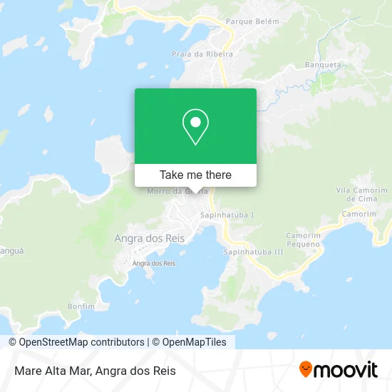
See Mare Alta Mar, Angra Dos Reis, on the map
Public Transit to Mare Alta Mar in Angra Dos Reis
Wondering how to get to Mare Alta Mar in Angra Dos Reis? Moovit helps you find the best way to get to Mare Alta Mar with step-by-step directions from the nearest public transit station.
Moovit provides free maps and live directions to help you navigate through your city. View schedules, routes, timetables, and find out how long does it take to get to Mare Alta Mar in real time.
Looking for the nearest stop or station to Mare Alta Mar? Check out this list of stops closest to your destination: Rua Theóphilo Massad; Rua Comandante Castelo Branco; Rua José Elías Rabha; Mário Covas/ Sentido Centro; Rua Prefeito João Galindo; Estação Santa Luzia (Angra Dos Reis) ⛴.
Bus: 104, 106, 221, 230, T11, T21, C01, C01B, C03B, C03, C05B, T10, T20, C05, 206, 207, B207, 224, B106, 300, 306.Ferry: ANGRA DOS REIS - ILHA GRANDE, ANGRA DOS REIS - ILHA GRANDE.
Want to see if there’s another route that gets you there at an earlier time? Moovit helps you find alternative routes or times. Get directions from and directions to Mare Alta Mar easily from the Moovit App or Website.
We make riding to Mare Alta Mar easy, which is why over 1.5 million users, including users in Angra Dos Reis, trust Moovit as the best app for public transit. You don’t need to download an individual bus app or train app, Moovit is your all-in-one transit app that helps you find the best bus time or train time available.
For information on prices of bus, costs and ride fares to Mare Alta Mar, please check the Moovit app.
Use the app to navigate to popular places including to the airport, hospital, stadium, grocery store, mall, coffee shop, school, college, and university.
Mare Alta Mar Address: Rua Benedito Pereira Rocha, 398 Parque das Palmeiras Angra dos Reis-RJ 23906-250 street in Angra Dos Reis
- Associação Pestalozzi Angra dos Reis,
- Somed Saude,
- Academia Sheila Klautau,
- Rua Benedito Pereira Rocha,
- Condomínio Village do Sol,
- Escola Municipal Balneario,
- Pronaos Rosacruz de Angra dos Reis Amorc,
- Associação dos Aposentados e Pensionistas de Angra,
- Fedrizzi Surf Shop,
- Igreja de São Cristóvão,
- Grupo Pé-de-Moleque,
- Clube dos Criadores de Pássaros Canoros de Angra dos Reis,
- Elias Antônio Cia,
- Apfar,
- Espaço sete,
- Restaurante Samburá,
- Delicias da Gabi 4,
- Studio Design e Stilo,
- Renatas Delicatessen,
- Condominio do Edificio Lagoa Azul
Places Near Mare Alta Mar (Angra Dos Reis)
- Centro Histórico de Paraty, Parati,
- Rua Prefeito João Gregório Galindo, Cunhambebe,
- Praia de Paraty Mirim, Parati,
- Verolme, Jacuecanga,
- praia jabaquara - parati, Parati,
- BR 101, Km 508 s/n, Cunhambebe,
- Rodovia Procurador Haroldo Fernandes Duarte, Km 513,5 s / n, Cunhambebe,
- Condominio Laranjeiras, Parati Mirim,
- Rua Prefeito João Gregório Galindo 2487, Angra Dos Reis,
- Rodovia BR 101, Km 533 s/n, Mambucaba,
- Avenida Almirante Jair Carneiro Toscano de Brito 110, Angra Dos Reis,
- Avenida Antônio Bertholdo da Silva Jordão 7346, Jacuecanga,
- Vila Residencial De Mambucaba, Mambucaba,
- Vila Galé Eco Resort De Angra, Angra Dos Reis,
- Alambique Engenho D'Ouro, Parati,
- Cachoeira do Tobogã, Parati,
- Garatucaia, Angra Dos Reis,
- Rua Cônegos Bittencourt, Angra Dos Reis,
- Mambucaba, Mambucaba,
- Praia do Laboratório, Angra Dos Reis
How to get to popular places in Angra dos Reis with public transit
Get around Angra Dos Reis by public transit!
Traveling around Angra Dos Reis has never been so easy. See step by step directions as you travel to any attraction, street or major public transit station. View bus and train schedules, arrival times, service alerts and detailed routes on a map, so you know exactly how to get to anywhere in Angra Dos Reis.
When traveling to any destination around Angra Dos Reis use Moovit's Live Directions with Get Off Notifications to know exactly where and how far to walk, how long to wait for your line, and how many stops are left. Moovit will alert you when it's time to get off — no need to constantly re-check whether yours is the next stop.
Wondering how to use public transit in Angra Dos Reis or how to pay for public transit in Angra Dos Reis? Moovit public transit app can help you navigate your way with public transit easily, and at minimum cost. It includes public transit fees, ticket prices, and costs. Looking for a map of Angra Dos Reis public transit lines? Moovit public transit app shows all public transit maps in Angra Dos Reis with all Bus and Ferry routes and stops on an interactive map.
Angra dos Reis has 2 transit type(s), including: Bus and Ferry, operated by several transit agencies, including Viação Senhor do Bonfim, Colitur Transportes Rodoviários, Cooparatyense (Vans), Costa Verde Transportes, Barcas Rio, Objetiva Tour, Vilanova Tour, Rodoviário Oceano, BusUFF and Colitur (Tarifa Zero - Paraty)