How to get to Market by bus?
Click on the bus route to see step by step directions with maps, line arrival times and updated time schedules.
From 522b Mecidiyeköy Ümraniye, Şişli
88 minFrom Süleymaniye, Fatih
53 minFrom Yenibosna Metrobüs Durağı, Bahçelievler
82 minFrom Etiler İETT Durağı, Etiler, Beşiktaş
88 minFrom ATV Esra Erol Sütüdyosu YeniBosna, Bakirköy
80 minFrom Esenler Otogar, Basaksehir
86 minFrom samatya hastanesi, Fatih
58 minFrom Hisar Veraset ve Harçlar Vergi Dairesi, Eminönü, Fatih
51 minFrom Halkalı Mehmet Akif Ersoy Kalp Ve Damar Hastanesi, Küçükçekmece
117 minFrom Bahçelievler Devlet Hastanesi, Bahçelievler
99 min
How to get to Market by metro?
Click on the metro route to see step by step directions with maps, line arrival times and updated time schedules.
From 522b Mecidiyeköy Ümraniye, Şişli
73 minFrom Süleymaniye, Fatih
64 minFrom Yenibosna Metrobüs Durağı, Bahçelievler
63 minFrom Etiler İETT Durağı, Etiler, Beşiktaş
90 minFrom ATV Esra Erol Sütüdyosu YeniBosna, Bakirköy
62 minFrom Esenler Otogar, Basaksehir
75 minFrom Hisar Veraset ve Harçlar Vergi Dairesi, Eminönü, Fatih
72 minFrom Halkalı Mehmet Akif Ersoy Kalp Ve Damar Hastanesi, Küçükçekmece
88 minFrom Bahçelievler Devlet Hastanesi, Bahçelievler
79 min
Bus stops near Market in Gaziosmanpasa
Dolmus & Minibus stations near Market in Gaziosmanpasa
Bus lines to Market in Gaziosmanpasa
- A27, Yıldıztabya,VIEW
- A27, 5. Levent - Yıldıztabya - Rami / Ring,VIEW
- A27, Pazariçi,VIEW
- A37, Gaziosmanpaşa,VIEW
- A74, Yayla ,VIEW
- A74, Habipler ,VIEW
- A11+A27, Otogar ,VIEW
- TM9, Gaziosmanpaşa - Alibeyköy / Ring,VIEW
- TM13, Alibeyköy Metro-Teleferik Pierreloti,VIEW
- TM14, Yenimahalle/Sarıgöl-Alibeyköy / Ring,VIEW
- TM16, Gop Yeni Mahalle Metro-Alibeyköy Metro,VIEW
- 33ES, Giyimkent-Eminönü,VIEW
- 50A, Alibeyköy Metro-Edirnekapı,VIEW
- 50P, Çırçır Metro-Eminönü,VIEW
- 55, Şişli Merkez-Gaziosmanpaşa,VIEW
- 55ET, Gaziosmanpaşa Belediye-Beşiktaş Peronlar,VIEW
- 55T, Gaziosmanpaşa-Harbiye Askeri Müze,VIEW
- 55Y, Sadabad Osmanlı Arşivi-Yenibosna Metro,VIEW
- 99A, Eminönü-Gaziosmanpaşa,VIEW
- 55G, Beşiktaş Peronlar-Gaziosmanpaşa,VIEW
What are the closest stations to Market?
The closest stations to Market are:
- Gaziosmanpaşa Belediye - Esentepe 2 Yönü is 186 meters away, 3 min walk.
- Gaziosmanpaşa - Son Durak(55t) Yönü is 363 meters away, 5 min walk.
- Gaziosmanpaşa is 413 meters away, 6 min walk.
- Gaziosmanpaşa Meydan is 434 meters away, 6 min walk.
- Halitpaşa Caddesi - Y.Tabya ( Esentepe)1 Yönü is 540 meters away, 8 min walk.
Which bus lines stop near Market?
These bus lines stop near Market: 36ES, 50A, 50P, 55, 55T, 99A.
Which metro lines stop near Market?
These metro lines stop near Market: M1A, M1B.
Which Dolmus & Minibus lines stop near Market?
These Dolmus & Minibus lines stop near Market: A27, A74.
What’s the nearest bus station to Market in Gaziosmanpasa?
The nearest bus station to Market in Gaziosmanpasa is Gaziosmanpaşa Belediye - Esentepe 2 Yönü. It’s a 3 min walk away.
What’s the nearest Dolmus & Minibus station to Market in Gaziosmanpasa?
The nearest Dolmus & Minibus stations to Market in Gaziosmanpasa are Gaziosmanpaşa and Gaziosmanpaşa Meydan. The closest one is a 6 min walk away.
What time is the first bus to Market in Gaziosmanpasa?
The 55G is the first bus that goes to Market in Gaziosmanpasa. It stops nearby at 3:00 AM.
What time is the last bus to Market in Gaziosmanpasa?
The 55G is the last bus that goes to Market in Gaziosmanpasa. It stops nearby at 2:47 AM.
What time is the first Dolmus & Minibus to Market in Gaziosmanpasa?
The A34 is the first Dolmus & Minibus that goes to Market in Gaziosmanpasa. It stops nearby at 5:31 AM.
What time is the last Dolmus & Minibus to Market in Gaziosmanpasa?
The A27 is the last Dolmus & Minibus that goes to Market in Gaziosmanpasa. It stops nearby at 12:25 AM.
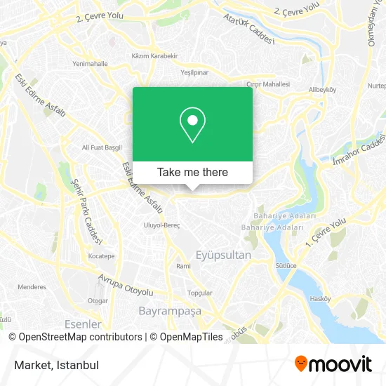
See Market, Gaziosmanpasa, on the map
Public Transit to Market in Gaziosmanpasa
Wondering how to get to Market in Gaziosmanpasa? Moovit helps you find the best way to get to Market with step-by-step directions from the nearest public transit station.
Moovit provides free maps and live directions to help you navigate through your city. View schedules, routes, timetables, and find out how long does it take to get to Market in real time.
Looking for the nearest stop or station to Market? Check out this list of stops closest to your destination: Gaziosmanpaşa Belediye - Esentepe 2 Yönü; Gaziosmanpaşa - Son Durak(55t) Yönü; Gaziosmanpaşa; Gaziosmanpaşa Meydan; Halitpaşa Caddesi - Y.Tabya ( Esentepe)1 Yönü.
Bus: 36ES, 50A, 50P, 55, 55T, 99A, A27, A27, A27, A37, A74, 55G, A38, 38B, 88A.Metro: M1A, M1B.Dolmus & Minibus: A27, A74, A17, A34, A34, A38.
Want to see if there’s another route that gets you there at an earlier time? Moovit helps you find alternative routes or times. Get directions from and directions to Market easily from the Moovit App or Website.
We make riding to Market easy, which is why over 1.5 million users, including users in Gaziosmanpasa, trust Moovit as the best app for public transit. You don’t need to download an individual bus app or train app, Moovit is your all-in-one transit app that helps you find the best bus time or train time available.
For information on prices of bus, metro, Dolmus & Minibus and Metrobus, costs and ride fares to Market, please check the Moovit app.
Use the app to navigate to popular places including to the airport, hospital, stadium, grocery store, mall, coffee shop, school, college, and university.
Market Address: Hamam Caddesi, 30 street in Gaziosmanpasa
- Hamam Caddesi,
- Sultan Sarnıç Düğün Sarayı,
- Gaziosmanpaşa Belediyesi,
- Beylikdüzü Hz. Ebubekir Camii,
- Gop Bayrampaşa Minibüs Durağı,
- Tula Lokantası,
- Gop Nurtepe Minibüsü,
- Sarıgöl Cami,
- PTT Arkası Sokak / Dereyolu Sokak,
- Ezgi Düğün Salonu,
- Kızılay Hastanesi,
- Gaziosmanpaşa Ali Külünk Semt Polikliniği,
- Chp Gaziosmanpaşa ilçe başkanlığı,
- Ziraat Bankası yıldıztabya Şubesi,
- Türkiye İş Bankası,
- Ordu Caddesi,
- Tepebaşı Durağı,
- Ordu,
- Bekir Sami Dedeoğlu Ilkogretim Okulu,
- Vatan Partisi Gaziosmanpaşa İlçe Başkanlığı
Places Near Market (Gaziosmanpasa)
- Başakşehir Çam Ve Sakura Şehir Hastanesi, Basaksehir,
- Bakırköy Sosyete Pazarı, Bakirköy,
- Topkule Kışlası 47.Komando Tugay Komutanlığı, Esenler,
- İstanbul,
- Gebze-Harem Minibüs Hattı, Gebze,
- VİALAND AVM, Eyüp,
- 41 Burda AVM, Kocaeli Merkezi,
- Hilltown AVM, Maltepe,
- İstinye Park, Sariyer,
- Gebze Koop Durağı, Gebze,
- 2 Nolu Minibüss, Beylikduzu,
- Beylikdüzü - 4 Nolu Minibüs Hattı, Beylikduzu,
- Şehit Prof. Dr. İlhan Varank Eğitim Ve Araştırma Hastanesi, Sancaktepe,
- Karaköy Genelevi, Karaköy, Beyoğlu,
- Tersane İstanbul, Beyoğlu,
- 212 AVM, Bagcilar,
- METROPOL IsTaNBuL, Ataşehir,
- Hz. Yuşa Tepesi, Beykoz,
- Mall Of İstanbul, Basaksehir,
- Mehmet Emin Tokadî Hz. Türbesi, Fatih
How to get to popular places in Istanbul with public transit
Get around Gaziosmanpasa by public transit!
Traveling around Gaziosmanpasa has never been so easy. See step by step directions as you travel to any attraction, street or major public transit station. View bus and train schedules, arrival times, service alerts and detailed routes on a map, so you know exactly how to get to anywhere in Gaziosmanpasa.
When traveling to any destination around Gaziosmanpasa use Moovit's Live Directions with Get Off Notifications to know exactly where and how far to walk, how long to wait for your line, and how many stops are left. Moovit will alert you when it's time to get off — no need to constantly re-check whether yours is the next stop.
Wondering how to use public transit in Gaziosmanpasa or how to pay for public transit in Gaziosmanpasa? Moovit public transit app can help you navigate your way with public transit easily, and at minimum cost. It includes public transit fees, ticket prices, and costs. Looking for a map of Gaziosmanpasa public transit lines? Moovit public transit app shows all public transit maps in Gaziosmanpasa with all Bus, Train, Metro, Tram, Ferry, Metrobus and Dolmus & Minibus routes and stops on an interactive map.
Istanbul has 7 transit type(s), including: Bus, Train, Metro, Tram, Ferry, Metrobus and Dolmus & Minibus, operated by several transit agencies, including Marmaray, Metro İstanbul, Metrobüs, UAB, İETT, İETT ÇIFT KATLI HATLAR, İETT BÖLGESEL HATLAR, TCDD, Şehir Hatları, Dentur Avrasya, Beyden, Turyol, Mavi Marmara, Havaist and Prenstur
