Markham Stouffville Hospital stop - Thursday schedule
| Line | Direction | Time |
|---|---|---|
| PURPLE | Cornell Bus Terminal Via Highway 7 - Eb | 5:21 AM |
| PURPLE A | Cornell Bus Terminal Via Enterprise Boulevard - Eb | 5:37 AM |
| PURPLE | Cornell Bus Terminal Via Highway 7 - Eb | 5:41 AM |
| PURPLE A | Cornell Bus Terminal Via Enterprise Boulevard - Eb | 5:57 AM |
| PURPLE | Cornell Bus Terminal Via Highway 7 - Eb | 6:04 AM |
| PURPLE A | Cornell Bus Terminal Via Enterprise Boulevard - Eb | 6:22 AM |
| PURPLE | Cornell Bus Terminal Via Highway 7 - Eb | 6:26 AM |
| PURPLE A | Cornell Bus Terminal Via Enterprise Boulevard - Eb | 6:46 AM |
| PURPLE | Cornell Bus Terminal Via Highway 7 - Eb | 6:49 AM |
| PURPLE A | Cornell Bus Terminal Via Enterprise Boulevard - Eb | 7:04 AM |
| PURPLE | Cornell Bus Terminal Via Highway 7 - Eb | 7:07 AM |
| PURPLE A | Cornell Bus Terminal Via Enterprise Boulevard - Eb | 7:22 AM |
| PURPLE | Cornell Bus Terminal Via Highway 7 - Eb | 7:32 AM |
| PURPLE A | Cornell Bus Terminal Via Enterprise Boulevard - Eb | 7:46 AM |
| PURPLE | Cornell Bus Terminal Via Highway 7 - Eb | 7:50 AM |
| 401 | St Brother Andre School Special Via Box Grove - Mo | 7:54 AM |
| PURPLE A | Cornell Bus Terminal Via Enterprise Boulevard - Eb | 8:04 AM |
| PURPLE | Cornell Bus Terminal Via Highway 7 - Eb | 8:08 AM |
| PURPLE A | Cornell Bus Terminal Via Enterprise Boulevard - Eb | 8:27 AM |
| PURPLE | Cornell Bus Terminal Via Highway 7 - Eb | 8:30 AM |
| 417 | Bill Hogarth School Special - Mo | 8:36 AM |
| 417 | Bill Hogarth School Special - Mo | 8:37 AM |
| PURPLE A | Cornell Bus Terminal Via Enterprise Boulevard - Eb | 8:45 AM |
| PURPLE | Cornell Bus Terminal Via Highway 7 - Eb | 8:48 AM |
| 522 | Hagerman's Corners Via Kennedy Road - Wb | 9:01 AM |
Directions to Markham Stouffville Hospital stop with public transit
The following transit lines have routes that pass near Markham Stouffville Hospital
How to get to Markham Stouffville Hospital stop by bus?
Click on the bus route to see step by step directions with maps, line arrival times and updated time schedules.
How to get to Markham Stouffville Hospital stop by train?
Click on the train route to see step by step directions with maps, line arrival times and updated time schedules.
Bus stops near Markham Stouffville Hospital stop
- Church St / Markham Stouffville Hospital, 1 min walk,
- Church St / Butternut Lane, 2 min walk,
- Church St / Ninth Line, 3 min walk,
- Ninth Line / Church St, 4 min walk,
- Bur Oak Av / Church St, 5 min walk,
Bus lines to Markham Stouffville Hospital stop
- 1, Cornell Bus Terminal - Eb,
- 303, Finch Go Bus Terminal - Mo,
- 401, St Brother Andre School Special Via Box Grove - Mo,
- 402, Bur Oak / Pierre Elliott Trudeau School Special - Mo,
- 406, Markham District School Special Via Bur Oak - Mo,
- 416, Markham District School Special Via Ninth Line - Mo,
- 16, Cornell Bus Terminal - Eb,
- 417, Bill Hogarth School Special - Mo,
- 522, Hagerman's Corners Via Kennedy Road - Wb,
- 9, Stouffville - Nb,
- 18, Cornell Bus Terminal - Eb,
What are the closest stations to Markham Stouffville Hospital?
The closest stations to Markham Stouffville Hospital are:
- Church St / Markham Stouffville Hospital is 37 meters away, 1 min walk.
- Church St / Butternut Lane is 121 meters away, 2 min walk.
- Church St / Ninth Line is 198 meters away, 3 min walk.
- Ninth Line / Church St is 260 meters away, 4 min walk.
- Bur Oak Av / Church St is 313 meters away, 5 min walk.
Which bus lines stop near Markham Stouffville Hospital?
These bus lines stop near Markham Stouffville Hospital: PURPLE, PURPLE A.
Which train line stops near Markham Stouffville Hospital?
ST
What’s the nearest bus station to Markham Stouffville Hospital?
The nearest bus station to Markham Stouffville Hospital is Church St / Markham Stouffville Hospital. It’s a 1 min walk away.
What time is the first bus to Markham Stouffville Hospital?
The 1 is the first bus that goes to Markham Stouffville Hospital. It stops nearby at 4:06 AM.
What time is the last bus to Markham Stouffville Hospital?
The 1 is the last bus that goes to Markham Stouffville Hospital. It stops nearby at 2:24 AM.
How much is the bus fare to Markham Stouffville Hospital?
The bus fare to Markham Stouffville Hospital costs about $3.30 - $4.25.
See Markham Stouffville Hospital stop on the map
Public transit to Markham Stouffville Hospital stop (ID: 9810)
Looking for directions to Markham Stouffville Hospital in Markham, Canada?
Download the Moovit App to find the current schedule and step-by-step directions for Bus or Train routes that pass through Markham Stouffville Hospital.
Looking for the nearest stops closest to Markham Stouffville Hospital ? Check out this list of closest stops to your destination: Church St / Markham Stouffville Hospital; Church St / Butternut Lane; Church St / Ninth Line; Ninth Line / Church St; Bur Oak Av / Church St.
Bus: PURPLE, PURPLE A, 1, 303, 401, 402, 406, 16, 417, 522, 9, 18.Train: ST.
We make riding on public transit to Markham Stouffville Hospital easy, which is why over 1.5 million users, including users in Markham trust Moovit as the best app for public transit.
Use the app to navigate to popular places including to the airport, hospital, stadium, grocery store, mall, coffee shop, school, college, and university.
Markham Stouffville Hospital stop’s code is 9810
The first line to this stop is PURPLE, at 5:21 AM, and the last line is PURPLE at 1:15 AM.
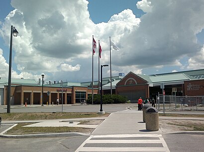
380 Church Street, Markham, ON, Canada
This stop serves York Region Transit’s lines
Bus stops near Markham Stouffville Hospital stop
Popular public transit stations in Markham
Get around Markham by public transit!
Traveling around Markham has never been so easy. See step by step directions as you travel to any attraction, street or major public transit station. View bus and train schedules, arrival times, service alerts and detailed routes on a map, so you know exactly how to get to anywhere in Markham.
When traveling to any destination around Markham use Moovit's Live Directions with Get Off Notifications to know exactly where and how far to walk, how long to wait for your line, and how many stops are left. Moovit will alert you when it's time to get off — no need to constantly re-check whether yours is the next stop.
Wondering how to use public transit in Markham or how to pay for public transit in Markham? Moovit public transit app can help you navigate your way with public transit easily, and at minimum cost. It includes public transit fees, ticket prices, and costs. Looking for a map of Markham public transit lines? Moovit public transit app shows all public transit maps in Markham with all Bus, Train, Subway, Streetcar and Ferry routes and stops on an interactive map.
Toronto has 5 transit type(s), including: Bus, Train, Subway, Streetcar and Ferry, operated by several transit agencies, including TTC, TTC Streetcar, Toronto Subway, Brampton Transit, MiWay, York Region Transit, GO Transit Bus, GO Transit, Durham Region Transit, UP Express, Grand River Transit, Guelph Transit, Hamilton Street Railway, Burlington Transit and Oakville Transit