Directions to Marlene Modas (Sengés) with public transportation
The following transit lines have routes that pass near Marlene Modas
How to get to Marlene Modas by bus?
Click on the bus route to see step by step directions with maps, line arrival times and updated time schedules.
From Copel, Jaguariaíva
96 minFrom Eskinao Frutas E Verduras, Jaguariaíva
70 minFrom Cemitério Municipal De Jaguariaíva, Jaguariaíva
86 minFrom Real Lanches, Jaguariaíva
69 minFrom Clínica de Olhos Dr Paulo Magalhães, Jaguariaíva
68 minFrom Sapataria Santos, Jaguariaíva
68 minFrom Imperial Lanches, Jaguariaíva
69 minFrom INSS-Instituto Nacional do Seguro Social, Jaguariaíva
72 minFrom Luizinho das Antenas, Jaguariaíva
69 minFrom Paulafrancielede, Jaguariaíva
69 min
Bus stops near Marlene Modas in Sengés
Bus lines to Marlene Modas in Sengés
What are the closest stations to Marlene Modas?
The closest stations to Marlene Modas are:
- Rua Santos Dumont, 38 is 128 meters away, 2 min walk.
- Terminal Rodoviário De Sengés is 618 meters away, 9 min walk.
Which bus line stops near Marlene Modas?
0801-30 PONTA GROSSA / SENGÉS (Ponta Grossa → Sengés (Via Castro / Piraí Do Sul / Jaguariaíva))
What’s the nearest bus station to Marlene Modas in Sengés?
The nearest bus station to Marlene Modas in Sengés is Rua Santos Dumont, 38. It’s a 2 min walk away.
What time is the first bus to Marlene Modas in Sengés?
The S01 CIRCULAR COHAPAR / JARDIM BRAÚNA is the first bus that goes to Marlene Modas in Sengés. It stops nearby at 6:36 AM.
What time is the last bus to Marlene Modas in Sengés?
The 0801-30 PONTA GROSSA / SENGÉS is the last bus that goes to Marlene Modas in Sengés. It stops nearby at 2:10 AM.
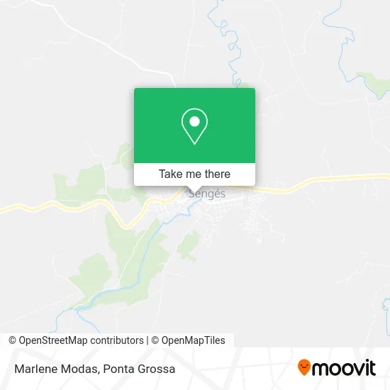
See Marlene Modas, Sengés, on the map
Public Transit to Marlene Modas in Sengés
Wondering how to get to Marlene Modas in Sengés? Moovit helps you find the best way to get to Marlene Modas with step-by-step directions from the nearest public transit station.
Moovit provides free maps and live directions to help you navigate through your city. View schedules, routes, timetables, and find out how long does it take to get to Marlene Modas in real time.
Looking for the nearest stop or station to Marlene Modas? Check out this list of stops closest to your destination: Rua Santos Dumont; Terminal Rodoviário De Sengés.
Bus: 0801-30 PONTA GROSSA / SENGÉS, S01 CIRCULAR COHAPAR / JARDIM BRAÚNA.
Want to see if there’s another route that gets you there at an earlier time? Moovit helps you find alternative routes or times. Get directions from and directions to Marlene Modas easily from the Moovit App or Website.
We make riding to Marlene Modas easy, which is why over 1.5 million users, including users in Sengés, trust Moovit as the best app for public transit. You don’t need to download an individual bus app or train app, Moovit is your all-in-one transit app that helps you find the best bus time or train time available.
For information on prices of bus, costs and ride fares to Marlene Modas, please check the Moovit app.
Use the app to navigate to popular places including to the airport, hospital, stadium, grocery store, mall, coffee shop, school, college, and university.
Marlene Modas Address: Rua Prefeito Daniel Jorge, 150 Sengés Sengés-PR 84220-000 street in Sengés
- Space Fest Artigos Para Festa,
- Grafica e Folha de Senges,
- Banco Bradesco,
- Ellu's Fitness Academia e Fisioterapia.,
- Bradesco,
- Cafofo's Lanchonete e Sorveteria,
- Padaria do Ponto,
- Agro Gomi,
- Indústria Química Sengés Ltda,
- Radio Fm Fonte das Aguias,
- Loja Leia,
- Brasileirinho S Lanches,
- Sueli Benck Pinto,
- Restaurante, Hamburgueria e Sorveteria Kdelicia,
- Moveis Liberatti,
- Fibra Net,
- Gerson21 Paisagismo e Jardinagem,
- Cachoeira Véu da Noiva, Sengés PR,
- Sonho Festt,
- Lojao das Fraldas
Places Near Marlene Modas (Sengés)
- Arena Multiuso Ponta Grossa, Olarias,
- Av. Anita Garibaldi, Órfãs,
- Hospital Vicentino São Camilo, Uvaranas,
- Uepg Campus Central, Centro,
- UniCesumar, Oficinas,
- Lago de Olarias, Olarias,
- Campus Uepg, Uvaranas,
- Parque Estadual de Vila Velha, Ponta Grossa,
- Uepg, Centro,
- Rua Padre Ildefonso 475, Centro,
- Jardim Carvalho, Jardim Carvalho,
- Lago de Olarias, Oficinas,
- Brf Ponta Grossa, Neves,
- Jardim Costa Rica, Ponta Grossa,
- Nilton Massagista, Contorno,
- Hospital Regional de Ponta Grossa, Centro,
- Centro de Eventos de Ponta Grossa, Contorno,
- Rua Joaquim Nabuco 59, Uvaranas,
- Hospital Sao Camilo - Ponta Grossa, Jardim Carvalho,
- Residencial Londres, Ponta Grossa
How to get to popular places in Ponta Grossa with public transit
Get around Sengés by public transit!
Traveling around Sengés has never been so easy. See step by step directions as you travel to any attraction, street or major public transit station. View bus and train schedules, arrival times, service alerts and detailed routes on a map, so you know exactly how to get to anywhere in Sengés.
When traveling to any destination around Sengés use Moovit's Live Directions with Get Off Notifications to know exactly where and how far to walk, how long to wait for your line, and how many stops are left. Moovit will alert you when it's time to get off — no need to constantly re-check whether yours is the next stop.
Wondering how to use public transit in Sengés or how to pay for public transit in Sengés? Moovit public transit app can help you navigate your way with public transit easily, and at minimum cost. It includes public transit fees, ticket prices, and costs. Looking for a map of Sengés public transit lines? Moovit public transit app shows all public transit maps in Sengés with all bus routes and stops on an interactive map.
Ponta Grossa has 1 transit type(s), including: bus, operated by several transit agencies, including Viação Cidade de Castro (Castro), Expresso Princesa dos Campos, Viação Princesa do Norte, Expresso Transpen (Jaguariaíva), Prefeitura Municipal de Arapoti, Prefeitura Municipal de Sengés, Expresso Transpen (Rodoviário), Prefeitura Municipal de Wenceslau Braz, Viação Campos Gerais, Viação Iapó (Metropolitanos) and Busão Grátis (Carambeí)