Directions to Marreta Service (Olinda) with public transportation
The following transit lines have routes that pass near Marreta Service
How to get to Marreta Service by bus?
Click on the bus route to see step by step directions with maps, line arrival times and updated time schedules.
From Rua da União, Boa Vista
48 minFrom Banco Itaú - Agência 1594, Casa Amarela
70 minFrom Encruzilhada, Encruzilhada
48 minFrom Avenida Doutor Jayme da Fonte, Santo Amaro
40 minFrom agencia INSS corredor do bispo, Soledade
51 minFrom Praça Oswaldo Cruz, Boa Vista
47 minFrom Hospital de Casa Forte, Casa Forte
75 minFrom Avenida Dr. Eurico Chaves, Casa Amarela
80 minFrom Shopping Boa Vista, Casa Amarela
69 minFrom Rua Joaquim Felipe 250, Boa Vista
51 min
Bus stops near Marreta Service in Olinda
Bus lines to Marreta Service in Olinda
- 1971 AMPARO, Amparo,VIEW
- 1966 TI RIO DOCE/TI PE-15 (FRAGOSO), Ti Rio Doce/Ti Pe-15 (Fragoso),VIEW
- 1975 AMPARO (BACURAU), Amparo (Bacurau),VIEW
- 1907 PAULISTA / RIO DOCE, Via Nobre E Bultrins,VIEW
- 1974 JARDIM ATLÂNTICO, Jardim Atlântico,VIEW
- 882 TI XAMBÁ / RIO DOCE (CARLOS DE LIMA CAVALCANTI), Via Bultrins,VIEW
- 1985 RIO DOCE (BACURAU), Rio Doce (Bacurau),VIEW
- 1986 TI PE-15 / TI RIO DOCE, TI PE-15 / TI Rio Doce,VIEW
What are the closest stations to Marreta Service?
The closest stations to Marreta Service are:
- Rua Safira, 74 is 7 meters away, 1 min walk.
- Av. Pedro Álvares Cabral, 65 is 93 meters away, 2 min walk.
- Av. Pedro Álvares Cabral, 440 is 427 meters away, 6 min walk.
- Av. Fagundes Varela, 140 is 435 meters away, 6 min walk.
Which bus line stops near Marreta Service?
1971 AMPARO (Amparo)
What’s the nearest bus station to Marreta Service in Olinda?
The nearest bus station to Marreta Service in Olinda is Rua Safira, 74. It’s a 1 min walk away.
What time is the first bus to Marreta Service in Olinda?
The 1975 AMPARO (BACURAU) is the first bus that goes to Marreta Service in Olinda. It stops nearby at 3:29 AM.
What time is the last bus to Marreta Service in Olinda?
The 1985 RIO DOCE (BACURAU) is the last bus that goes to Marreta Service in Olinda. It stops nearby at 2:51 AM.
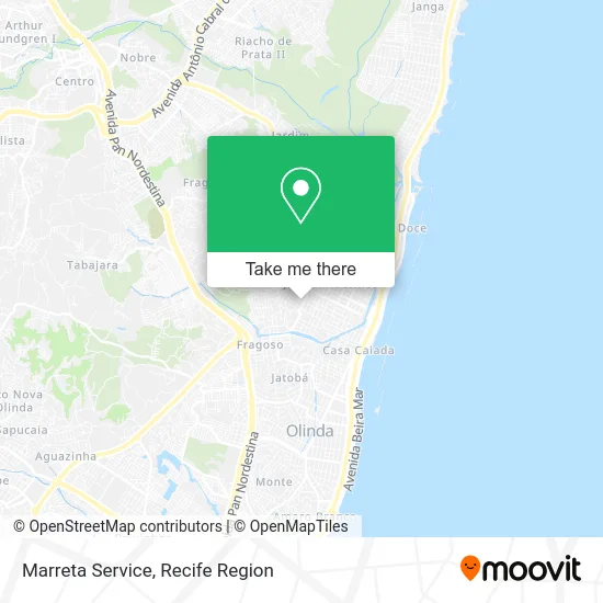
See Marreta Service, Olinda, on the map
Public Transit to Marreta Service in Olinda
Wondering how to get to Marreta Service in Olinda? Moovit helps you find the best way to get to Marreta Service with step-by-step directions from the nearest public transit station.
Moovit provides free maps and live directions to help you navigate through your city. View schedules, routes, timetables, and find out how long does it take to get to Marreta Service in real time.
Looking for the nearest stop or station to Marreta Service? Check out this list of stops closest to your destination: Rua Safira; Av. Pedro Álvares Cabral; Av. Pedro Álvares Cabral; Av. Fagundes Varela.
Bus: 1971 AMPARO, 1966 TI RIO DOCE/TI PE-15 (FRAGOSO), 1975 AMPARO (BACURAU), 1907 PAULISTA / RIO DOCE, 1974 JARDIM ATLÂNTICO, 882 TI XAMBÁ / RIO DOCE (CARLOS DE LIMA CAVALCANTI), 1985 RIO DOCE (BACURAU), 1986 TI PE-15 / TI RIO DOCE.
Want to see if there’s another route that gets you there at an earlier time? Moovit helps you find alternative routes or times. Get directions from and directions to Marreta Service easily from the Moovit App or Website.
We make riding to Marreta Service easy, which is why over 1.5 million users, including users in Olinda, trust Moovit as the best app for public transit. You don’t need to download an individual bus app or train app, Moovit is your all-in-one transit app that helps you find the best bus time or train time available.
For information on prices of bus, costs and ride fares to Marreta Service, please check the Moovit app.
Use the app to navigate to popular places including to the airport, hospital, stadium, grocery store, mall, coffee shop, school, college, and university.
Marreta Service Address: Rua Safira, 62 Jardim Atlântico Olinda-PE 53060-240 street in Olinda
- Tonare Marketing Digital,
- Milagres Comercio de Babidas e Agua Mineral,
- Engtec Facilities e Manutencao,
- Igreja do Nazareno em Jardim Atlântico,
- Caruaru Capital do Forró,
- Posto Torrão,
- Iel Olinda,
- Ja Holanda Sevicos e Locacoes Ltda,
- Igreja Evangélica Obreiros do Senhor,
- Igreja do Nazareno,
- Terainfor - Assistência Técnica,
- Clinica Popular Jardim Atlantico,
- Aline Borges Bolos Decorados,
- Tandrade Empreendimentos Imobiliários,
- Centro de Cultura Raul de Leoni,
- Ponte Capitão Temudo Recife,
- Mercadinho e Padaria Doce Sabor,
- Mercado e Padaria Pindorama,
- Casa do Bronze,
- Igreja Batista Chama Viva das Nacoes
Places Near Marreta Service (Olinda)
- Marco Zero, Bairro Do Recife,
- Shopping Recife, Boa Viagem,
- Hospital Maria Lucinda, Parnamirim,
- SHOPPING TACARUNA, Santo Amaro,
- Hospital Universitário Oswaldo Cruz, Santo Amaro,
- Centro de Convenções de Pernambuco, Olinda,
- Imip (Instituto Materno-Infantil De Pernambuco), Coelhos,
- hospital otavio de freitas - UTI, Tejipió,
- Hospital Agamenon Magalhães, Tamarineira,
- Parque da Jaqueira, Jaqueira,
- Shopping Patteo Olinda, Olinda,
- Arena de Pernambuco, São Lourenço Da Mata,
- Hospital Eduardo Campus Da Pessoa Idosa, Areias,
- Shopping RioMar Recife, Pina,
- Imbiribeira, Imbiribeira,
- Hospital Geral De Areias, Areias,
- llll, Fundão,
- Hospital Altino Ventura, Iputinga,
- SHOPPING GUARARAPES, Jaboatão Dos Guararapes,
- tuuuuu, Olinda
How to get to popular places in Recife Region with public transit
Get around Olinda by public transit!
Traveling around Olinda has never been so easy. See step by step directions as you travel to any attraction, street or major public transit station. View bus and train schedules, arrival times, service alerts and detailed routes on a map, so you know exactly how to get to anywhere in Olinda.
When traveling to any destination around Olinda use Moovit's Live Directions with Get Off Notifications to know exactly where and how far to walk, how long to wait for your line, and how many stops are left. Moovit will alert you when it's time to get off — no need to constantly re-check whether yours is the next stop.
Wondering how to use public transit in Olinda or how to pay for public transit in Olinda? Moovit public transit app can help you navigate your way with public transit easily, and at minimum cost. It includes public transit fees, ticket prices, and costs. Looking for a map of Olinda public transit lines? Moovit public transit app shows all public transit maps in Olinda with all Bus, Train, Subway and Ferry routes and stops on an interactive map.
Recife Region has 4 transit type(s), including: Bus, Train, Subway and Ferry, operated by several transit agencies, including CBTU (Metrorec), BRT (Via Livre), Grande Recife, BORBOREMA IMPERIAL (TIP), BORBOREMA IMPERIAL (B.V), RODOVIÁRIA POTENGY, EMPRESA METROPOLITANA, CONSÓRCIO RECIFE, SÃO JUDAS TADEU, Expresso 1002, Rodotur Turismo, Complementar Recife, Sistema Municipal - Jaboatão, Sistema Municipal - Cabo and Sistema Municipal - Ipojuca