How to get to Marx Brothers Field by bus?
Click on the bus route to see step by step directions with maps, line arrival times and updated time schedules.
From 111 Broadway, Manhattan
60 minFrom Ac Hotel Nyc Downtown, Manhattan
56 minFrom 28 Liberty, Manhattan
58 minFrom West Broadway Soho, Manhattan
59 minFrom 8th Ave and 31st St, Manhattan
46 minFrom Pier 15 View, Manhattan
57 minFrom Moxy NYC Downtown, Manhattan
60 minFrom Baby's All Right, Manhattan
61 minFrom Laguardia Airport (LGA) (La Guardia Airport), Queens
70 minFrom Newport Mall, Jersey City
74 min
How to get to Marx Brothers Field by train?
Click on the train route to see step by step directions with maps, line arrival times and updated time schedules.
From Newport Mall, Jersey City
150 minFrom 111 Broadway, Manhattan
183 minFrom Ac Hotel Nyc Downtown, Manhattan
189 minFrom 28 Liberty, Manhattan
185 minFrom West Broadway Soho, Manhattan
152 minFrom 8th Ave and 31st St, Manhattan
95 minFrom Pier 15 View, Manhattan
190 minFrom Moxy NYC Downtown, Manhattan
182 minFrom Baby's All Right, Manhattan
183 min
How to get to Marx Brothers Field by subway?
Click on the subway route to see step by step directions with maps, line arrival times and updated time schedules.
From 111 Broadway, Manhattan
37 minFrom Ac Hotel Nyc Downtown, Manhattan
40 minFrom 28 Liberty, Manhattan
36 minFrom West Broadway Soho, Manhattan
41 minFrom 8th Ave and 31st St, Manhattan
27 minFrom Pier 15 View, Manhattan
43 minFrom Moxy NYC Downtown, Manhattan
35 minFrom Baby's All Right, Manhattan
38 min
Bus stops near Marx Brothers Field in Manhattan
Ferry station near Marx Brothers Field in Manhattan
- East 90th St, 14 min walk,VIEW
Bus lines to Marx Brothers Field in Manhattan
- M96, East Side 1 Av Crosstown,VIEW
- M15, East Harlem 125 St Via 1 Av,VIEW
- BXM10, Midtown 23 St Via 5 Av,VIEW
- M15-SBS, Select Bus Service Houston St Via 2 Av,VIEW
- BXM1, Riverdale 263 St Via H Hudson Pkwy,VIEW
- BXM7, Co-Op City Dreiser Loop Via Bruckner Exy,VIEW
- M98, Limited Wshngtn Hts Cabrini Bl Via 3 Av,VIEW
- M101, Ft George Via 3 Av Via Amsterdam Av,VIEW
- M102, Harlem 147 St Via 3 Av Via Lenox Av,VIEW
- M103, East Harlem 125 St Via 3 Av,VIEW
- SHORTLINE HUDSON, Montgomery,VIEW
What are the closest stations to Marx Brothers Field?
The closest stations to Marx Brothers Field are:
- E 97 St/2 Av is 60 yards away, 2 min walk.
- 2 Av/E 97 St is 65 yards away, 2 min walk.
- 2 Av/E 96 St is 94 yards away, 2 min walk.
- 2 Av/E 95 St is 162 yards away, 3 min walk.
- 3 Av/E 97 St is 264 yards away, 4 min walk.
- 3rd Ave & E 97th St is 279 yards away, 4 min walk.
- 86 St is 467 yards away, 6 min walk.
- 103 St is 874 yards away, 11 min walk.
- East 90th St is 1120 yards away, 14 min walk.
Which bus line stops near Marx Brothers Field?
M15-SBS (Select Bus Service 125 St Via 1 Av)
Which train lines stop near Marx Brothers Field?
These train lines stop near Marx Brothers Field: 1, 3.
Which subway line stops near Marx Brothers Field?
Q (Uptown & Queens)
What’s the nearest subway station to Marx Brothers Field in Manhattan?
The nearest subway station to Marx Brothers Field in Manhattan is 86 St. It’s a 6 min walk away.
What’s the nearest bus station to Marx Brothers Field in Manhattan?
The nearest bus stations to Marx Brothers Field in Manhattan are E 97 St/2 Av, 2 Av/E 97 St and 2 Av/E 96 St. The closest one is a 2 min walk away.
What’s the nearest ferry station to Marx Brothers Field in Manhattan?
The nearest ferry station to Marx Brothers Field in Manhattan is East 90th St. It’s a 14 min walk away.
What time is the first subway to Marx Brothers Field in Manhattan?
The Q is the first subway that goes to Marx Brothers Field in Manhattan. It stops nearby at 3:05 AM.
What time is the last subway to Marx Brothers Field in Manhattan?
The 4 is the last subway that goes to Marx Brothers Field in Manhattan. It stops nearby at 3:50 AM.
What time is the first bus to Marx Brothers Field in Manhattan?
The M15 is the first bus that goes to Marx Brothers Field in Manhattan. It stops nearby at 3:05 AM.
What time is the last bus to Marx Brothers Field in Manhattan?
The M103 is the last bus that goes to Marx Brothers Field in Manhattan. It stops nearby at 3:12 AM.
What time is the first ferry to Marx Brothers Field in Manhattan?
The RS is the first ferry that goes to Marx Brothers Field in Manhattan. It stops nearby at 5:30 AM.
What time is the last ferry to Marx Brothers Field in Manhattan?
The AS is the last ferry that goes to Marx Brothers Field in Manhattan. It stops nearby at 8:59 PM.
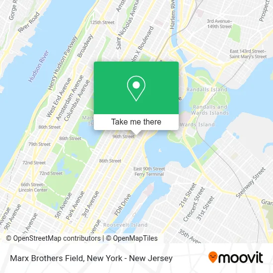
See Marx Brothers Field, Manhattan, on the map
Public Transit to Marx Brothers Field in Manhattan
Wondering how to get to Marx Brothers Field in Manhattan? Moovit helps you find the best way to get to Marx Brothers Field with step-by-step directions from the nearest public transit station.
Moovit provides free maps and live directions to help you navigate through your city. View schedules, routes, timetables, and find out how long does it take to get to Marx Brothers Field in real time.
Looking for the nearest stop or station to Marx Brothers Field? Check out this list of stops closest to your destination: E 97 St/2 Av; 2 Av/E 97 St; 2 Av/E 96 St; 2 Av/E 95 St; 3 Av/E 97 St; 3rd Ave & E 97th St; 86 St; 103 St; East 90th St.
Bus: M15-SBS, M96, M15, BXM10.Train: 1, 3.Subway: Q, N, R, 4, 6, 6X.Ferry: AS, RS.
Want to see if there’s another route that gets you there at an earlier time? Moovit helps you find alternative routes or times. Get directions from and directions to Marx Brothers Field easily from the Moovit App or Website.
We make riding to Marx Brothers Field easy, which is why over 1.5 million users, including users in Manhattan, trust Moovit as the best app for public transit. You don’t need to download an individual bus app or train app, Moovit is your all-in-one transit app that helps you find the best bus time or train time available.
For information on prices of subway, train and bus, costs and ride fares to Marx Brothers Field, please check the Moovit app.
Use the app to navigate to popular places including to the airport, hospital, stadium, grocery store, mall, coffee shop, school, college, and university.
Location: Manhattan, New York - New Jersey
- Ups Access Point Location,
- Western Union,
- Cfsc - Checks Cashed #65,
- E 97th 2nd Ave,
- Perk Coffee,
- Ups Access Point Location,
- Cfsc Checks Cashed 1869 2nd Ave,
- Capital One Bank,
- 2nd Ave (96th street 2nd ave),
- 96th St & 2nd Ave,
- Ecoatm,
- Nyc Luxor Limo,
- Citi Bike Station - 2nd Ave & E 96th St,
- NYC Health Hospitals Metropolitan Hospital Center-ER,
- New York Foundation For Senior,
- MTA Subway - 96th St (Q),
- Co-op Tech,
- Stanley Schoen,
- Winfield Street Coffee,
- Gvs
Places Near Marx Brothers Field (Manhattan)
- Chinatown, Manhattan,
- Bellevue Hospital, Manhattan,
- Wall Street, Manhattan,
- Katz's Deli, Manhattan,
- Rockefeller Center, Manhattan,
- Mountainside Hospital, Glen Ridge,
- 66 John Street, Manhattan,
- qqqq, Manhattan,
- 911 Memorial, Manhattan,
- San Gennaro Feast, Manhattan,
- Hudson Yards, Manhattan,
- 26 Federal Plaza, Manhattan,
- Times Square, Manhattan,
- 3 Stone St, Manhattan,
- Pier 83, Manhattan,
- SoHo, Manhattan,
- 111 Centre New York City Supreme Court, Manhattan,
- 1 Police Plaza, Manhattan,
- 376 Hudson Street, Manhattan,
- Queens Center Mall, Queens
How to get to popular places in New York - New Jersey with public transit
Get around Manhattan by public transit!
Traveling around Manhattan has never been so easy. See step by step directions as you travel to any attraction, street or major public transit station. View bus and train schedules, arrival times, service alerts and detailed routes on a map, so you know exactly how to get to anywhere in Manhattan.
When traveling to any destination around Manhattan use Moovit's Live Directions with Get Off Notifications to know exactly where and how far to walk, how long to wait for your line, and how many stops are left. Moovit will alert you when it's time to get off — no need to constantly re-check whether yours is the next stop.
Wondering how to use public transit in Manhattan or how to pay for public transit in Manhattan? Moovit public transit app can help you navigate your way with public transit easily, and at minimum cost. It includes public transit fees, ticket prices, and costs. Looking for a map of Manhattan public transit lines? Moovit public transit app shows all public transit maps in Manhattan with all Bus, Train, Subway, Light Rail, Ferry and Cable Car routes and stops on an interactive map.
New York - New Jersey has 6 transit type(s), including: Bus, Train, Subway, Light Rail, Ferry and Cable Car, operated by several transit agencies, including MTA Subway, Metro-North Railroad, LIRR, PATH, MTA New York City Transit - Express routes, MTA Bus, NJ Transit, NYC Ferry, NICE bus, Bee-Line Bus, NJ Transit Rail, Norwalk Transit District, Hartford Line, River Valley Transit and HART