Directions to Mary Modas (Sítio Cercado) with public transportation
The following transit lines have routes that pass near Mary Modas
How to get to Mary Modas by bus?
Click on the bus route to see step by step directions with maps, line arrival times and updated time schedules.
From Avenida Senador Salgado Filho, Uberaba
51 minFrom Rua Lamenha Lins, Rebouças
49 minFrom Cemitério Parque Memorial da Vida, São José Dos Pinhais
72 minFrom Copel - Agência de Atendimento, Boqueirão
41 minFrom Rua Imaculada Conceicao, Prado Velho
45 minFrom Rua Dr. Bley Zorning, Boqueirão
35 minFrom Rua Nunes Machado, Rebouças
47 minFrom Rua 24 de Maio, Rebouças
54 minFrom Rua Chile, Rebouças
50 minFrom Copel - Agência de Atendimento, Novo Mundo
33 min
Bus stops near Mary Modas in Sítio Cercado
Bus lines to Mary Modas in Sítio Cercado
- 637 SANTA JOANA, Terminal Sítio Cercado → Terminal Pinheirinho,VIEW
- 683 FUTURAMA / SÍTIO CERCADO, Futurama → Terminal Sitio Cercado,VIEW
- 636 RIO NEGRO, Rio Negro → Terminal Pinheirinho,VIEW
- 689 MAD. SÃO PEDRO / RIO NEGRO, Praça Rui Barbosa ↺ São Pedro / Rio Negro (Circular),VIEW
- Y95 FAZENDA / SÍTIO CERCADO, FAZENDA / SÍTIO CERCADO,VIEW
- 524 BAIRRO NOVO B / C, BAIRRO NOVO B / C,VIEW
- 542 BAIRRO NOVO B, BAIRRO NOVO B,VIEW
- 548 OSTERNACK / SÍTIO CERCADO, OSTERNACK / SÍTIO CERCADO,VIEW
- 552 SAMBAQUI, SAMBAQUI,VIEW
- 553 MORADIAS PARQUE IGUAÇU, MORADIAS PARQUE IGUAÇU,VIEW
What are the closest stations to Mary Modas?
The closest stations to Mary Modas are:
- R. Celeste Tortato Gabardo, 539 is 106 meters away, 2 min walk.
- R. Celeste Tortato Gabardo, 228 is 244 meters away, 4 min walk.
- R. Cruzeiro Do Sul, 836 is 360 meters away, 5 min walk.
- R. Cruzeiro Do Sul, 839 is 392 meters away, 6 min walk.
- R. Filósofo Huberto Rohden, 3075 is 459 meters away, 6 min walk.
Which bus lines stop near Mary Modas?
These bus lines stop near Mary Modas: 545 TRABALHADOR, 553 MORADIAS PARQUE IGUAÇU, 636 RIO NEGRO, 637 SANTA JOANA, 683 FUTURAMA / SÍTIO CERCADO.
What’s the nearest bus station to Mary Modas in Sítio Cercado?
The nearest bus station to Mary Modas in Sítio Cercado is R. Celeste Tortato Gabardo, 539. It’s a 2 min walk away.
What time is the first bus to Mary Modas in Sítio Cercado?
The 689 MAD. SÃO PEDRO / RIO NEGRO is the first bus that goes to Mary Modas in Sítio Cercado. It stops nearby at 3:06 AM.
What time is the last bus to Mary Modas in Sítio Cercado?
The 689 MAD. SÃO PEDRO / RIO NEGRO is the last bus that goes to Mary Modas in Sítio Cercado. It stops nearby at 3:07 AM.
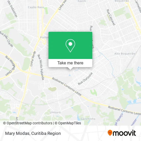
See Mary Modas, Sítio Cercado, on the map
Public Transit to Mary Modas in Sítio Cercado
Wondering how to get to Mary Modas in Sítio Cercado? Moovit helps you find the best way to get to Mary Modas with step-by-step directions from the nearest public transit station.
Moovit provides free maps and live directions to help you navigate through your city. View schedules, routes, timetables, and find out how long does it take to get to Mary Modas in real time.
Looking for the nearest stop or station to Mary Modas? Check out this list of stops closest to your destination: R. Celeste Tortato Gabardo; R. Celeste Tortato Gabardo; R. Cruzeiro Do Sul; R. Cruzeiro Do Sul; R. Filósofo Huberto Rohden.
Bus: 545 TRABALHADOR, 553 MORADIAS PARQUE IGUAÇU, 636 RIO NEGRO, 637 SANTA JOANA, 683 FUTURAMA / SÍTIO CERCADO, 689 MAD. SÃO PEDRO / RIO NEGRO, Y95 FAZENDA / SÍTIO CERCADO, 524 BAIRRO NOVO B / C, 542 BAIRRO NOVO B, 548 OSTERNACK / SÍTIO CERCADO, 552 SAMBAQUI.
Want to see if there’s another route that gets you there at an earlier time? Moovit helps you find alternative routes or times. Get directions from and directions to Mary Modas easily from the Moovit App or Website.
We make riding to Mary Modas easy, which is why over 1.5 million users, including users in Sítio Cercado, trust Moovit as the best app for public transit. You don’t need to download an individual bus app or train app, Moovit is your all-in-one transit app that helps you find the best bus time or train time available.
For information on prices of bus, costs and ride fares to Mary Modas, please check the Moovit app.
Use the app to navigate to popular places including to the airport, hospital, stadium, grocery store, mall, coffee shop, school, college, and university.
Mary Modas Address: Rua Nova Esperança, Sítio Cercado Curitiba-PR 81900-200 street in Sítio Cercado
- Bellas Frutas,
- Rede de Farmácias Farmatotal,
- Delita Transportadora Turistica,
- Lr Xavier Serviços,
- Unidade de Saúde Salvador Allende,
- Bar Do Bigode,
- Ivo Severino de S.A.,
- Ajp Limpeza e Acabamentos,
- Restaurante Dona Vani,
- Gomes Sorveteria,
- Farmacia Irmãos Pavesi,
- Cafe e Panificadora Dom Capone,
- Cruzeiro do Sul Foto e Vídeo,
- Rua Celeste Tortato Gabardo, 538 - Sítio Cercado,
- Gisele Martins Ferros Para Construção,
- Supermrcado Colatusso,
- Thiagoagnussantos,
- Dom Capone panificadora e confeitaria,
- Kimera Comercio de Fogos de Artificio e Pipas,
- Auto Mecanica Fantato Ltda
Places Near Mary Modas (Sítio Cercado)
- Hospital Angelina Caron, Campina Grande Do Sul,
- Hospital Erasto Gaertner, Jardim Das Américas,
- Shopping Estação, Rebouças,
- Hospital Da Cruz Vermelha, Batel,
- Rua General Mário Tourinho, Campina Do Siqueira,
- Hospital do Rocio, Campo,
- Shopping Palladium, Portão,
- Hhhhh, Fazendinha,
- Hospital Nossa Senhora Das Graças, Mercês,
- Hospital de Clínicas (HC - UFPR), Centro,
- Rua Martim Afonso 558, Mercês,
- Jardim Botânico de Curitiba PR, Centro,
- Hospital Madalena Sofia, Bairro Alto,
- Arena Da Baixada - Curitiba,
- Pontifícia Universidade Católica do Paraná (PUCPR), Prado Velho,
- Jockey Plaza Shopping Center, Tarumã,
- Campo Largo, Campo,
- Park Shopping Barigüi, Mossunguê,
- Parque Barigui, Mercês,
- Hospital Universitário Evangélico de Curitiba, Bigorrilho
How to get to popular places in Curitiba Region with public transit
Get around Sítio Cercado by public transit!
Traveling around Sítio Cercado has never been so easy. See step by step directions as you travel to any attraction, street or major public transit station. View bus and train schedules, arrival times, service alerts and detailed routes on a map, so you know exactly how to get to anywhere in Sítio Cercado.
When traveling to any destination around Sítio Cercado use Moovit's Live Directions with Get Off Notifications to know exactly where and how far to walk, how long to wait for your line, and how many stops are left. Moovit will alert you when it's time to get off — no need to constantly re-check whether yours is the next stop.
Wondering how to use public transit in Sítio Cercado or how to pay for public transit in Sítio Cercado? Moovit public transit app can help you navigate your way with public transit easily, and at minimum cost. It includes public transit fees, ticket prices, and costs. Looking for a map of Sítio Cercado public transit lines? Moovit public transit app shows all public transit maps in Sítio Cercado with all Bus and Cable Car routes and stops on an interactive map.
Curitiba Region has 2 transit type(s), including: Bus and Cable Car, operated by several transit agencies, including Sistema Integrado de Mobilidade (URBS), Sistema Integrado de Mobilidade (AMEP), URBS (Cartões bancários e Dinheiro), URBS (Cartões bancários / Cartão URBS), AMEP (Cartões bancários / Cartão MetroCard), AMEP (Cartões bancários / Cartão MetroCard / Dinheiro), Viação Colombo (Dinheiro), TRIAR (Cartão TRIAR / Dinheiro), Empresa Curitiba Cerro Azul (Dinheiro), Expresso Nossa Senhora da Penha (Dinheiro), Empresa Campo Alto Tijucas (Dinheiro), Auto Viação São José (Cartão VEM / Dinheiro), BRT S/A (Cartão VEM / Dinheiro), TransPiedade (Cartão Cidadão / Dinheiro) and Oceânica Sul (Cartão Transporte / Dinheiro)