Directions to Masonic Charity Foundation (Wallingford) with public transportation
The following transit lines have routes that pass near Masonic Charity Foundation
 Bus: 215, 292.
- Train: AMTRAK HARTFORD LINE, HARTFORD LINE, NORTHEAST REGIONAL, VALLEY FLYER.
How to get to Masonic Charity Foundation by bus?
Click on the bus route to see step by step directions with maps, line arrival times and updated time schedules.
How to get to Masonic Charity Foundation by train?
Click on the train route to see step by step directions with maps, line arrival times and updated time schedules.
Bus stop near Masonic Charity Foundation in Wallingford
- Masonic Home @ Hospital & Main Building, 20 min walk,VIEW
Train stations near Masonic Charity Foundation in Wallingford
Bus lines to Masonic Charity Foundation in Wallingford
- 292, 292 - North Colony Rd-Masonic Home,VIEW
What are the closest stations to Masonic Charity Foundation?
The closest stations to Masonic Charity Foundation are:
- Masonic Home @ Hospital & Main Building is 1634 yards away, 20 min walk.
- Wallingford is 1908 yards away, 23 min walk.
- Wallingford Amtrak is 2442 yards away, 29 min walk.
Which bus line stops near Masonic Charity Foundation?
215 (215m - Meriden-Amazon-Wallingford Rr Stn Via Universal Dr)
Which train lines stop near Masonic Charity Foundation?
These train lines stop near Masonic Charity Foundation: AMTRAK HARTFORD LINE, HARTFORD LINE, NORTHEAST REGIONAL, VALLEY FLYER.
What’s the nearest train station to Masonic Charity Foundation in Wallingford?
The nearest train station to Masonic Charity Foundation in Wallingford is Wallingford. It’s a 23 min walk away.
What time is the first train to Masonic Charity Foundation in Wallingford?
The NORTHEAST REGIONAL is the first train that goes to Masonic Charity Foundation in Wallingford. It stops nearby at 5:21 AM.
What time is the last train to Masonic Charity Foundation in Wallingford?
The HARTFORD LINE is the last train that goes to Masonic Charity Foundation in Wallingford. It stops nearby at 11:28 PM.
What time is the first bus to Masonic Charity Foundation in Wallingford?
The 292 is the first bus that goes to Masonic Charity Foundation in Wallingford. It stops nearby at 9:40 AM.
What time is the last bus to Masonic Charity Foundation in Wallingford?
The 292 is the last bus that goes to Masonic Charity Foundation in Wallingford. It stops nearby at 3:40 PM.
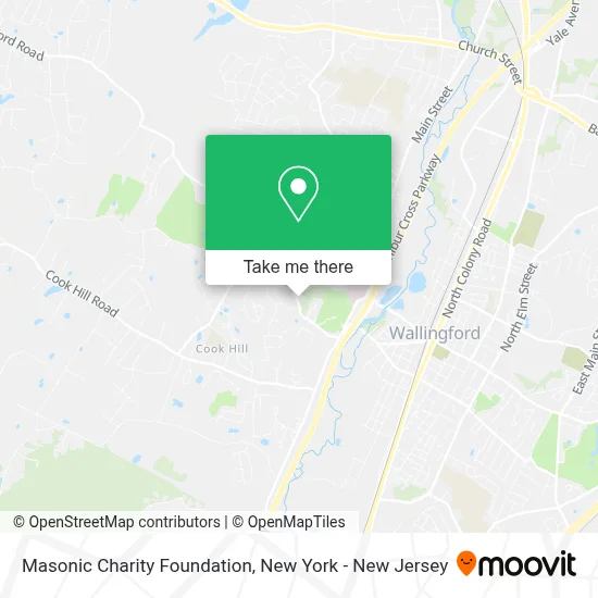
See Masonic Charity Foundation, Wallingford, on the map
Public Transit to Masonic Charity Foundation in Wallingford
Wondering how to get to Masonic Charity Foundation in Wallingford? Moovit helps you find the best way to get to Masonic Charity Foundation with step-by-step directions from the nearest public transit station.
Moovit provides free maps and live directions to help you navigate through your city. View schedules, routes, timetables, and find out how long does it take to get to Masonic Charity Foundation in real time.
Looking for the nearest stop or station to Masonic Charity Foundation? Check out this list of stops closest to your destination: Masonic Home @ Hospital & Main Building; Wallingford; Wallingford Amtrak.
Bus: 215, 292.Train: AMTRAK HARTFORD LINE, HARTFORD LINE, NORTHEAST REGIONAL, VALLEY FLYER.
Want to see if there’s another route that gets you there at an earlier time? Moovit helps you find alternative routes or times. Get directions from and directions to Masonic Charity Foundation easily from the Moovit App or Website.
We make riding to Masonic Charity Foundation easy, which is why over 1.5 million users, including users in Wallingford, trust Moovit as the best app for public transit. You don’t need to download an individual bus app or train app, Moovit is your all-in-one transit app that helps you find the best bus time or train time available.
For information on prices of train and bus, costs and ride fares to Masonic Charity Foundation, please check the Moovit app.
Use the app to navigate to popular places including to the airport, hospital, stadium, grocery store, mall, coffee shop, school, college, and university.
Masonic Charity Foundation Address: 74 Cheshire Rd street in Wallingford
- Masonicare at Ashlar Village,
- Pact Primary Care | Wallingford,
- L.O.V.E. Lightworker Of Vibrational Energy Llc,
- Peterson Realty,
- Lufberry Memorial Park,
- The Flying Ace Disc Golf Course at Lufbery Park,
- Maryann Meade & Associates,
- Bassoli.Us,
- Bristol Connecticut Realtor,
- Grizzly Home Inspections,
- Masonicare Health Center,
- Louri's Collection,
- ATM,
- USPS Collection Box - Blue Box,
- The Apartments on Masonic Avenue,
- Masonicare,
- Apple Country Supply,
- Ct Rising Star Limo,
- Butterfly Meadow Wallingford Ct,
- Mellie Joynt
Places Near Masonic Charity Foundation (Wallingford)
- qqqq, Manhattan,
- Pier 83, Manhattan,
- Katz's Deli, Manhattan,
- 376 Hudson Street, Manhattan,
- Hudson Yards, Manhattan,
- Chinatown, Manhattan,
- Wall Street, Manhattan,
- 66 John Street, Manhattan,
- 26 Federal Plaza, Manhattan,
- Times Square, Manhattan,
- Bellevue Hospital, Manhattan,
- Queens Center Mall, Queens,
- 111 Centre New York City Supreme Court, Manhattan,
- San Gennaro Feast, Manhattan,
- 3 Stone St, Manhattan,
- SoHo, Manhattan,
- 1 Police Plaza, Manhattan,
- 911 Memorial, Manhattan,
- Mountainside Hospital, Glen Ridge,
- Rockefeller Center, Manhattan
How to get to popular places in New York - New Jersey with public transit
Get around Wallingford by public transit!
Traveling around Wallingford has never been so easy. See step by step directions as you travel to any attraction, street or major public transit station. View bus and train schedules, arrival times, service alerts and detailed routes on a map, so you know exactly how to get to anywhere in Wallingford.
When traveling to any destination around Wallingford use Moovit's Live Directions with Get Off Notifications to know exactly where and how far to walk, how long to wait for your line, and how many stops are left. Moovit will alert you when it's time to get off — no need to constantly re-check whether yours is the next stop.
Wondering how to use public transit in Wallingford or how to pay for public transit in Wallingford? Moovit public transit app can help you navigate your way with public transit easily, and at minimum cost. It includes public transit fees, ticket prices, and costs. Looking for a map of Wallingford public transit lines? Moovit public transit app shows all public transit maps in Wallingford with all Bus, Train, Subway, Light Rail, Ferry and Cable Car routes and stops on an interactive map.
New York - New Jersey has 6 transit type(s), including: Bus, Train, Subway, Light Rail, Ferry and Cable Car, operated by several transit agencies, including MTA Subway, Metro-North Railroad, LIRR, PATH, MTA New York City Transit - Express routes, MTA Bus, NJ Transit, NYC Ferry, NICE bus, Bee-Line Bus, NJ Transit Rail, Norwalk Transit District, Hartford Line, River Valley Transit and HART