Directions to Masonry Work (Baltimore) with public transportation
The following transit lines have routes that pass near Masonry Work
 Bus: CITYLINK BROWN, 63, 115, 30.
How to get to Masonry Work by bus?
Click on the bus route to see step by step directions with maps, line arrival times and updated time schedules.
From Nick's Fish House, Baltimore
53 minFrom Franklin Square Dr (franklin hospital), Baltimore County
42 minFrom Coppin State University, Baltimore
53 minFrom Baltimore Greyhound Station, Baltimore
55 minFrom Patterson Park, Baltimore
32 minFrom Horseshoe Baltimore, Baltimore
56 minFrom Horseshoe Casino Baltimore, Baltimore
50 minFrom Mitchell Court House, Baltimore
35 minFrom Pier Six Pavilion, Baltimore
32 minFrom Baltimore Polytechnic Institute, Baltimore
46 min
Bus stops near Masonry Work in Baltimore
Bus lines to Masonry Work in Baltimore
What are the closest stations to Masonry Work?
The closest stations to Masonry Work are:
- Belair Rd & Arizona Ave Nb is 115 yards away, 2 min walk.
- Gardenville Loop at Belair Rd is 130 yards away, 2 min walk.
- Belair Rd & Gardenville Loop Sb is 138 yards away, 2 min walk.
- Frankford Ave & Belair Rd Wb is 669 yards away, 9 min walk.
Which bus line stops near Masonry Work?
CITYLINK BROWN (Overlea)
What’s the nearest bus station to Masonry Work in Baltimore?
The nearest bus stations to Masonry Work in Baltimore are Belair Rd & Arizona Ave Nb, Gardenville Loop at Belair Rd and Belair Rd & Gardenville Loop Sb. The closest one is a 2 min walk away.
What time is the first bus to Masonry Work in Baltimore?
The 63 is the first bus that goes to Masonry Work in Baltimore. It stops nearby at 3:04 AM.
What time is the last bus to Masonry Work in Baltimore?
The 63 is the last bus that goes to Masonry Work in Baltimore. It stops nearby at 3:08 AM.
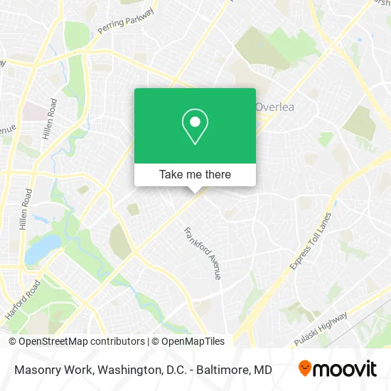
See Masonry Work, Baltimore, on the map
Public Transit to Masonry Work in Baltimore
Wondering how to get to Masonry Work in Baltimore? Moovit helps you find the best way to get to Masonry Work with step-by-step directions from the nearest public transit station.
Moovit provides free maps and live directions to help you navigate through your city. View schedules, routes, timetables, and find out how long does it take to get to Masonry Work in real time.
Looking for the nearest stop or station to Masonry Work? Check out this list of stops closest to your destination: Belair Rd & Arizona Ave Nb; Gardenville Loop at Belair Rd; Belair Rd & Gardenville Loop Sb; Frankford Ave & Belair Rd Wb.
Bus: CITYLINK BROWN, 63, 115, 30.
Want to see if there’s another route that gets you there at an earlier time? Moovit helps you find alternative routes or times. Get directions from and directions to Masonry Work easily from the Moovit App or Website.
We make riding to Masonry Work easy, which is why over 1.5 million users, including users in Baltimore, trust Moovit as the best app for public transit. You don’t need to download an individual bus app or train app, Moovit is your all-in-one transit app that helps you find the best bus time or train time available.
For information on prices of bus, costs and ride fares to Masonry Work, please check the Moovit app.
Use the app to navigate to popular places including to the airport, hospital, stadium, grocery store, mall, coffee shop, school, college, and university.
Masonry Work Address: 5620 Belair Rd Baltimore, MD 21206 street in Baltimore
- Coast 2 Coast Tags & Title,
- P+R Gardenville,
- Hamilton Ave US-1,
- Tattoophilia Boutique & Piercings,
- Plattaking,
- Penske Truck Rental,
- Conscience Carpet Cleaning Carpet Cleaning,
- Cream Smoke Shop,
- The Celestial Cafe,
- Hillsmere Restaurant and Bar,
- Celestial Cafe,
- New Bergers Tavern,
- Best Tire and Auto,
- Aerie Capital Management,
- 12 Hustlez,
- Wanda Caesar,
- The Cafe Theatre,
- Laras Painting,
- Sage Wellness Group,
- Dreamz Event Space Rentals
Places Near Masonry Work (Baltimore)
- Sibley Memorial Hospital, Washington,
- Camden Yards, Baltimore,
- Amazon Hq2, Arlington County,
- M&T Bank Stadium, Baltimore,
- Marriott Marquis Washington, DC, Washington,
- Museum Of The Bible, Washington,
- Warner Theatre, Washington,
- Washington DC VA Medical Center, Washington,
- Westfield Montgomery Mall, Montgomery County,
- Pennsylvania Ave NW (3rd st and pennsylvania), Washington,
- Basilica of the National Shrine, Washington,
- National Zoo, Washington,
- PG Mall, Prince George's County,
- Washington National Cathedral, Washington,
- Capital One Arena, Washington,
- National Mall, Washington,
- National Museum of African American History and Culture, Washington,
- The Anthem, Washington,
- Rock Creek Tennis Center, Washington,
- Georgetown, Washington
How to get to popular places in Washington, D.C. - Baltimore, MD with public transit
Get around Baltimore by public transit!
Traveling around Baltimore has never been so easy. See step by step directions as you travel to any attraction, street or major public transit station. View bus and train schedules, arrival times, service alerts and detailed routes on a map, so you know exactly how to get to anywhere in Baltimore.
When traveling to any destination around Baltimore use Moovit's Live Directions with Get Off Notifications to know exactly where and how far to walk, how long to wait for your line, and how many stops are left. Moovit will alert you when it's time to get off — no need to constantly re-check whether yours is the next stop.
Wondering how to use public transit in Baltimore or how to pay for public transit in Baltimore? Moovit public transit app can help you navigate your way with public transit easily, and at minimum cost. It includes public transit fees, ticket prices, and costs. Looking for a map of Baltimore public transit lines? Moovit public transit app shows all public transit maps in Baltimore with all Bus, Train, Metro, Light Rail and Ferry routes and stops on an interactive map.
Washington, D.C. - Baltimore, MD has 5 transit type(s), including: Bus, Train, Metro, Light Rail and Ferry, operated by several transit agencies, including WMATA, Montgomery County Ride On, Fairfax Connector, TheBus, PRTC, DASH - Alexandria, Arlington Transit (ART), RTA of Central Maryland, MDOT MTA, MDOT MTA Light RailLink, MDOT MTA Commuter Bus, MDOT MTA Local Bus, FXBGO!, Virginia Railway Express (VRE) and MARC