Directions to Mass Auto Repair (Boston) with public transportation
The following transit lines have routes that pass near Mass Auto Repair
 Bus: 14, 22, 28, 29, 10.
- Train: FAIRMOUNT, FRANKLIN/FOXBORO, PROVIDENCE/STOUGHTON, FAIRMOUNT LINE SHUTTLE.
- Subway: ORANGE LINE, RED LINE.
How to get to Mass Auto Repair by bus?
Click on the bus route to see step by step directions with maps, line arrival times and updated time schedules.
From Assembly Row, Somerville
101 minFrom 415 Summer Street, Boston
61 minFrom One Beacon Street, Boston
50 minFrom Sarma, Somerville
99 minFrom Pemberton Square, Boston
53 minFrom Highland Ave Somerville MA, Somerville
99 minFrom Somerville, MA, Somerville
100 minFrom Copley Square Hotel, Boston
45 minFrom Consulate General of Italy, Boston
52 minFrom South Shore Plaza Mbta Bus Stop, Braintree Town
72 min
How to get to Mass Auto Repair by train?
Click on the train route to see step by step directions with maps, line arrival times and updated time schedules.
How to get to Mass Auto Repair by subway?
Click on the subway route to see step by step directions with maps, line arrival times and updated time schedules.
From Assembly Row, Somerville
74 minFrom 415 Summer Street, Boston
62 minFrom One Beacon Street, Boston
54 minFrom Sarma, Somerville
75 minFrom Pemberton Square, Boston
54 minFrom Highland Ave Somerville MA, Somerville
78 minFrom Somerville, MA, Somerville
74 minFrom Copley Square Hotel, Boston
49 minFrom Consulate General of Italy, Boston
49 min
Bus stops near Mass Auto Repair in Boston
Train stations near Mass Auto Repair in Boston
Subway station near Mass Auto Repair in Boston
- Shawmut, 30 min walk,VIEW
Bus lines to Mass Auto Repair in Boston
- 14, Heath St,VIEW
- 22, Kenmore Via Ruggles,VIEW
- 28, Avenue Louis Pasteur Via Ruggles,VIEW
- 29, Jackson Square,VIEW
- 10, Townsend & Humboldt,VIEW
- 16, City Point Via Andrew,VIEW
- 23, Franklin Park,VIEW
- 45, Malcolm X Blvd,VIEW
- 32, Forest Hills - Wolcott Square,VIEW
- 34, Forest Hills - Dedham Mall,VIEW
- 36, Forest Hills - VA Hospital,VIEW
What are the closest stations to Mass Auto Repair?
The closest stations to Mass Auto Repair are:
- Blue Hill Ave @ Wales St is 47 yards away, 1 min walk.
- Four Corners/Geneva is 139 yards away, 2 min walk.
- Franklin Park Loop @ Zoo Entrance is 583 yards away, 8 min walk.
- Blue Hill Ave @ Ellington St is 587 yards away, 8 min walk.
- Talbot Avenue is 2264 yards away, 27 min walk.
- Shawmut is 2520 yards away, 30 min walk.
Which bus lines stop near Mass Auto Repair?
These bus lines stop near Mass Auto Repair: 14, 22, 28, 29.
Which train line stops near Mass Auto Repair?
FAIRMOUNT (#1619 | Fairmount)
Which subway lines stop near Mass Auto Repair?
These subway lines stop near Mass Auto Repair: ORANGE LINE, RED LINE.
What’s the nearest subway station to Mass Auto Repair in Boston?
The nearest subway station to Mass Auto Repair in Boston is Shawmut. It’s a 30 min walk away.
What’s the nearest train station to Mass Auto Repair in Boston?
The nearest train station to Mass Auto Repair in Boston is Four Corners/Geneva. It’s a 2 min walk away.
What’s the nearest bus station to Mass Auto Repair in Boston?
The nearest bus station to Mass Auto Repair in Boston is Blue Hill Ave @ Wales St. It’s a 1 min walk away.
What time is the first subway to Mass Auto Repair in Boston?
The RED LINE is the first subway that goes to Mass Auto Repair in Boston. It stops nearby at 5:16 AM.
What time is the last subway to Mass Auto Repair in Boston?
The RED LINE is the last subway that goes to Mass Auto Repair in Boston. It stops nearby at 2:03 AM.
What time is the first train to Mass Auto Repair in Boston?
The FAIRMOUNT is the first train that goes to Mass Auto Repair in Boston. It stops nearby at 4:41 AM.
What time is the last train to Mass Auto Repair in Boston?
The FAIRMOUNT is the last train that goes to Mass Auto Repair in Boston. It stops nearby at 12:03 AM.
What time is the first bus to Mass Auto Repair in Boston?
The 28 is the first bus that goes to Mass Auto Repair in Boston. It stops nearby at 3:14 AM.
What time is the last bus to Mass Auto Repair in Boston?
The 28 is the last bus that goes to Mass Auto Repair in Boston. It stops nearby at 2:18 AM.
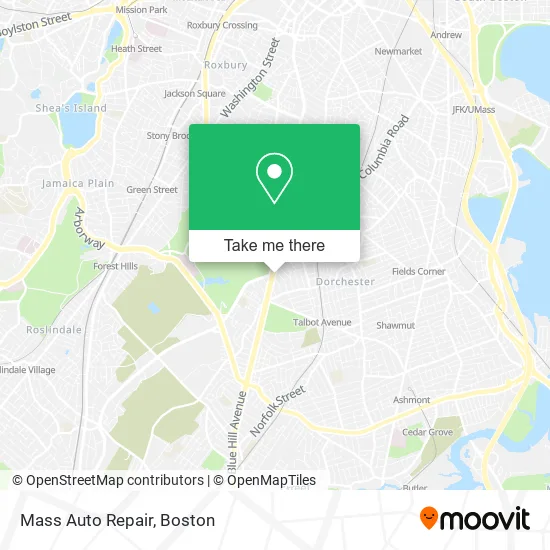
See Mass Auto Repair, Boston, on the map
Public Transit to Mass Auto Repair in Boston
Wondering how to get to Mass Auto Repair in Boston? Moovit helps you find the best way to get to Mass Auto Repair with step-by-step directions from the nearest public transit station.
Moovit provides free maps and live directions to help you navigate through your city. View schedules, routes, timetables, and find out how long does it take to get to Mass Auto Repair in real time.
Looking for the nearest stop or station to Mass Auto Repair? Check out this list of stops closest to your destination: Blue Hill Ave @ Wales St; Four Corners/Geneva; Franklin Park Loop @ Zoo Entrance; Blue Hill Ave @ Ellington St; Talbot Avenue; Shawmut.
Bus: 14, 22, 28, 29, 10, 16, 23, 45, 32, 34, 36.Train: FAIRMOUNT, FRANKLIN/FOXBORO, PROVIDENCE/STOUGHTON, FAIRMOUNT LINE SHUTTLE.Subway: ORANGE LINE, RED LINE.
Want to see if there’s another route that gets you there at an earlier time? Moovit helps you find alternative routes or times. Get directions from and directions to Mass Auto Repair easily from the Moovit App or Website.
We make riding to Mass Auto Repair easy, which is why over 1.7 million users, including users in Boston, trust Moovit as the best app for public transit. You don’t need to download an individual bus app or train app, Moovit is your all-in-one transit app that helps you find the best bus time or train time available.
For information on prices of bus, subway and train, costs and ride fares to Mass Auto Repair, please check the Moovit app.
Use the app to navigate to popular places including to the airport, hospital, stadium, grocery store, mall, coffee shop, school, college, and university.
Mass Auto Repair Address: 780 Blue Hill Ave Dorchester Center, MA 02124 street in Boston
- D & L Auto Body & Repair,
- Deeper Life Revival,
- Century Convenience,
- Blue Hill Locks & Locksmith,
- Secret Squirrel Spot,
- Fernandez Imported Domestic Liquors,
- 54 Egmont,
- Dmi Auto & Alarm (D M I Auto & Alarm Serv & Accessary of Boston),
- Yelys Restaurant Dorchester,
- Yarimar Enterprises,
- Simina Hair Braiding,
- Bradshaw Childrens Center at Abcd,
- Daisy's Hair Studio,
- Best Design Studio,
- Studio 844 Unisex Hair Salon,
- Mommaspicetheartis,
- Black Indian Inn,
- Heating Repair Seven Days,
- El Dugout Autobody,
- Junior's Tire Services
Places Near Mass Auto Repair (Boston)
- Wilbur Theatre, Boston,
- Isabella Stewart Gardner Museum, Boston,
- House Of Blues, Boston,
- Seaport District, Boston,
- North End, Boston,
- Faneuil Hall, Boston,
- Wang Theater, Boston,
- Leader Bank Pavilion (Leader Bank Pavillion), Boston,
- Boston Convention & Exhibition Center, Boston,
- Boston Common, Boston,
- Boston Children's Hospital, Boston,
- Mgm Music Hall, Boston,
- Boston Medical Center, Boston,
- Td Garden, Boston,
- Quincy Market, Boston,
- Castle Island, Boston,
- Museum Of Science, Boston,
- Cheers, Boston,
- Massachusetts General Hospital, Boston,
- Prudential Center, Boston
How to get to popular places in Boston with public transit
Get around Boston by public transit!
Traveling around Boston has never been so easy. See step by step directions as you travel to any attraction, street or major public transit station. View bus and train schedules, arrival times, service alerts and detailed routes on a map, so you know exactly how to get to anywhere in Boston.
When traveling to any destination around Boston use Moovit's Live Directions with Get Off Notifications to know exactly where and how far to walk, how long to wait for your line, and how many stops are left. Moovit will alert you when it's time to get off — no need to constantly re-check whether yours is the next stop.
Wondering how to use public transit in Boston or how to pay for public transit in Boston? Moovit public transit app can help you navigate your way with public transit easily, and at minimum cost. It includes public transit fees, ticket prices, and costs. Looking for a map of Boston public transit lines? Moovit public transit app shows all public transit maps in Boston with all Bus, Train, Subway and Ferry routes and stops on an interactive map.
Boston has 4 transit type(s), including: Bus, Train, Subway and Ferry, operated by several transit agencies, including MBTA, Southeastern Regional Transit Authority, MetroWest Regional Transit Authority, Rhode Island Public Transit Authority, WRTA, Lowell Regional Transit Authority, Merrimack Valley Transit, Montachusett Regional Transit Authority, Cape Cod Regional Transit Authority, Brockton Area Transit Authority, Martha's Vineyard Transit Authority, the WAVE - Nantucket Regional Transit Authority, GATRA, Cape Ann Transportation Authority and Massport