How to get to Massimo Confor by bus?
Click on the bus route to see step by step directions with maps, line arrival times and updated time schedules.
From Gaiole In Chianti, Gaiole In Chianti
68 minFrom Alta Val d'Elsa River Park, Colle Di Val D'Elsa
149 minFrom Le Pozze Di Lecchi, Gaiole In Chianti
77 minFrom Colle Di Val D'Elsa, Colle Di Val D'Elsa
46 minFrom New Maltraverso Sports Center, Colle Di Val D'Elsa
143 minFrom Prada - Space Outlet, Arezzo
151 minFrom Siena Eye Laser, Poggibonsi
120 minFrom Rapolano Terme, Rapolano Terme
56 minFrom Antica Querciolaia Thermal Baths, Rapolano Terme
60 minFrom Greve In Chianti, Greve In Chianti
210 min
How to get to Massimo Confor by train?
Click on the train route to see step by step directions with maps, line arrival times and updated time schedules.
Bus stops near Massimo Confor in Siena
Train station near Massimo Confor in Siena
- Siena, 17 min walk,VIEW
Bus lines to Massimo Confor in Siena
- 0S1, Tozzi Street,VIEW
- 601, Massetana Gas Station,VIEW
- 0S3, Two Bridges,VIEW
- S30, Castello,VIEW
- S30, Siena Le Scotte Hospital,VIEW
- S30, Tozzi Street,VIEW
- S31, Volte Basse,VIEW
- S33, Brenna,VIEW
- S33, Rosia,VIEW
- S54, Matteotti Square,VIEW
- 104, Railway,VIEW
- 110, Casciano Main,VIEW
- 114, Buonconvento,VIEW
- 116, Railway,VIEW
- 122, Rosia,VIEW
- 501, Coroncina Circle,VIEW
- 616, Porta Tufi,VIEW
- 506, Le Scotte-Abbadia Ruffolo-Coroncina-Schools-Center,VIEW
- 514, Coroncina-Massetana-Piazza Gramsci,VIEW
- 602, Massetana-Gramsci,VIEW
What are the closest stations to Massimo Confor?
The closest stations to Massimo Confor are:
- Poggio Al Vento is 83 meters away, 2 min walk.
- Pescaia is 1241 meters away, 16 min walk.
- Siena is 1321 meters away, 17 min walk.
- XXIV May 90 is 2322 meters away, 30 min walk.
Which bus lines stop near Massimo Confor?
These bus lines stop near Massimo Confor: 0S1, 0S3, 640, GT1, S54.
Which train line stops near Massimo Confor?
R (Siena)
What’s the nearest train station to Massimo Confor in Siena?
The nearest train station to Massimo Confor in Siena is Siena. It’s a 17 min walk away.
What’s the nearest bus station to Massimo Confor in Siena?
The nearest bus station to Massimo Confor in Siena is Poggio Al Vento. It’s a 2 min walk away.
What time is the first train to Massimo Confor in Siena?
The R is the first train that goes to Massimo Confor in Siena. It stops nearby at 5:45 AM.
What time is the last train to Massimo Confor in Siena?
The R is the last train that goes to Massimo Confor in Siena. It stops nearby at 11:17 PM.
What time is the first bus to Massimo Confor in Siena?
The 0S1 is the first bus that goes to Massimo Confor in Siena. It stops nearby at 6:45 AM.
What time is the last bus to Massimo Confor in Siena?
The S33 is the last bus that goes to Massimo Confor in Siena. It stops nearby at 8:57 PM.
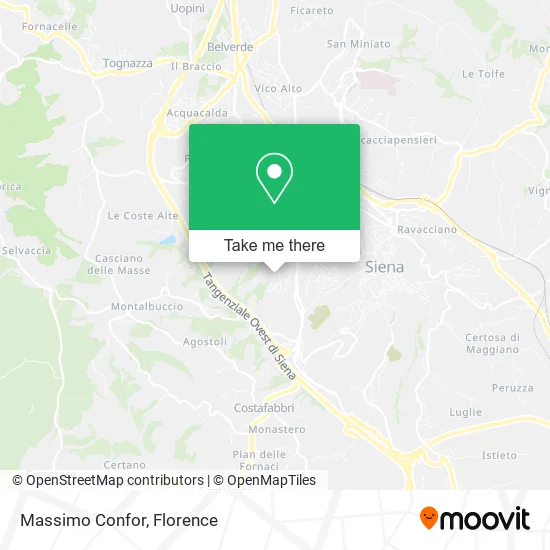
See Massimo Confor, Siena, on the map
Public Transit to Massimo Confor in Siena
Wondering how to get to Massimo Confor in Siena? Moovit helps you find the best way to get to Massimo Confor with step-by-step directions from the nearest public transit station.
Moovit provides free maps and live directions to help you navigate through your city. View schedules, routes, timetables, and find out how long does it take to get to Massimo Confor in real time.
Looking for the nearest stop or station to Massimo Confor? Check out this list of stops closest to your destination: Poggio Al Vento; Pescaia; Siena; XXIV May 90.
Bus: 0S1, 0S3, 640, GT1, S54, 601, S30, S30, S30, S31, 506, 514, 602, S18.Train: R.
Want to see if there’s another route that gets you there at an earlier time? Moovit helps you find alternative routes or times. Get directions from and directions to Massimo Confor easily from the Moovit App or Website.
We make riding to Massimo Confor easy, which is why over 1.5 million users, including users in Siena, trust Moovit as the best app for public transit. You don’t need to download an individual bus app or train app, Moovit is your all-in-one transit app that helps you find the best bus time or train time available.
For information on prices of bus and train, costs and ride fares to Massimo Confor, please check the Moovit app.
Use the app to navigate to popular places including to the airport, hospital, stadium, grocery store, mall, coffee shop, school, college, and university.
Massimo Confor Address: Via Michelangelo Buonarroti, 10 53100 Siena street in Siena
- Pixel Due by Carlo Mormile,
- My Youth,
- Dr. Roberto Ceni,
- Fregosi Daniela,
- Individual Company,
- Local Operational Unit,
- Vento del Poggio,
- Bancaitb Tobacco Shop,
- Smoke & More by Giuseppe Farina,
- Michele Landi,
- Il Mirto by Nastasi Tiziana & C.,
- Mercanti Pietro Construction Company,
- Hair Revolution Hairdressers Siena,
- Dr. Giulio Andreini,
- Cianci Real Estate,
- Hair Studio by Debora Brogi,
- Lavinia Alberino,
- Francoplast,
- Villa Zara,
- Alessandro Cinaglia
Places Near Massimo Confor (Siena)
- Piero Palagi Hospital Facility-Florence, Florence,
- IKEA Florence, Sesto Fiorentino,
- Michelangelo Square, Florence,
- Viola Park, Bagno a Ripoli,
- Torregalli Hospital Scandicci *, Scandicci,
- Mandela Forum (Nelson Mandela Forum), Florence,
- Artemio Franchi Municipal Stadium, Florence,
- I Gigli, Campi Bisenzio,
- OOO, Florence,
- Asmana, Campi Bisenzio,
- Tobacco Manufacture, Florence,
- Nelson Mandela Forum, Florence,
- Campi Bisenzio, Campi Bisenzio,
- Cascine Park, Florence,
- Michelangelo Square, Florence,
- Field of Mars, Florence,
- Wanny Palace, Florence,
- Santa Maria Novella Station, Florence,
- Verdi Theater, Florence,
- Santa Maria Nuova Hospital, Florence
How to get to popular places in Florence with public transit
Get around Siena by public transit!
Traveling around Siena has never been so easy. See step by step directions as you travel to any attraction, street or major public transit station. View bus and train schedules, arrival times, service alerts and detailed routes on a map, so you know exactly how to get to anywhere in Siena.
When traveling to any destination around Siena use Moovit's Live Directions with Get Off Notifications to know exactly where and how far to walk, how long to wait for your line, and how many stops are left. Moovit will alert you when it's time to get off — no need to constantly re-check whether yours is the next stop.
Wondering how to use public transit in Siena or how to pay for public transit in Siena? Moovit public transit app can help you navigate your way with public transit easily, and at minimum cost. It includes public transit fees, ticket prices, and costs. Looking for a map of Siena public transit lines? Moovit public transit app shows all public transit maps in Siena with all Bus, Train, Light Rail, Ferry and Funicular routes and stops on an interactive map.
Florence has 5 transit type(s), including: Bus, Train, Light Rail, Ferry and Funicular, operated by several transit agencies, including Florence Urban - Tuscan Bus Lines, GEST, Florence and Province - Tuscan Bus Lines, Livorno and Province - Tuscan Bus Lines, Arezzo, Florence and Provinces - Tuscan Bus Lines, Prato and Province - Tuscan Bus Lines, Massa, Carrara and Province - Tuscan Bus Lines, Pisa and Province - Tuscan Bus Lines, Grosseto, Siena and Provinces - Tuscan Bus Lines, Arezzo, Siena and Provinces - Tuscan Bus Lines, Pistoia and Province - Tuscan Bus Lines, Siena and Province - Tuscan Bus Lines, Arezzo and Province - Tuscan Bus Lines, Lucca and Province - Tuscan Bus Lines and Trenitalia