How to get to Matassoni Nilo by bus?
Click on the bus route to see step by step directions with maps, line arrival times and updated time schedules.
From Norcenni Girasole Club, Figline Valdarno
70 minFrom Korian-Frate Sole Care Home, Figline Valdarno
255 minFrom Frate Sole Care Home, Figline Valdarno
254 minFrom Hu Norcenni Girasole Village, Figline Valdarno
68 minFrom Sammezzano Castle, Reggello
223 minFrom Dr. Tani Alfiero, Figline Valdarno
57 minFrom Serristori Hospital, Figline and Incisa Valdarno
61 minFrom Gaiole In Chianti, Gaiole In Chianti
482 minFrom Figline Valdarno, Figline Valdarno
57 minFrom Rondine, Arezzo
102 min
Bus stops near Matassoni Nilo in Arezzo
Train station near Matassoni Nilo in Arezzo
- Montevarchi-Terranuova, 52 min walk,VIEW
Bus lines to Matassoni Nilo in Arezzo
- D, Ville-Badiola-Treggiaia,VIEW
- YELLOW, Terranuova-Loro-Malva-San Giovanni-Ville-Terranuova,VIEW
- MIV10, Loro-Terranuova-Via Poggilupi/Via Ville-San Giovanni Valdarno,VIEW
- A, Terranuova-Penna-Montemarciano-Nuova Squarcia,VIEW
- C, Terranuova-Cicogna-Casti,VIEW
- F, Tasso-Caprenne-Cicogna-Paterna,VIEW
- B, Terranuova Bracciolini Prosperi Square,VIEW
- BLU, Terranuova-Campogalli-Traiana-Cicogna-Terranuova,VIEW
- E, Cicogna-Traiana-Campogialli-Ascione,VIEW
- VERDE, Terranuova-Hospital-Diaz-Montevarchi,VIEW
- MIV02, Terranuova-Hospital-Via della Farnia-Montevarchi,VIEW
- MIV03, Montevarchi-Terranuova-San Giovanni Valdarno,VIEW
- MIV04, Levane-Ponte Leonardo-Terranuova-Ponte Leonardo-Montevarchi,VIEW
- LAP109, Arezzo-Loro Ciuffenna,VIEW
- LAP112, San Giustino-Terranuova,VIEW
- 360 A, Montevarchi-Incisa Valdarno-Pontassieve-Florence,VIEW
- 360 B, Montevarchi-Incisa Valdarno-Pontassieve-Florence,VIEW
What are the closest stations to Matassoni Nilo?
The closest stations to Matassoni Nilo are:
- Via Ville After Road Start is 82 meters away, 2 min walk.
- First Village Road End is 101 meters away, 2 min walk.
- Calvino School is 209 meters away, 3 min walk.
- Via S.Tito (Terranuova Bus Station) is 316 meters away, 5 min walk.
- Montevarchi-Terranuova is 4050 meters away, 52 min walk.
Which bus lines stop near Matassoni Nilo?
These bus lines stop near Matassoni Nilo: 353 A, D, YELLOW, MIV10, SI330, VERDE.
What’s the nearest bus station to Matassoni Nilo in Arezzo?
The nearest bus stations to Matassoni Nilo in Arezzo are Via Ville After Road Start and First Village Road End. The closest one is a 2 min walk away.
What time is the first train to Matassoni Nilo in Arezzo?
The R is the first train that goes to Matassoni Nilo in Arezzo. It stops nearby at 6:05 AM.
What time is the last train to Matassoni Nilo in Arezzo?
The R is the last train that goes to Matassoni Nilo in Arezzo. It stops nearby at 12:17 AM.
What time is the first bus to Matassoni Nilo in Arezzo?
The BLU is the first bus that goes to Matassoni Nilo in Arezzo. It stops nearby at 7:35 AM.
What time is the last bus to Matassoni Nilo in Arezzo?
The YELLOW is the last bus that goes to Matassoni Nilo in Arezzo. It stops nearby at 6:15 PM.
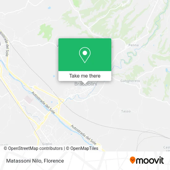
See Matassoni Nilo, Arezzo, on the map
Public Transit to Matassoni Nilo in Arezzo
Wondering how to get to Matassoni Nilo in Arezzo? Moovit helps you find the best way to get to Matassoni Nilo with step-by-step directions from the nearest public transit station.
Moovit provides free maps and live directions to help you navigate through your city. View schedules, routes, timetables, and find out how long does it take to get to Matassoni Nilo in real time.
Looking for the nearest stop or station to Matassoni Nilo? Check out this list of stops closest to your destination: Via Ville After Road Start; First Village Road End; Calvino School; Via S.Tito (Terranuova Bus Station); Montevarchi-Terranuova.
Bus: 353 A, D, YELLOW, MIV10, SI330, VERDE, YELLOW, A, C, F, B, BLU, E, MIV02, MIV03.Train: R, R.
Want to see if there’s another route that gets you there at an earlier time? Moovit helps you find alternative routes or times. Get directions from and directions to Matassoni Nilo easily from the Moovit App or Website.
We make riding to Matassoni Nilo easy, which is why over 1.5 million users, including users in Arezzo, trust Moovit as the best app for public transit. You don’t need to download an individual bus app or train app, Moovit is your all-in-one transit app that helps you find the best bus time or train time available.
For information on prices of bus and train, costs and ride fares to Matassoni Nilo, please check the Moovit app.
Use the app to navigate to popular places including to the airport, hospital, stadium, grocery store, mall, coffee shop, school, college, and university.
Matassoni Nilo Address: Via Poggio Bracciolini, 52028 Terranuova Bracciolini street in Arezzo
- New Cicogna Carpentry,
- Albini & Fontanot SpA Effelegno Sas Trade Hardware Fixtures,
- Environment Services Center,
- Pentotal,
- Luigi Levice,
- Pietro Betti,
- A.S. Traiana,
- C.T.C.,
- Dante Zamponi,
- Anspi Traiana Social Club,
- Carresi Fulvia,
- Scacchieri Sergio,
- Giovannantonio Zotti,
- Alticosi S.n.c. Gren & Co.,
- Isotermica by Francesco Tronci,
- Tozzi Marco,
- Arteq Srl Leather Production Switchboard,
- Arezzo Province Merchants Association,
- Arts and Crafts,
- Pasquale Di Florio
Places Near Matassoni Nilo (Arezzo)
- Asmana, Campi Bisenzio,
- Visarno Arena, Florence,
- Visarno Hippodrome, Florence,
- Cascine Park, Florence,
- Mandela Forum (Nelson Mandela Forum), Florence,
- OOO, Florence,
- IKEA Florence, Sesto Fiorentino,
- Field of Mars, Florence,
- Piero Palagi Hospital Facility-Florence, Florence,
- Artemio Franchi Municipal Stadium, Florence,
- I Gigli, Campi Bisenzio,
- Santa Maria Nuova Hospital, Florence,
- Nelson Mandela Forum, Florence,
- Torregalli Hospital Scandicci *, Scandicci,
- Santa Maria Novella Station, Florence,
- Campi Bisenzio, Campi Bisenzio,
- Verdi Theater, Florence,
- Tobacco Manufacture, Florence,
- Michelangelo Square, Florence,
- Michelangelo Square, Florence
How to get to popular places in Florence with public transit
Get around Arezzo by public transit!
Traveling around Arezzo has never been so easy. See step by step directions as you travel to any attraction, street or major public transit station. View bus and train schedules, arrival times, service alerts and detailed routes on a map, so you know exactly how to get to anywhere in Arezzo.
When traveling to any destination around Arezzo use Moovit's Live Directions with Get Off Notifications to know exactly where and how far to walk, how long to wait for your line, and how many stops are left. Moovit will alert you when it's time to get off — no need to constantly re-check whether yours is the next stop.
Wondering how to use public transit in Arezzo or how to pay for public transit in Arezzo? Moovit public transit app can help you navigate your way with public transit easily, and at minimum cost. It includes public transit fees, ticket prices, and costs. Looking for a map of Arezzo public transit lines? Moovit public transit app shows all public transit maps in Arezzo with all Bus, Train, Light Rail, Ferry and Funicular routes and stops on an interactive map.
Florence has 5 transit type(s), including: Bus, Train, Light Rail, Ferry and Funicular, operated by several transit agencies, including Florence Urban - Tuscan Bus Lines, GEST, Livorno and Province - Tuscan Bus Lines, Arezzo, Florence and Provinces - Tuscan Bus Lines, Prato and Province - Tuscan Bus Lines, Lucca and Province - Tuscan Bus Lines, Massa, Carrara and Province - Tuscan Bus Lines, Pisa and Province - Tuscan Bus Lines, Grosseto, Siena and Provinces - Tuscan Bus Lines, Arezzo, Siena and Provinces - Tuscan Bus Lines, Florence and Province - Tuscan Bus Lines, Pistoia and Province - Tuscan Bus Lines, Siena and Province - Tuscan Bus Lines, Arezzo and Province - Tuscan Bus Lines and Trenitalia