How to get to Mateos y Ortea Inversion by bus?
Click on the bus route to see step by step directions with maps, line arrival times and updated time schedules.
From Hospital Sanitas La Zarzuela, Madrid
70 minFrom Hospital Vithas Madrid Aravaca, Área Metropolitana De Madrid Y Corredor Del Henares
76 minFrom Mercadillo de Majadahonda, Majadahonda
34 minFrom Fremap Majadahonda, Majadahonda
54 minFrom El Corte Inglés, Pozuelo De Alarcón
45 minFrom Hospital De La Zarzuela, Área Metropolitana De Madrid Y Corredor Del Henares
70 minFrom Hospital De Majadahonda Fremap, Área Metropolitana De Madrid Y Corredor Del Henares
57 minFrom Hipercor, Pozuelo De Alarcón
46 minFrom Autovía del Noroeste A-6 (Carretera de La Coruña), Las Rozas De Madrid
58 minFrom Universidad Camilo José Cela (UCJC), Villanueva De La Cañada
73 min
How to get to Mateos y Ortea Inversion by train?
Click on the train route to see step by step directions with maps, line arrival times and updated time schedules.
From Hospital Sanitas La Zarzuela, Madrid
66 minFrom El Corte Inglés, Pozuelo De Alarcón
41 minFrom Hospital De La Zarzuela, Área Metropolitana De Madrid Y Corredor Del Henares
66 minFrom Hipercor, Pozuelo De Alarcón
41 minFrom Autovía del Noroeste A-6 (Carretera de La Coruña), Las Rozas De Madrid
51 min
Bus stops near Mateos y Ortea Inversion in Las Rozas De Madrid
Train stations near Mateos y Ortea Inversion in Las Rozas De Madrid
Bus lines to Mateos y Ortea Inversion in Las Rozas De Madrid
- 629, Ctra. A-6 - Est. Pinar,VIEW
- 2, Monte Rozas - El Encinar,VIEW
- 622, San José Pedrosillo - Urb. Las Encinas,VIEW
- 633, Cañada De Las Merinas - Centro De Salud,VIEW
- 685, Ctra. M-505 - Burgocentro,VIEW
- VAC223, Ruta 2: Madrid (Directo),VIEW
- 628, Av. Lazarejo - Perales,VIEW
- N903, Gta. Urgull - Monte Ulia,VIEW
What are the closest stations to Mateos y Ortea Inversion?
The closest stations to Mateos y Ortea Inversion are:
- Camilo José Cela - A. Pérez Esquivel is 90 meters away, 2 min walk.
- Camilo José Cela - Octavio Paz is 305 meters away, 5 min walk.
- Ctra. A-6 - Parque Empresarial Las Rozas is 581 meters away, 8 min walk.
- Camilo José Cela - Severo Ochoa is 826 meters away, 11 min walk.
- Pinar De Las Rozas is 2594 meters away, 33 min walk.
- Las Rozas is 3449 meters away, 45 min walk.
Which bus lines stop near Mateos y Ortea Inversion?
These bus lines stop near Mateos y Ortea Inversion: 628, 629, 685.
Which train line stops near Mateos y Ortea Inversion?
C10 (Villalba De Guadarrama)
What’s the nearest bus station to Mateos y Ortea Inversion in Las Rozas De Madrid?
The nearest bus station to Mateos y Ortea Inversion in Las Rozas De Madrid is Camilo José Cela - A. Pérez Esquivel. It’s a 2 min walk away.
What time is the first train to Mateos y Ortea Inversion in Las Rozas De Madrid?
The C8A is the first train that goes to Mateos y Ortea Inversion in Las Rozas De Madrid. It stops nearby at 6:10 AM.
What time is the last train to Mateos y Ortea Inversion in Las Rozas De Madrid?
The C8A is the last train that goes to Mateos y Ortea Inversion in Las Rozas De Madrid. It stops nearby at 12:07 AM.
What time is the first bus to Mateos y Ortea Inversion in Las Rozas De Madrid?
The N903 is the first bus that goes to Mateos y Ortea Inversion in Las Rozas De Madrid. It stops nearby at 3:17 AM.
What time is the last bus to Mateos y Ortea Inversion in Las Rozas De Madrid?
The N903 is the last bus that goes to Mateos y Ortea Inversion in Las Rozas De Madrid. It stops nearby at 3:15 AM.
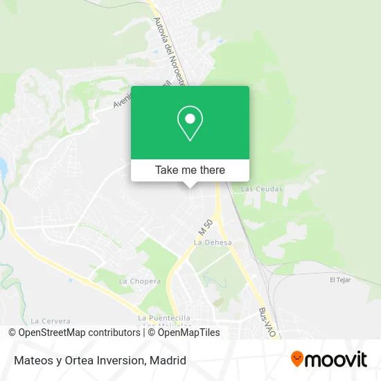
See Mateos y Ortea Inversion, Las Rozas De Madrid, on the map
Public Transit to Mateos y Ortea Inversion in Las Rozas De Madrid
Wondering how to get to Mateos y Ortea Inversion in Las Rozas De Madrid? Moovit helps you find the best way to get to Mateos y Ortea Inversion with step-by-step directions from the nearest public transit station.
Moovit provides free maps and live directions to help you navigate through your city. View schedules, routes, timetables, and find out how long does it take to get to Mateos y Ortea Inversion in real time.
Looking for the nearest stop or station to Mateos y Ortea Inversion? Check out this list of stops closest to your destination: Camilo José Cela - A. Pérez Esquivel; Camilo José Cela - Octavio Paz; Ctra. A-6 - Parque Empresarial Las Rozas; Camilo José Cela - Severo Ochoa; Pinar De Las Rozas; Las Rozas.
Bus: 628, 629, 685, 2, 622, 633, VAC223, N903.Train: C10, C8A, C8B, REG, REG, C7.
Want to see if there’s another route that gets you there at an earlier time? Moovit helps you find alternative routes or times. Get directions from and directions to Mateos y Ortea Inversion easily from the Moovit App or Website.
We make riding to Mateos y Ortea Inversion easy, which is why over 1.5 million users, including users in Las Rozas De Madrid, trust Moovit as the best app for public transit. You don’t need to download an individual bus app or train app, Moovit is your all-in-one transit app that helps you find the best bus time or train time available.
For information on prices of bus and train, costs and ride fares to Mateos y Ortea Inversion, please check the Moovit app.
Use the app to navigate to popular places including to the airport, hospital, stadium, grocery store, mall, coffee shop, school, college, and university.
Mateos y Ortea Inversion Address: Calle Adolfo Pérez Esquivel, 4 28232 Monte Rozas Las Rozas de Madrid street in Las Rozas De Madrid
- Grupo Daniel Alonso,
- Club de Boxeo HOOK Las Rozas,
- Turboauto,
- Escuela Infantil Nemomarlin,
- Porto Cervo Arquitectura,
- Unabarra Cafetería,
- Klein Pelucanina,
- Ginvips El Palm,
- Kebap Barbacoa,
- Adolfo Perez Esquivel 3,
- Nextcs,
- Ofi,
- Fightland,
- Servisitemedical,
- Nordic Phama,
- Lumen,
- Hanky Planet Las Rozas,
- Greenfields Real Estate,
- Inmo B & B Alquileres,
- Consulta Salud Dental
Places Near Mateos y Ortea Inversion (Las Rozas De Madrid)
- Rastro De Madrid, Área Metropolitana De Madrid Y Corredor Del Henares,
- Centro Comercial Oasiz Madrid, Área Metropolitana De Madrid Y Corredor Del Henares,
- Estacion de Chamartin, Madrid,
- Hospital Universitario La Paz, Madrid,
- Centro Comercial La Gavia, Área Metropolitana De Madrid Y Corredor Del Henares,
- Centro Comercial Islazul, Área Metropolitana De Madrid Y Corredor Del Henares,
- Plaza Mayor, Madrid,
- Hospital Clínico Universitario San Carlos, Madrid,
- Centro Comercial La Vaguada, Área Metropolitana De Madrid Y Corredor Del Henares,
- Hospital Universitario Ramón y Cajal, Madrid,
- Wizink Center, Madrid,
- Estadio Wanda Metropolitano, Área Metropolitana De Madrid Y Corredor Del Henares,
- Tres Aguas, Alcorcón,
- Nassica, Área Metropolitana De Madrid Y Corredor Del Henares,
- Mendez Alvaro, Madrid,
- Mercadillo de Majadahonda, Majadahonda,
- Calle de López de Hoyos 169, Madrid,
- Palacio De Vistalegre, Área Metropolitana De Madrid Y Corredor Del Henares,
- Sala La Riviera, Madrid,
- Plenilunio, Área Metropolitana De Madrid Y Corredor Del Henares
How to get to popular places in Madrid with public transit
Get around Las Rozas De Madrid by public transit!
Traveling around Las Rozas De Madrid has never been so easy. See step by step directions as you travel to any attraction, street or major public transit station. View bus and train schedules, arrival times, service alerts and detailed routes on a map, so you know exactly how to get to anywhere in Las Rozas De Madrid.
When traveling to any destination around Las Rozas De Madrid use Moovit's Live Directions with Get Off Notifications to know exactly where and how far to walk, how long to wait for your line, and how many stops are left. Moovit will alert you when it's time to get off — no need to constantly re-check whether yours is the next stop.
Wondering how to use public transit in Las Rozas De Madrid or how to pay for public transit in Las Rozas De Madrid? Moovit public transit app can help you navigate your way with public transit easily, and at minimum cost. It includes public transit fees, ticket prices, and costs. Looking for a map of Las Rozas De Madrid public transit lines? Moovit public transit app shows all public transit maps in Las Rozas De Madrid with all Bus, Train, Metro and Light Rail routes and stops on an interactive map.
Madrid has 4 transit type(s), including: Bus, Train, Metro and Light Rail, operated by several transit agencies, including Metro de Madrid, Metro Ligero, Tranvía de Parla, Renfe Cercanías - Servicios de Autobús especiales, Renfe Cercanias, Renfe Cercanías, EMT, Interurbanos, Urbanos de Alcalá de Henares, Urbanos de Alcobendas, Urbanos de Alcorcón, Urbanos de Algete, Urbanos de Aranjuez, Urbanos de Arganda del Rey and Urbanos de Arroyomolinos