How to get to Mathematic Dept by bus?
Click on the bus route to see step by step directions with maps, line arrival times and updated time schedules.
From Sam's Club, North Westside
66 minFrom Jose Marti Park, Miami
83 minFrom Brickell & Calle Ocho, Miami
87 minFrom Miami VA Hospital, Miami
98 minFrom METRORail-Vizcaya (Vizcaya Metrorail Station), Miami
94 minFrom Zezgo Miami Rent A Car, Miami
55 minFrom Bruce W. Carter VA Medical Center, Miami
104 minFrom Dade county courthouse, Miami
98 minFrom Brickell City Centre, Miami
90 minFrom Consulado Republica Dominicana, Miami
89 min
How to get to Mathematic Dept by train?
Click on the train route to see step by step directions with maps, line arrival times and updated time schedules.
From Jose Marti Park, Miami
40 minFrom Brickell & Calle Ocho, Miami
31 minFrom Miami VA Hospital, Miami
35 minFrom METRORail-Vizcaya (Vizcaya Metrorail Station), Miami
24 minFrom Zezgo Miami Rent A Car, Miami
48 minFrom Bruce W. Carter VA Medical Center, Miami
41 minFrom Dade county courthouse, Miami
34 minFrom Brickell City Centre, Miami
34 minFrom Consulado Republica Dominicana, Miami
33 min
Bus stops near Mathematic Dept in Miami
Train station near Mathematic Dept in Miami
- University, 11 min walk,VIEW
Bus lines to Mathematic Dept in Miami
What are the closest stations to Mathematic Dept?
The closest stations to Mathematic Dept are:
- Miller Rd & San Amaro Dr is 367 yards away, 5 min walk.
- San Amaro Dr & Delgado Av is 666 yards away, 8 min walk.
- Ponce De Leon Bd & Merrick St is 837 yards away, 11 min walk.
- University Metrorail Station is 843 yards away, 11 min walk.
- University is 903 yards away, 11 min walk.
Which bus lines stop near Mathematic Dept?
These bus lines stop near Mathematic Dept: 40, 56, 57.
Which train lines stop near Mathematic Dept?
These train lines stop near Mathematic Dept: GREEN, ORANGE.
What’s the nearest train station to Mathematic Dept in Miami?
The nearest train station to Mathematic Dept in Miami is University. It’s a 11 min walk away.
What’s the nearest bus station to Mathematic Dept in Miami?
The nearest bus station to Mathematic Dept in Miami is Miller Rd & San Amaro Dr. It’s a 5 min walk away.
What time is the first train to Mathematic Dept in Miami?
The GREEN is the first train that goes to Mathematic Dept in Miami. It stops nearby at 5:02 AM.
What time is the last train to Mathematic Dept in Miami?
The GREEN is the last train that goes to Mathematic Dept in Miami. It stops nearby at 1:02 AM.
What time is the first bus to Mathematic Dept in Miami?
The 400 is the first bus that goes to Mathematic Dept in Miami. It stops nearby at 3:22 AM.
What time is the last bus to Mathematic Dept in Miami?
The 400 is the last bus that goes to Mathematic Dept in Miami. It stops nearby at 2:25 AM.
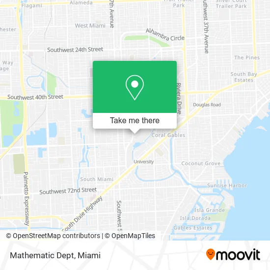
See Mathematic Dept, Miami, on the map
Public Transit to Mathematic Dept in Miami
Wondering how to get to Mathematic Dept in Miami? Moovit helps you find the best way to get to Mathematic Dept with step-by-step directions from the nearest public transit station.
Moovit provides free maps and live directions to help you navigate through your city. View schedules, routes, timetables, and find out how long does it take to get to Mathematic Dept in real time.
Looking for the nearest stop or station to Mathematic Dept? Check out this list of stops closest to your destination: Miller Rd & San Amaro Dr; San Amaro Dr & Delgado Av; Ponce De Leon Bd & Merrick St; University Metrorail Station; University.
Bus: 40, 56, 57, CGABDT, 400.Train: GREEN, ORANGE.
Want to see if there’s another route that gets you there at an earlier time? Moovit helps you find alternative routes or times. Get directions from and directions to Mathematic Dept easily from the Moovit App or Website.
We make riding to Mathematic Dept easy, which is why over 1.5 million users, including users in Miami, trust Moovit as the best app for public transit. You don’t need to download an individual bus app or train app, Moovit is your all-in-one transit app that helps you find the best bus time or train time available.
For information on prices of bus and train, costs and ride fares to Mathematic Dept, please check the Moovit app.
Use the app to navigate to popular places including to the airport, hospital, stadium, grocery store, mall, coffee shop, school, college, and university.
Mathematic Dept Address: 1365 Memorial Dr Coral Gables, FL 33146 street in Miami
- Leonard and Jayne Abess Center for Ecosystem Science and Policy,
- University Of Miami, Coral Gables Campus - Richter Library,
- University of Miami, Coral Gables Campus - Lot #101,
- FedEx,
- Halfmoon Empandas,
- University of Miami School of Law,
- Frost School of Music / School of Law,
- McArthur Engineering Building,
- Um Lakeside Patio and Stage,
- Bank of America,
- UM Farmers Market,
- University of Miami College of Engineering,
- Maurice Gusman Concert Hall,
- Maurice Gusman Concert Hall at Frost School Um,
- The Coco Market,
- Shalala Student Center Complex,
- STARBUCKS,
- M2o,
- University of Miami Student Center Complex,
- Jamba
Places Near Mathematic Dept (Miami)
- Marlins Park, Miami,
- Sawgrass mall ( FL ), Miami Beach,
- Sawgrass Mall, Miami,
- Miami VA Hospital, Miami,
- Zoo Miami, Miami,
- Aventura Mall, Miami,
- Hard Rock Stadium, Miami Gardens,
- Richard E. Gerstein Justice Building, Miami,
- Keiser University Flagship Campus, West Palm Beach,
- Brickell City Centre, Miami,
- Aventura Mall, Miami Beach,
- Dolphin Mall, Miami,
- Miami Design District, Miami,
- Wynwood, Miami,
- Port of Miami Cruise Terminal, Miami,
- Miami Freedom Park, Miami,
- Dolphin Mall Bus, Miami,
- Little Havana, Miami,
- Bayside Marketplace, Miami,
- Miami-Dade County Courthouse, Miami
How to get to popular places in Miami with public transit
Get around Miami by public transit!
Traveling around Miami has never been so easy. See step by step directions as you travel to any attraction, street or major public transit station. View bus and train schedules, arrival times, service alerts and detailed routes on a map, so you know exactly how to get to anywhere in Miami.
When traveling to any destination around Miami use Moovit's Live Directions with Get Off Notifications to know exactly where and how far to walk, how long to wait for your line, and how many stops are left. Moovit will alert you when it's time to get off — no need to constantly re-check whether yours is the next stop.
Wondering how to use public transit in Miami or how to pay for public transit in Miami? Moovit public transit app can help you navigate your way with public transit easily, and at minimum cost. It includes public transit fees, ticket prices, and costs. Looking for a map of Miami public transit lines? Moovit public transit app shows all public transit maps in Miami with all Bus, Train, Light Rail and Ferry routes and stops on an interactive map.
Miami has 4 transit type(s), including: Bus, Train, Light Rail and Ferry, operated by several transit agencies, including Broward County Transit, Miami-Dade Transit, Metrorail, Palm Tran, Tri-Rail, Brightline, MARTY, City of Homestead Trolley, Key West Transit, Treasure Coast Connector, GoLine IRT, Amtrak, Greyhound-us, FlixBus-us and Aventura Express Shuttle Bus