Directions to Mathnasium (Oakdale) with public transportation
The following transit lines have routes that pass near Mathnasium
 Bus: 2.
- Train: MONTAUK BRANCH.
How to get to Mathnasium by bus?
Click on the bus route to see step by step directions with maps, line arrival times and updated time schedules.
From Tanger Outlets, Deer Park
103 minFrom Plainview, NY, Plainview
191 minFrom Baxter Pavillion @ Good Sam, West Islip
63 minFrom Jake's 58 Casino, Islandia
105 minFrom Crest Hollow Country Club, Woodbury
175 minFrom Good Samaritan Hospital Medical Center, West Islip
78 minFrom Paramount, Huntington
169 minFrom Hauppauge ny, Hauppauge
102 minFrom Brentwood, NY, Brentwood
88 minFrom Tanger Outlets, Deer Park, Deer Park
101 min
How to get to Mathnasium by train?
Click on the train route to see step by step directions with maps, line arrival times and updated time schedules.
Train station near Mathnasium in Oakdale
- Oakdale, 9 min walk,VIEW
What are the closest stations to Mathnasium?
The closest stations to Mathnasium are:
- Oakdale is 665 yards away, 9 min walk.
Which bus line stops near Mathnasium?
2 (Patchogue Rr)
Which train line stops near Mathnasium?
MONTAUK BRANCH (Montauk)
What’s the nearest train station to Mathnasium in Oakdale?
The nearest train station to Mathnasium in Oakdale is Oakdale. It’s a 9 min walk away.
What time is the first train to Mathnasium in Oakdale?
The MONTAUK BRANCH is the first train that goes to Mathnasium in Oakdale. It stops nearby at 4:47 AM.
What time is the last train to Mathnasium in Oakdale?
The MONTAUK BRANCH is the last train that goes to Mathnasium in Oakdale. It stops nearby at 2:45 AM.
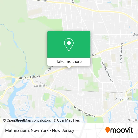
See Mathnasium, Oakdale, on the map
Public Transit to Mathnasium in Oakdale
Wondering how to get to Mathnasium in Oakdale? Moovit helps you find the best way to get to Mathnasium with step-by-step directions from the nearest public transit station.
Moovit provides free maps and live directions to help you navigate through your city. View schedules, routes, timetables, and find out how long does it take to get to Mathnasium in real time.
Looking for the nearest stop or station to Mathnasium? Check out this list of stops closest to your destination: Oakdale.
Bus: 2.Train: MONTAUK BRANCH.
Want to see if there’s another route that gets you there at an earlier time? Moovit helps you find alternative routes or times. Get directions from and directions to Mathnasium easily from the Moovit App or Website.
We make riding to Mathnasium easy, which is why over 1.5 million users, including users in Oakdale, trust Moovit as the best app for public transit. You don’t need to download an individual bus app or train app, Moovit is your all-in-one transit app that helps you find the best bus time or train time available.
For information on prices of bus and train, costs and ride fares to Mathnasium, please check the Moovit app.
Get to Mathnasium with public transit and pay for the ride in the Moovit app. In addition to all info you may need for your trip to Mathnasium, including live directions, real-time arrivals and fare prices, you can also buy public transit passes for your rides. No need for cash or paper tickets to get to Mathnasium - everything you need is accessible in the app with a click of the button.
Use the app to navigate to popular places including to the airport, hospital, stadium, grocery store, mall, coffee shop, school, college, and university.
Mathnasium Address: 4512 Sunrise Hwy street in Oakdale
- La Roma Pastry Shop,
- Peter Alexandra Salon,
- Bellissimo Salon,
- Haio Sushi & Asian Fusion,
- Jj Dynasty,
- Vinted Go Parcel Shop,
- Walgreens Pharmacy,
- Walgreens #18339,
- Libertyx Bitcoin Atm,
- Pizzaiolo Gourmet Eatery,
- Matted Memories,
- Bella Bambina's Pizza,
- Ahrc,
- Lidl,
- Oakdale NY - Sunrise Hwy,
- Christopher Studio-Dance,
- Bank Of America Atm,
- D&B Beer and Vape Shop,
- Rahkil Maizel, Md,
- Suffolk County Locksmiths Inc
Places Near Mathnasium (Oakdale)
- Bellevue Hospital, Manhattan,
- 26 Federal Plaza, Manhattan,
- 66 John Street, Manhattan,
- Chinatown, Manhattan,
- 911 Memorial, Manhattan,
- SoHo, Manhattan,
- Wall Street, Manhattan,
- Times Square, Manhattan,
- Rockefeller Center, Manhattan,
- Hudson Yards, Manhattan,
- 1 Police Plaza, Manhattan,
- 376 Hudson Street, Manhattan,
- qqqq, Manhattan,
- Mountainside Hospital, Glen Ridge,
- Pier 83, Manhattan,
- Queens Center Mall, Queens,
- Katz's Deli, Manhattan,
- San Gennaro Feast, Manhattan,
- 3 Stone St, Manhattan,
- 111 Centre New York City Supreme Court, Manhattan
How to get to popular places in New York - New Jersey with public transit
Get around Oakdale by public transit!
Traveling around Oakdale has never been so easy. See step by step directions as you travel to any attraction, street or major public transit station. View bus and train schedules, arrival times, service alerts and detailed routes on a map, so you know exactly how to get to anywhere in Oakdale.
When traveling to any destination around Oakdale use Moovit's Live Directions with Get Off Notifications to know exactly where and how far to walk, how long to wait for your line, and how many stops are left. Moovit will alert you when it's time to get off — no need to constantly re-check whether yours is the next stop.
Wondering how to use public transit in Oakdale or how to pay for public transit in Oakdale? Moovit public transit app can help you navigate your way with public transit easily, and at minimum cost. It includes public transit fees, ticket prices, and costs. Looking for a map of Oakdale public transit lines? Moovit public transit app shows all public transit maps in Oakdale with all Bus, Train, Subway, Light Rail, Ferry and Cable Car routes and stops on an interactive map.
New York - New Jersey has 6 transit type(s), including: Bus, Train, Subway, Light Rail, Ferry and Cable Car, operated by several transit agencies, including MTA Subway, Metro-North Railroad, LIRR, PATH, MTA New York City Transit - Express routes, MTA Bus, NJ Transit, NYC Ferry, NICE bus, Bee-Line Bus, NJ Transit Rail, Norwalk Transit District, Hartford Line, River Valley Transit and HART