Directions to Mathnasium (Lynbrook) with public transportation
The following transit lines have routes that pass near Mathnasium
 Bus: N25, N31X/M, N32, N4, N4X.
- Train: BABYLON BRANCH, LONG BEACH BRANCH, WEST HEMPSTEAD BRANCH.
How to get to Mathnasium by bus?
Click on the bus route to see step by step directions with maps, line arrival times and updated time schedules.
From jetBlue Terminal 5 JFK Int'l Airport NY, Queens
98 minFrom Walmart, Queens
39 minFrom Far Rockaway, NY, Queens
40 minFrom Avis Car Rental - JFK International Airport JFK, Queens
74 minFrom Long island Jewish Hospital, Queens
60 minFrom Saint Albans, NY, Queens
47 minFrom Queens County Farm Museum, Queens
70 minFrom Queens Village, Queens
61 minFrom Roosevelt Field Mall Bus Terminal, East Garden City
44 minFrom Social Security Office, Queens
42 min
How to get to Mathnasium by train?
Click on the train route to see step by step directions with maps, line arrival times and updated time schedules.
Bus stops near Mathnasium in Lynbrook
Train stations near Mathnasium in Lynbrook
Bus lines to Mathnasium in Lynbrook
What are the closest stations to Mathnasium?
The closest stations to Mathnasium are:
- Broadway & Sunrise Hwy. is 348 yards away, 5 min walk.
- Lynbrook Rr is 392 yards away, 6 min walk.
- Hemp Av / Merrick is 401 yards away, 5 min walk.
- East Rockaway is 1230 yards away, 15 min walk.
- Lynbrook is 1955 yards away, 24 min walk.
- Westwood is 2292 yards away, 28 min walk.
Which bus lines stop near Mathnasium?
These bus lines stop near Mathnasium: N25, N31X/M, N32, N4, N4X.
Which train lines stop near Mathnasium?
These train lines stop near Mathnasium: BABYLON BRANCH, LONG BEACH BRANCH.
What’s the nearest train station to Mathnasium in Lynbrook?
The nearest train station to Mathnasium in Lynbrook is East Rockaway. It’s a 15 min walk away.
What’s the nearest bus station to Mathnasium in Lynbrook?
The nearest bus stations to Mathnasium in Lynbrook are Broadway & Sunrise Hwy. and Hemp Av / Merrick. The closest one is a 5 min walk away.
What time is the first train to Mathnasium in Lynbrook?
The BABYLON BRANCH is the first train that goes to Mathnasium in Lynbrook. It stops nearby at 3:23 AM.
What time is the last train to Mathnasium in Lynbrook?
The BABYLON BRANCH is the last train that goes to Mathnasium in Lynbrook. It stops nearby at 3:23 AM.
What time is the first bus to Mathnasium in Lynbrook?
The N4 is the first bus that goes to Mathnasium in Lynbrook. It stops nearby at 3:07 AM.
What time is the last bus to Mathnasium in Lynbrook?
The N4 is the last bus that goes to Mathnasium in Lynbrook. It stops nearby at 3:09 AM.
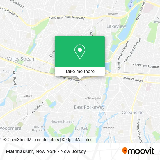
See Mathnasium, Lynbrook, on the map
Public Transit to Mathnasium in Lynbrook
Wondering how to get to Mathnasium in Lynbrook? Moovit helps you find the best way to get to Mathnasium with step-by-step directions from the nearest public transit station.
Moovit provides free maps and live directions to help you navigate through your city. View schedules, routes, timetables, and find out how long does it take to get to Mathnasium in real time.
Looking for the nearest stop or station to Mathnasium? Check out this list of stops closest to your destination: Broadway & Sunrise Hwy.; Lynbrook Rr; Hemp Av / Merrick; East Rockaway; Lynbrook; Westwood.
Bus: N25, N31X/M, N32, N4, N4X, N31, N25/58.Train: BABYLON BRANCH, LONG BEACH BRANCH, WEST HEMPSTEAD BRANCH.
Want to see if there’s another route that gets you there at an earlier time? Moovit helps you find alternative routes or times. Get directions from and directions to Mathnasium easily from the Moovit App or Website.
We make riding to Mathnasium easy, which is why over 1.5 million users, including users in Lynbrook, trust Moovit as the best app for public transit. You don’t need to download an individual bus app or train app, Moovit is your all-in-one transit app that helps you find the best bus time or train time available.
For information on prices of bus, train and light rail, costs and ride fares to Mathnasium, please check the Moovit app.
Use the app to navigate to popular places including to the airport, hospital, stadium, grocery store, mall, coffee shop, school, college, and university.
Mathnasium Address: 381 Sunrise Hwy street in Lynbrook
- Fight Wage Theft,
- Braxton Global Inc,
- Simon Paston & Sons Agency,
- Privilege Auto Group,
- Melissa Matassa - Geico Insurance Agent,
- Mind Meets Movement Counseling Services,
- Henry M Zupnick,
- Melissa Matassa,
- Cancos Tile and Stone,
- B2b Drybar,
- Adf Accessories,
- Everclad Law,
- First Battalion Mma and Fitness,
- Ww (Weight Watchers),
- Owens Truckmen,
- Theartisannyc,
- Insurance Resource Of NY Agency,
- Luxury Dental Pc Of Long Island,
- Purpose Fund Group,
- David's Wholesale & Retail Fabrics & Trim
Places Near Mathnasium (Lynbrook)
- 911 Memorial, Manhattan,
- Pier 83, Manhattan,
- 111 Centre New York City Supreme Court, Manhattan,
- Queens Center Mall, Queens,
- Hudson Yards, Manhattan,
- Rockefeller Center, Manhattan,
- SoHo, Manhattan,
- 1 Police Plaza, Manhattan,
- Katz's Deli, Manhattan,
- Wall Street, Manhattan,
- Chinatown, Manhattan,
- 26 Federal Plaza, Manhattan,
- Mountainside Hospital, Glen Ridge,
- 376 Hudson Street, Manhattan,
- Bellevue Hospital, Manhattan,
- Times Square, Manhattan,
- 66 John Street, Manhattan,
- San Gennaro Feast, Manhattan,
- 3 Stone St, Manhattan,
- qqqq, Manhattan
How to get to popular places in New York - New Jersey with public transit
Get around Lynbrook by public transit!
Traveling around Lynbrook has never been so easy. See step by step directions as you travel to any attraction, street or major public transit station. View bus and train schedules, arrival times, service alerts and detailed routes on a map, so you know exactly how to get to anywhere in Lynbrook.
When traveling to any destination around Lynbrook use Moovit's Live Directions with Get Off Notifications to know exactly where and how far to walk, how long to wait for your line, and how many stops are left. Moovit will alert you when it's time to get off — no need to constantly re-check whether yours is the next stop.
Wondering how to use public transit in Lynbrook or how to pay for public transit in Lynbrook? Moovit public transit app can help you navigate your way with public transit easily, and at minimum cost. It includes public transit fees, ticket prices, and costs. Looking for a map of Lynbrook public transit lines? Moovit public transit app shows all public transit maps in Lynbrook with all Bus, Train, Subway, Light Rail, Ferry and Cable Car routes and stops on an interactive map.
New York - New Jersey has 6 transit type(s), including: Bus, Train, Subway, Light Rail, Ferry and Cable Car, operated by several transit agencies, including MTA Subway, Metro-North Railroad, LIRR, PATH, MTA New York City Transit - Express routes, MTA Bus, NJ Transit, NYC Ferry, NICE bus, Bee-Line Bus, NJ Transit Rail, Norwalk Transit District, Hartford Line, River Valley Transit and HART