How to get to Mathus Matematik Merkezi by bus?
Click on the bus route to see step by step directions with maps, line arrival times and updated time schedules.
From Rihtim Vergi Dairesi, Ataşehir
74 minFrom Sultanbeyli Merkez İett Durağı, Sultanbeyli
48 minFrom Hilltown AVM Küçükyalı, Maltepe
81 minFrom E-11 Sabiha Gökçen - Kadıköy, Ataşehir
63 minFrom Kozyatağı Metro İstasyonu, Ataşehir
66 minFrom Watergarden, Ataşehir
92 minFrom Ümraniye İlçe Nüfus Müdürlüğü, Ümraniye
40 minFrom Ataşehir Ağız ve Diş Sağlığı Hastanesi, Ataşehir
90 minFrom Fatih Sultan Mehmet Eğitim Ve Araştırma Hastanesi, Ataşehir
73 minFrom Marmara Üniversitesi Başıbüyük Kampüsü, Maltepe
98 min
How to get to Mathus Matematik Merkezi by metro?
Click on the metro route to see step by step directions with maps, line arrival times and updated time schedules.
From Rihtim Vergi Dairesi, Ataşehir
50 minFrom Hilltown AVM Küçükyalı, Maltepe
51 minFrom E-11 Sabiha Gökçen - Kadıköy, Ataşehir
64 minFrom Kozyatağı Metro İstasyonu, Ataşehir
41 minFrom Ümraniye İlçe Nüfus Müdürlüğü, Ümraniye
25 minFrom Ataşehir Ağız ve Diş Sağlığı Hastanesi, Ataşehir
48 minFrom Fatih Sultan Mehmet Eğitim Ve Araştırma Hastanesi, Ataşehir
49 minFrom Marmara Üniversitesi Başıbüyük Kampüsü, Maltepe
76 min
Bus stops near Mathus Matematik Merkezi in Sancaktepe
Metro station near Mathus Matematik Merkezi in Sancaktepe
- Sarıgazi, 2 min walk,VIEW
Dolmus & Minibus station near Mathus Matematik Merkezi in Sancaktepe
- Sarıgazi Köyiçi - Son Durak Yönü, 5 min walk,VIEW
Bus lines to Mathus Matematik Merkezi in Sancaktepe
- C311, Dudullu-Sarıgazi-Yenidoğan-Abdurrahmangazi,VIEW
- C311, Dudullu-Esenşehir-Yenidoğan-Abdurrahmangazi,VIEW
- BL401, Viaport - Dudullu,VIEW
- 9S, Yeşıltepe/Çekmeköy Metro-Atatürk Mah.,VIEW
- 11, Yenidoğan - Altunizade Metrobüs,VIEW
- 11ÜS, Sultanbeyli - Üsküdar,VIEW
- 14, Yenidoğan/ Ümraniye - Kadıköy,VIEW
- 14S, Sultanbeyli - Kozyatağı Metro,VIEW
- 14YK, Yenidoğan / Şile Yolu - Ayrılık Çeşmesi,VIEW
- 19A, Yenidoğan - Ayrılık Çeşmesi,VIEW
- 19E, Yenidoğan/ Ataşehir - Kozyatağı Metro,VIEW
- 19EK, Yenidoğan/ Ataşehir - Kadıköy,VIEW
- 19S, Yenidoğan / Sarıgazi - Kadıköy,VIEW
- 19SK, Yenıdoğan/Sarıgazı-Kozyatağı Metro,VIEW
- 19V, Veysel Karani / Samandıra - Kozyatağı Metro,VIEW
- ÇM43, Atatürk Mahallesi-Necip Fazıl Metro,VIEW
- UM60, Sancaktepe - Necip Fazıl Metro,VIEW
- UM61, Paşaköy/Yenidoğan-Necip Fazıl Metro,VIEW
- UM74, Sultanbeyli Devlet Hast./ Necip Fazıl Metro - Dudullu Osb,VIEW
- 122H, S.Gökçen Havalimanı / Yenişehir - 4.Levent Metro,VIEW
What are the closest stations to Mathus Matematik Merkezi?
The closest stations to Mathus Matematik Merkezi are:
- Sarıgazi Metro - Ümraniye Yönü is 23 meters away, 1 min walk.
- Sarıgazi is 78 meters away, 2 min walk.
- Sarıgazi Merkez - Kadıköy Yönü is 268 meters away, 4 min walk.
- Sarıgazi Köyiçi - Son Durak Yönü is 344 meters away, 5 min walk.
- Namik Kemal Caddesi - Son Durak Yönü is 430 meters away, 6 min walk.
- Sarıgazi Atatürk Caddesi - Ümraniye Yönü is 524 meters away, 7 min walk.
- 60.Yıl Sarıgazi Ortaokulu - Sultanbeyli Yönü is 557 meters away, 8 min walk.
Which bus lines stop near Mathus Matematik Merkezi?
These bus lines stop near Mathus Matematik Merkezi: 11ÜS, 14, 19A, 19S, 622.
Which metro line stops near Mathus Matematik Merkezi?
M5 (Üsküdar→Samandıra Merkez)
Which Dolmus & Minibus line stops near Mathus Matematik Merkezi?
BL401 (Dudullu)
What’s the nearest metro station to Mathus Matematik Merkezi in Sancaktepe?
The nearest metro station to Mathus Matematik Merkezi in Sancaktepe is Sarıgazi. It’s a 2 min walk away.
What’s the nearest bus station to Mathus Matematik Merkezi in Sancaktepe?
The nearest bus station to Mathus Matematik Merkezi in Sancaktepe is Sarıgazi Metro - Ümraniye Yönü. It’s a 1 min walk away.
What’s the nearest Dolmus & Minibus station to Mathus Matematik Merkezi in Sancaktepe?
The nearest Dolmus & Minibus station to Mathus Matematik Merkezi in Sancaktepe is Sarıgazi Köyiçi - Son Durak Yönü. It’s a 5 min walk away.
What time is the first metro to Mathus Matematik Merkezi in Sancaktepe?
The M5 is the first metro that goes to Mathus Matematik Merkezi in Sancaktepe. It stops nearby at 3:08 AM.
What time is the last metro to Mathus Matematik Merkezi in Sancaktepe?
The M5 is the last metro that goes to Mathus Matematik Merkezi in Sancaktepe. It stops nearby at 12:29 AM.
What time is the first bus to Mathus Matematik Merkezi in Sancaktepe?
The 19S is the first bus that goes to Mathus Matematik Merkezi in Sancaktepe. It stops nearby at 3:01 AM.
What time is the last bus to Mathus Matematik Merkezi in Sancaktepe?
The M5 is the last bus that goes to Mathus Matematik Merkezi in Sancaktepe. It stops nearby at 4:07 AM.
What time is the first Dolmus & Minibus to Mathus Matematik Merkezi in Sancaktepe?
The C311 is the first Dolmus & Minibus that goes to Mathus Matematik Merkezi in Sancaktepe. It stops nearby at 5:51 AM.
What time is the last Dolmus & Minibus to Mathus Matematik Merkezi in Sancaktepe?
The BL401 is the last Dolmus & Minibus that goes to Mathus Matematik Merkezi in Sancaktepe. It stops nearby at 11:57 PM.
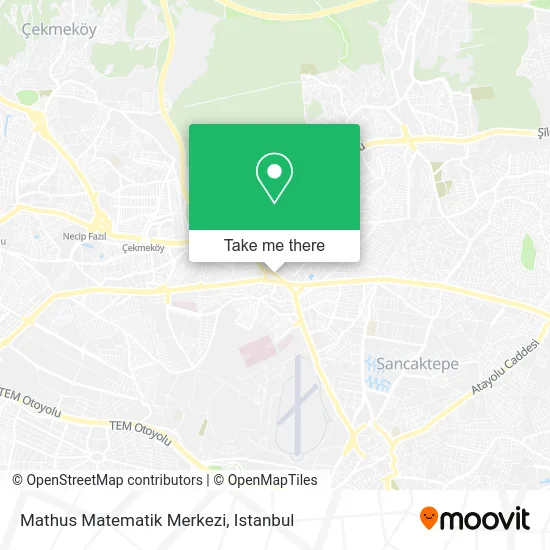
See Mathus Matematik Merkezi, Sancaktepe, on the map
Public Transit to Mathus Matematik Merkezi in Sancaktepe
Wondering how to get to Mathus Matematik Merkezi in Sancaktepe? Moovit helps you find the best way to get to Mathus Matematik Merkezi with step-by-step directions from the nearest public transit station.
Moovit provides free maps and live directions to help you navigate through your city. View schedules, routes, timetables, and find out how long does it take to get to Mathus Matematik Merkezi in real time.
Looking for the nearest stop or station to Mathus Matematik Merkezi? Check out this list of stops closest to your destination: Sarıgazi Metro - Ümraniye Yönü; Sarıgazi; Sarıgazi Merkez - Kadıköy Yönü; Sarıgazi Köyiçi - Son Durak Yönü; Namik Kemal Caddesi - Son Durak Yönü; Sarıgazi Atatürk Caddesi - Ümraniye Yönü; 60.Yıl Sarıgazi Ortaokulu - Sultanbeyli Yönü.
Bus: 11ÜS, 14, 19A, 19S, 622, C311, C311, BL401, 9S, 11, AND2K, C311, 19YK, ÇM44, UM73, SM3, 132S, 132YB.Metro: M5.Dolmus & Minibus: BL401, C311.
Want to see if there’s another route that gets you there at an earlier time? Moovit helps you find alternative routes or times. Get directions from and directions to Mathus Matematik Merkezi easily from the Moovit App or Website.
We make riding to Mathus Matematik Merkezi easy, which is why over 1.5 million users, including users in Sancaktepe, trust Moovit as the best app for public transit. You don’t need to download an individual bus app or train app, Moovit is your all-in-one transit app that helps you find the best bus time or train time available.
For information on prices of metro, bus and Dolmus & Minibus, costs and ride fares to Mathus Matematik Merkezi, please check the Moovit app.
Use the app to navigate to popular places including to the airport, hospital, stadium, grocery store, mall, coffee shop, school, college, and university.
Location: Sancaktepe, Istanbul
- Fındık Ibo Uykuluk Kokoreç,
- Halı Çarşı,
- Fındık İbo'nun Yeri Kokoreç & Uykuluk,
- Sarıgazî Gırgır Cafe,
- Ulucanlar Kıraathanesi,
- Çarşı Avm,
- Hazal Teras Restaurant,
- Ev Center Alışveriş Merkezleri,
- Haseki Egitim Ve Arastirma Hastanesi,
- Sancaktepe Tapu Müdürlüǧü,
- Hacı Bekir Künç,
- Sancaktepe Sarıgazi Merkez Taxi,
- Kardeşler Tekel Bayii,
- Sarıgazi cordon cafe,
- Sancaktepe Kaymakamlığı Sosyal Yardımlaşma Ve Dayanışma Vakfı,
- Bölge Hastanesi,
- Ev Center,
- Sarıgazı Sınav Dershanesı,
- Woxx Cafe Bistro,
- Sancaktepe Jakamen
Places Near Mathus Matematik Merkezi (Sancaktepe)
- 41 Burda AVM, Kocaeli Merkezi,
- Karaköy Genelevi, Karaköy, Beyoğlu,
- VİALAND AVM, Eyüp,
- Gebze Koop Durağı, Gebze,
- Başakşehir Çam Ve Sakura Şehir Hastanesi, Basaksehir,
- Topkule Kışlası 47.Komando Tugay Komutanlığı, Esenler,
- İstanbul,
- METROPOL IsTaNBuL, Ataşehir,
- 2 Nolu Minibüss, Beylikduzu,
- 212 AVM, Bagcilar,
- Şehit Prof. Dr. İlhan Varank Eğitim Ve Araştırma Hastanesi, Sancaktepe,
- Mehmet Emin Tokadî Hz. Türbesi, Fatih,
- Beylikdüzü - 4 Nolu Minibüs Hattı, Beylikduzu,
- Tersane İstanbul, Beyoğlu,
- Hz. Yuşa Tepesi, Beykoz,
- Bakırköy Sosyete Pazarı, Bakirköy,
- Hilltown AVM, Maltepe,
- İstinye Park, Sariyer,
- Gebze-Harem Minibüs Hattı, Gebze,
- Mall Of İstanbul, Basaksehir
How to get to popular places in Istanbul with public transit
Get around Sancaktepe by public transit!
Traveling around Sancaktepe has never been so easy. See step by step directions as you travel to any attraction, street or major public transit station. View bus and train schedules, arrival times, service alerts and detailed routes on a map, so you know exactly how to get to anywhere in Sancaktepe.
When traveling to any destination around Sancaktepe use Moovit's Live Directions with Get Off Notifications to know exactly where and how far to walk, how long to wait for your line, and how many stops are left. Moovit will alert you when it's time to get off — no need to constantly re-check whether yours is the next stop.
Wondering how to use public transit in Sancaktepe or how to pay for public transit in Sancaktepe? Moovit public transit app can help you navigate your way with public transit easily, and at minimum cost. It includes public transit fees, ticket prices, and costs. Looking for a map of Sancaktepe public transit lines? Moovit public transit app shows all public transit maps in Sancaktepe with all Bus, Train, Metro, Tram, Ferry, Metrobus and Dolmus & Minibus routes and stops on an interactive map.
Istanbul has 7 transit type(s), including: Bus, Train, Metro, Tram, Ferry, Metrobus and Dolmus & Minibus, operated by several transit agencies, including Marmaray, Metro İstanbul, Metrobüs, UAB, İETT, İETT ÇIFT KATLI HATLAR, İETT BÖLGESEL HATLAR, TCDD, Şehir Hatları, Dentur Avrasya, Beyden, Turyol, Mavi Marmara, Havaist and Prenstur
