How to get to Matos Level Eminent Realty by bus?
Click on the bus route to see step by step directions with maps, line arrival times and updated time schedules.
Bus stops near Matos Level Eminent Realty in Manchester
Bus lines to Matos Level Eminent Realty in Manchester
What are the closest stations to Matos Level Eminent Realty?
The closest stations to Matos Level Eminent Realty are:
- New State Rd @ Hilliard St is 344 yards away, 5 min walk.
- Middle Tpke W @ Adams St is 759 yards away, 10 min walk.
Which bus lines stop near Matos Level Eminent Realty?
These bus lines stop near Matos Level Eminent Realty: 84, 88.
What’s the nearest bus station to Matos Level Eminent Realty in Manchester?
The nearest bus station to Matos Level Eminent Realty in Manchester is New State Rd @ Hilliard St. It’s a 5 min walk away.
What time is the first bus to Matos Level Eminent Realty in Manchester?
The 88 is the first bus that goes to Matos Level Eminent Realty in Manchester. It stops nearby at 4:30 AM.
What time is the last bus to Matos Level Eminent Realty in Manchester?
The 91 is the last bus that goes to Matos Level Eminent Realty in Manchester. It stops nearby at 11:53 PM.
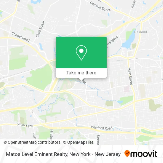
See Matos Level Eminent Realty, Manchester, on the map
Public Transit to Matos Level Eminent Realty in Manchester
Wondering how to get to Matos Level Eminent Realty in Manchester? Moovit helps you find the best way to get to Matos Level Eminent Realty with step-by-step directions from the nearest public transit station.
Moovit provides free maps and live directions to help you navigate through your city. View schedules, routes, timetables, and find out how long does it take to get to Matos Level Eminent Realty in real time.
Looking for the nearest stop or station to Matos Level Eminent Realty? Check out this list of stops closest to your destination: New State Rd @ Hilliard St; Middle Tpke W @ Adams St.
Bus: 84, 88, 91.
Want to see if there’s another route that gets you there at an earlier time? Moovit helps you find alternative routes or times. Get directions from and directions to Matos Level Eminent Realty easily from the Moovit App or Website.
We make riding to Matos Level Eminent Realty easy, which is why over 1.5 million users, including users in Manchester, trust Moovit as the best app for public transit. You don’t need to download an individual bus app or train app, Moovit is your all-in-one transit app that helps you find the best bus time or train time available.
For information on prices of bus and train, costs and ride fares to Matos Level Eminent Realty, please check the Moovit app.
Use the app to navigate to popular places including to the airport, hospital, stadium, grocery store, mall, coffee shop, school, college, and university.
Matos Level Eminent Realty Address: 642 Hilliard St Manchester, CT 06042 street in Manchester
- Bldg 4,
- Highland Guitar Studio,
- Georgies Kitchen Restaurant & Catering,
- Sassy Black Yarns,
- First Bilingual Day Care and Preschool,
- Caregivers Home Care Providers Ct LLC,
- GKN Aerospace,
- Falconridge Apartments,
- Odyssey Community School,
- Hockanum River Hiking Trail,
- James O'Brien,
- HJM Realty,
- Express Rental,
- Portrait Innovations,
- Steven P Chung DMD,
- Jarvis Rd Locksmith Co,
- Gospel Assoc Church,
- AmpUp,
- Laurel Marsh Trail,
- Sundance Signs
Places Near Matos Level Eminent Realty (Manchester)
- Hudson Yards, Manhattan,
- Rockefeller Center, Manhattan,
- 3 Stone St, Manhattan,
- 111 Centre New York City Supreme Court, Manhattan,
- San Gennaro Feast, Manhattan,
- qqqq, Manhattan,
- 911 Memorial, Manhattan,
- 376 Hudson Street, Manhattan,
- Chinatown, Manhattan,
- 1 Police Plaza, Manhattan,
- Wall Street, Manhattan,
- SoHo, Manhattan,
- Pier 83, Manhattan,
- 66 John Street, Manhattan,
- Bellevue Hospital, Manhattan,
- Queens Center Mall, Queens,
- Katz's Deli, Manhattan,
- 26 Federal Plaza, Manhattan,
- Mountainside Hospital, Glen Ridge,
- Times Square, Manhattan
How to get to popular places in New York - New Jersey with public transit
Get around Manchester by public transit!
Traveling around Manchester has never been so easy. See step by step directions as you travel to any attraction, street or major public transit station. View bus and train schedules, arrival times, service alerts and detailed routes on a map, so you know exactly how to get to anywhere in Manchester.
When traveling to any destination around Manchester use Moovit's Live Directions with Get Off Notifications to know exactly where and how far to walk, how long to wait for your line, and how many stops are left. Moovit will alert you when it's time to get off — no need to constantly re-check whether yours is the next stop.
Wondering how to use public transit in Manchester or how to pay for public transit in Manchester? Moovit public transit app can help you navigate your way with public transit easily, and at minimum cost. It includes public transit fees, ticket prices, and costs. Looking for a map of Manchester public transit lines? Moovit public transit app shows all public transit maps in Manchester with all Bus, Train, Subway, Light Rail, Ferry and Cable Car routes and stops on an interactive map.
New York - New Jersey has 6 transit type(s), including: Bus, Train, Subway, Light Rail, Ferry and Cable Car, operated by several transit agencies, including MTA Subway, Metro-North Railroad, LIRR, PATH, MTA New York City Transit - Express routes, MTA Bus, NJ Transit, NYC Ferry, NICE bus, Bee-Line Bus, NJ Transit Rail, Norwalk Transit District, Hartford Line, River Valley Transit and HART