How to get to Matts Mina by bus?
Click on the bus route to see step by step directions with maps, line arrival times and updated time schedules.
From Cruce Av. Canadá / Av. Arriola, La Victori
43 minFrom Teatro Canout, Miraflores
42 minFrom Estación Javier Prado - Metropolitano, Lince
43 minFrom Larcomar, Miraflores
43 minFrom Parque El Olivar, San Isidro
45 minFrom Av. Conquistadores, San Isidro
50 minFrom kILOMETRO 17 PANAMERICANA SUR, Villa El S
38 minFrom San Miguel, Surquillo
33 minFrom Av Defensores del Morro, Chorrillos
35 minFrom METRO AV CANADA, La Victori
44 min
How to get to Matts Mina by metro?
Click on the metro route to see step by step directions with maps, line arrival times and updated time schedules.
Bus stops near Matts Mina in Lima
Metro station near Matts Mina in Lima
- Miguel Iglesias, 33 min walk,VIEW
Bus lines to Matts Mina in Lima
- 1056, Villa El Salvador - San Juan de Lurigancho,VIEW
- 1060, Campoy (San Juan De Lurigancho) - Nueva Esperanza (Villa María Del Triunfo),VIEW
- 1093, S.J.M. - Surquillo - S.J.M.,VIEW
- 1097, Av. Santa Rosa (San Juan De Lurigancho) - Las Palmas (Pachacamac) ,VIEW
- 1099, 28 De Julio (Lima) - San Gabriel (Villa María Del Triunfo),VIEW
- 1100, Huaycan (Ate) - Las Palmas (Pachacamac),VIEW
- 1108, Montevideo (Lima) - Cementerio (Villa El Salvador),VIEW
- 1109, San Gabriel (Villa María Del Triunfo) - Espinar (Miraflores),VIEW
- 1110, Miraflores - VMT,VIEW
- 1123, José Gálvez (Villa María Del Triunfo) - Parque Kennedy (Miraflores),VIEW
- 1124, V.M.T. - Surquillo,VIEW
- 1125, Surquillo - V.M.T.,VIEW
- 1127, Surquillo - Lurin,VIEW
- 1128, Angamos (Surco) - Las Palmas (Pachacamac),VIEW
- 1185, Ensenada (Puente Piedra) - Av. Lima (Villa El Salvador),VIEW
- 1200, 28 De Julio (Lima) - San Gabriel (Villa María Del Triunfo),VIEW
- 1247, Jose Galvez (Pachacamac) - Chuquitanta (San Martin De Porres),VIEW
- 1252, V.M.T. - San Miguel,VIEW
- 1262, Pastor Sevilla (Villa El Salvador) - Pachacútec (Ventanilla),VIEW
- 1280, Tablada (Villa María Del Triunfo) - Profam (Santa Rosa),VIEW
What are the closest stations to Matts Mina?
The closest stations to Matts Mina are:
- Los Héroes is 321 meters away, 5 min walk.
- Avenida Tomás Guzmán, 577 is 514 meters away, 7 min walk.
- Baltazar is 619 meters away, 9 min walk.
- Avenida Salvador Allende 974 is 786 meters away, 11 min walk.
- Miguel Iglesias is 2584 meters away, 33 min walk.
Which bus lines stop near Matts Mina?
These bus lines stop near Matts Mina: 1093, 1108, 1110, 1123, 1127, 1200, 1472, 7805, 8614.
Which metro line stops near Matts Mina?
LINEA 1 (Bayóvar (San Juan De Lurigancho) - Separadora Industrial (Villa El Salvador))
What’s the nearest bus station to Matts Mina in Lima?
The nearest bus station to Matts Mina in Lima is Los Héroes. It’s a 5 min walk away.
What time is the first metro to Matts Mina in Lima?
The LINEA 1 is the first metro that goes to Matts Mina in Lima. It stops nearby at 5:04 AM.
What time is the last metro to Matts Mina in Lima?
The LINEA 1 is the last metro that goes to Matts Mina in Lima. It stops nearby at 10:42 PM.
What time is the first bus to Matts Mina in Lima?
The 1471 is the first bus that goes to Matts Mina in Lima. It stops nearby at 4:08 AM.
What time is the last bus to Matts Mina in Lima?
The 1280 is the last bus that goes to Matts Mina in Lima. It stops nearby at 1:34 AM.
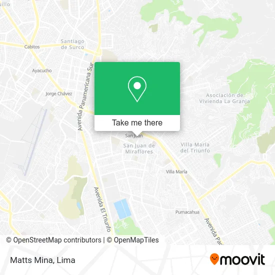
See Matts Mina, Lima, on the map
Public Transit to Matts Mina in Lima
Wondering how to get to Matts Mina in Lima? Moovit helps you find the best way to get to Matts Mina with step-by-step directions from the nearest public transit station.
Moovit provides free maps and live directions to help you navigate through your city. View schedules, routes, timetables, and find out how long does it take to get to Matts Mina in real time.
Looking for the nearest stop or station to Matts Mina? Check out this list of stops closest to your destination: Los Héroes; Avenida Tomás Guzmán; Baltazar; Avenida Salvador Allende 974; Miguel Iglesias.
Bus: 1093, 1108, 1110, 1123, 1127, 1200, 1472, 7805, 8614, 1056, 1060, 1097, 1099, 1315, 7804, 7811, OM19, 1111, 1059, 1062, 1096, 1113, 1118.Metro: LINEA 1.
Want to see if there’s another route that gets you there at an earlier time? Moovit helps you find alternative routes or times. Get directions from and directions to Matts Mina easily from the Moovit App or Website.
We make riding to Matts Mina easy, which is why over 1.5 million users, including users in Lima, trust Moovit as the best app for public transit. You don’t need to download an individual bus app or train app, Moovit is your all-in-one transit app that helps you find the best bus time or train time available.
For information on prices of bus and metro, costs and ride fares to Matts Mina, please check the Moovit app.
Use the app to navigate to popular places including to the airport, hospital, stadium, grocery store, mall, coffee shop, school, college, and university.
Matts Mina Address: Jirón Valentín Espejo 851 San Juan de Miraflores Parcela D, 15801 San Juan de Miraflores street in Lima
- Jiron Valentin Espejo 930 S J M,
- AV TOMAS GUZMAN 835 ESQUINA CON JR JOSE DIAZ ZONA D SAN JUAN DE MIRAFLORES,
- AV TOMAS GUZMÁN N° 835 ZONA D SAN JUAN DE MIRAFLORES,
- El Anzuelo de Yvonne,
- Atala Parra Heriberta,
- Jr Juan Castilla Cdra 9 Zona D San Juan de Miraflores,
- Parque Los Héroes,
- Calle Maximiliano Carranza 886,
- Kinoni,
- Caja Trujillo,
- Colegio Rvdo.Hno.Gastón María,
- Moche,
- JR ENRIQUE DEL VILLAR 945 ZONA D,
- Avenida San Juan 713,
- Olva Courier,
- JUAN CASTILLO 683 ZONA D SJM,
- Colegio Sec David Livingstone,
- Jirón Joaquín Bernal 880,
- Bodega Santa Rosa,
- Avenida Los Héroes
Places Near Matts Mina (Lima)
- Circuito Mágico Del Agua, Lima,
- Jockey Plaza, Santiago D,
- Parque Kennedy, Miraflores,
- Larcomar, Miraflores,
- Miraflores, Miraflores,
- Gamarra,
- Centro Comercial Plaza Norte, Independen,
- Av. Salaverry, Jesus Mari,
- Pontificia Universidad Católica del Perú - PUCP, San Miguel,
- Av. Abancay, Lima,
- Av. La Marina, San Miguel,
- Paradero Av.Brasil,
- Mall Del Sur,
- Real Plaza Puruchuco, Ate,
- Barranco, Barranco,
- Plaza San Miguel, San Miguel,
- Aeropuerto Internacional Jorge Chávez, Ventanilla,
- Hospital Edgardo Rebagliati Martins, Jesus Mari,
- Parque de las Leyendas, San Miguel,
- av arequipa, Lima
How to get to popular places in Lima with public transit
Get around Lima by public transit!
Traveling around Lima has never been so easy. See step by step directions as you travel to any attraction, street or major public transit station. View bus and train schedules, arrival times, service alerts and detailed routes on a map, so you know exactly how to get to anywhere in Lima.
When traveling to any destination around Lima use Moovit's Live Directions with Get Off Notifications to know exactly where and how far to walk, how long to wait for your line, and how many stops are left. Moovit will alert you when it's time to get off — no need to constantly re-check whether yours is the next stop.
Wondering how to use public transit in Lima or how to pay for public transit in Lima? Moovit public transit app can help you navigate your way with public transit easily, and at minimum cost. It includes public transit fees, ticket prices, and costs. Looking for a map of Lima public transit lines? Moovit public transit app shows all public transit maps in Lima with all Bus, Metro and Ferry routes and stops on an interactive map.
Lima has 3 transit type(s), including: Bus, Metro and Ferry, operated by several transit agencies, including Metro de Lima Línea 2 , Metro de Lima, Corredor Rojo, Metropolitano, Metropolitano - Alimentadores, Corredor Morado, Corredor Azul, Rutas Tradicionales, Transportes y Servicios La Esperanza S.A., Las Flores S.A., Virgen de la Asunción S.A., Consorcio HAM, Transportes y Service Canadá S.A., ETUL4SA and ETUCHISA