How to get to Mauro Rios by bus?
Click on the bus route to see step by step directions with maps, line arrival times and updated time schedules.
From Conjunto Catalina - Mangueirão, Bengui
46 minFrom Shopping Castanheira, Entroncamento
33 minFrom Rodovia BR 316, km 05 s/n, Ananindeua
44 minFrom Supermercado Preço Baixo (Una), Ananindeua
50 minFrom Rua John Engelhard - Pratinha (Icoaraci), Bengui
37 minFrom UPA 24h - Unidade De Pronto Atendimento, Bengui
60 minFrom Mangueirinho, Entroncamento
45 minFrom Conjunto Residencial Orlando Lobato, Bengui
60 minFrom Estação BRT - Marambaia, Entroncamento
35 minFrom Conjunto Valparaiso, Ananindeua
50 min
Bus stops near Mauro Rios in Belém
- Municipalidade Com Soares Carneiro, 2 min walk,VIEW
- Municipalidade Com Dom Pedro I, 2 min walk,VIEW
- Sen. Lemos Com D. Pedro I, 5 min walk,VIEW
- Soares Carneiro Com Sen. Lemos, 5 min walk,VIEW
- P.A. Cabral Com Dom Pedro I | Sentido Norte, 6 min walk,VIEW
- P.A. Cabral Com Dom Pedro I | Supermercado Economico, 6 min walk,VIEW
- Jerônimo Com D. Pedro I, 7 min walk,VIEW
Ferry stations near Mauro Rios in Belém
Bus lines to Mauro Rios in Belém
- 636, Marex - Pres. Vargas,VIEW
- 757, Jardim Europa,VIEW
- 889, Icoaraci - Centro (Via Centenário),VIEW
- 306, UFPA - Pedreira,VIEW
- 441, Ceasa - Felipe Patroni,VIEW
- 114, Cremação II - Alcindo Cacela,VIEW
- 417, Ufpa/ Alcindo Cacela - José Malcher,VIEW
- 422, Alcindo Cacela - Domingos Marreiros,VIEW
- 443, Pedreira - Lomas (Linha A),VIEW
- 445, Pedreira - Lomas (Seletivo),VIEW
- 546 A, Sacramenta - Nazaré (Via Pedro Miranda),VIEW
- 546 B, Sacramenta Nazaré - Via Cabral (Ida),VIEW
- 549, Djalma Dutra,VIEW
- 635, Cdp/Providência - Ver-O-Peso,VIEW
- 642, Benguí/Marex - Centro,VIEW
- 664, Benguí - Ver-O-Peso,VIEW
- 756, Jardim Europa - Ver-O-Peso,VIEW
- 795, Cabanagem - Pres. Vargas,VIEW
- 871, Icoaraci - Ver-O-Peso,VIEW
- 932, Terminal Cidade Nova,VIEW
What are the closest stations to Mauro Rios?
The closest stations to Mauro Rios are:
- Municipalidade Com Soares Carneiro is 72 meters away, 2 min walk.
- Municipalidade Com Dom Pedro I is 125 meters away, 2 min walk.
- Sen. Lemos Com D. Pedro I is 300 meters away, 5 min walk.
- Soares Carneiro Com Sen. Lemos is 347 meters away, 5 min walk.
- P.A. Cabral Com Dom Pedro I | Sentido Norte is 372 meters away, 6 min walk.
- P.A. Cabral Com Dom Pedro I | Supermercado Economico is 397 meters away, 6 min walk.
- Jerônimo Com D. Pedro I is 516 meters away, 7 min walk.
- Praça Do Pescador is 1852 meters away, 24 min walk.
- Arapari Navegação is 1989 meters away, 26 min walk.
Which bus lines stop near Mauro Rios?
These bus lines stop near Mauro Rios: 642, 757, 785, 795, 889, 932, 944.
What’s the nearest bus station to Mauro Rios in Belém?
The nearest bus stations to Mauro Rios in Belém are Municipalidade Com Soares Carneiro and Municipalidade Com Dom Pedro I. The closest one is a 2 min walk away.
What’s the nearest ferry station to Mauro Rios in Belém?
The nearest ferry station to Mauro Rios in Belém is Praça Do Pescador. It’s a 24 min walk away.
What time is the first bus to Mauro Rios in Belém?
The 664 is the first bus that goes to Mauro Rios in Belém. It stops nearby at 3:07 AM.
What time is the last bus to Mauro Rios in Belém?
The 869 is the last bus that goes to Mauro Rios in Belém. It stops nearby at 3:38 AM.
What time is the first ferry to Mauro Rios in Belém?
The L022 is the first ferry that goes to Mauro Rios in Belém. It stops nearby at 6:10 AM.
What time is the last ferry to Mauro Rios in Belém?
The T004 is the last ferry that goes to Mauro Rios in Belém. It stops nearby at 11:07 PM.
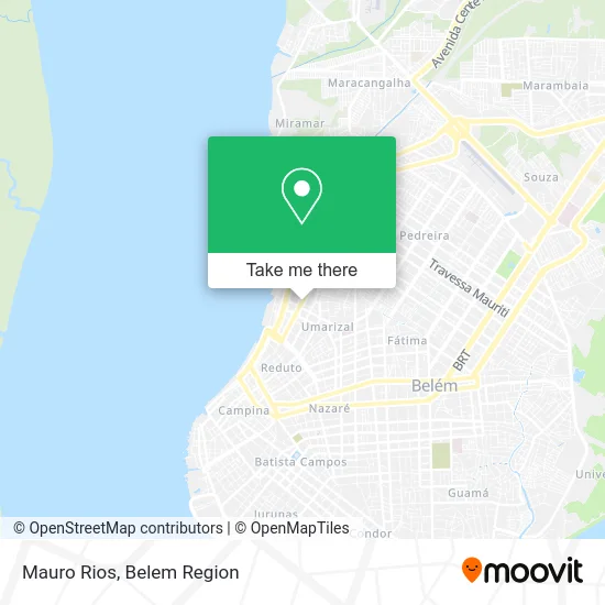
See Mauro Rios, Belém, on the map
Public Transit to Mauro Rios in Belém
Wondering how to get to Mauro Rios in Belém? Moovit helps you find the best way to get to Mauro Rios with step-by-step directions from the nearest public transit station.
Moovit provides free maps and live directions to help you navigate through your city. View schedules, routes, timetables, and find out how long does it take to get to Mauro Rios in real time.
Looking for the nearest stop or station to Mauro Rios? Check out this list of stops closest to your destination: Municipalidade Com Soares Carneiro; Municipalidade Com Dom Pedro I; Sen. Lemos Com D. Pedro I; Soares Carneiro Com Sen. Lemos; P.A. Cabral Com Dom Pedro I | Sentido Norte; P.A. Cabral Com Dom Pedro I | Supermercado Economico; Jerônimo Com D. Pedro I; Praça Do Pescador; Arapari Navegação.
Bus: 642, 757, 785, 795, 889, 932, 944, 636, 306, 441, 114, 417, 422, 443, 445, 632, 663, 862, 666, 758, 869, 906.Ferry: L022.
Want to see if there’s another route that gets you there at an earlier time? Moovit helps you find alternative routes or times. Get directions from and directions to Mauro Rios easily from the Moovit App or Website.
We make riding to Mauro Rios easy, which is why over 1.5 million users, including users in Belém, trust Moovit as the best app for public transit. You don’t need to download an individual bus app or train app, Moovit is your all-in-one transit app that helps you find the best bus time or train time available.
For information on prices of bus, costs and ride fares to Mauro Rios, please check the Moovit app.
Use the app to navigate to popular places including to the airport, hospital, stadium, grocery store, mall, coffee shop, school, college, and university.
Mauro Rios Address: Rua Municipalidade, 1554 Umarizal Belém-PA 66050-350 street in Belém
- Salao Rita Hair,
- Consul Vet,
- Pet Shop Dia de Cao,
- Solve Engenharia,
- Instituto São Vicente de Paulo,
- Mauro Rios Advocacia E Consultoria,
- Faculdade Tecnológica Da Amazônia - FAETAM,
- Gpr Consultoria Em Gestão Empresarial,
- Drago Serviço Combinado de Escritorio e Apoio Administrativo,
- Mirai Offices - Cyrela,
- Art Home Comércio e Serviços Ltda,
- Linha Marex - Presidente Vargas,
- Dias Comércio de Compensados,
- Escola Augusto Montinegro,
- Loja Aeb Multimarcas Outlet,
- Loja Da Borracha,
- Eduepa,
- Torre de Luxemburgo,
- Condominio do Edificio Quadra Residence,
- Afn Construções e Serviços
Places Near Mauro Rios (Belém)
- Doca, Belém,
- Centro Integrado de Inclusão e Reabilitação - CIIR, Entroncamento,
- Praça Brasil, Belém,
- Shopping Bosque Grão Pará, Entroncamento,
- Av.Senador Lemos, Belém,
- Aeroporto Internacional de Belém (BEL), Entroncamento,
- Boulevard Shopping, Belém,
- Shopping Metrópole Ananindeua, Ananindeua,
- Mangal Das Garças, Belém,
- Grão Pará, Belém,
- Santa Casa De Misericórdia, Belém,
- Shopping Pátio Belém, Belém,
- Bancrevea, Bengui,
- Avenida Júlio Cesar, Belém,
- Avenida Augusto Montenegro, Belém,
- Parque Shopping Belém, Bengui,
- Shopping Center Bosque Grão Pará, Entroncamento,
- Hangar PA, Belém,
- Linha 872: Icoaraci - Almirante Barroso (Presidente Vargas), Icoaraci,
- hospital Barros Barreto, Belém
How to get to popular places in Belem Region with public transit
Get around Belém by public transit!
Traveling around Belém has never been so easy. See step by step directions as you travel to any attraction, street or major public transit station. View bus and train schedules, arrival times, service alerts and detailed routes on a map, so you know exactly how to get to anywhere in Belém.
When traveling to any destination around Belém use Moovit's Live Directions with Get Off Notifications to know exactly where and how far to walk, how long to wait for your line, and how many stops are left. Moovit will alert you when it's time to get off — no need to constantly re-check whether yours is the next stop.
Wondering how to use public transit in Belém or how to pay for public transit in Belém? Moovit public transit app can help you navigate your way with public transit easily, and at minimum cost. It includes public transit fees, ticket prices, and costs. Looking for a map of Belém public transit lines? Moovit public transit app shows all public transit maps in Belém with all Bus and Ferry routes and stops on an interactive map.
Belem Region has 2 transit type(s), including: Bus and Ferry, operated by several transit agencies, including BRT Metropolitano, BRT Belém, SETRANSBEL, Coopcaban, Expresso Modelo, Voyage Transportes, Amazonat, Coopersati, Luane Transportes, Cooptarvc, Ruth Transportes, Mayara Transportes, Cooptauá, Expresso São José and Castanhal (Clara, Rosa's, Salve Maria)