How to get to Mavi by bus?
Click on the bus route to see step by step directions with maps, line arrival times and updated time schedules.
From küçükçekmece marmaray, Küçükçekmece
68 minFrom Tema İstanbul, Küçükçekmece
105 minFrom AVCILAR MINIBUS DURAGI, Avcilar
31 minFrom Kanuni Sultan Süleyman Hastanesi, Küçükçekmece
106 minFrom Avcılar Metrobüs Durağı, Avcilar
38 minFrom İSTANBUL HAVAALANI, Avcilar
48 minFrom Atakent Mahallesi, Küçükçekmece
91 minFrom Güvercintepe, Basaksehir
125 min
Dolmus & Minibus stations near Mavi in Beylikduzu
Bus stops near Mavi in Beylikduzu
Bus lines to Mavi in Beylikduzu
- A43, Avcılar(Küçükçekmece) - Haramidere Ring,VIEW
- BL100, Büyükçekmece - Beykent,VIEW
- BL101, Büyükçekmece - Zafer,VIEW
- BL101, Büyükçekmece - Doğan Araslı - Mimsan,VIEW
- HVL2, Beylikdüzü - İstanbul Havalimanı ✈,VIEW
- ES3, Esenyurt Devlet Hastanesi - Haramidere,VIEW
- BM5, Sahil Mah./ Kavaklı - Haramidere,VIEW
- BM6, Beylikdüzü - Haramidere,VIEW
- BM7, Haramidere - Yakuplu - Beylikdüzü,VIEW
- HT18, Hadımköy/I.Ü. Cerrahpaşa Kampüsü - Tüyap,VIEW
- HT48, Arel Üniversitesi / Tepekent - Avcılar Metrobüs,VIEW
- 76, Beylikdüzü - Bakırköy,VIEW
- 76BA, Büyükçekmece - Avcılar Metrobüs,VIEW
- 76G, Gürpınar - Avcılar Metrobüs,VIEW
- 76TM, Tepekent - Haramidere,VIEW
- 144, Boğazköy/Bahçekent-Haramidere,VIEW
- 144H, Heybetli Sok./Deliklikaya - Haramidere,VIEW
- 145T, Beylikdüzü - Taksim,VIEW
- 303A, Silivri - Avcılar Metrobüs,VIEW
- 400A, Beykent - Haramidere,VIEW
What are the closest stations to Mavi?
The closest stations to Mavi are:
- Sakarya Cad. is 120 meters away, 3 min walk.
- Migros is 217 meters away, 4 min walk.
- Beylikdüzü - Haramidere-Gürpınar Yönü is 280 meters away, 5 min walk.
- Beylikdüzü - Büyükçekmece Yönü is 478 meters away, 7 min walk.
- Güzelyurt - Avcılar Yönü is 670 meters away, 9 min walk.
Which bus lines stop near Mavi?
These bus lines stop near Mavi: 142T, 429A, 448, 458.
Which Metrobus lines stop near Mavi?
These Metrobus lines stop near Mavi: 34BZ, 34G.
What’s the nearest bus station to Mavi in Beylikduzu?
The nearest bus station to Mavi in Beylikduzu is Beylikdüzü - Haramidere-Gürpınar Yönü. It’s a 5 min walk away.
What’s the nearest Dolmus & Minibus station to Mavi in Beylikduzu?
The nearest Dolmus & Minibus station to Mavi in Beylikduzu is Sakarya Cad.. It’s a 3 min walk away.
What time is the first bus to Mavi in Beylikduzu?
The HVL2 is the first bus that goes to Mavi in Beylikduzu. It stops nearby at 3:15 AM.
What time is the last bus to Mavi in Beylikduzu?
The HVL2 is the last bus that goes to Mavi in Beylikduzu. It stops nearby at 2:45 AM.
What time is the first Dolmus & Minibus to Mavi in Beylikduzu?
The BL109 is the first Dolmus & Minibus that goes to Mavi in Beylikduzu. It stops nearby at 6:00 AM.
What time is the last Dolmus & Minibus to Mavi in Beylikduzu?
The BL109 is the last Dolmus & Minibus that goes to Mavi in Beylikduzu. It stops nearby at 12:10 AM.
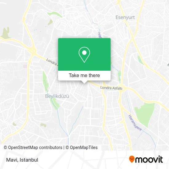
See Mavi, Beylikduzu, on the map
Public Transit to Mavi in Beylikduzu
Wondering how to get to Mavi in Beylikduzu? Moovit helps you find the best way to get to Mavi with step-by-step directions from the nearest public transit station.
Moovit provides free maps and live directions to help you navigate through your city. View schedules, routes, timetables, and find out how long does it take to get to Mavi in real time.
Looking for the nearest stop or station to Mavi? Check out this list of stops closest to your destination: Sakarya Cad.; Migros; Beylikdüzü - Haramidere-Gürpınar Yönü; Beylikdüzü - Büyükçekmece Yönü; Güzelyurt - Avcılar Yönü.
Bus: 142T, 429A, 448, 458, A43, BL100, BL101, BL101, HVL2, ES1.Metrobus: 34BZ, 34G.Dolmus & Minibus: BL109, BL109, BL109, BL109, BL109.
Want to see if there’s another route that gets you there at an earlier time? Moovit helps you find alternative routes or times. Get directions from and directions to Mavi easily from the Moovit App or Website.
We make riding to Mavi easy, which is why over 1.5 million users, including users in Beylikduzu, trust Moovit as the best app for public transit. You don’t need to download an individual bus app or train app, Moovit is your all-in-one transit app that helps you find the best bus time or train time available.
For information on prices of Metrobus, bus and Dolmus & Minibus, costs and ride fares to Mavi, please check the Moovit app.
Use the app to navigate to popular places including to the airport, hospital, stadium, grocery store, mall, coffee shop, school, college, and university.
Mavi Address: Beylikdüzü Migros AVM street in Beylikduzu
- Migros Poligon Park,
- Toyzz Shop Beylikdüzü 5 M Migros Avm,
- Tekbir Giyim/Beylikdüzü,
- Yonat Bayan Giyim Migros AVM,
- Keşanlı Ali,
- Migros AVM,
- Beylikdüzü Evlendirme Dairesi,
- Beylikdüzü Migros AVM,
- Divan Pastanesi,
- Continental İstanbul Beylikdüzü Lastik Bayi - Deniz Ticaret,
- armes iletişim turkcell migros,
- Crazy Park Lunapark Ve Oyun Dünyası,
- Özsüt Beylikdüzü Migros Avm,
- Aslı Börek Migros Avm,
- Marmara Park Avm Boyner,
- Gloria Jean's Coffees,
- Pierre Cardin Marmara Forum,
- Dr Erdal Omer Ozsoz Diş Kliniği,
- Bolçi Beyoğlu çikolatası,
- 5m Migros
Places Near Mavi (Beylikduzu)
- Tersane İstanbul, Beyoğlu,
- Mehmet Emin Tokadî Hz. Türbesi, Fatih,
- İstinye Park, Sariyer,
- 41 Burda AVM, Kocaeli Merkezi,
- Hz. Yuşa Tepesi, Beykoz,
- Beylikdüzü - 4 Nolu Minibüs Hattı, Beylikduzu,
- Hilltown AVM, Maltepe,
- Mall Of İstanbul, Basaksehir,
- İstanbul,
- METROPOL IsTaNBuL, Ataşehir,
- Şehit Prof. Dr. İlhan Varank Eğitim Ve Araştırma Hastanesi, Sancaktepe,
- VİALAND AVM, Eyüp,
- 2 Nolu Minibüss, Beylikduzu,
- Karaköy Genelevi, Karaköy, Beyoğlu,
- Gebze-Harem Minibüs Hattı, Gebze,
- Başakşehir Çam Ve Sakura Şehir Hastanesi, Basaksehir,
- Bakırköy Sosyete Pazarı, Bakirköy,
- Topkule Kışlası 47.Komando Tugay Komutanlığı, Esenler,
- 212 AVM, Bagcilar,
- Gebze Koop Durağı, Gebze
How to get to popular places in Istanbul with public transit
Get around Beylikduzu by public transit!
Traveling around Beylikduzu has never been so easy. See step by step directions as you travel to any attraction, street or major public transit station. View bus and train schedules, arrival times, service alerts and detailed routes on a map, so you know exactly how to get to anywhere in Beylikduzu.
When traveling to any destination around Beylikduzu use Moovit's Live Directions with Get Off Notifications to know exactly where and how far to walk, how long to wait for your line, and how many stops are left. Moovit will alert you when it's time to get off — no need to constantly re-check whether yours is the next stop.
Wondering how to use public transit in Beylikduzu or how to pay for public transit in Beylikduzu? Moovit public transit app can help you navigate your way with public transit easily, and at minimum cost. It includes public transit fees, ticket prices, and costs. Looking for a map of Beylikduzu public transit lines? Moovit public transit app shows all public transit maps in Beylikduzu with all Bus, Train, Metro, Tram, Ferry, Metrobus and Dolmus & Minibus routes and stops on an interactive map.
Istanbul has 7 transit type(s), including: Bus, Train, Metro, Tram, Ferry, Metrobus and Dolmus & Minibus, operated by several transit agencies, including Marmaray, Metro İstanbul, Metrobüs, UAB, İETT, İETT ÇIFT KATLI HATLAR, İETT BÖLGESEL HATLAR, TCDD, Şehir Hatları, Dentur Avrasya, Beyden, Turyol, Mavi Marmara, Havaist and Prenstur
