How to get to Maxi K by bus?
Click on the bus route to see step by step directions with maps, line arrival times and updated time schedules.
From San Pedro Viejo, Concepcion
36 minFrom Lomas de Penco., Penco
58 minFrom Cerro Verde Alto, Penco
56 minFrom Cementerio Penco, Penco
56 minFrom cerro los lobos viejos, Talcahuano
55 minFrom Cerro Zaror, Talcahuano
49 minFrom Colegio San Francisco, Talcahuano
63 minFrom Isla Rocuant, Talcahuano
35 minFrom Condominio Los Pioneros, Coronel
55 minFrom Juzgado de Familia de Talcahuano, Talcahuano
35 min
Bus stops near Maxi K in Talcahuano
- Mall Plaza Trebol Hacia El Norte (Paradero Sur), 2 min walk,VIEW
- Mall Plaza Trebol Hacia El Norte (Paradero Norte), 3 min walk,VIEW
- Mall Plaza Trebol Hacia El Sur (Paradero Poniente), 4 min walk,VIEW
- Mall Plaza Trebol Hacia El Sur (Paradero Oriente), 5 min walk,VIEW
- Av. Jorge Alessandri Esq. Santa Isabel, 17 min walk,VIEW
- Clinica Bio Bio, 17 min walk,VIEW
- Las Palomas Esq Los Colibries, 32 min walk,VIEW
Bus lines to Maxi K in Talcahuano
- B02, B02 - Mall - Casino,VIEW
- 10BO, 10b - Lobos Viejos,VIEW
- 10CP, 10p - Leonera,VIEW
- 10DM, 10m - Los Bloques,VIEW
- 10JL, 10l - Los Bloques,VIEW
- 10TK, 10t - Tumbes,VIEW
- 11CM, 11c - Talcahuano,VIEW
- 11EQ, 11q - Los Bloques,VIEW
- 11FR, 11f - Talcahuano,VIEW
- 13GS, 13g - Pta. Leones,VIEW
- 14HT, 14h - San Vicente,VIEW
- 16HK, 16k - Leonera,VIEW
- 16IV, 16v - Leonera,VIEW
- 20JL, 20l - Boca Sur,VIEW
- 20TM, 20m - San Pedro De La Costa,VIEW
- 20VA, 20v - Pta. Los Leones,VIEW
- 20ZW, 20z - Pta. Los Leones,VIEW
- 30QE, 30q - Higueras,VIEW
- 40GN, 40n - 4 Esquinas,VIEW
- 41QV, 41v - Hualpencillo,VIEW
What are the closest stations to Maxi K?
The closest stations to Maxi K are:
- Mall Plaza Trebol Hacia El Norte (Paradero Sur) is 138 meters away, 2 min walk.
- Mall Plaza Trebol Hacia El Norte (Paradero Norte) is 154 meters away, 3 min walk.
- Mall Plaza Trebol Hacia El Sur (Paradero Poniente) is 285 meters away, 4 min walk.
- Mall Plaza Trebol Hacia El Sur (Paradero Oriente) is 349 meters away, 5 min walk.
- Av. Jorge Alessandri Esq. Santa Isabel is 1270 meters away, 17 min walk.
- Clinica Bio Bio is 1274 meters away, 17 min walk.
- Las Palomas Esq Los Colibries is 2447 meters away, 32 min walk.
Which bus lines stop near Maxi K?
These bus lines stop near Maxi K: 10AN, 10BO, 11FR, 14HT, 20TM, 20VA, 20ZW, 70KH.
What’s the nearest bus station to Maxi K in Talcahuano?
The nearest bus station to Maxi K in Talcahuano is Mall Plaza Trebol Hacia El Norte (Paradero Sur). It’s a 2 min walk away.
What time is the first bus to Maxi K in Talcahuano?
The 90YX is the first bus that goes to Maxi K in Talcahuano. It stops nearby at 5:01 AM.
What time is the last bus to Maxi K in Talcahuano?
The 80K is the last bus that goes to Maxi K in Talcahuano. It stops nearby at 1:51 AM.
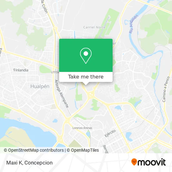
See Maxi K, Talcahuano, on the map
Public Transit to Maxi K in Talcahuano
Wondering how to get to Maxi K in Talcahuano? Moovit helps you find the best way to get to Maxi K with step-by-step directions from the nearest public transit station.
Moovit provides free maps and live directions to help you navigate through your city. View schedules, routes, timetables, and find out how long does it take to get to Maxi K in real time.
Looking for the nearest stop or station to Maxi K? Check out this list of stops closest to your destination: Mall Plaza Trebol Hacia El Norte (Paradero Sur); Mall Plaza Trebol Hacia El Norte (Paradero Norte); Mall Plaza Trebol Hacia El Sur (Paradero Poniente); Mall Plaza Trebol Hacia El Sur (Paradero Oriente); Av. Jorge Alessandri Esq. Santa Isabel; Clinica Bio Bio; Las Palomas Esq Los Colibries.
Bus: 10AN, 10BO, 11FR, 14HT, 20TM, 20VA, 20ZW, 70KH, B02, 10CP, 10DM, 10JL, 30NC, 57YP, 80H, 80Q, 80Z, 60XK, 60YL, 44AB, 44EU.
Want to see if there’s another route that gets you there at an earlier time? Moovit helps you find alternative routes or times. Get directions from and directions to Maxi K easily from the Moovit App or Website.
We make riding to Maxi K easy, which is why over 1.5 million users, including users in Talcahuano, trust Moovit as the best app for public transit. You don’t need to download an individual bus app or train app, Moovit is your all-in-one transit app that helps you find the best bus time or train time available.
For information on prices of bus, costs and ride fares to Maxi K, please check the Moovit app.
Use the app to navigate to popular places including to the airport, hospital, stadium, grocery store, mall, coffee shop, school, college, and university.
Maxi K Address: Boulevar El Trébol street in Talcahuano
- Duoc Uc concepción,
- Tur Bus Mall Plaza Del Trebol,
- Panadería Olimpia Mall,
- Santa Isabel,
- Farmacia Ahumada Boulevard Trébol,
- Paradero Taxi Mall Acceso 1,
- Hilachas,
- Bariloche,
- Fiesta & Regalos,
- Supermercado Santa Isabel,
- Avenida Presidente Jorge Alessandri Rodriguez 3177,
- Banco Estado,
- Estacion El Trebol,
- Terrazas Mall Plaza Trébol,
- Cordillera S.A.,
- Bobbibrown,
- Garita De Carabineros,
- Registro Civil e Identificación,
- Lipigas,
- Automotores Gildemeister - Plaza El Trébol
Places Near Maxi K (Talcahuano)
- Hospital Clínico Del Sur, Concepcion,
- Hospital Las Higueras, Talcahuano,
- Vega Monumental, Concepcion,
- Caleta Tumbes, Talcahuano,
- Penco, Penco,
- Jumbo - Easy Hualpén, Concepcion,
- Mall Plaza del Trebol, Talcahuano,
- Universidad De Concepción, Concepcion,
- Hualpén, Concepcion,
- Zoológico de Concepción, Concepcion,
- Club Hípico De Concepción, Talcahuano,
- Universidad Del Bío-Bío, Concepcion,
- San Pedro De La Paz, Concepcion,
- Playa Lenga,
- En la micro camino a chiguayante, Concepcion,
- Mall Plaza Mirador Bío Bío, Concepcion,
- Lomas San Sebastian, Talcahuano,
- En La Micro Camino A Tome, Concepcion,
- Clinica bio bio, Concepcion,
- Terminal Aeropuerto Carriel Sur, Talcahuano
How to get to popular places in Concepcion with public transit
Get around Talcahuano by public transit!
Traveling around Talcahuano has never been so easy. See step by step directions as you travel to any attraction, street or major public transit station. View bus and train schedules, arrival times, service alerts and detailed routes on a map, so you know exactly how to get to anywhere in Talcahuano.
When traveling to any destination around Talcahuano use Moovit's Live Directions with Get Off Notifications to know exactly where and how far to walk, how long to wait for your line, and how many stops are left. Moovit will alert you when it's time to get off — no need to constantly re-check whether yours is the next stop.
Wondering how to use public transit in Talcahuano or how to pay for public transit in Talcahuano? Moovit public transit app can help you navigate your way with public transit easily, and at minimum cost. It includes public transit fees, ticket prices, and costs. Looking for a map of Talcahuano public transit lines? Moovit public transit app shows all public transit maps in Talcahuano with all bus routes and stops on an interactive map.
Concepcion has 1 transit type(s), including: bus, operated by several transit agencies, including División de Transporte Público Regional