Directions to Maxtelecom (Colombo) with public transportation
The following transit lines have routes that pass near Maxtelecom
How to get to Maxtelecom by bus?
Click on the bus route to see step by step directions with maps, line arrival times and updated time schedules.
From Hospital Da Polícia Militar, Jardim Botânico
50 minFrom Rua Tv Particular II (VL ARAUJO), Colombo
69 minFrom UFPR - Universidade Federal do Paraná, Jardim Botânico
49 minFrom Rua Almirante Tamandaré, Alto Da Rua XV
33 minFrom Rua Vicente de Carvalho 113, Cajuru
56 minFrom Rua Leonardo Novicki, Cajuru
82 minFrom Avenida Senador Souza Naves, Alto Da Rua XV
37 minFrom Hospital e Maternidade Santa Madalena Sofia, Bairro Alto
37 minFrom Rua Engenheiro Costa Barros, Cajuru
55 minFrom Rodoviária de Curitiba, Jardim Botânico
44 min
Bus stops near Maxtelecom in Colombo
Bus lines to Maxtelecom in Colombo
- B43 RIO VERDE, Praça da Bíblia → Terminal Boa Vista,VIEW
- B39 CAMPO ALTO / SANTA CÂNDIDA, Terminal Santa Cândida ↺ Campo Alto / Capela do Atuba (Circular),VIEW
- I90 CACHOEIRA / MARACANÃ, Terminal Cachoeira → Terminal Maracanã,VIEW
- B03 GUARAITUBA / ALTO DA XV (VIA MARACANÃ), Terminal Guaraituba ↺ Jardim Social / Alto da Rua XV (Circular),VIEW
- B06 GUARAITUBA / RUI BARBOSA (VIA MARACANÃ / SEMIDIRETO), Marechal Dedoro / Rui Barbosa → Terminal Guaraituba ,VIEW
- B11 MARACANÃ / SANTA CÂNDIDA, Terminal Maracanã → Terminal Santa Cândida,VIEW
- B20 GUARAITUBA / CABRAL (VIA MARACANÃ), Terminal Guaraituba → Terminal Cabral,VIEW
- B29 ROÇA GRANDE / APDEC (VIA MARACANÃ), Terminal Roça Grande → APDEC,VIEW
- B42 MARACANÃ / ESTAÇÃO ATUBA, Terminal Maracanã → Estação Atuba,VIEW
- B58 MARACANÃ / SANTA CÂNDIDA (CIRCULAR), Terminal Santa Cândida ↺ Terminal Maracanã (Circular),VIEW
- B69 MAD. CURITIBA / SÃO DIMAS, São Dimas → Terminal Guadalupe,VIEW
- B89 GUARAITUBA / RUI BARBOSA (VIA MARACANÃ / CABRAL), Terminal Guaraituba → Praça Rui Barbosa,VIEW
- Y99 TUNAS DO PARANÁ / GUADALUPE, Terminal Guadalupe → Tunas do Paraná,VIEW
- B57 CAMPO ALTO / SANTA CÂNDIDA, Terminal Santa Cândida ↺ Terminal Maracanã (Circular),VIEW
- 0950-500 CURITIBA / ADRIANÓPOLIS (VIA TUNAS DO PARANÁ), Curitiba → Adrianópolis,VIEW
What are the closest stations to Maxtelecom?
The closest stations to Maxtelecom are:
- Rua Gustavo Kabitschke, 705a is 253 meters away, 4 min walk.
- Rua Gustavo Kabitschke, 1181 is 596 meters away, 8 min walk.
- Rua Pedro Gorski, 459 is 605 meters away, 8 min walk.
- Rodovia Br 476 (Estrada Da Ribeira) - Liquigas is 815 meters away, 11 min walk.
Which bus lines stop near Maxtelecom?
These bus lines stop near Maxtelecom: B03 GUARAITUBA / ALTO DA XV (VIA MARACANÃ), B06 GUARAITUBA / RUI BARBOSA (VIA MARACANÃ / SEMIDIRETO), B20 GUARAITUBA / CABRAL (VIA MARACANÃ), B42 MARACANÃ / ESTAÇÃO ATUBA, B43 RIO VERDE, U01 SEDE / MARACANÃ.
What’s the nearest bus station to Maxtelecom in Colombo?
The nearest bus station to Maxtelecom in Colombo is Rua Gustavo Kabitschke, 705a. It’s a 4 min walk away.
What time is the first bus to Maxtelecom in Colombo?
The B69 MAD. CURITIBA / SÃO DIMAS is the first bus that goes to Maxtelecom in Colombo. It stops nearby at 4:12 AM.
What time is the last bus to Maxtelecom in Colombo?
The B20 GUARAITUBA / CABRAL (VIA MARACANÃ) is the last bus that goes to Maxtelecom in Colombo. It stops nearby at 12:28 AM.
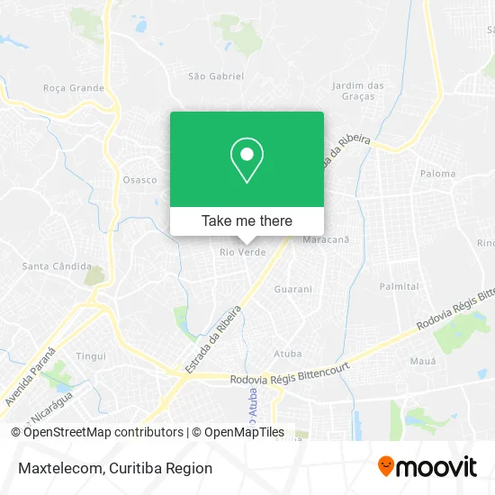
See Maxtelecom, Colombo, on the map
Public Transit to Maxtelecom in Colombo
Wondering how to get to Maxtelecom in Colombo? Moovit helps you find the best way to get to Maxtelecom with step-by-step directions from the nearest public transit station.
Moovit provides free maps and live directions to help you navigate through your city. View schedules, routes, timetables, and find out how long does it take to get to Maxtelecom in real time.
Looking for the nearest stop or station to Maxtelecom? Check out this list of stops closest to your destination: Rua Gustavo Kabitschke; Rua Gustavo Kabitschke; Rua Pedro Gorski; Rodovia Br 476 (Estrada Da Ribeira) - Liquigas.
Bus: B03 GUARAITUBA / ALTO DA XV (VIA MARACANÃ), B06 GUARAITUBA / RUI BARBOSA (VIA MARACANÃ / SEMIDIRETO), B20 GUARAITUBA / CABRAL (VIA MARACANÃ), B42 MARACANÃ / ESTAÇÃO ATUBA, B43 RIO VERDE, U01 SEDE / MARACANÃ, I90 CACHOEIRA / MARACANÃ, B39 CAMPO ALTO / SANTA CÂNDIDA, B11 MARACANÃ / SANTA CÂNDIDA, B29 ROÇA GRANDE / APDEC (VIA MARACANÃ), B57 CAMPO ALTO / SANTA CÂNDIDA, 0950-500 CURITIBA / ADRIANÓPOLIS (VIA TUNAS DO PARANÁ).
Want to see if there’s another route that gets you there at an earlier time? Moovit helps you find alternative routes or times. Get directions from and directions to Maxtelecom easily from the Moovit App or Website.
We make riding to Maxtelecom easy, which is why over 1.5 million users, including users in Colombo, trust Moovit as the best app for public transit. You don’t need to download an individual bus app or train app, Moovit is your all-in-one transit app that helps you find the best bus time or train time available.
For information on prices of bus, costs and ride fares to Maxtelecom, please check the Moovit app.
Use the app to navigate to popular places including to the airport, hospital, stadium, grocery store, mall, coffee shop, school, college, and university.
Maxtelecom Address: Rua Egito, 53 Rio Verde Colombo-PR 83405-060 street in Colombo
- Nanga Parbat,
- Dello Distribuidora,
- Savema Comércio de Pecas,
- Versátil Services,
- Vps Transportes de Cargas,
- Santa Cana Distribuidora de Bebidas,
- Dn Tecnologia,
- Ribeiro Auto Center,
- Jade Administradora e Participação,
- Cct Transportes,
- Marechal Servicos Empresariais Ltda,
- Maverick Multimarcas,
- Cantinho da Terezi,
- Empreiteira de Mão de Obra Ias,
- Grid Lava Car,
- Cila Vest Modas - Moda Evangélica de Curitiba e Região,
- Bva Distribuidora de Alimentos,
- Condominio Residencial Marrocos,
- Residencial Miranda,
- Rio Verde
Places Near Maxtelecom (Colombo)
- Shopping Estação, Rebouças,
- Arena Da Baixada - Curitiba,
- Hospital Madalena Sofia, Bairro Alto,
- Shopping Palladium, Portão,
- Jardim Botânico de Curitiba PR, Centro,
- Hospital Angelina Caron, Campina Grande Do Sul,
- Rua General Mário Tourinho, Campina Do Siqueira,
- Hhhhh, Fazendinha,
- Park Shopping Barigüi, Mossunguê,
- Hospital Nossa Senhora Das Graças, Mercês,
- Jockey Plaza Shopping Center, Tarumã,
- Rua Martim Afonso 558, Mercês,
- Pontifícia Universidade Católica do Paraná (PUCPR), Prado Velho,
- Hospital de Clínicas (HC - UFPR), Centro,
- Campo Largo, Campo,
- Hospital Universitário Evangélico de Curitiba, Bigorrilho,
- Hospital Erasto Gaertner, Jardim Das Américas,
- Hospital Da Cruz Vermelha, Batel,
- Parque Barigui, Mercês,
- Hospital do Rocio, Campo
How to get to popular places in Curitiba Region with public transit
Get around Colombo by public transit!
Traveling around Colombo has never been so easy. See step by step directions as you travel to any attraction, street or major public transit station. View bus and train schedules, arrival times, service alerts and detailed routes on a map, so you know exactly how to get to anywhere in Colombo.
When traveling to any destination around Colombo use Moovit's Live Directions with Get Off Notifications to know exactly where and how far to walk, how long to wait for your line, and how many stops are left. Moovit will alert you when it's time to get off — no need to constantly re-check whether yours is the next stop.
Wondering how to use public transit in Colombo or how to pay for public transit in Colombo? Moovit public transit app can help you navigate your way with public transit easily, and at minimum cost. It includes public transit fees, ticket prices, and costs. Looking for a map of Colombo public transit lines? Moovit public transit app shows all public transit maps in Colombo with all Bus and Cable Car routes and stops on an interactive map.
Curitiba Region has 2 transit type(s), including: Bus and Cable Car, operated by several transit agencies, including Sistema Integrado de Mobilidade (URBS), Sistema Integrado de Mobilidade (AMEP), URBS (Cartões bancários e Dinheiro), URBS (Cartões bancários / Cartão URBS), AMEP (Cartões bancários / Cartão MetroCard), AMEP (Cartões bancários / Cartão MetroCard / Dinheiro), Viação Colombo (Dinheiro), TRIAR (Cartão TRIAR / Dinheiro), Empresa Curitiba Cerro Azul (Dinheiro), Expresso Nossa Senhora da Penha (Dinheiro), Empresa Campo Alto Tijucas (Dinheiro), Auto Viação São José (Cartão VEM / Dinheiro), BRT S/A (Cartão VEM / Dinheiro), TransPiedade (Cartão Cidadão / Dinheiro) and Oceânica Sul (Cartão Transporte / Dinheiro)
Public transit lines with stations closest to Maxtelecom in Colombo
Bus lines with stations closest to Maxtelecom in Colombo
Rodovia Br 476 (Estrada Da Ribeira) - Liquigas
 B03 GUARAITUBA / ALTO DA XV (VIA MARACANÃ)GUARAITUBA / ALTO DA XV (via MARACANÃ)
- B06 GUARAITUBA / RUI BARBOSA (VIA MARACANÃ / SEMIDIRETO)GUARAITUBA / RUI BARBOSA (via MARACANÃ / SEMIDIRETO)
- B11 MARACANÃ / SANTA CÂNDIDAMARACANÃ / SANTA CÂNDIDA
- B20 GUARAITUBA / CABRAL (VIA MARACANÃ)GUARAITUBA / CABRAL (via MARACANÃ)
- B29 ROÇA GRANDE / APDEC (VIA MARACANÃ)ROÇA GRANDE / APDEC (via MARACANÃ)