Directions to Mea Cedars (Colombo) with public transportation
The following transit lines have routes that pass near Mea Cedars
How to get to Mea Cedars by bus?
Click on the bus route to see step by step directions with maps, line arrival times and updated time schedules.
From Juvevê, Juvevê
38 minFrom Estação Tubo Detran - 307-Bairro Alto / Santa Felicidade - 023-Inter 2 (Anti-Horário), Capão Da Imbúia
61 minFrom São Lourenço, São Lourenço
60 minFrom Jockey Club do Paraná, Tarumã
58 minFrom Linha 204 Ligeirinho Sta. Cândida/Pinheirinho, Cabral
47 minFrom Linha C42 Pinhais/Bairro Alto, Bairro Alto
52 minFrom Rodovia Joao Leopoldo Jacomel, Pinhais
56 minFrom Estação Tubo Detran, Capão Da Imbúia
61 minFrom Colonia Antonio Prado, Almirante Tamandaré
58 minFrom Pontifícia Universidade Católica do Paraná (PUCPR), Bairro Alto
65 min
Bus stops near Mea Cedars in Colombo
Bus lines to Mea Cedars in Colombo
- U01 SEDE / MARACANÃ, Terminal Maracanã → Terminal Sede Colombo,VIEW
- S16 GUARACI, Terminal Sede Colombo → Terminal Roça Grande,VIEW
- S89 SÃO SEBASTIÃO / GUADALUPE (VIA SÃO GABRIEL), São Sebastião → Terminal Guadalupe,VIEW
- B78 SÃO GABRIEL / GUADALUPE, São Gabriel → Terminal Guadalupe,VIEW
- B76 SÃO SEBASTIÃO / GUADALUPE, São Sebastião → Terminal Guadalupe,VIEW
- U11 ITAJACURU / SANTA GEMA (IMBUIAL), Terminal Sede Colombo ↺ Itajacuru / Santa Gema (Circular),VIEW
What are the closest stations to Mea Cedars?
The closest stations to Mea Cedars are:
- Rua Ângelo Lazaroto 136 is 141 meters away, 2 min walk.
- Rua Heitor Busato 371 is 141 meters away, 2 min walk.
- Rua Alfredo Miguel Badui, 173 is 176 meters away, 3 min walk.
- Avenida Prefeito João Batista Stocco, 1728 is 394 meters away, 6 min walk.
- Avenida Prefeito João Batista Stocco, 2341 is 394 meters away, 6 min walk.
Which bus lines stop near Mea Cedars?
These bus lines stop near Mea Cedars: B76 SÃO SEBASTIÃO / GUADALUPE, B78 SÃO GABRIEL / GUADALUPE, S16 GUARACI, U01 SEDE / MARACANÃ.
What’s the nearest bus station to Mea Cedars in Colombo?
The nearest bus stations to Mea Cedars in Colombo are Rua Ângelo Lazaroto 136 and Rua Heitor Busato 371. The closest one is a 2 min walk away.
What time is the first bus to Mea Cedars in Colombo?
The B78 SÃO GABRIEL / GUADALUPE is the first bus that goes to Mea Cedars in Colombo. It stops nearby at 5:05 AM.
What time is the last bus to Mea Cedars in Colombo?
The B78 SÃO GABRIEL / GUADALUPE is the last bus that goes to Mea Cedars in Colombo. It stops nearby at 11:53 PM.
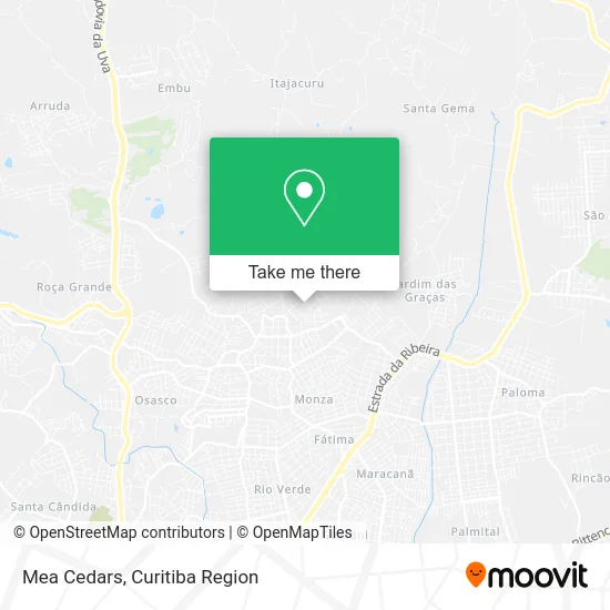
See Mea Cedars, Colombo, on the map
Public Transit to Mea Cedars in Colombo
Wondering how to get to Mea Cedars in Colombo? Moovit helps you find the best way to get to Mea Cedars with step-by-step directions from the nearest public transit station.
Moovit provides free maps and live directions to help you navigate through your city. View schedules, routes, timetables, and find out how long does it take to get to Mea Cedars in real time.
Looking for the nearest stop or station to Mea Cedars? Check out this list of stops closest to your destination: Rua Ângelo Lazaroto 136; Rua Heitor Busato 371; Rua Alfredo Miguel Badui; Avenida Prefeito João Batista Stocco; Avenida Prefeito João Batista Stocco.
Bus: B76 SÃO SEBASTIÃO / GUADALUPE, B78 SÃO GABRIEL / GUADALUPE, S16 GUARACI, U01 SEDE / MARACANÃ, S89 SÃO SEBASTIÃO / GUADALUPE (VIA SÃO GABRIEL), U11 ITAJACURU / SANTA GEMA (IMBUIAL).
Want to see if there’s another route that gets you there at an earlier time? Moovit helps you find alternative routes or times. Get directions from and directions to Mea Cedars easily from the Moovit App or Website.
We make riding to Mea Cedars easy, which is why over 1.5 million users, including users in Colombo, trust Moovit as the best app for public transit. You don’t need to download an individual bus app or train app, Moovit is your all-in-one transit app that helps you find the best bus time or train time available.
For information on prices of bus, costs and ride fares to Mea Cedars, please check the Moovit app.
Use the app to navigate to popular places including to the airport, hospital, stadium, grocery store, mall, coffee shop, school, college, and university.
Mea Cedars Address: Rua Alfredo Miguel Baduy, 400 São Gabriel Colombo-PR 83407-150 street in Colombo
- Super Menudo,
- Skate Shop Maresia,
- Mw Automotive,
- Aveplay Aviario e Comércio de Armarinhos Ltda - Me,
- Comercio de Confeccoes Sao Gabriel,
- Materiais de Construção São Sebastião,
- Andre Consertos e Manutencao de Veicu,
- Banca Emanuelle,
- Helena de Acucar,
- Vitoria Modas,
- Campo São Gabriel,
- Bar do Baiano,
- Arte Car Martelinho de Ouro,
- Aloya Produto Artesanal,
- Geovanny Entregas,
- Caratuva Bolsas,
- Machado Express,
- Panificadora Vo Irene,
- Erica Antunes,
- Lucis Armarinho
Places Near Mea Cedars (Colombo)
- Hhhhh, Fazendinha,
- Arena Da Baixada - Curitiba,
- Rua Martim Afonso 558, Mercês,
- Hospital Universitário Evangélico de Curitiba, Bigorrilho,
- Hospital Erasto Gaertner, Jardim Das Américas,
- Jockey Plaza Shopping Center, Tarumã,
- Parque Barigui, Mercês,
- Hospital Da Cruz Vermelha, Batel,
- Park Shopping Barigüi, Mossunguê,
- Rua General Mário Tourinho, Campina Do Siqueira,
- Hospital Angelina Caron, Campina Grande Do Sul,
- Shopping Palladium, Portão,
- Hospital Madalena Sofia, Bairro Alto,
- Campo Largo, Campo,
- Hospital Nossa Senhora Das Graças, Mercês,
- Hospital do Rocio, Campo,
- Jardim Botânico de Curitiba PR, Centro,
- Shopping Estação, Rebouças,
- Pontifícia Universidade Católica do Paraná (PUCPR), Prado Velho,
- Hospital de Clínicas (HC - UFPR), Centro
How to get to popular places in Curitiba Region with public transit
Get around Colombo by public transit!
Traveling around Colombo has never been so easy. See step by step directions as you travel to any attraction, street or major public transit station. View bus and train schedules, arrival times, service alerts and detailed routes on a map, so you know exactly how to get to anywhere in Colombo.
When traveling to any destination around Colombo use Moovit's Live Directions with Get Off Notifications to know exactly where and how far to walk, how long to wait for your line, and how many stops are left. Moovit will alert you when it's time to get off — no need to constantly re-check whether yours is the next stop.
Wondering how to use public transit in Colombo or how to pay for public transit in Colombo? Moovit public transit app can help you navigate your way with public transit easily, and at minimum cost. It includes public transit fees, ticket prices, and costs. Looking for a map of Colombo public transit lines? Moovit public transit app shows all public transit maps in Colombo with all Bus and Cable Car routes and stops on an interactive map.
Curitiba Region has 2 transit type(s), including: Bus and Cable Car, operated by several transit agencies, including Sistema Integrado de Mobilidade (URBS), Sistema Integrado de Mobilidade (AMEP), URBS (Cartões bancários e Dinheiro), URBS (Cartões bancários / Cartão URBS), AMEP (Cartões bancários / Cartão MetroCard), AMEP (Cartões bancários / Cartão MetroCard / Dinheiro), Viação Colombo (Dinheiro), TRIAR (Cartão TRIAR / Dinheiro), Empresa Curitiba Cerro Azul (Dinheiro), Expresso Nossa Senhora da Penha (Dinheiro), Empresa Campo Alto Tijucas (Dinheiro), Auto Viação São José (Cartão VEM / Dinheiro), BRT S/A (Cartão VEM / Dinheiro), TransPiedade (Cartão Cidadão / Dinheiro) and Oceânica Sul (Cartão Transporte / Dinheiro)