Directions to Med Ed Convenience Store (Albemarle County) with public transportation
The following transit lines have routes that pass near Med Ed Convenience Store
 Bus: AFTON EXPRESS, GREYHOUND US0600, T, BUCKINGHAM, CROZET.
- Train: NORTHEAST REGIONAL, CARDINAL, CRESCENT, FOOTHILLS EXPRESS.
How to get to Med Ed Convenience Store by bus?
Click on the bus route to see step by step directions with maps, line arrival times and updated time schedules.
How to get to Med Ed Convenience Store by train?
Click on the train route to see step by step directions with maps, line arrival times and updated time schedules.
Bus stops near Med Ed Convenience Store in Albemarle County
Train station near Med Ed Convenience Store in Albemarle County
- Charlottesville Amtrak Station, 21 min walk,VIEW
Bus lines to Med Ed Convenience Store in Albemarle County
What are the closest stations to Med Ed Convenience Store?
The closest stations to Med Ed Convenience Store are:
- Mccormick Rd at Uva Chapel is 323 yards away, 4 min walk.
- Emmet St @ Central Grounds Garage is 379 yards away, 5 min walk.
- University Of Virginia Bavaro Hall is 462 yards away, 6 min walk.
- Whitehead Rd @ Rice Hall is 632 yards away, 8 min walk.
- Charlottesville Amtrak Station is 1726 yards away, 21 min walk.
Which bus lines stop near Med Ed Convenience Store?
These bus lines stop near Med Ed Convenience Store: AFTON EXPRESS, GREYHOUND US0600, T.
Which train line stops near Med Ed Convenience Store?
NORTHEAST REGIONAL (Roanoke)
What’s the nearest train station to Med Ed Convenience Store in Albemarle County?
The nearest train station to Med Ed Convenience Store in Albemarle County is Charlottesville Amtrak Station. It’s a 21 min walk away.
What’s the nearest bus station to Med Ed Convenience Store in Albemarle County?
The nearest bus station to Med Ed Convenience Store in Albemarle County is Mccormick Rd at Uva Chapel. It’s a 4 min walk away.
What time is the first train to Med Ed Convenience Store in Albemarle County?
The NORTHEAST REGIONAL is the first train that goes to Med Ed Convenience Store in Albemarle County. It stops nearby at 10:07 AM.
What time is the last train to Med Ed Convenience Store in Albemarle County?
The CRESCENT is the last train that goes to Med Ed Convenience Store in Albemarle County. It stops nearby at 8:52 PM.
What time is the first bus to Med Ed Convenience Store in Albemarle County?
The AFTON EXPRESS is the first bus that goes to Med Ed Convenience Store in Albemarle County. It stops nearby at 6:07 AM.
What time is the last bus to Med Ed Convenience Store in Albemarle County?
The T is the last bus that goes to Med Ed Convenience Store in Albemarle County. It stops nearby at 10:30 PM.
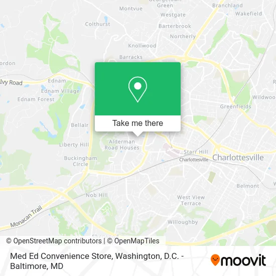
See Med Ed Convenience Store, Albemarle County, on the map
Public Transit to Med Ed Convenience Store in Albemarle County
Wondering how to get to Med Ed Convenience Store in Albemarle County? Moovit helps you find the best way to get to Med Ed Convenience Store with step-by-step directions from the nearest public transit station.
Moovit provides free maps and live directions to help you navigate through your city. View schedules, routes, timetables, and find out how long does it take to get to Med Ed Convenience Store in real time.
Looking for the nearest stop or station to Med Ed Convenience Store? Check out this list of stops closest to your destination: Mccormick Rd at Uva Chapel; Emmet St @ Central Grounds Garage; University Of Virginia Bavaro Hall; Whitehead Rd @ Rice Hall; Charlottesville Amtrak Station.
Bus: AFTON EXPRESS, GREYHOUND US0600, T, BUCKINGHAM, CROZET, CROZET, 29, CROZET.Train: NORTHEAST REGIONAL, CARDINAL, CRESCENT, FOOTHILLS EXPRESS.
Want to see if there’s another route that gets you there at an earlier time? Moovit helps you find alternative routes or times. Get directions from and directions to Med Ed Convenience Store easily from the Moovit App or Website.
We make riding to Med Ed Convenience Store easy, which is why over 1.5 million users, including users in Albemarle County, trust Moovit as the best app for public transit. You don’t need to download an individual bus app or train app, Moovit is your all-in-one transit app that helps you find the best bus time or train time available.
For information on prices of bus and train, costs and ride fares to Med Ed Convenience Store, please check the Moovit app.
Use the app to navigate to popular places including to the airport, hospital, stadium, grocery store, mall, coffee shop, school, college, and university.
Med Ed Convenience Store Address: 10 Bonny Castle Dr Charlottesville, VA 22904 street in Albemarle County
- Charlottesville VA,
- Einstein Bros Bagels,
- Bonnycastle Circle,
- The Castle,
- Menus Home Fresh Food Company,
- Bonnycastle House,
- Bonnycastle Snack Bar,
- Dabney House,
- Dell Tennis Courts,
- Mccormick Laundry,
- Hancock House,
- McCormick Road Residence Area,
- Kent House,
- Mccormick Road Houses,
- Metcalf House,
- Mccormick Mail Room,
- R1 Permit,
- Cost Plus World Market,
- Dell 1 Building,
- Dell Building 1
Places Near Med Ed Convenience Store (Albemarle County)
- Georgetown, Washington,
- Amazon Hq2, Arlington County,
- Westfield Montgomery Mall, Montgomery County,
- The Anthem, Washington,
- Washington National Cathedral, Washington,
- Pennsylvania Ave NW (3rd st and pennsylvania), Washington,
- PG Mall, Prince George's County,
- Rock Creek Tennis Center, Washington,
- Capital One Arena, Washington,
- Washington DC VA Medical Center, Washington,
- Basilica of the National Shrine, Washington,
- Museum Of The Bible, Washington,
- Sibley Memorial Hospital, Washington,
- M&T Bank Stadium, Baltimore,
- Marriott Marquis Washington, DC, Washington,
- Warner Theatre, Washington,
- National Museum of African American History and Culture, Washington,
- National Zoo, Washington,
- National Theatre, Washington,
- Camden Yards, Baltimore
How to get to popular places in Washington, D.C. - Baltimore, MD with public transit
Get around Albemarle County by public transit!
Traveling around Albemarle County has never been so easy. See step by step directions as you travel to any attraction, street or major public transit station. View bus and train schedules, arrival times, service alerts and detailed routes on a map, so you know exactly how to get to anywhere in Albemarle County.
When traveling to any destination around Albemarle County use Moovit's Live Directions with Get Off Notifications to know exactly where and how far to walk, how long to wait for your line, and how many stops are left. Moovit will alert you when it's time to get off — no need to constantly re-check whether yours is the next stop.
Wondering how to use public transit in Albemarle County or how to pay for public transit in Albemarle County? Moovit public transit app can help you navigate your way with public transit easily, and at minimum cost. It includes public transit fees, ticket prices, and costs. Looking for a map of Albemarle County public transit lines? Moovit public transit app shows all public transit maps in Albemarle County with all Bus, Train, Metro, Light Rail and Ferry routes and stops on an interactive map.
Washington, D.C. - Baltimore, MD has 5 transit type(s), including: Bus, Train, Metro, Light Rail and Ferry, operated by several transit agencies, including WMATA, Montgomery County Ride On, Fairfax Connector, TheBus, PRTC, DASH - Alexandria, Arlington Transit (ART), RTA of Central Maryland, MDOT MTA, MDOT MTA Light RailLink, MDOT MTA Commuter Bus, MDOT MTA Local Bus, FXBGO!, Virginia Railway Express (VRE) and MARC