How to get to Med-Lab by bus?
Click on the bus route to see step by step directions with maps, line arrival times and updated time schedules.
From 73 W. Flagler Street, Miami
58 minFrom Miami-Dade Tax Collector, Miami
50 minFrom SW 122 Ave & Coral Way, Kendale Lakes-Tamiami
66 minFrom Ministerio Internacional El Rey Jesus, Miami
36 minFrom Chase, Miami
69 minFrom SW 11th St / SW 3rd Ave, Miami
56 minFrom The Kampong, National Tropical Botanical Garden, Miami
70 minFrom Consulado General De Nicaragua, Miami
39 minFrom Miami Senior High School, Miami
31 minFrom Main Library - Miami-Dade Public Library System, Miami
49 min
Bus stops near Med-Lab in Miami
Bus lines to Med-Lab in Miami
What are the closest stations to Med-Lab?
The closest stations to Med-Lab are:
- Nw 62 Av@nw 7 St is 16 yards away, 1 min walk.
- Nw 7 St & 62 Av is 217 yards away, 3 min walk.
- Nw 7 St & Nw 60 Av is 702 yards away, 9 min walk.
Which bus lines stop near Med-Lab?
These bus lines stop near Med-Lab: 57, 7.
What’s the nearest bus station to Med-Lab in Miami?
The nearest bus station to Med-Lab in Miami is Nw 62 Av@nw 7 St. It’s a 1 min walk away.
What time is the first bus to Med-Lab in Miami?
The 7 is the first bus that goes to Med-Lab in Miami. It stops nearby at 5:19 AM.
What time is the last bus to Med-Lab in Miami?
The 7 is the last bus that goes to Med-Lab in Miami. It stops nearby at 12:02 AM.
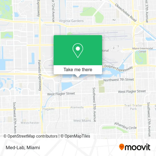
See Med-Lab, Miami, on the map
Public Transit to Med-Lab in Miami
Wondering how to get to Med-Lab in Miami? Moovit helps you find the best way to get to Med-Lab with step-by-step directions from the nearest public transit station.
Moovit provides free maps and live directions to help you navigate through your city. View schedules, routes, timetables, and find out how long does it take to get to Med-Lab in real time.
Looking for the nearest stop or station to Med-Lab? Check out this list of stops closest to your destination: Nw 62 Av@nw 7 St; Nw 7 St & 62 Av; Nw 7 St & Nw 60 Av.
Bus: 57, 7, MIAFLAG.
Want to see if there’s another route that gets you there at an earlier time? Moovit helps you find alternative routes or times. Get directions from and directions to Med-Lab easily from the Moovit App or Website.
We make riding to Med-Lab easy, which is why over 1.5 million users, including users in Miami, trust Moovit as the best app for public transit. You don’t need to download an individual bus app or train app, Moovit is your all-in-one transit app that helps you find the best bus time or train time available.
For information on prices of bus and train, costs and ride fares to Med-Lab, please check the Moovit app.
Use the app to navigate to popular places including to the airport, hospital, stadium, grocery store, mall, coffee shop, school, college, and university.
Med-Lab Address: 800 NW 62nd Ave Miami, FL 33126 street in Miami
- Gestoria Uruguaya,
- Sole Farms,
- Quick Hook Towing & Recovery,
- MTR & Associates,
- Waterford Business District,
- Multiexport Foods,
- Santiago Arka,
- Primedical Inc,
- Airlinepros,
- Fedex Express LAC Division,
- Super Pest Control,
- Sol Pa'Ellas,
- Federal Express Corporation,
- Aegfuels,
- Services International,
- Digicel Top Up,
- Blink Charging,
- Advantage Credit Counseling,
- Wehavedevs,
- Baxter
Places Near Med-Lab (Miami)
- Dolphin Mall Bus, Miami,
- Zoo Miami, Miami,
- Little Havana, Miami,
- Marlins Park, Miami,
- Dolphin Mall, Miami,
- Sawgrass mall ( FL ), Miami Beach,
- Bayside Marketplace, Miami,
- Sawgrass Mall, Miami,
- Miami Design District, Miami,
- Hard Rock Stadium, Miami Gardens,
- Miami Freedom Park, Miami,
- Port of Miami Cruise Terminal, Miami,
- Miami-Dade County Courthouse, Miami,
- Aventura Mall, Miami,
- Richard E. Gerstein Justice Building, Miami,
- Wynwood, Miami,
- Miami VA Hospital, Miami,
- Keiser University Flagship Campus, West Palm Beach,
- Brickell City Centre, Miami,
- Aventura Mall, Miami Beach
How to get to popular places in Miami with public transit
Get around Miami by public transit!
Traveling around Miami has never been so easy. See step by step directions as you travel to any attraction, street or major public transit station. View bus and train schedules, arrival times, service alerts and detailed routes on a map, so you know exactly how to get to anywhere in Miami.
When traveling to any destination around Miami use Moovit's Live Directions with Get Off Notifications to know exactly where and how far to walk, how long to wait for your line, and how many stops are left. Moovit will alert you when it's time to get off — no need to constantly re-check whether yours is the next stop.
Wondering how to use public transit in Miami or how to pay for public transit in Miami? Moovit public transit app can help you navigate your way with public transit easily, and at minimum cost. It includes public transit fees, ticket prices, and costs. Looking for a map of Miami public transit lines? Moovit public transit app shows all public transit maps in Miami with all Bus, Train, Light Rail and Ferry routes and stops on an interactive map.
Miami has 4 transit type(s), including: Bus, Train, Light Rail and Ferry, operated by several transit agencies, including Broward County Transit, Miami-Dade Transit, Metrorail, Palm Tran, Tri-Rail, Brightline, MARTY, City of Homestead Trolley, Key West Transit, Treasure Coast Connector, GoLine IRT, Amtrak, Greyhound-us, FlixBus-us and Aventura Express Shuttle Bus