Directions to Med-Response (Tazewell County) with public transportation
The following transit lines have routes that pass near Med-Response
 Bus: GREYHOUND US0140, MAIN, GOLD.
Bus stops near Med-Response in Tazewell County
Bus lines to Med-Response in Tazewell County
- Family Auto,
- Tobacco Hut and Vape,
- College Coin Laundry,
- Domino's,
- Ramella & Associates,
- Wells Fargo Advisors,
- EZ Rentals,
- SUBWAY,
- D.A. Davidson,
- Creative Cuts & Trims,
- Jonathan Yates do,
- Bluefield Internal Medicine PC,
- Crazy Tomato,
- C P Vasudevan MD,
- LabCorp,
- H2 Health,
- Kollege Mart,
- ATM,
- Foot Pain Center,
- Shell
Places Near Med-Response (Tazewell County)
- Amazon Hq2, Arlington County,
- Westfield Montgomery Mall, Montgomery County,
- Pennsylvania Ave NW (3rd st and pennsylvania), Washington,
- The Anthem, Washington,
- Georgetown, Washington,
- Camden Yards, Baltimore,
- National Theatre, Washington,
- Washington DC VA Medical Center, Washington,
- Capital One Arena, Washington,
- Museum Of The Bible, Washington,
- M&T Bank Stadium, Baltimore,
- National Museum of African American History and Culture, Washington,
- Sibley Memorial Hospital, Washington,
- National Zoo, Washington,
- Washington National Cathedral, Washington,
- Warner Theatre, Washington,
- PG Mall, Prince George's County,
- Rock Creek Tennis Center, Washington,
- Marriott Marquis Washington, DC, Washington,
- Basilica of the National Shrine, Washington
How to get to popular places in Washington, D.C. - Baltimore, MD with public transit
What are the closest stations to Med-Response?
The closest stations to Med-Response are:
- 2058 Leatherwood Ln at Westgate Shopping Center is 405 yards away, 6 min walk.
- 1000 Leatherwood Ln at Food City is 682 yards away, 9 min walk.
Which bus line stops near Med-Response?
GREYHOUND US0140 (Detroit Bus Station)
What’s the nearest bus station to Med-Response in Tazewell County?
The nearest bus station to Med-Response in Tazewell County is 2058 Leatherwood Ln at Westgate Shopping Center. It’s a 6 min walk away.
What time is the first bus to Med-Response in Tazewell County?
The GOLD is the first bus that goes to Med-Response in Tazewell County. It stops nearby at 7:35 AM.
What time is the last bus to Med-Response in Tazewell County?
The GOLD is the last bus that goes to Med-Response in Tazewell County. It stops nearby at 5:35 PM.
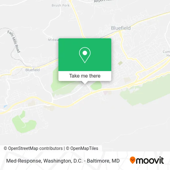
See Med-Response, Tazewell County, on the map
Public Transit to Med-Response in Tazewell County
Wondering how to get to Med-Response in Tazewell County? Moovit helps you find the best way to get to Med-Response with step-by-step directions from the nearest public transit station.
Moovit provides free maps and live directions to help you navigate through your city. View schedules, routes, timetables, and find out how long does it take to get to Med-Response in real time.
Looking for the nearest stop or station to Med-Response? Check out this list of stops closest to your destination: 2058 Leatherwood Ln at Westgate Shopping Center; 1000 Leatherwood Ln at Food City.
Bus: GREYHOUND US0140, MAIN, GOLD.
Want to see if there’s another route that gets you there at an earlier time? Moovit helps you find alternative routes or times. Get directions from and directions to Med-Response easily from the Moovit App or Website.
We make riding to Med-Response easy, which is why over 1.5 million users, including users in Tazewell County, trust Moovit as the best app for public transit. You don’t need to download an individual bus app or train app, Moovit is your all-in-one transit app that helps you find the best bus time or train time available.
For information on prices of bus and train, costs and ride fares to Med-Response, please check the Moovit app.
Use the app to navigate to popular places including to the airport, hospital, stadium, grocery store, mall, coffee shop, school, college, and university.
Med-Response Address: 2113 College Ave Bluefield, VA 24605 street in Tazewell County
Get around Tazewell County by public transit!
Traveling around Tazewell County has never been so easy. See step by step directions as you travel to any attraction, street or major public transit station. View bus and train schedules, arrival times, service alerts and detailed routes on a map, so you know exactly how to get to anywhere in Tazewell County.
When traveling to any destination around Tazewell County use Moovit's Live Directions with Get Off Notifications to know exactly where and how far to walk, how long to wait for your line, and how many stops are left. Moovit will alert you when it's time to get off — no need to constantly re-check whether yours is the next stop.
Wondering how to use public transit in Tazewell County or how to pay for public transit in Tazewell County? Moovit public transit app can help you navigate your way with public transit easily, and at minimum cost. It includes public transit fees, ticket prices, and costs. Looking for a map of Tazewell County public transit lines? Moovit public transit app shows all public transit maps in Tazewell County with all Bus, Train, Metro, Light Rail and Ferry routes and stops on an interactive map.
Washington, D.C. - Baltimore, MD has 5 transit type(s), including: Bus, Train, Metro, Light Rail and Ferry, operated by several transit agencies, including WMATA, Montgomery County Ride On, Fairfax Connector, TheBus, PRTC, DASH - Alexandria, Arlington Transit (ART), RTA of Central Maryland, MDOT MTA, MDOT MTA Light RailLink, MDOT MTA Commuter Bus, MDOT MTA Local Bus, FXBGO!, Virginia Railway Express (VRE) and MARC