How to get to Meijides Auto Service by bus?
Click on the bus route to see step by step directions with maps, line arrival times and updated time schedules.
From Ramada by Wyndham Miami Springs Miami International Airport, Miami
30 minFrom Venetian Pool, Miami
52 minFrom The Palms Hotel & Spa, Miami Beach
58 minFrom Lincoln Road, Miami Beach
48 minFrom Walmart Doral Offices, North Westside
61 minFrom Best Buy, Miami Beach
34 minFrom HIALEAH FLAMINGO NORTH ROUTE, North Westside
67 minFrom Hotel Riu Plaza Miami Beach, Miami Beach
59 minFrom Chase, Miami
66 minFrom W 49th St / NW 103rd St, Hialeah
62 min
How to get to Meijides Auto Service by train?
Click on the train route to see step by step directions with maps, line arrival times and updated time schedules.
Bus stops near Meijides Auto Service in Miami
Train station near Meijides Auto Service in Miami
- Santa Clara, 13 min walk,VIEW
Bus lines to Meijides Auto Service in Miami
What are the closest stations to Meijides Auto Service?
The closest stations to Meijides Auto Service are:
- Nw 20 St & Nw 18 Av is 101 yards away, 2 min walk.
- Nw 17 Av & Nw 20 St is 262 yards away, 4 min walk.
- Santa Clara is 1030 yards away, 13 min walk.
Which bus lines stop near Meijides Auto Service?
These bus lines stop near Meijides Auto Service: 17, 20, 32, MIAALP.
Which train line stops near Meijides Auto Service?
GREEN (Dadeland South Stat.rail Northbound→Palmetto Station Rail Northbound)
What’s the nearest train station to Meijides Auto Service in Miami?
The nearest train station to Meijides Auto Service in Miami is Santa Clara. It’s a 13 min walk away.
What’s the nearest bus station to Meijides Auto Service in Miami?
The nearest bus station to Meijides Auto Service in Miami is Nw 20 St & Nw 18 Av. It’s a 2 min walk away.
What time is the first train to Meijides Auto Service in Miami?
The ORANGE is the first train that goes to Meijides Auto Service in Miami. It stops nearby at 5:08 AM.
What time is the last train to Meijides Auto Service in Miami?
The GREEN is the last train that goes to Meijides Auto Service in Miami. It stops nearby at 12:37 AM.
What time is the first bus to Meijides Auto Service in Miami?
The 17 is the first bus that goes to Meijides Auto Service in Miami. It stops nearby at 4:15 AM.
What time is the last bus to Meijides Auto Service in Miami?
The 17 is the last bus that goes to Meijides Auto Service in Miami. It stops nearby at 1:27 AM.
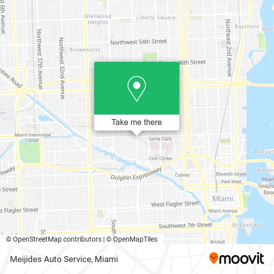
See Meijides Auto Service, Miami, on the map
Public Transit to Meijides Auto Service in Miami
Wondering how to get to Meijides Auto Service in Miami? Moovit helps you find the best way to get to Meijides Auto Service with step-by-step directions from the nearest public transit station.
Moovit provides free maps and live directions to help you navigate through your city. View schedules, routes, timetables, and find out how long does it take to get to Meijides Auto Service in real time.
Looking for the nearest stop or station to Meijides Auto Service? Check out this list of stops closest to your destination: Nw 20 St & Nw 18 Av; Nw 17 Av & Nw 20 St; Santa Clara.
Bus: 17, 20, 32, MIAALP.Train: GREEN, ORANGE.
Want to see if there’s another route that gets you there at an earlier time? Moovit helps you find alternative routes or times. Get directions from and directions to Meijides Auto Service easily from the Moovit App or Website.
We make riding to Meijides Auto Service easy, which is why over 1.5 million users, including users in Miami, trust Moovit as the best app for public transit. You don’t need to download an individual bus app or train app, Moovit is your all-in-one transit app that helps you find the best bus time or train time available.
For information on prices of bus and train, costs and ride fares to Meijides Auto Service, please check the Moovit app.
Use the app to navigate to popular places including to the airport, hospital, stadium, grocery store, mall, coffee shop, school, college, and university.
Meijides Auto Service Address: 1690 NW 20th St Miami, FL 33142 street in Miami
- La Nueva Catrachita,
- On the Run,
- Navy Federal Credit Union,
- Rambo Car Wash,
- Alapata Valero,
- Monchy's Patio Restaurant,
- ATM,
- Cryptobase Bitcoin ATM,
- Money Wire,
- El Encanto Medical Centers,
- Hyper Racing Scooter,
- D&G Construction Safety Supplies,
- Luna Haze,
- E & I Our Flowers,
- TD Bank,
- Car Lock Out,
- Cap 1,
- smart Start Ignition Interlock,
- Bitbox Bitcoin ATM,
- Urribarri Jesus
Places Near Meijides Auto Service (Miami)
- Zoo Miami, Miami,
- Richard E. Gerstein Justice Building, Miami,
- Miami Design District, Miami,
- Port of Miami Cruise Terminal, Miami,
- Hard Rock Stadium, Miami Gardens,
- Keiser University Flagship Campus, West Palm Beach,
- Little Havana, Miami,
- Dolphin Mall Bus, Miami,
- Sawgrass mall ( FL ), Miami Beach,
- Miami-Dade County Courthouse, Miami,
- Dolphin Mall, Miami,
- Bayside Marketplace, Miami,
- Brickell City Centre, Miami,
- Wynwood, Miami,
- Marlins Park, Miami,
- Sawgrass Mall, Miami,
- 1351 NW 12th St, Miami,
- Aventura Mall, Miami,
- Miami Freedom Park, Miami,
- Aventura Mall, Miami Beach
How to get to popular places in Miami with public transit
Get around Miami by public transit!
Traveling around Miami has never been so easy. See step by step directions as you travel to any attraction, street or major public transit station. View bus and train schedules, arrival times, service alerts and detailed routes on a map, so you know exactly how to get to anywhere in Miami.
When traveling to any destination around Miami use Moovit's Live Directions with Get Off Notifications to know exactly where and how far to walk, how long to wait for your line, and how many stops are left. Moovit will alert you when it's time to get off — no need to constantly re-check whether yours is the next stop.
Wondering how to use public transit in Miami or how to pay for public transit in Miami? Moovit public transit app can help you navigate your way with public transit easily, and at minimum cost. It includes public transit fees, ticket prices, and costs. Looking for a map of Miami public transit lines? Moovit public transit app shows all public transit maps in Miami with all Bus, Train, Light Rail and Ferry routes and stops on an interactive map.
Miami has 4 transit type(s), including: Bus, Train, Light Rail and Ferry, operated by several transit agencies, including Broward County Transit, Miami-Dade Transit, Metrorail, Palm Tran, Tri-Rail, Brightline, MARTY, City of Homestead Trolley, Key West Transit, Treasure Coast Connector, GoLine IRT, Amtrak, Greyhound-us, FlixBus-us and Aventura Express Shuttle Bus