How to get to Mennecy by bus?
Click on the bus route to see step by step directions with maps, line arrival times and updated time schedules.
Bus stops near Mennecy
RER station near Mennecy
- Mennecy, 25 min walk,VIEW
Bus lines to Mennecy
What are the closest stations to Mennecy?
The closest stations to Mennecy are:
- Buisson Houdard is 157 meters away, 3 min walk.
- Jeannotte is 231 meters away, 4 min walk.
- Charles de Gaulle is 505 meters away, 7 min walk.
- Tournenfils is 579 meters away, 8 min walk.
- Mennecy is 1941 meters away, 25 min walk.
Which RER line stops near Mennecy?
D (Malesherbes/ Melun/ Corbeil-Essonnes /Juvisy)
Which bus lines stop near Mennecy?
These bus lines stop near Mennecy: 4251, 4307, 4309.
What’s the nearest bus station to Mennecy?
The nearest bus station to Mennecy is Buisson Houdard. It’s a 3 min walk away.
What’s the nearest RER station to Mennecy?
The nearest RER station to Mennecy is Mennecy. It’s a 25 min walk away.
What time is the first RER to Mennecy?
The D is the first RER that goes to Mennecy. It stops nearby at 6:17 AM.
What time is the last RER to Mennecy?
The D is the last RER that goes to Mennecy. It stops nearby at 11:17 PM.
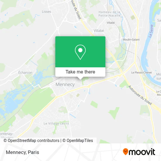
See Mennecy on the map
Public Transportation to Mennecy
Wondering how to get to Mennecy? Moovit helps you find the best way to get to Mennecy with step-by-step directions from the nearest public transit station.
Moovit provides free maps and live directions to help you navigate through your city. View schedules, routes, timetables, and find out how long does it take to get to Mennecy in real time.
Looking for the nearest stop or station to Mennecy? Check out this list of stops closest to your destination: Buisson Houdard; Jeannotte; Charles de Gaulle; Tournenfils; Mennecy.
RER: D.Bus: 4251, 4307, 4309, 4340, 4327, 4329, 4318, TÀD 4318, 4332.
Want to see if there’s another route that gets you there at an earlier time? Moovit helps you find alternative routes or times. Get directions from and directions to Mennecy easily from the Moovit App or Website.
We make riding to Mennecy easy, which is why over 1.5 million users, including users in Mennecy, trust Moovit as the best app for public transit. You don’t need to download an individual bus app or train app, Moovit is your all-in-one transit app that helps you find the best bus time or train time available.
For information on prices of bus and RER, costs and ride fares to Mennecy, please check the Moovit app.
Use the app to navigate to popular places including to the airport, hospital, stadium, grocery store, mall, coffee shop, school, college, and university.
Location: Mennecy, Paris
- Maison Départementale Des Solidarités,
- 1 Avenue du Buisson Houdart,
- Stéphane-Élie Albou,
- Jeannotte,
- Demenagement Maroc,
- Creapole 2,
- Zac de Montvrain,
- 9 Avenue du Buisson Houdart,
- Esso,
- 16 Bd Charles de Gaulle,
- Informatique Bureau Services,
- Station BP de Mennecy,
- Amazon Locker-Adib,
- 1 Rue Paul Emile Victor,
- IZIVIA Fast,
- Bowling de Mennecy,
- Ohlala -Bar à Cocktails,
- Maison du Frais,
- Decor Men,
- Messan
Places Near Mennecy
- Galeries Lafayette, Paris,
- 29 Rue Manin, Paris,
- Hôpital Pitié Salpêtrière, Paris,
- Hôpital Henri Mondor, Creteil,
- Galeries Lafayette Haussmann, Paris,
- Gare Routière Flixbus, Paris,
- Fondation Louis Vuitton, Paris,
- Théâtre Mogador, Paris,
- Atelier Des Lumieres, Paris,
- Marché Saint-Pierre, Paris,
- Centre Hospitalier des 15/20, Paris,
- Hôpital Beaujon, Clichy,
- Hopital Lariboisière, Paris,
- Beaugrenelle, Paris,
- Hopital Foch, Suresnes,
- Hôpital Saint-Joseph, Paris,
- Hôpital Cochin, Paris,
- Hôpital Necker, Paris,
- Créteil Soleil, Creteil,
- Hôpital de la Pitié-Salpêtrière, Paris
How to get to popular places in Paris with public transit
Get around Mennecy by public transit!
Traveling around Mennecy has never been so easy. See step by step directions as you travel to any attraction, street or major public transit station. View bus and train schedules, arrival times, service alerts and detailed routes on a map, so you know exactly how to get to anywhere in Mennecy.
When traveling to any destination around Mennecy use Moovit's Live Directions with Get Off Notifications to know exactly where and how far to walk, how long to wait for your line, and how many stops are left. Moovit will alert you when it's time to get off — no need to constantly re-check whether yours is the next stop.
Wondering how to use public transit in Mennecy or how to pay for public transit in Mennecy? Moovit public transit app can help you navigate your way with public transit easily, and at minimum cost. It includes public transit fees, ticket prices, and costs. Looking for a map of Mennecy public transit lines? Moovit public transit app shows all public transit maps in Mennecy with all Bus, Train, Metro, Light Rail, RER, Funicular and Gondola routes and stops on an interactive map.
Paris has 7 transit type(s), including: Bus, Train, Metro, Light Rail, RER, Funicular and Gondola, operated by several transit agencies, including RATP, RER, RER Bus de remplacement, Train, Train Bus de remplacement, Tramway Bus de remplacement, TER, ADP, Magical Shuttle, Argenteuil - Boucles de Seine, Autocars Dominique, Bièvre, Brie et 2 Morin, Le Bus - C.C. du Clermontois and Cœur d’Essonne