How to get to Mep Engineering by bus?
Click on the bus route to see step by step directions with maps, line arrival times and updated time schedules.
From Fontainebleau Miami Beach, Miami Beach
50 minFrom Best Western Plus Atlantic Beach Resort Miami Beach, Miami Beach
50 minFrom Hialeah Hospital Emergency Room, Hialeah
57 minFrom Sawgrass Mills, Fort Lauderdale, Miami Beach
58 minFrom Mid-Beach, Miami Beach
49 minFrom Hyatt Centric Brickell Miami, Miami
55 minFrom Cadillac Hotel & Beach Club, Miami Beach
51 minFrom Nordstrom Rack, Miami
42 minFrom Miami Beach Boardwalk, Miami Beach
51 minFrom Alton Rd & 5th Street, Miami Beach
47 min
How to get to Mep Engineering by train?
Click on the train route to see step by step directions with maps, line arrival times and updated time schedules.
Bus stops near Mep Engineering in Miami
Train station near Mep Engineering in Miami
- Santa Clara, 47 min walk,VIEW
Bus lines to Mep Engineering in Miami
What are the closest stations to Mep Engineering?
The closest stations to Mep Engineering are:
- Nw 17 Av & Nw 27 St is 116 yards away, 2 min walk.
- Nw 20 St & Nw 17 Av is 456 yards away, 6 min walk.
- Santa Clara is 3957 yards away, 47 min walk.
Which bus lines stop near Mep Engineering?
These bus lines stop near Mep Engineering: 17, 20, 32, 36.
Which train lines stop near Mep Engineering?
These train lines stop near Mep Engineering: GREEN, ORANGE.
What’s the nearest bus station to Mep Engineering in Miami?
The nearest bus station to Mep Engineering in Miami is Nw 17 Av & Nw 27 St. It’s a 2 min walk away.
What time is the first train to Mep Engineering in Miami?
The ORANGE is the first train that goes to Mep Engineering in Miami. It stops nearby at 5:08 AM.
What time is the last train to Mep Engineering in Miami?
The GREEN is the last train that goes to Mep Engineering in Miami. It stops nearby at 12:37 AM.
What time is the first bus to Mep Engineering in Miami?
The 17 is the first bus that goes to Mep Engineering in Miami. It stops nearby at 4:16 AM.
What time is the last bus to Mep Engineering in Miami?
The 17 is the last bus that goes to Mep Engineering in Miami. It stops nearby at 1:25 AM.
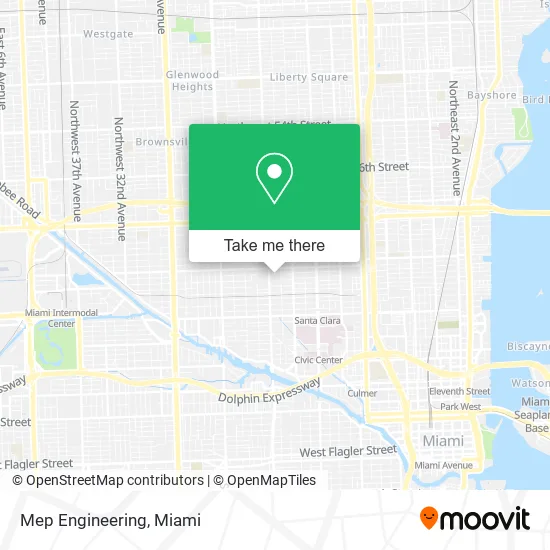
See Mep Engineering, Miami, on the map
Public Transit to Mep Engineering in Miami
Wondering how to get to Mep Engineering in Miami? Moovit helps you find the best way to get to Mep Engineering with step-by-step directions from the nearest public transit station.
Moovit provides free maps and live directions to help you navigate through your city. View schedules, routes, timetables, and find out how long does it take to get to Mep Engineering in real time.
Looking for the nearest stop or station to Mep Engineering? Check out this list of stops closest to your destination: Nw 17 Av & Nw 27 St; Nw 20 St & Nw 17 Av; Santa Clara.
Bus: 17, 20, 32, 36, MIAALP.Train: GREEN, ORANGE.
Want to see if there’s another route that gets you there at an earlier time? Moovit helps you find alternative routes or times. Get directions from and directions to Mep Engineering easily from the Moovit App or Website.
We make riding to Mep Engineering easy, which is why over 1.5 million users, including users in Miami, trust Moovit as the best app for public transit. You don’t need to download an individual bus app or train app, Moovit is your all-in-one transit app that helps you find the best bus time or train time available.
For information on prices of bus and train, costs and ride fares to Mep Engineering, please check the Moovit app.
Use the app to navigate to popular places including to the airport, hospital, stadium, grocery store, mall, coffee shop, school, college, and university.
Mep Engineering Address: 1590 NW 27th St Miami, FL 33142 street in Miami
- Ifbb Iramis Portero LL,
- Allapattah,
- City of Miami Parks,
- Taino Multiservices Express,
- Major Leaf & Tobacco Products,
- ATM,
- Gio's Style Barber Shop,
- GMC Coin Laundry,
- Token by D3adstock Ave,
- Empire Food Boat,
- Doctors Medical Centers by Cano Health,
- Ewtn,
- Mision Nuestra Señora de la Altagracia,
- Specialized Therapy Center,
- Yaris Liquor LLC,
- Aledani Transport,
- Bastillo Cafeteria,
- Lucky Llama Duct Cleaners,
- Classic Wheel Repair,
- Class Master
Places Near Mep Engineering (Miami)
- Miami Design District, Miami,
- Bayside Marketplace, Miami,
- Zoo Miami, Miami,
- Aventura Mall, Miami Beach,
- Aventura Mall, Miami,
- Dolphin Mall Bus, Miami,
- Miami Freedom Park, Miami,
- Keiser University Flagship Campus, West Palm Beach,
- Richard E. Gerstein Justice Building, Miami,
- Dolphin Mall, Miami,
- Wynwood, Miami,
- Miami VA Hospital, Miami,
- Miami-Dade County Courthouse, Miami,
- Port of Miami Cruise Terminal, Miami,
- Brickell City Centre, Miami,
- Little Havana, Miami,
- Sawgrass Mall, Miami,
- Marlins Park, Miami,
- Sawgrass mall ( FL ), Miami Beach,
- Hard Rock Stadium, Miami Gardens
How to get to popular places in Miami with public transit
Get around Miami by public transit!
Traveling around Miami has never been so easy. See step by step directions as you travel to any attraction, street or major public transit station. View bus and train schedules, arrival times, service alerts and detailed routes on a map, so you know exactly how to get to anywhere in Miami.
When traveling to any destination around Miami use Moovit's Live Directions with Get Off Notifications to know exactly where and how far to walk, how long to wait for your line, and how many stops are left. Moovit will alert you when it's time to get off — no need to constantly re-check whether yours is the next stop.
Wondering how to use public transit in Miami or how to pay for public transit in Miami? Moovit public transit app can help you navigate your way with public transit easily, and at minimum cost. It includes public transit fees, ticket prices, and costs. Looking for a map of Miami public transit lines? Moovit public transit app shows all public transit maps in Miami with all Bus, Train, Light Rail and Ferry routes and stops on an interactive map.
Miami has 4 transit type(s), including: Bus, Train, Light Rail and Ferry, operated by several transit agencies, including Broward County Transit, Miami-Dade Transit, Metrorail, Palm Tran, Tri-Rail, Brightline, MARTY, City of Homestead Trolley, Key West Transit, Treasure Coast Connector, GoLine IRT, Amtrak, Greyhound-us, FlixBus-us and Aventura Express Shuttle Bus