Directions to Mercado Becker (Pinheirinho) with public transportation
The following transit lines have routes that pass near Mercado Becker
How to get to Mercado Becker by bus?
Click on the bus route to see step by step directions with maps, line arrival times and updated time schedules.
From Hospital Sugisawa, Rebouças
33 minFrom Shopping Estação, Rebouças
37 minFrom Jardim das Américas, Jardim Das Américas
48 minFrom Praça Rui Barbosa, Centro
39 minFrom Estação Tubo Praça Eufrásio Correia, Centro
32 minFrom Rua Professor Brasílio Ovídio da Costa 1703, Santa Quitéria
39 minFrom Avenida Silva Jardim, Rebouças
36 minFrom Rua Visconde do Rio Branco 1488, Centro
43 minFrom Avenida Silva Jardim, Rebouças
42 minFrom Rua Ana Berta Roskamp, Jardim Das Américas
46 min
Bus stops near Mercado Becker in Pinheirinho
Bus lines to Mercado Becker in Pinheirinho
- 600 TEQUALY / QUARTEL GENERAL, Terminal Pinheirinho → Quartel General,VIEW
- 632 QUARTEL GENERAL, Quartel General → Terminal Pinheirinho,VIEW
- H11 ARAUCÁRIA / PINHEIRINHO, Terminal Pinheirinho → Terminal Central Araucária,VIEW
- 060 INTERBAIRROS VI, Terminal Pinheirinho → Terminal Campo Comprido,VIEW
- F71 FAZENDA / GUADALUPE, Terminal Guadalupe → Terminal Fazenda,VIEW
- G72 AREIA BRANCA / GUADALUPE, Terminal Guadalupe → Areia Branca,VIEW
- G72 QUITANDINHA / GUADALUPE, Terminal Guadalupe → Quitandinha,VIEW
- 636 RIO NEGRO, Terminal Pinheirinho → Rio Negro,VIEW
- 644 PINHEIRINHO / CIC, Terminal Pinheirinho → Terminal CIC,VIEW
What are the closest stations to Mercado Becker?
The closest stations to Mercado Becker are:
- R. Orestes Códega, 446 is 39 meters away, 1 min walk.
- R. Marechal Otávio Saldanha Mazza, 8600 - Jardinete Ângelo Cavol is 474 meters away, 7 min walk.
Which bus lines stop near Mercado Becker?
These bus lines stop near Mercado Becker: 632 QUARTEL GENERAL, F71 FAZENDA / GUADALUPE, G72 AREIA BRANCA / GUADALUPE, H11 ARAUCÁRIA / PINHEIRINHO.
What’s the nearest bus station to Mercado Becker in Pinheirinho?
The nearest bus station to Mercado Becker in Pinheirinho is R. Orestes Códega, 446. It’s a 1 min walk away.
What time is the first bus to Mercado Becker in Pinheirinho?
The 632 QUARTEL GENERAL is the first bus that goes to Mercado Becker in Pinheirinho. It stops nearby at 5:16 AM.
What time is the last bus to Mercado Becker in Pinheirinho?
The H11 ARAUCÁRIA / PINHEIRINHO is the last bus that goes to Mercado Becker in Pinheirinho. It stops nearby at 12:42 AM.
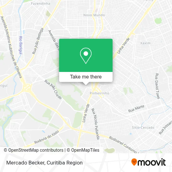
See Mercado Becker, Pinheirinho, on the map
Public Transit to Mercado Becker in Pinheirinho
Wondering how to get to Mercado Becker in Pinheirinho? Moovit helps you find the best way to get to Mercado Becker with step-by-step directions from the nearest public transit station.
Moovit provides free maps and live directions to help you navigate through your city. View schedules, routes, timetables, and find out how long does it take to get to Mercado Becker in real time.
Looking for the nearest stop or station to Mercado Becker? Check out this list of stops closest to your destination: R. Orestes Códega; R. Marechal Otávio Saldanha Mazza.
Bus: 632 QUARTEL GENERAL, F71 FAZENDA / GUADALUPE, G72 AREIA BRANCA / GUADALUPE, H11 ARAUCÁRIA / PINHEIRINHO, 600 TEQUALY / QUARTEL GENERAL, 060 INTERBAIRROS VI, G72 QUITANDINHA / GUADALUPE.
Want to see if there’s another route that gets you there at an earlier time? Moovit helps you find alternative routes or times. Get directions from and directions to Mercado Becker easily from the Moovit App or Website.
We make riding to Mercado Becker easy, which is why over 1.5 million users, including users in Pinheirinho, trust Moovit as the best app for public transit. You don’t need to download an individual bus app or train app, Moovit is your all-in-one transit app that helps you find the best bus time or train time available.
For information on prices of bus, costs and ride fares to Mercado Becker, please check the Moovit app.
Use the app to navigate to popular places including to the airport, hospital, stadium, grocery store, mall, coffee shop, school, college, and university.
Mercado Becker Address: Rua Orestes Codega, 492 Pinheirinho Curitiba-PR 81150-200 street in Pinheirinho
- Farol do Saber José de Alencar,
- Wf Obras,
- E. M. São Mateus do Sul,
- Capri Residence,
- Residencial Capri,
- Edifício Residencial Bela Vista,
- Araujo Representacoes,
- Alvo,
- Kraft Ferragens,
- Lava Car do Tuti,
- Box Rodeal Vidros,
- Rua Osorio Damas De Oliveira,
- Vikings Power,
- Docarmo,
- Mayra Suelem Macedo,
- Igreja Presbiteriana do Pinheirinho,
- Braço Forte,
- Pet Shop Patinhas,
- Curitiba Clean,
- Neuza de Fátima Fagundes & Cia
Places Near Mercado Becker (Pinheirinho)
- Parque Barigui, Mercês,
- Hhhhh, Fazendinha,
- Hospital Angelina Caron, Campina Grande Do Sul,
- Arena Da Baixada - Curitiba,
- Shopping Palladium, Portão,
- Hospital Erasto Gaertner, Jardim Das Américas,
- Hospital Madalena Sofia, Bairro Alto,
- Shopping Estação, Rebouças,
- Rua Martim Afonso 558, Mercês,
- Hospital Da Cruz Vermelha, Batel,
- Hospital do Rocio, Campo,
- Jardim Botânico de Curitiba PR, Centro,
- Rua General Mário Tourinho, Campina Do Siqueira,
- Pontifícia Universidade Católica do Paraná (PUCPR), Prado Velho,
- Hospital Do Senhor - Madre Virgínia, São José Dos Pinhais,
- Hospital de Clínicas (HC - UFPR), Centro,
- Hospital Nossa Senhora Das Graças, Mercês,
- Hospital Universitário Evangélico de Curitiba, Bigorrilho,
- Park Shopping Barigüi, Mossunguê,
- Jockey Plaza Shopping Center, Tarumã
How to get to popular places in Curitiba Region with public transit
Get around Pinheirinho by public transit!
Traveling around Pinheirinho has never been so easy. See step by step directions as you travel to any attraction, street or major public transit station. View bus and train schedules, arrival times, service alerts and detailed routes on a map, so you know exactly how to get to anywhere in Pinheirinho.
When traveling to any destination around Pinheirinho use Moovit's Live Directions with Get Off Notifications to know exactly where and how far to walk, how long to wait for your line, and how many stops are left. Moovit will alert you when it's time to get off — no need to constantly re-check whether yours is the next stop.
Wondering how to use public transit in Pinheirinho or how to pay for public transit in Pinheirinho? Moovit public transit app can help you navigate your way with public transit easily, and at minimum cost. It includes public transit fees, ticket prices, and costs. Looking for a map of Pinheirinho public transit lines? Moovit public transit app shows all public transit maps in Pinheirinho with all Bus and Cable Car routes and stops on an interactive map.
Curitiba Region has 2 transit type(s), including: Bus and Cable Car, operated by several transit agencies, including Sistema Integrado de Mobilidade (URBS), Sistema Integrado de Mobilidade (AMEP), URBS (Cartões bancários e Dinheiro), URBS (Cartões bancários / Cartão URBS), AMEP (Cartões bancários / Cartão MetroCard), AMEP (Cartões bancários / Cartão MetroCard / Dinheiro), Viação Colombo (Dinheiro), TRIAR (Cartão TRIAR / Dinheiro), Empresa Curitiba Cerro Azul (Dinheiro), Expresso Nossa Senhora da Penha (Dinheiro), Empresa Campo Alto Tijucas (Dinheiro), Auto Viação São José (Cartão VEM / Dinheiro), BRT S/A (Cartão VEM / Dinheiro), TransPiedade (Cartão Cidadão / Dinheiro) and Oceânica Sul (Cartão Transporte / Dinheiro)