How to get to Mercearia by bus?
Click on the bus route to see step by step directions with maps, line arrival times and updated time schedules.
From Estrada da Cachamorra, Campo Grande
54 minFrom Supervia - Central do Brasil X Santa Cruz (Expresso), Santa Cruz
51 minFrom Rua Itueira, Campo Grande
42 minFrom Estrada Do Mato Alto, Campo Grande
47 minFrom Ct Ninho das Garças - Guaratiba, Guaratiba
80 minFrom Hospital da Mulher Mariska Ribeiro, Bangu
57 minFrom Avenida das Américas / BRT Transoeste, Guaratiba
62 minFrom Praça 1º de Maio, Bangu
67 minFrom Vila Kennedy, Vila Kennedy
42 minFrom Hospital Eduardo Rabello, Senador Vasconcelos
53 min
Bus stops near Mercearia in Campo Grande
Train station near Mercearia in Campo Grande
- Benjamin Do Monte, 28 min walk,VIEW
Bus lines to Mercearia in Campo Grande
What are the closest stations to Mercearia?
The closest stations to Mercearia are:
- Estrada Do Tingui, 2224-2266 is 431 meters away, 6 min walk.
- Estrada Santa Maria, 2325-2347 is 641 meters away, 9 min walk.
- Estrada Santa Maria, 2322 is 675 meters away, 9 min walk.
- Estrada Carvalho Ramos, 3255 is 777 meters away, 11 min walk.
- Benjamin Do Monte is 2128 meters away, 28 min walk.
Which bus lines stop near Mercearia?
These bus lines stop near Mercearia: 119T, 821, 841.
What’s the nearest train station to Mercearia in Campo Grande?
The nearest train station to Mercearia in Campo Grande is Benjamin Do Monte. It’s a 28 min walk away.
What’s the nearest bus station to Mercearia in Campo Grande?
The nearest bus station to Mercearia in Campo Grande is Estrada Do Tingui, 2224-2266. It’s a 6 min walk away.
What time is the first train to Mercearia in Campo Grande?
The RAMAL SANTA CRUZ is the first train that goes to Mercearia in Campo Grande. It stops nearby at 4:07 AM.
What time is the last train to Mercearia in Campo Grande?
The RAMAL SANTA CRUZ is the last train that goes to Mercearia in Campo Grande. It stops nearby at 11:47 PM.
What time is the first bus to Mercearia in Campo Grande?
The SN 821 is the first bus that goes to Mercearia in Campo Grande. It stops nearby at 3:14 AM.
What time is the last bus to Mercearia in Campo Grande?
The SN 821 is the last bus that goes to Mercearia in Campo Grande. It stops nearby at 2:36 AM.
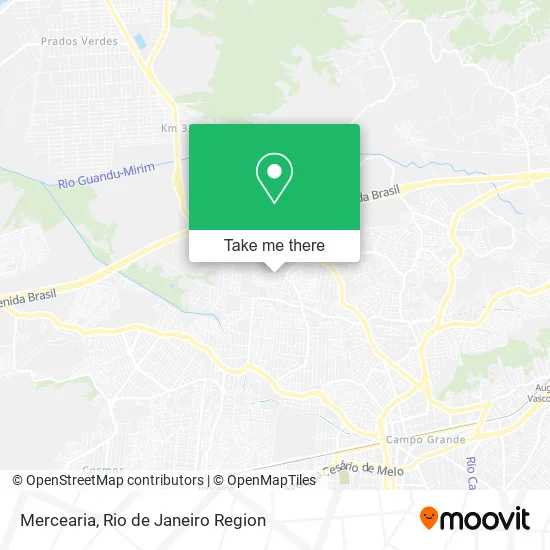
See Mercearia, Campo Grande, on the map
Public Transit to Mercearia in Campo Grande
Wondering how to get to Mercearia in Campo Grande? Moovit helps you find the best way to get to Mercearia with step-by-step directions from the nearest public transit station.
Moovit provides free maps and live directions to help you navigate through your city. View schedules, routes, timetables, and find out how long does it take to get to Mercearia in real time.
Looking for the nearest stop or station to Mercearia? Check out this list of stops closest to your destination: Estrada Do Tingui; Estrada Santa Maria; Estrada Santa Maria; Estrada Carvalho Ramos; Benjamin Do Monte.
Bus: 119T, 821, 841, 757, 2308, SN 821, 822, 808.Train: RAMAL SANTA CRUZ.
Want to see if there’s another route that gets you there at an earlier time? Moovit helps you find alternative routes or times. Get directions from and directions to Mercearia easily from the Moovit App or Website.
We make riding to Mercearia easy, which is why over 1.5 million users, including users in Campo Grande, trust Moovit as the best app for public transit. You don’t need to download an individual bus app or train app, Moovit is your all-in-one transit app that helps you find the best bus time or train time available.
For information on prices of bus, costs and ride fares to Mercearia, please check the Moovit app.
Use the app to navigate to popular places including to the airport, hospital, stadium, grocery store, mall, coffee shop, school, college, and university.
Mercearia Address: Rua Frederico de Menezes, Campo Grande Rio de Janeiro-RJ 23075-570 street in Campo Grande
- Igreja Evangelica Assembléia de Deus do Tingui,
- Rua Frederico de Menezes,
- Rua José Fontes Filho,
- Eu Aventureiro,
- Salao de Festas dos Anjos,
- Braga,
- Rua Projetada D 1000,
- Lavanderia e Tinturaria Confiança,
- Rua Ayrton Senna,
- Mansao do Marlon,
- Congregacao Tingui,
- Bf Refrigeração,
- Studio Cell,
- Rua Ayrton Sena Ac R Frederico Menezes 14,
- Rua Gonzaga Junior,
- Robson Caetano Julio,
- Dallas Barbeiro,
- Rua Ayrton Senna 233,
- Academia Castro Alves,
- Escola Municipal Luiz Edmundo
Places Near Mercearia (Campo Grande)
- Rua Ulysses Guimarães 16, Cidade Nova,
- Praia do Arpoador, Ipanema,
- Shopping Downtown, Barra Da Tijuca,
- Norte Shopping, Cachambi,
- Rua Licínio Cardoso, São Francisco Xavier,
- Museu Do Amanhã, Centro,
- Feira Livre da Gloria, Glória,
- Niterói, Niterói,
- Hospital Federal Cardoso Fontes, Jacarepaguá,
- Rio De Janeiro,
- Feirão De Malhas, Duque De Caxias,
- Hospital Municipal Ronaldo Gazolla, Acari,
- Avenida Rio Branco, Centro,
- Avenida Venezuela 134, Saúde,
- Shopping Nova América, Del Castilho,
- Hospital Federal Do Andaraí, Andaraí,
- Hospital Pedro Ernesto, Vila Isabel,
- Rodoviária Novo Rio (Rodoviária do Rio de Janeiro), Santo Cristo,
- Shopping RioSul, Botafogo,
- Shopping Rio Sul, Botafogo
How to get to popular places in Rio de Janeiro Region with public transit
Get around Campo Grande by public transit!
Traveling around Campo Grande has never been so easy. See step by step directions as you travel to any attraction, street or major public transit station. View bus and train schedules, arrival times, service alerts and detailed routes on a map, so you know exactly how to get to anywhere in Campo Grande.
When traveling to any destination around Campo Grande use Moovit's Live Directions with Get Off Notifications to know exactly where and how far to walk, how long to wait for your line, and how many stops are left. Moovit will alert you when it's time to get off — no need to constantly re-check whether yours is the next stop.
Wondering how to use public transit in Campo Grande or how to pay for public transit in Campo Grande? Moovit public transit app can help you navigate your way with public transit easily, and at minimum cost. It includes public transit fees, ticket prices, and costs. Looking for a map of Campo Grande public transit lines? Moovit public transit app shows all public transit maps in Campo Grande with all Bus, Train, Metro, Light Rail, Ferry, Cable Car, Gondola and Funicular routes and stops on an interactive map.
Rio de Janeiro Region has 8 transit type(s), including: Bus, Train, Metro, Light Rail, Ferry, Cable Car, Gondola and Funicular, operated by several transit agencies, including TrensRJ, Metrô Rio, VLT Carioca, Barcas Rio, BRT MOBI-Rio, Auto Viação Alpha, Auto Viação Tijuca, Gire Transportes, Transurb, Viação Nossa Senhora das Graças, Consórcio INTERSUL, Braso Lisboa (Municipal), Caprichosa Auto Ônibus, Auto Viação Três Amigos and Rodoviária Âncora Matias