Directions to Mercearia Do Nego (Goianápolis) with public transportation
The following transit lines have routes that pass near Mercearia Do Nego
 Bus: 771.
How to get to Mercearia Do Nego by bus?
Click on the bus route to see step by step directions with maps, line arrival times and updated time schedules.
From Jardim das Oliveiras, Goiania
65 minFrom Santa Branca Ecoturismo, Terezópolis De Goiás
269 minFrom BR 060,Km 131,8 s/n, Goianápolis
253 minFrom Rod. Br 153/060, Km 155 s/n, Terezópolis De Goiás
272 minFrom Residencial Irisville, Goiania
81 minFrom Residencial Flor do Ipê, Senador Canedo
81 minFrom Residencial Aldeia do Vale, U.T.P. Ceasa/Aldeia Do Vale
158 minFrom Vila Rica, Goiania
195 minFrom Jardim Do Lago, Senador Canedo
123 min
Bus stop near Mercearia Do Nego in Goianápolis
- Av. Manoel Cardoso Godoy, 6 min walk,VIEW
Bus lines to Mercearia Do Nego in Goianápolis
- 771, T. Novo Mundo ⇆ Goianápolis,VIEW
What are the closest stations to Mercearia Do Nego?
The closest stations to Mercearia Do Nego are:
- Av. Manoel Cardoso Godoy is 428 meters away, 6 min walk.
Which bus line stops near Mercearia Do Nego?
771 (T. Novo Mundo → Goianápolis → Terezópolis)
What’s the nearest bus station to Mercearia Do Nego in Goianápolis?
The nearest bus station to Mercearia Do Nego in Goianápolis is Av. Manoel Cardoso Godoy. It’s a 6 min walk away.
What time is the first bus to Mercearia Do Nego in Goianápolis?
The 771 is the first bus that goes to Mercearia Do Nego in Goianápolis. It stops nearby at 5:10 AM.
What time is the last bus to Mercearia Do Nego in Goianápolis?
The 771 is the last bus that goes to Mercearia Do Nego in Goianápolis. It stops nearby at 8:57 PM.
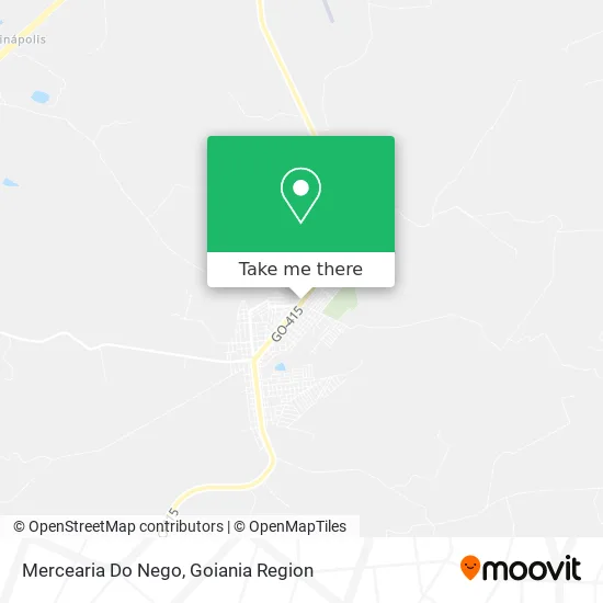
See Mercearia Do Nego, Goianápolis, on the map
Public Transit to Mercearia Do Nego in Goianápolis
Wondering how to get to Mercearia Do Nego in Goianápolis? Moovit helps you find the best way to get to Mercearia Do Nego with step-by-step directions from the nearest public transit station.
Moovit provides free maps and live directions to help you navigate through your city. View schedules, routes, timetables, and find out how long does it take to get to Mercearia Do Nego in real time.
Looking for the nearest stop or station to Mercearia Do Nego? Check out this list of stops closest to your destination: Av. Manoel Cardoso Godoy.
Bus: 771.
Want to see if there’s another route that gets you there at an earlier time? Moovit helps you find alternative routes or times. Get directions from and directions to Mercearia Do Nego easily from the Moovit App or Website.
We make riding to Mercearia Do Nego easy, which is why over 1.5 million users, including users in Goianápolis, trust Moovit as the best app for public transit. You don’t need to download an individual bus app or train app, Moovit is your all-in-one transit app that helps you find the best bus time or train time available.
For information on prices of bus, costs and ride fares to Mercearia Do Nego, please check the Moovit app.
Use the app to navigate to popular places including to the airport, hospital, stadium, grocery store, mall, coffee shop, school, college, and university.
Mercearia Do Nego Address: Avenida Manoel Cardoso de Godoy, 214 Goianápolis Goianápolis-GO 75170-000 street in Goianápolis
- Incomisa,
- Fontenele Representacoes,
- Veronicegoncalves,
- Impress,
- Viveiro Muda Forte,
- Banco 24horas,
- Vargas Licita,
- Igreja Assembelia de Deus Água Viva,
- Rafael Barbosa,
- Posto Tomatao,
- Irmãos Alexandre Ltda,
- Hotel e Churrascaria Tomatao,
- Auto Posto e Churrascaria Tonatão,
- Taynaramartins,
- Ak Store,
- De Pinho Log,
- Assembleia de Deus de Anápolis - Goianápolis-Centro,
- Tiggers Açai e Burger,
- Helena Perfumaria e Cosmeticos,
- Algodao Doce Moda Infantil
Places Near Mercearia Do Nego (Goianápolis)
- Avenida T-2, U.T.P. Bueno,
- Hospital e Maternidade São Judas Tadeu, U.T.P. Jardim Europa,
- Terminal Rodoviário De Goiânia, U.T.P. Central,
- Rodovia BR - 153, Aparecida De Goiânia,
- Jardim América Goiânia - GO, U.T.P. Jardim America,
- HUGOL - Hospital De Urgências Governador Octávio Lage, U.T.P. V. Regina/Pq. Ind. Paulista/Santos Dumont,
- Hospital de Urgências de Goiânia (HUGO), U.T.P. Pedro Ludovico/Bela Vista/Jardim Das Esmeraldas,
- Hospital Santa Casa de Misericórdia de Goiânia, U.T.P. Bueno,
- Buriti Shopping, Aparecida De Goiânia,
- Terminal Praça A, U.T.P. Campinas,
- Terminal Araguaia, Aparecida De Goiânia,
- Avenida 44, Goiania,
- Aeroporto de Goiânia / Santa Genoveva (GYN), U.T.P. Aeroporto Internacional,
- ICF Instituto de Ciências Farmacêuticas Unidade Clinica, U.T.P. Novo Horizonte/Faicalville,
- Terminal Recanto do Bosque, Goiania,
- Rodeio Show de Aparecida, Aparecida De Goiânia,
- Hospital das Clínicas (HC), U.T.P. Leste Universitario,
- Setor Expansul, Aparecida De Goiânia,
- Senador Canedo, Senador Canedo,
- Avenida Rio Verde, Aparecida De Goiânia
How to get to popular places in Goiania Region with public transit
Get around Goianápolis by public transit!
Traveling around Goianápolis has never been so easy. See step by step directions as you travel to any attraction, street or major public transit station. View bus and train schedules, arrival times, service alerts and detailed routes on a map, so you know exactly how to get to anywhere in Goianápolis.
When traveling to any destination around Goianápolis use Moovit's Live Directions with Get Off Notifications to know exactly where and how far to walk, how long to wait for your line, and how many stops are left. Moovit will alert you when it's time to get off — no need to constantly re-check whether yours is the next stop.
Wondering how to use public transit in Goianápolis or how to pay for public transit in Goianápolis? Moovit public transit app can help you navigate your way with public transit easily, and at minimum cost. It includes public transit fees, ticket prices, and costs. Looking for a map of Goianápolis public transit lines? Moovit public transit app shows all public transit maps in Goianápolis with all bus routes and stops on an interactive map.
Goiania Region has 1 transit type(s), including: bus, operated by several transit agencies, including Redemob Consórcio - CMTC