How to get to Merck by bus?
Click on the bus route to see step by step directions with maps, line arrival times and updated time schedules.
From Avenida de Aragón 402, Madrid
38 minFrom Leroy Merlin, Área Metropolitana De Madrid Y Corredor Del Henares
48 minFrom IKEA Ensanche de Vallecas, Madrid
86 minFrom Hotel Axor Feria, Área Metropolitana De Madrid Y Corredor Del Henares
44 minFrom Torrejón de Ardoz, Torrejón De Ardoz
62 minFrom Vicalvaro, Madrid
73 minFrom Polígono Industrial Las Mercedes, Área Metropolitana De Madrid Y Corredor Del Henares
44 minFrom Rejas, Madrid
51 minFrom Hotel Nuevo Boston, Madrid
42 minFrom Holiday Inn Express Madrid Airport Hotel Madrid, Madrid
40 min
Bus stops near Merck in Mejorada Del Campo
Bus lines to Merck in Mejorada Del Campo
- 285, Estación Ferrocarril - Est. San Fernando,VIEW
- 280, Coslada (FF.CC.) - Hospital - Loeches,VIEW
- 282, Madrid (Avda. América) - San Fernando - Mejorada,VIEW
- 340, Torrejón de Ardoz - Mejorada del Campo,VIEW
- 341, Madrid (Pavones) - Mejorada - Velilla,VIEW
- N203, Madrid (Ciudad Lineal) - Coslada - S. Fernando - Velilla/Loeches,VIEW
What are the closest stations to Merck?
The closest stations to Merck are:
- Av. Europa - Ciudad De Lisboa is 377 meters away, 5 min walk.
- Av. Concordia - Ciudad De Atenas is 771 meters away, 10 min walk.
Which bus lines stop near Merck?
These bus lines stop near Merck: 282, 341.
What’s the nearest bus station to Merck in Mejorada Del Campo?
The nearest bus station to Merck in Mejorada Del Campo is Av. Europa - Ciudad De Lisboa. It’s a 5 min walk away.
What time is the first bus to Merck in Mejorada Del Campo?
The N203 is the first bus that goes to Merck in Mejorada Del Campo. It stops nearby at 3:16 AM.
What time is the last bus to Merck in Mejorada Del Campo?
The N203 is the last bus that goes to Merck in Mejorada Del Campo. It stops nearby at 2:12 AM.
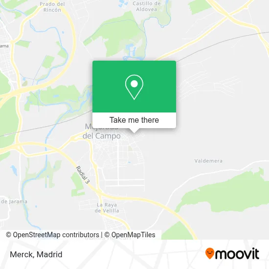
See Merck, Mejorada Del Campo, on the map
Public Transit to Merck in Mejorada Del Campo
Wondering how to get to Merck in Mejorada Del Campo? Moovit helps you find the best way to get to Merck with step-by-step directions from the nearest public transit station.
Moovit provides free maps and live directions to help you navigate through your city. View schedules, routes, timetables, and find out how long does it take to get to Merck in real time.
Looking for the nearest stop or station to Merck? Check out this list of stops closest to your destination: Av. Europa - Ciudad De Lisboa; Av. Concordia - Ciudad De Atenas.
Bus: 282, 341, 285, 280, 340, N203.
Want to see if there’s another route that gets you there at an earlier time? Moovit helps you find alternative routes or times. Get directions from and directions to Merck easily from the Moovit App or Website.
We make riding to Merck easy, which is why over 1.5 million users, including users in Mejorada Del Campo, trust Moovit as the best app for public transit. You don’t need to download an individual bus app or train app, Moovit is your all-in-one transit app that helps you find the best bus time or train time available.
For information on prices of bus and train, costs and ride fares to Merck, please check the Moovit app.
Use the app to navigate to popular places including to the airport, hospital, stadium, grocery store, mall, coffee shop, school, college, and university.
Merck Address: Calle Margarita Salas, 2 28840 Mejorada del Campo street in Mejorada Del Campo
- Calle Federica Montseny,
- Calle Oslo / Calle Moscú,
- Mejorada Gatuna,
- Calle Berna, 8,
- Parque Del Henares,
- Skate Park Mejorada Del Campo,
- Avenida Europa,
- Recinto Ferial,
- Calle Ciudad de París, 22,
- Centro De Salud Mejorada,
- Calzados Plus Ultra S.a.,
- Edificio Recinto Ferial,
- Urbanización Trébol,
- Escuela Municipal De Música Y Danza Mejorada Del Campo,
- Camino de Torres de la Alameda,
- IES Los olivos,
- Seguros Pelayo Mejorada del Campo,
- El Tallar,
- Cristina Carrascosa Serrano,
- Camino de Alcala
Places Near Merck (Mejorada Del Campo)
- Plenilunio, Área Metropolitana De Madrid Y Corredor Del Henares,
- Centro Comercial Oasiz Madrid, Área Metropolitana De Madrid Y Corredor Del Henares,
- Centro Comercial Islazul, Área Metropolitana De Madrid Y Corredor Del Henares,
- Centro Comercial La Vaguada, Área Metropolitana De Madrid Y Corredor Del Henares,
- Rastro De Madrid, Área Metropolitana De Madrid Y Corredor Del Henares,
- Centro Comercial La Gavia, Área Metropolitana De Madrid Y Corredor Del Henares,
- Plaza Mayor, Madrid,
- Calle de López de Hoyos 169, Madrid,
- Mercadillo de Majadahonda, Majadahonda,
- Tres Aguas, Alcorcón,
- Sala La Riviera, Madrid,
- Mendez Alvaro, Madrid,
- Estadio Wanda Metropolitano, Área Metropolitana De Madrid Y Corredor Del Henares,
- Wizink Center, Madrid,
- Estacion de Chamartin, Madrid,
- Nassica, Área Metropolitana De Madrid Y Corredor Del Henares,
- Palacio De Vistalegre, Área Metropolitana De Madrid Y Corredor Del Henares,
- Hospital Universitario Ramón y Cajal, Madrid,
- Hospital Clínico Universitario San Carlos, Madrid,
- Hospital Universitario La Paz, Madrid
How to get to popular places in Madrid with public transit
Get around Mejorada Del Campo by public transit!
Traveling around Mejorada Del Campo has never been so easy. See step by step directions as you travel to any attraction, street or major public transit station. View bus and train schedules, arrival times, service alerts and detailed routes on a map, so you know exactly how to get to anywhere in Mejorada Del Campo.
When traveling to any destination around Mejorada Del Campo use Moovit's Live Directions with Get Off Notifications to know exactly where and how far to walk, how long to wait for your line, and how many stops are left. Moovit will alert you when it's time to get off — no need to constantly re-check whether yours is the next stop.
Wondering how to use public transit in Mejorada Del Campo or how to pay for public transit in Mejorada Del Campo? Moovit public transit app can help you navigate your way with public transit easily, and at minimum cost. It includes public transit fees, ticket prices, and costs. Looking for a map of Mejorada Del Campo public transit lines? Moovit public transit app shows all public transit maps in Mejorada Del Campo with all Bus, Train, Metro and Light Rail routes and stops on an interactive map.
Madrid has 4 transit type(s), including: Bus, Train, Metro and Light Rail, operated by several transit agencies, including Metro de Madrid, Metro Ligero, Tranvía de Parla, Renfe Cercanías - Servicios de Autobús especiales, Renfe Cercanias, Renfe Cercanías, EMT, Interurbanos, Urbanos de Alcalá de Henares, Urbanos de Alcobendas, Urbanos de Alcorcón, Urbanos de Algete, Urbanos de Aranjuez, Urbanos de Arganda del Rey and Urbanos de Arroyomolinos