How to get to Merkez Av by bus?
Click on the bus route to see step by step directions with maps, line arrival times and updated time schedules.
From Dumlupınar Spor Tesisleri Tenis Kortu, Selçuklu
45 minFrom Akyokuş, Selçuklu
43 minFrom Meram Şifa Hatun Anadolu Sağlık Meslek Lisesi, Meram
52 minFrom Çınar Düğün Salonu, Selçuklu
41 minFrom Konya Araplar Mahallesi, Selçuklu
65 minFrom Ahmet Yesevi Caddesi, Selçuklu
60 minFrom Yazır Kanyon Parkı, Selçuklu
74 minFrom Sille Seyir Tepesi, Selçuklu
45 minFrom Meram, Selçuklu
34 minFrom Dutlukır Parkı, Meram
75 min
Bus stops near Merkez Av in Selçuklu
- Üçler Mezarlığı, 4 min walk,VIEW
- İL Milli Eğitim Müdürlüğü, 6 min walk,VIEW
- Piri Esat, 7 min walk,VIEW
- Kızılay Hastanesi, 7 min walk,VIEW
- Şerafettin Cami 1, 7 min walk,VIEW
- Kayalıpark 2, 7 min walk,VIEW
- Şerafettin Cami 2, 8 min walk,VIEW
- Eski Garaj, 8 min walk,VIEW
- Kayalıpark 1, 8 min walk,VIEW
- Taş Cami, 9 min walk,VIEW
- Şerafettin Cami 4, 10 min walk,VIEW
Light Rail stations near Merkez Av in Selçuklu
Bus lines to Merkez Av in Selçuklu
- 50-A, Sakyatan Bakırtolu Şatır,VIEW
- 81-A, Ortakonak Di̇vanlar,VIEW
- 92-A, Dedemli̇ Çarıklar,VIEW
- 92-B, Çarıklar Dedemli̇,VIEW
- 99-A, Tatköy,VIEW
- 103-A, Feti̇h Cad Aykent 2. Organi̇ze,VIEW
- 112-A, Şehir Hastanesi Alaaddin,VIEW
- 16-A, Asarçay Elmacı,VIEW
- 19-A, Kurtuluş,VIEW
- 23-A, Büyük Aymanas,VIEW
- 24-A, Zi̇ya Barlas,VIEW
- 24-B, Zi̇ya Barlas Maraş Cad,VIEW
- 26-A, Ormankaya,VIEW
- 26-B, Ormankaya,VIEW
- 27-A, Seli̇m Sultan,VIEW
- 28-A, Taşra Dede,VIEW
- 29-A, Uluırmak,VIEW
- 79-A, Aybahçe,VIEW
- 87-A, Süleymani̇ye,VIEW
- 91-A, Kaşınhanı,VIEW
What are the closest stations to Merkez Av?
The closest stations to Merkez Av are:
- Üçler Mezarlığı is 315 meters away, 4 min walk.
- İL Milli Eğitim Müdürlüğü is 443 meters away, 6 min walk.
- Mevlana (T37) is 476 meters away, 7 min walk.
- Piri Esat is 505 meters away, 7 min walk.
- Kızılay Hastanesi is 523 meters away, 7 min walk.
- Şerafettin Cami 1 is 535 meters away, 7 min walk.
- Kayalıpark 2 is 542 meters away, 7 min walk.
- Şerafettin Cami 2 is 557 meters away, 8 min walk.
- Eski Garaj is 558 meters away, 8 min walk.
- Kayalıpark 1 is 559 meters away, 8 min walk.
- Taş Cami is 671 meters away, 9 min walk.
- Şerafettin Cami 4 is 744 meters away, 10 min walk.
- Alaaddin (T31) is 886 meters away, 12 min walk.
Which bus lines stop near Merkez Av?
These bus lines stop near Merkez Av: 12-A, 20-A, 29-A, 41-A, 42-A, 54-A, 92-A.
Which light rail line stops near Merkez Av?
150-B (Kültürpark)
What’s the nearest light rail station to Merkez Av in Selçuklu?
The nearest light rail station to Merkez Av in Selçuklu is Mevlana (T37). It’s a 7 min walk away.
What’s the nearest bus station to Merkez Av in Selçuklu?
The nearest bus station to Merkez Av in Selçuklu is Üçler Mezarlığı. It’s a 4 min walk away.
What time is the first light rail to Merkez Av in Selçuklu?
The 153-A is the first light rail that goes to Merkez Av in Selçuklu. It stops nearby at 4:00 AM.
What time is the last light rail to Merkez Av in Selçuklu?
The 153-A is the last light rail that goes to Merkez Av in Selçuklu. It stops nearby at 1:40 AM.
What time is the first bus to Merkez Av in Selçuklu?
The 38-B is the first bus that goes to Merkez Av in Selçuklu. It stops nearby at 6:05 AM.
What time is the last bus to Merkez Av in Selçuklu?
The 92-B is the last bus that goes to Merkez Av in Selçuklu. It stops nearby at 1:09 AM.
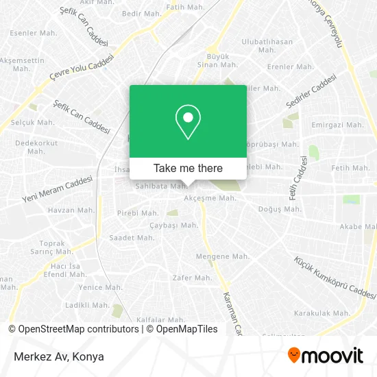
See Merkez Av, Selçuklu, on the map
Public Transit to Merkez Av in Selçuklu
Wondering how to get to Merkez Av in Selçuklu? Moovit helps you find the best way to get to Merkez Av with step-by-step directions from the nearest public transit station.
Moovit provides free maps and live directions to help you navigate through your city. View schedules, routes, timetables, and find out how long does it take to get to Merkez Av in real time.
Looking for the nearest stop or station to Merkez Av? Check out this list of stops closest to your destination: Üçler Mezarlığı; İL Milli Eğitim Müdürlüğü; Mevlana (T37); Piri Esat; Kızılay Hastanesi; Şerafettin Cami 1; Kayalıpark 2; Şerafettin Cami 2; Eski Garaj; Kayalıpark 1; Taş Cami; Şerafettin Cami 4; Alaaddin (T31).
Bus: 12-A, 20-A, 29-A, 41-A, 42-A, 54-A, 92-A, 50-A, 81-A, 92-B, 99-A, 16-A, 19-A, 23-A, 24-A, 24-B, 65-A, 120-A, 94-A, 83-A.Light Rail: 150-B.
Want to see if there’s another route that gets you there at an earlier time? Moovit helps you find alternative routes or times. Get directions from and directions to Merkez Av easily from the Moovit App or Website.
We make riding to Merkez Av easy, which is why over 1.5 million users, including users in Selçuklu, trust Moovit as the best app for public transit. You don’t need to download an individual bus app or train app, Moovit is your all-in-one transit app that helps you find the best bus time or train time available.
For information on prices of bus and light rail, costs and ride fares to Merkez Av, please check the Moovit app.
Use the app to navigate to popular places including to the airport, hospital, stadium, grocery store, mall, coffee shop, school, college, and university.
Location: Selçuklu, Konya
- Halkbank Aziziye Şubesi,
- Modern Vakıflar Çarşısı 33,
- Safa İş Merkezi,
- Kafkas Silahçılık,
- Türk Kızılayı Konya Toplum Merkezi,
- Tuncel-İpek Mustafa,
- Sobacılar İçi,
- Sungur Çarşısı,
- Mümtaz Koru Verem Savaş Dispanseri,
- YILDIRIM İÇ GİYİM TOPTAN&perakende,
- Karatay Toplum Sağliği Merkezi,
- Gülen Çeyiz Manifatura,
- pardesü dünyası,
- Sobacılar İçi Bulgur Tekke Sok. 19,
- esma ceyiz,
- KIZILAY HASTANESİ,
- Verem Savaş Dispanseri,
- ÇAĞLAYAN Havai fişek,
- Şükran Mahallesi,
- Kömürcüler Sokak
Places Near Merkez Av (Selçuklu)
- Kerhâne, Selçuklu,
- Adliye Sancak Dolmuşu, Selçuklu,
- Konya Beyhekim Devlet Hastanesi, Selçuklu,
- Selçuklu Kongre Merkezi, Selçuklu,
- Konya Havalimanı, Selçuklu,
- Meram Tıp Fakültesi, Meram,
- Kelebekler Vadisi, Selçuklu,
- Kent Plaza (Konya Kent Plaza Alisveris Merkezi), Selçuklu,
- Selçuklu Nüfus Müdürlüğü, Selçuklu,
- Konya Şehir Hastanesi, Selçuklu,
- Bosna Hersek Mh Mutlu Son Masaj Salonu, Selçuklu,
- Fatih Işıklar - Özalkent Dolmuşu, Selçuklu,
- Konya Tren Garı, Selçuklu,
- Bosna Kampüs Dolmuş Duragı, Selçuklu,
- Konya YHT Garı, Selçuklu,
- Konya Otogar, Selçuklu,
- Konya Yüksek Hızlı Tren Garı (Konya YHT Garı), Selçuklu,
- Konya Real Avm, Selçuklu,
- Büsan Sanayi, Selçuklu,
- Otogar Aydınlık Dolmuşu, Selçuklu
How to get to popular places in Konya with public transit
Get around Selçuklu by public transit!
Traveling around Selçuklu has never been so easy. See step by step directions as you travel to any attraction, street or major public transit station. View bus and train schedules, arrival times, service alerts and detailed routes on a map, so you know exactly how to get to anywhere in Selçuklu.
When traveling to any destination around Selçuklu use Moovit's Live Directions with Get Off Notifications to know exactly where and how far to walk, how long to wait for your line, and how many stops are left. Moovit will alert you when it's time to get off — no need to constantly re-check whether yours is the next stop.
Wondering how to use public transit in Selçuklu or how to pay for public transit in Selçuklu? Moovit public transit app can help you navigate your way with public transit easily, and at minimum cost. It includes public transit fees, ticket prices, and costs. Looking for a map of Selçuklu public transit lines? Moovit public transit app shows all public transit maps in Selçuklu with all Bus and Light Rail routes and stops on an interactive map.
Konya has 2 transit type(s), including: Bus and Light Rail, operated by several transit agencies, including ATUS and Havaş