How to get to Met Asian Management Development Centre by bus?
Click on the bus route to see step by step directions with maps, line arrival times and updated time schedules.
From Sophia College Science Building, Mumbadevi
53 minFrom Kamathipura, Mumbadevi
47 minFrom Vasant Oasis, Andheri East
55 minFrom Orchid Hotel Mumbai, Vile Parle
33 minFrom Lamington Road, Mumbadevi
48 minFrom Lokhandwala Market, Versova
57 minFrom Byculla Station-Rani Baug, Byculla
40 minFrom Veera Desai Road, Versova
48 minFrom Barc, Anushakti Nagar
48 min
How to get to Met Asian Management Development Centre by train?
Click on the train route to see step by step directions with maps, line arrival times and updated time schedules.
How to get to Met Asian Management Development Centre by metro?
Click on the metro route to see step by step directions with maps, line arrival times and updated time schedules.
From Sophia College Science Building, Mumbadevi
59 minFrom Kamathipura, Mumbadevi
67 minFrom Vasant Oasis, Andheri East
68 minFrom Orchid Hotel Mumbai, Vile Parle
54 minFrom Lamington Road, Mumbadevi
55 minFrom Lokhandwala Market, Versova
98 minFrom Byculla Station-Rani Baug, Byculla
64 minFrom Veera Desai Road, Versova
86 min
Bus stops near Met Asian Management Development Centre in Vandre West
Metro station near Met Asian Management Development Centre in Vandre West
- Shitala Devi Mandir, 33 min walk,VIEW
Train station near Met Asian Management Development Centre in Vandre West
- Bandra, 36 min walk,VIEW
Bus lines to Met Asian Management Development Centre in Vandre West
What are the closest stations to Met Asian Management Development Centre?
The closest stations to Met Asian Management Development Centre are:
- Mount Carmel Church (Lilavati Hospital) is 89 meters away, 2 min walk.
- Parijat is 134 meters away, 2 min walk.
- Mount Carmel Church is 251 meters away, 4 min walk.
- Saint Peter Church is 524 meters away, 7 min walk.
- Shitala Devi Mandir is 2548 meters away, 33 min walk.
- Bandra is 2776 meters away, 36 min walk.
Which bus lines stop near Met Asian Management Development Centre?
These bus lines stop near Met Asian Management Development Centre: 212, A-215, A-219, C-86.
Which train lines stop near Met Asian Management Development Centre?
These train lines stop near Met Asian Management Development Centre: HR, WR, WR-AC.
Which metro line stops near Met Asian Management Development Centre?
LINE 3 (Aarey JVLR)
What’s the nearest bus station to Met Asian Management Development Centre in Vandre West?
The nearest bus stations to Met Asian Management Development Centre in Vandre West are Mount Carmel Church (Lilavati Hospital) and Parijat. The closest one is a 2 min walk away.
What time is the first metro to Met Asian Management Development Centre in Vandre West?
The LINE 3 is the first metro that goes to Met Asian Management Development Centre in Vandre West. It stops nearby at 6:16 AM.
What time is the last metro to Met Asian Management Development Centre in Vandre West?
The LINE 3 is the last metro that goes to Met Asian Management Development Centre in Vandre West. It stops nearby at 11:01 PM.
What time is the first train to Met Asian Management Development Centre in Vandre West?
The WR is the first train that goes to Met Asian Management Development Centre in Vandre West. It stops nearby at 4:05 AM.
What time is the last train to Met Asian Management Development Centre in Vandre West?
The WR is the last train that goes to Met Asian Management Development Centre in Vandre West. It stops nearby at 1:32 AM.
What time is the first bus to Met Asian Management Development Centre in Vandre West?
The A-214 is the first bus that goes to Met Asian Management Development Centre in Vandre West. It stops nearby at 5:50 AM.
What time is the last bus to Met Asian Management Development Centre in Vandre West?
The C-86 is the last bus that goes to Met Asian Management Development Centre in Vandre West. It stops nearby at 12:44 AM.
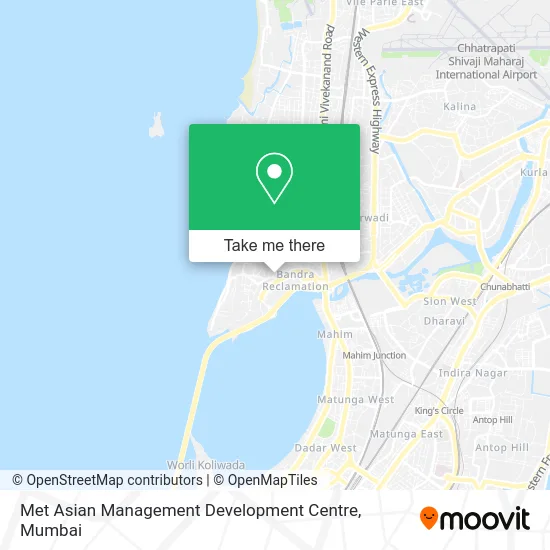
See Met Asian Management Development Centre, Vandre West, on the map
Public Transit to Met Asian Management Development Centre in Vandre West
Wondering how to get to Met Asian Management Development Centre in Vandre West? Moovit helps you find the best way to get to Met Asian Management Development Centre with step-by-step directions from the nearest public transit station.
Moovit provides free maps and live directions to help you navigate through your city. View schedules, routes, timetables, and find out how long does it take to get to Met Asian Management Development Centre in real time.
Looking for the nearest stop or station to Met Asian Management Development Centre? Check out this list of stops closest to your destination: Mount Carmel Church (Lilavati Hospital); Parijat; Mount Carmel Church; Saint Peter Church; Shitala Devi Mandir; Bandra.
Bus: 212, A-215, A-219, C-86, A-214, A-211.Train: HR, WR, WR-AC, BR, CGDR.Metro: LINE 3.
Want to see if there’s another route that gets you there at an earlier time? Moovit helps you find alternative routes or times. Get directions from and directions to Met Asian Management Development Centre easily from the Moovit App or Website.
We make riding to Met Asian Management Development Centre easy, which is why over 1.5 million users, including users in Vandre West, trust Moovit as the best app for public transit. You don’t need to download an individual bus app or train app, Moovit is your all-in-one transit app that helps you find the best bus time or train time available.
For information on prices of bus, metro and train, costs and ride fares to Met Asian Management Development Centre, please check the Moovit app.
Use the app to navigate to popular places including to the airport, hospital, stadium, grocery store, mall, coffee shop, school, college, and university.
Met Asian Management Development Centre Address: Mumbai 400050 MH street in Vandre West
- MET College,
- Zakaat Fitra Foundation al Madinah Saudi Arabia,
- Mumbai Education Trust (MET),
- Met Rishikul Vidyalaya,
- Met Institute Of Pharmacy in Bandra West,
- Lucky Chat,
- Swayam Siddha,
- Bhujbal Knowledge City,
- Dr. D.R. Kulkarni Gastrointestinal Surgeon Clinic,
- Dr. Manoj Bharucha Clinic,
- Dr. Chetan Oberai Clinic,
- Manik Vidya Mandir School in Bandra West,
- Indranil Apartment,
- Dr. Uma Ali Clinic,
- Dr Paresh Varty Clinic,
- Lilavati Hospital And Research Centre,
- Prashant Gholap Foundation,
- Dr. Swati Kshirsagar Clinic,
- Dr. Nandita Palshetkar Clinic,
- Dr. Nitin N. Dange Clinic
Places Near Met Asian Management Development Centre (Vandre West)
- Shanmukhananda Hall, Sion , Mumbai, Sion Koliwada,
- NESCO, Goregaon,
- Worli Sea Face,
- Hinduja Hospital, Mahim,
- Dome @ Nsci - Svp Stadium Mumbai, Worli,
- R CITY MALL, Ghatkopar East,
- Oberoi Sky City, Borivali East,
- Govardhan Ecovillage, Palghar (St),
- Oberoi Mall, Dindoshi,
- Malabar Hill, Malabar Hill,
- Gateway Of India,
- INFINITI Mall (Infinity Mall, andheri), Versova,
- Bombay Exhibition Center, Goregaon,
- Bhaucha Dhakka,
- TCS Olympus, Thane,
- Rani Baug, Byculla,
- Ikea, Worli,
- Mumbai University, Kalina,
- J. J. Hospital, Byculla,
- Inorbit Mall, Malad West
How to get to popular places in Mumbai with public transit
Get around Vandre West by public transit!
Traveling around Vandre West has never been so easy. See step by step directions as you travel to any attraction, street or major public transit station. View bus and train schedules, arrival times, service alerts and detailed routes on a map, so you know exactly how to get to anywhere in Vandre West.
When traveling to any destination around Vandre West use Moovit's Live Directions with Get Off Notifications to know exactly where and how far to walk, how long to wait for your line, and how many stops are left. Moovit will alert you when it's time to get off — no need to constantly re-check whether yours is the next stop.
Wondering how to use public transit in Vandre West or how to pay for public transit in Vandre West? Moovit public transit app can help you navigate your way with public transit easily, and at minimum cost. It includes public transit fees, ticket prices, and costs. Looking for a map of Vandre West public transit lines? Moovit public transit app shows all public transit maps in Vandre West with all Bus, Train, Metro and Ferry routes and stops on an interactive map.
Mumbai has 4 transit type(s), including: Bus, Train, Metro and Ferry, operated by several transit agencies, including MMMOCL (Maha Mumbai Metro Operation Corporation Ltd.), NMM CIDCO (Navi Mumbai Metro Maha Metro), Reliance Mumbai Metro, MMRCL (Mumbai Metro Rail Corporation Ltd), BEST (Brihanmumbai Electricity Supply & Transport), BEST AC Services, A.C.Trains (Air-Conditioning Trains), W.R. (Western Railways), C.R. (Central Railways), C.R.MEMU (Central Railways Shuttle MEMU Trains), H.R. (Harbour Railways), T.R.(Trans Harbour Railways), U.R.(Uran-Ulwe Railways), I.R.(Indian Railways) and TMT (Thane Municipal Transport)