How to get to Met Kitchen by bus?
Click on the bus route to see step by step directions with maps, line arrival times and updated time schedules.
From Edgewater, Miami
46 minFrom Liv Nightclub, Fountainebleau Hotel, Miami Beach
51 minFrom Fontainebleau Miami Beach, Miami Beach
52 minFrom Aventura Mall, Miami
52 minFrom AA Arena, Miami
41 minFrom The Salvation Army, Miami
63 minFrom Ives Dairy Road & 441, Miami
53 minFrom 19370 Collins Ave, Miami Beach
56 minFrom Amazon Fulfillment Center-DMF1, Miami
67 minFrom Wynwood Walls, Miami
52 min
Bus stops near Met Kitchen in Miami
Bus lines to Met Kitchen in Miami
What are the closest stations to Met Kitchen?
The closest stations to Met Kitchen are:
- Ne 6 Av @ Ne 123 St is 92 yards away, 2 min walk.
- Ne 6 Av & 124 St is 122 yards away, 2 min walk.
- Ne 125 St @ Ne 6 Av is 236 yards away, 3 min walk.
- Ne 125 St & Ne 4 Ct is 475 yards away, 6 min walk.
Which bus lines stop near Met Kitchen?
These bus lines stop near Met Kitchen: 125, 9.
What’s the nearest bus station to Met Kitchen in Miami?
The nearest bus stations to Met Kitchen in Miami are Ne 6 Av @ Ne 123 St and Ne 6 Av & 124 St. The closest one is a 2 min walk away.
What time is the first bus to Met Kitchen in Miami?
The 9 is the first bus that goes to Met Kitchen in Miami. It stops nearby at 4:17 AM.
What time is the last bus to Met Kitchen in Miami?
The 9 is the last bus that goes to Met Kitchen in Miami. It stops nearby at 12:51 AM.
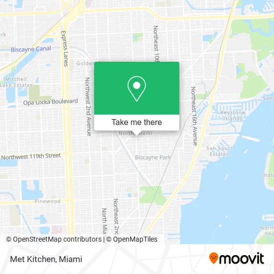
See Met Kitchen, Miami, on the map
Public Transit to Met Kitchen in Miami
Wondering how to get to Met Kitchen in Miami? Moovit helps you find the best way to get to Met Kitchen with step-by-step directions from the nearest public transit station.
Moovit provides free maps and live directions to help you navigate through your city. View schedules, routes, timetables, and find out how long does it take to get to Met Kitchen in real time.
Looking for the nearest stop or station to Met Kitchen? Check out this list of stops closest to your destination: Ne 6 Av @ Ne 123 St; Ne 6 Av & 124 St; Ne 125 St @ Ne 6 Av; Ne 125 St & Ne 4 Ct.
Bus: 125, 9, 16, NOMGRN, NOMORG, 25, NOMBLU.
Want to see if there’s another route that gets you there at an earlier time? Moovit helps you find alternative routes or times. Get directions from and directions to Met Kitchen easily from the Moovit App or Website.
We make riding to Met Kitchen easy, which is why over 1.5 million users, including users in Miami, trust Moovit as the best app for public transit. You don’t need to download an individual bus app or train app, Moovit is your all-in-one transit app that helps you find the best bus time or train time available.
For information on prices of bus, costs and ride fares to Met Kitchen, please check the Moovit app.
Use the app to navigate to popular places including to the airport, hospital, stadium, grocery store, mall, coffee shop, school, college, and university.
Met Kitchen Address: 12327 NE 6th Ave Miami, FL 33161 street in Miami
- Tastings Soflo,
- Studiob,
- Lakay Food Spot,
- Therese Cuisine,
- Prepped & Delish,
- Ladie's Unisex Beauty Salon,
- Hattie's House,
- Mistikasur,
- Libertyx Bitcoin ATM,
- Universelle Vision & Telecommunications,
- Real Facts,
- The Doctor Dental Services,
- Around The Clock Locksmith,
- Latinos Salud,
- North Miami Community Redevelopment Agency,
- Distinction Hair Salon,
- Getcoins,
- 12440 NE 6th Ct Parking,
- Law Office of K.B. Sharp, P.A,
- Excelsior Public Adjusting
Places Near Met Kitchen (Miami)
- Bayside Marketplace, Miami,
- Zoo Miami, Miami,
- Little Havana, Miami,
- Miami VA Hospital, Miami,
- Dolphin Mall Bus, Miami,
- Keiser University Flagship Campus, West Palm Beach,
- Dolphin Mall, Miami,
- Richard E. Gerstein Justice Building, Miami,
- Miami Freedom Park, Miami,
- Aventura Mall, Miami,
- Marlins Park, Miami,
- Hard Rock Stadium, Miami Gardens,
- Sawgrass mall ( FL ), Miami Beach,
- Miami-Dade County Courthouse, Miami,
- Miami Design District, Miami,
- Sawgrass Mall, Miami,
- Brickell City Centre, Miami,
- Wynwood, Miami,
- Aventura Mall, Miami Beach,
- Port of Miami Cruise Terminal, Miami
How to get to popular places in Miami with public transit
Get around Miami by public transit!
Traveling around Miami has never been so easy. See step by step directions as you travel to any attraction, street or major public transit station. View bus and train schedules, arrival times, service alerts and detailed routes on a map, so you know exactly how to get to anywhere in Miami.
When traveling to any destination around Miami use Moovit's Live Directions with Get Off Notifications to know exactly where and how far to walk, how long to wait for your line, and how many stops are left. Moovit will alert you when it's time to get off — no need to constantly re-check whether yours is the next stop.
Wondering how to use public transit in Miami or how to pay for public transit in Miami? Moovit public transit app can help you navigate your way with public transit easily, and at minimum cost. It includes public transit fees, ticket prices, and costs. Looking for a map of Miami public transit lines? Moovit public transit app shows all public transit maps in Miami with all Bus, Train, Light Rail and Ferry routes and stops on an interactive map.
Miami has 4 transit type(s), including: Bus, Train, Light Rail and Ferry, operated by several transit agencies, including Broward County Transit, Miami-Dade Transit, Metrorail, Palm Tran, Tri-Rail, Brightline, MARTY, City of Homestead Trolley, Key West Transit, Treasure Coast Connector, GoLine IRT, Amtrak, Greyhound-us, FlixBus-us and Aventura Express Shuttle Bus