Directions to Meta Distribuidora (Olinda) with public transportation
The following transit lines have routes that pass near Meta Distribuidora
How to get to Meta Distribuidora by bus?
Click on the bus route to see step by step directions with maps, line arrival times and updated time schedules.
From Afogados, Afogados
55 minFrom Hospital Da Mulher Do Recife, Curado
71 minFrom Maternidade Prof Bandeira Filho, Afogados
50 minFrom Hospital Casa Forte - Hapvida Saúde, Casa Forte
49 minFrom Praça de Casa Forte, Casa Forte
54 minFrom Mustardinha, Mustardinha
54 minFrom Policlínica Waldemar de Oliveira, Santo Amaro
43 minFrom Sport Club do Recife, Ilha Do Retiro
52 minFrom Hospital da Mulher, Curado
68 minFrom Hospital da Mulher do Recife, Curado
71 min
Bus stops near Meta Distribuidora in Olinda
Bus lines to Meta Distribuidora in Olinda
- 842 ÁGUAS COMPRIDAS / TI XAMBÁ, Via Santa Casa E Alto Da Conquista,VIEW
- 843 ALTO DA BONDADE / TI XAMBÁ, Alto Da Bondade / Ti Xambá,VIEW
- 844 SANTA CASA / TI XAMBÁ, Via Mirueira,VIEW
- 846 ÁGUAS COMPRIDAS (BACURAU), Águas Compridas (Bacurau),VIEW
- 894 TI XAMBÁ / CÓRREGO DO ABACAXI, TI Xambá / Córrego do Abacaxi,VIEW
- 895 ALTO SOL NASCENTE / TI XAMBÁ, Ti Xambá,VIEW
- 852 CAIXA D'ÁGUA / TI XAMBÁ, Via Alto da Bondade Sentido TI Xambá,VIEW
- 892 ALTO DO CAJUEIRO / TI XAMBÁ, Alto Do Cajueiro / Ti Xambá,VIEW
What are the closest stations to Meta Distribuidora?
The closest stations to Meta Distribuidora are:
- Estrada De Águas Compridas, 109 is 24 meters away, 1 min walk.
- Estrada De Águas Compridas, 762 is 123 meters away, 2 min walk.
- Rua Austrália, 113 is 590 meters away, 8 min walk.
Which bus lines stop near Meta Distribuidora?
These bus lines stop near Meta Distribuidora: 842 ÁGUAS COMPRIDAS / TI XAMBÁ, 843 ALTO DA BONDADE / TI XAMBÁ, 844 SANTA CASA / TI XAMBÁ, 895 ALTO SOL NASCENTE / TI XAMBÁ.
What’s the nearest bus station to Meta Distribuidora in Olinda?
The nearest bus station to Meta Distribuidora in Olinda is Estrada De Águas Compridas, 109. It’s a 1 min walk away.
What time is the first bus to Meta Distribuidora in Olinda?
The 846 ÁGUAS COMPRIDAS (BACURAU) is the first bus that goes to Meta Distribuidora in Olinda. It stops nearby at 3:30 AM.
What time is the last bus to Meta Distribuidora in Olinda?
The 846 ÁGUAS COMPRIDAS (BACURAU) is the last bus that goes to Meta Distribuidora in Olinda. It stops nearby at 2:51 AM.
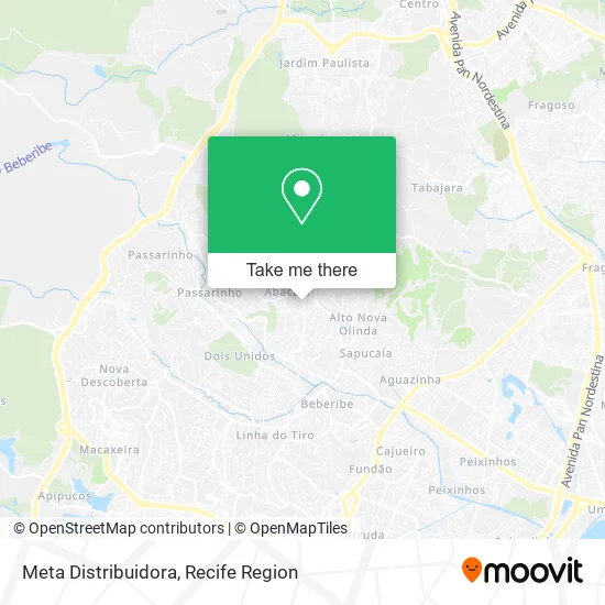
See Meta Distribuidora, Olinda, on the map
Public Transit to Meta Distribuidora in Olinda
Wondering how to get to Meta Distribuidora in Olinda? Moovit helps you find the best way to get to Meta Distribuidora with step-by-step directions from the nearest public transit station.
Moovit provides free maps and live directions to help you navigate through your city. View schedules, routes, timetables, and find out how long does it take to get to Meta Distribuidora in real time.
Looking for the nearest stop or station to Meta Distribuidora? Check out this list of stops closest to your destination: Estrada De Águas Compridas; Estrada De Águas Compridas; Rua Austrália.
Bus: 842 ÁGUAS COMPRIDAS / TI XAMBÁ, 843 ALTO DA BONDADE / TI XAMBÁ, 844 SANTA CASA / TI XAMBÁ, 895 ALTO SOL NASCENTE / TI XAMBÁ, 846 ÁGUAS COMPRIDAS (BACURAU), 894 TI XAMBÁ / CÓRREGO DO ABACAXI, 852 CAIXA D'ÁGUA / TI XAMBÁ, 892 ALTO DO CAJUEIRO / TI XAMBÁ.
Want to see if there’s another route that gets you there at an earlier time? Moovit helps you find alternative routes or times. Get directions from and directions to Meta Distribuidora easily from the Moovit App or Website.
We make riding to Meta Distribuidora easy, which is why over 1.5 million users, including users in Olinda, trust Moovit as the best app for public transit. You don’t need to download an individual bus app or train app, Moovit is your all-in-one transit app that helps you find the best bus time or train time available.
For information on prices of bus, costs and ride fares to Meta Distribuidora, please check the Moovit app.
Use the app to navigate to popular places including to the airport, hospital, stadium, grocery store, mall, coffee shop, school, college, and university.
Meta Distribuidora Address: Rua Quinze de Outubro, 14 Águas Compridas Olinda-PE 53160-320 street in Olinda
- Cna Águas Claras,
- Acsb Mercadinho,
- Nucleo de Apoio e Assistencia Comunitaria,
- Associação Educativa e Divulgadora de Ensinos Biblicos,
- Novo Car,
- Suzana Lanches,
- Ninho Ar,
- Alvaro S Cavalcanti,
- Bruna Buffet,
- Nalu na Onda,
- Rafel Acougue,
- Igreja Assembleia de Deus Novo Cantico,
- Jonathan du Corte,
- Bar e Restaurante do Mestre,
- Só Descartáveis,
- Mercadinho do Vlademir,
- Salão Espaço Mulher,
- Supermercado do Amigo Biá,
- Geno Moto Pé+as,
- Granja Asa Branca
Places Near Meta Distribuidora (Olinda)
- llll, Fundão,
- tuuuuu, Olinda,
- Imip (Instituto Materno-Infantil De Pernambuco), Coelhos,
- SHOPPING GUARARAPES, Jaboatão Dos Guararapes,
- Shopping Recife, Boa Viagem,
- Hospital Eduardo Campus Da Pessoa Idosa, Areias,
- Shopping Patteo Olinda, Olinda,
- Hospital Universitário Oswaldo Cruz, Santo Amaro,
- Parque da Jaqueira, Jaqueira,
- hospital otavio de freitas - UTI, Tejipió,
- Shopping RioMar Recife, Pina,
- Hospital Maria Lucinda, Parnamirim,
- Hospital Geral De Areias, Areias,
- Arena de Pernambuco, São Lourenço Da Mata,
- Imbiribeira, Imbiribeira,
- Hospital Altino Ventura, Iputinga,
- Centro de Convenções de Pernambuco, Olinda,
- Marco Zero, Bairro Do Recife,
- Hospital Agamenon Magalhães, Tamarineira,
- SHOPPING TACARUNA, Santo Amaro
How to get to popular places in Recife Region with public transit
Get around Olinda by public transit!
Traveling around Olinda has never been so easy. See step by step directions as you travel to any attraction, street or major public transit station. View bus and train schedules, arrival times, service alerts and detailed routes on a map, so you know exactly how to get to anywhere in Olinda.
When traveling to any destination around Olinda use Moovit's Live Directions with Get Off Notifications to know exactly where and how far to walk, how long to wait for your line, and how many stops are left. Moovit will alert you when it's time to get off — no need to constantly re-check whether yours is the next stop.
Wondering how to use public transit in Olinda or how to pay for public transit in Olinda? Moovit public transit app can help you navigate your way with public transit easily, and at minimum cost. It includes public transit fees, ticket prices, and costs. Looking for a map of Olinda public transit lines? Moovit public transit app shows all public transit maps in Olinda with all Bus, Train and Subway routes and stops on an interactive map.
Recife Region has 3 transit type(s), including: Bus, Train and Subway, operated by several transit agencies, including CBTU (Metrorec), BRT (Via Livre), Grande Recife, BORBOREMA IMPERIAL (TIP), BORBOREMA IMPERIAL (B.V), RODOVIÁRIA POTENGY, EMPRESA METROPOLITANA, CONSÓRCIO RECIFE, SÃO JUDAS TADEU, Expresso 1002, Rodotur Turismo, Complementar Recife, Sistema Municipal - Jaboatão, Sistema Municipal - Cabo and Sistema Municipal - Ipojuca